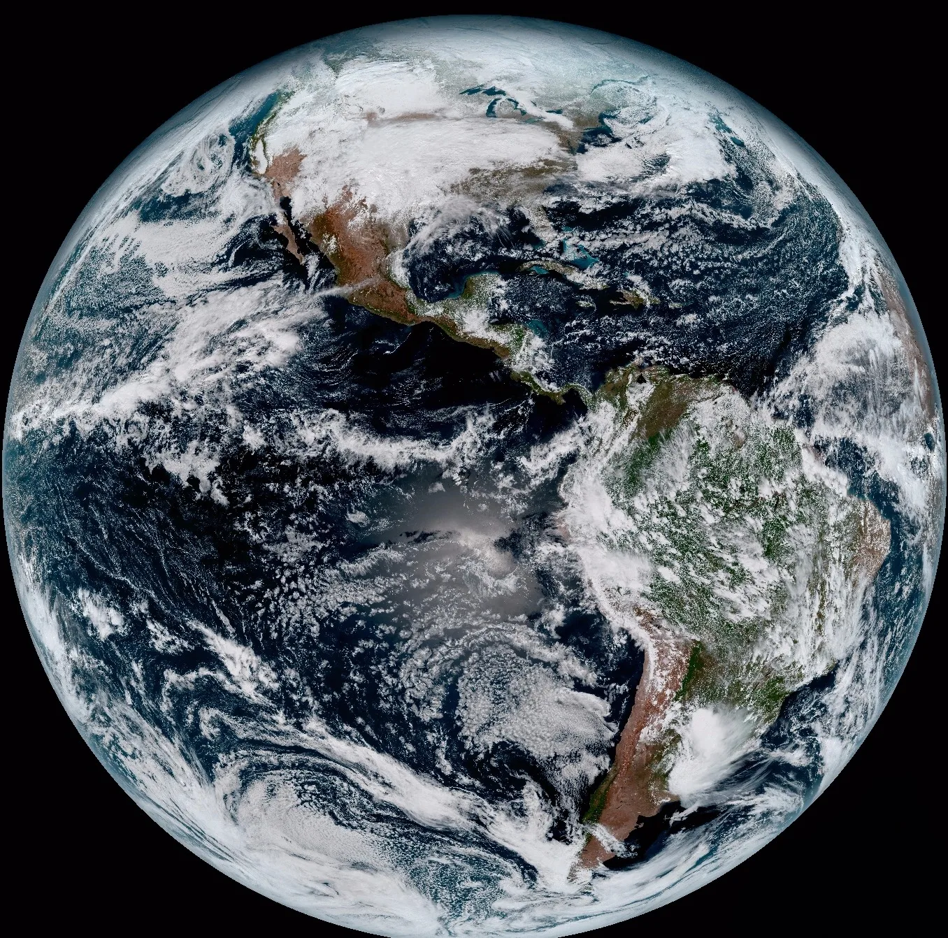
What Is Satellite Imagery, and How Does Satellite Imaging Work
On this page
- What Is Satellite Imagery
- Satellite Imagery vs a Map
- How Does Satellite Imagery Work
- Types of Satellite Imagery
- Satellite Image Resolution
- Advantages of Satellite Imagery
- 01. Global reach, no overflight permission needed
- 02. Consistent, repeatable measurement
- 03. Lower cost than aircraft or ground survey
- 04. Safer access to hazardous sites
- 05. A continuous historical archive
- What Satellite Imagery Is Used For
- Frequently asked questions
- Sources and further reading
A practical guide to what satellite imagery is and how satellite imaging actually works, covering how a satellite image differs from an ordinary map, the orbits and sensors behind every sat image, the main types of satellite imagery in use today, and the real advantages that make it worth using.
Quick answer
Satellite imagery is the picture or digital dataset a sensor on an orbiting satellite captures of Earth's surface and transmits back to the ground, not a photo of the satellite itself. It's captured by passive optical sensors, which record reflected sunlight, or active radar sensors, which transmit their own signal and work through cloud and darkness, flown mainly in Sun-synchronous low Earth orbit or, for continuous regional monitoring, geostationary orbit. Unlike a static map, satellite imagery is a direct, frequently updated depiction of what's actually on the ground, which is why it's used for everything from crop monitoring to disaster response.
What Is Satellite Imagery
Satellite imagery is the picture or dataset produced when a sensor on an orbiting satellite records reflected sunlight or an emitted radar signal from Earth's surface and radios that data back to a ground station, where it's processed into a usable image. A handful of related terms get used almost interchangeably, so here's what each one actually means.
- Satellite imagery. The broad, general term for any picture or dataset a satellite's sensor captures of Earth, used as a mass noun the way "footage" or "data" is.
- A satellite image, satellite photograph, or satellite picture. One single captured scene, a specific picture from a specific pass.
- Satellite images, or informally sat images. The plural, more than one captured scene.
- Satellite imaging. The broader activity itself, orbiting a satellite, pointing its sensor, capturing a scene, and transmitting it home, the process that produces every satellite image that exists.
- An imaging satellite. The hardware, a satellite designed specifically to capture pictures or scientific data, as opposed to the much larger population of satellites built for communications, navigation, or other non-imaging roles.
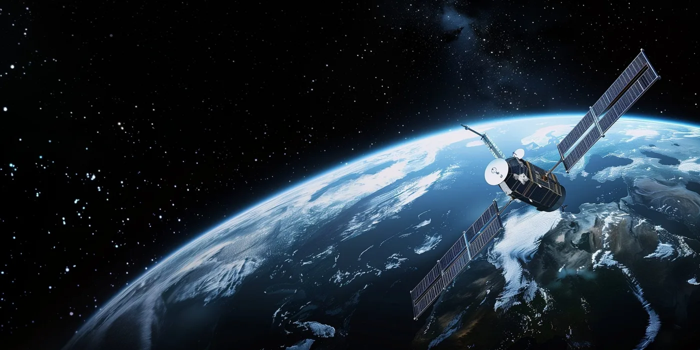
None of these terms describe a photo of the satellite hardware itself, a different kind of picture, or the fact that not every satellite is an imaging satellite, Sputnik 1, the first artificial satellite, carried no camera at all. Both distinctions, along with the very first satellite image and satellite map ever captured, are covered in full in our guide to the history of satellite imagery.
Satellite Imagery vs a Map
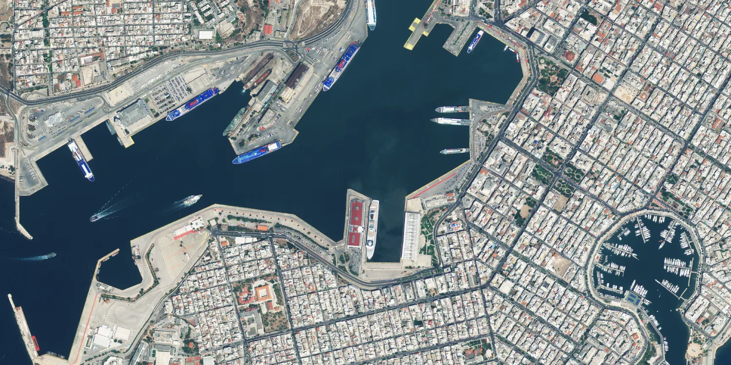
A map and a satellite image answer different questions, and confusing the two is where a lot of searches go wrong. A traditional map is a static, hand-interpreted abstraction, a cartographer or software decided which roads, boundaries, and labels to show and which details to leave out, and that abstraction only changes when someone redraws it. The alternative is the opposite, a direct, photographic depiction of whatever was actually on the ground the day the sensor passed overhead, construction in progress, a flood still receding, a wildfire's actual burn scar, none of which a standard map would show until someone manually updated it, often months or years later.
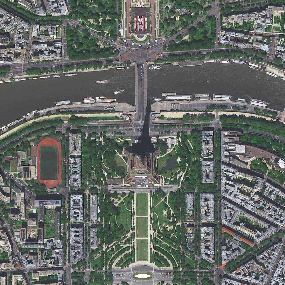
That difference is exactly why the two are usually used together rather than as substitutes. A map still wins for labeled navigation, boundaries, and names. Imagery wins whenever the question is what's actually there right now, which is why it underpins change detection, disaster response, and site monitoring that a static map simply can't keep up with. For how satellite imagery stacks up against aerial photography specifically, including resolution, cost, and when to use each, see our guide to aerial photography vs satellite imagery.
How Does Satellite Imagery Work
Every satellite image starts with two choices an operator made before launch, which orbit to fly and which kind of sensor to carry. The full mechanics, orbit, sensor, downlink, and the processing that turns raw signal into a finished image, are covered step by step in our guide to how satellite images are actually taken; the short version is below.
| Orbit | Altitude | What it trades off |
|---|---|---|
| Sun-synchronous low Earth orbit | ~500 to 800 km | Crosses any point at the same local solar time on every pass, keeping lighting consistent; used by most imaging satellites |
| Geostationary orbit | ~35,786 km | Holds a fixed, continuous stare at one region; trades resolution for constant coverage, mostly used for weather |
The sensor itself is either passive or active:
- Passive optical. A very stable, very large camera that records sunlight reflecting off the ground. It needs daylight and a clear sky to work.
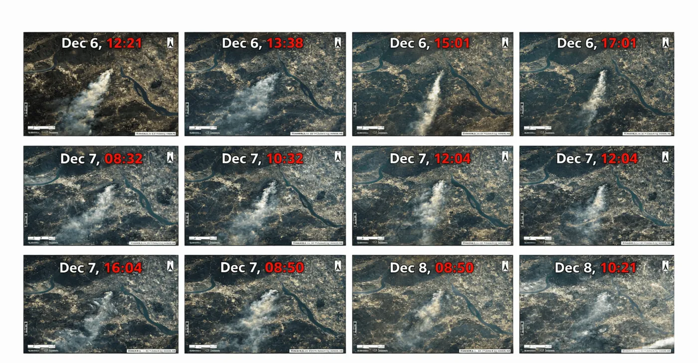
- Active radar (SAR). Synthetic Aperture Radar transmits its own microwave pulses and measures what bounces back, which means it keeps capturing a usable satellite image through cloud, smoke, and total darkness, conditions that stop an optical sensor outright.
Types of Satellite Imagery
Weather forecasters classify what a satellite captures into three core types, a framework that applies well beyond weather. Earth observation satellites extend that same logic with two more practical categories built for mapping rather than meteorology.
| Type | What it captures | Day or night | Best for |
|---|---|---|---|
| Visible (VIS) | Reflected sunlight, the way an ordinary camera sees it | Day only | General reference, cloud cover, mapping |
| Infrared (IR) | Surface and cloud-top heat rather than light | Day and night | Storm intensity, wildfire and heat detection |
| Water vapor (WV) | Upper-atmosphere moisture, shown in false color | Day and night | Predicting rainfall and severe weather |
| True color | A sensor's own red, green, and blue bands mapped straight across | Day only | Looks like an ordinary photo; general reference |
| Multispectral / false color | A non-visible band, like near-infrared, substituted for a visible one | Day only | Vegetation health, water, and moisture differences |
The pair below shows the same wetland scene in true color and false-color infrared.
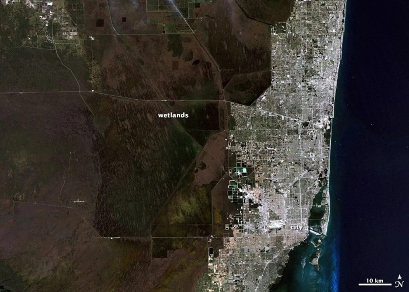
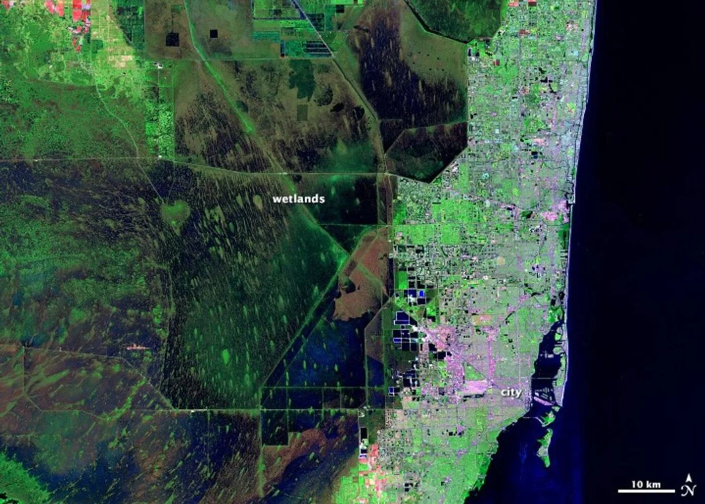
A full taxonomy of every satellite imagery type, including radar, thermal infrared, low-light, and polar-orbiting composites, each with a real example, is covered in our guide to real Earth images from space.
Satellite Image Resolution
Resolution is the other big variable, how much detail a satellite image actually resolves, and it's usually described as ground sample distance (GSD), the real-world size one pixel represents. A smaller GSD means finer detail; a 0.30 m image resolves a parked car, while a 2 m image only resolves a building footprint.
| Tier | Typical GSD | What becomes visible | Example source |
|---|---|---|---|
| Moderate resolution | 10 to 30 m | Land cover, large fields, broad change over time | Sentinel-2, Landsat (free) |
| High resolution | 1 to 2 m | Individual buildings, roads, large vehicles | Commercial optical satellites |
| Very high resolution | 30 to 50 cm | Individual cars, small structures, rooftop equipment | Commercial optical satellites |
| Super high resolution | 15 to 25 cm | Fine detail like road markings and pallets | The sharpest commercial satellites flying today |
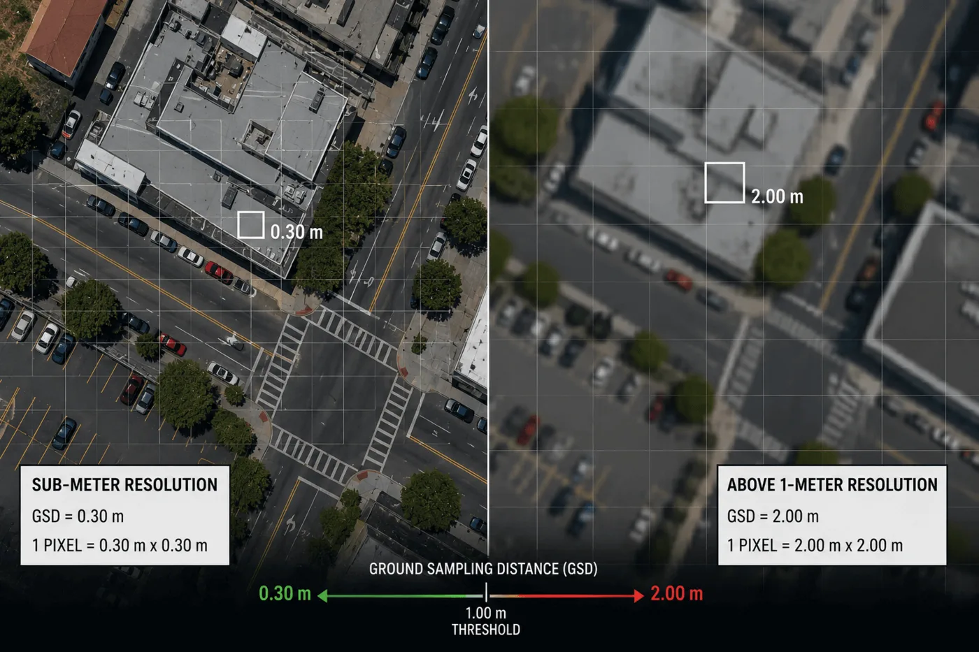
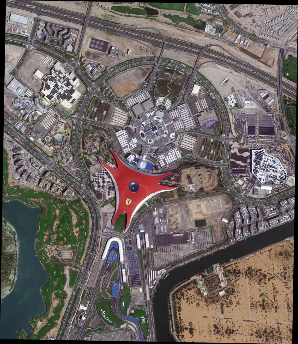
For help matching a resolution tier to a specific project and budget, see our guide to choosing the right satellite resolution.
Want to see these imagery types over your own area?
Search free Sentinel-2 and Landsat archive imagery, or task a fresh optical or radar capture, directly from this site.
Advantages of Satellite Imagery
Satellite imagery earned its place alongside drones and aerial survey for five concrete reasons, not just novelty.
01. Global reach, no overflight permission needed
A satellite crosses borders and hazardous or restricted areas that a drone or aircraft legally or physically can't, making it the only practical option for monitoring a denied, remote, or conflict-affected area.
02. Consistent, repeatable measurement
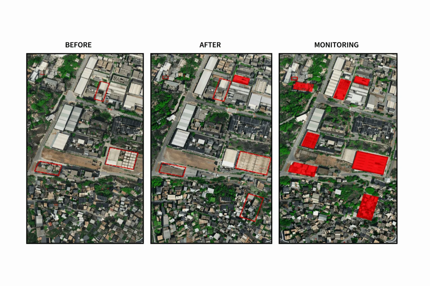
A Sun-synchronous orbit crosses the same location at the same local solar time on every pass, so two images taken months apart are directly comparable, the basis for reliable change detection rather than a one-off snapshot.
03. Lower cost than aircraft or ground survey
Archive satellite imagery over a given site often already exists and can be licensed for a fraction of mobilizing an aircraft or survey crew, and even a new tasked capture skips the travel, permitting, and crew costs a physical site visit requires.
04. Safer access to hazardous sites
Active mines, disaster zones, and industrial accident sites can be monitored without putting a person on the ground, covered in practice in our guide to how satellite imagery prevents mining accidents.
05. A continuous historical archive
Programs like Landsat have imaged the same land surface continuously since 1972, giving researchers a decades-long, consistent record no newer sensor could reconstruct retroactively, the full story of which is in our guide to the history of satellite imagery.
What Satellite Imagery Is Used For
Those advantages translate into real use across almost every industry that manages land, assets, or risk. For the full breakdown by industry, with the exact resolution, sensor, and price tier each use case needs, see our guide to what satellite images are used for.
- Agriculture.
- Monitoring crop health and vegetation stress across a growing season
- Scheduling irrigation from soil moisture and canopy data
- Forecasting yield before harvest, covered in our guide to precision agriculture satellite imagery
- Mining and exploration.
- Tailings dam stability and deformation monitoring
- Flagging mineral and alteration signatures before any ground survey
- Tracking pit expansion and reclamation progress, detailed in our guides to how satellites monitor mining and hyperspectral mineral exploration
- Government and disaster response.
- Large-scale, state-wide imagery mosaics for land use compliance
- Real-time flood, storm, and wildfire damage mapping
- All-weather radar coverage when cloud cover blocks optical sensors, covered in our guide to SAR imagery for disaster response
- Infrastructure and utilities.
- Monitoring pipelines, power lines, dams, and bridges for condition and encroachment
- Vegetation management along transmission corridors
- Tracking facility construction and expansion, covered on our satellite imagery for oil and gas page
- Environmental monitoring.
- Tracking deforestation and forest health over decades, not just a single capture
- Monitoring water quality, algae blooms, and coastal erosion
- Measuring ice extent and long-term climate change, detailed in our guide to forestry canopy monitoring
- Urban planning and insurance.
- Catching unapproved construction through automated change detection
- Tracking city growth and traffic patterns over time
- Verifying storm or flood damage insurance claims without a site visit, covered in our guides to change detection for urban growth and satellite imagery as insurance evidence
Key takeaways
- Satellite imagery is the picture or dataset a satellite's sensor captures of Earth and transmits to the ground. A satellite image means one scene, satellite images or sat images means more than one, and satellite imaging is the broader capture-and-transmit process itself.
- Unlike a map, a static, hand-interpreted abstraction, satellite imagery is a direct, frequently updated depiction of whatever is actually on the ground on a given day.
- Satellite imagery comes from passive optical sensors, which need daylight and clear sky, or active radar sensors, which work through cloud and darkness, flown in Sun-synchronous low Earth orbit or, for continuous regional monitoring, geostationary orbit.
- Weather forecasters classify imagery as visible, infrared, or water vapor; Earth observation adds true color and multispectral false-color imagery, each revealing different detail from the same underlying data.
- Satellite imagery's core advantages are global reach, consistent repeatable measurement, lower cost than aircraft or ground survey, safer access to hazardous sites, and, for programs like Landsat, a continuous historical archive.
Frequently asked questions
What is satellite imagery?
Satellite imagery is the picture or digital dataset a sensor on an orbiting satellite captures of Earth's surface and transmits back to a ground station, where it's processed into a usable image. It's distinct from a photo of the satellite hardware itself.
What is a satellite image?
A satellite image is one single scene captured by a satellite's sensor, whether an optical camera recording reflected sunlight or a radar instrument recording its own transmitted signal bouncing back. Satellite image, satellite photograph, and satellite picture all describe the same thing.
What is satellite imaging?
Satellite imaging is the broader process behind every satellite image, orbiting a satellite, pointing its sensor, capturing a scene, and transmitting the data back to Earth for processing. Satellite imagery is the result that process produces.
What are sat images?
Sat images is an informal, shortened way of saying satellite images, pictures or datasets captured by a satellite's onboard sensor. It means exactly the same thing as satellite imagery, just phrased more casually.
What is the difference between satellite imagery and a map?
A map is a static, hand-interpreted abstraction, showing only the roads, boundaries, and labels someone chose to include, and it only changes when manually redrawn. Satellite imagery is a direct, photographic depiction of whatever was actually on the ground the day the satellite passed overhead, which is why it can show construction progress, flood extent, or fire damage that a map won't reflect for months or years.
What are the advantages of satellite imagery?
Satellite imagery offers global reach without needing overflight permission, consistent and repeatable measurement over time for reliable change detection, lower cost than mobilizing aircraft or a ground survey crew, safer access to hazardous or remote sites, and, for long-running programs like Landsat, a continuous historical archive going back decades.
What are the main types of satellite imagery?
Weather forecasters classify satellite imagery as visible (VIS, reflected sunlight, daylight only), infrared (IR, surface and cloud-top heat, works day and night), or water vapor (WV, upper-atmosphere moisture shown in false color). Earth observation satellites add true color imagery, which looks like an ordinary photo, and multispectral or false-color imagery, which substitutes a non-visible band to reveal vegetation health, water, or moisture.
How does satellite imagery work?
A satellite's sensor, either a passive optical camera that records sunlight reflecting off the ground or an active radar instrument that transmits its own microwave signal and measures the return, captures a scene as it passes overhead. Most imaging satellites fly a Sun-synchronous low Earth orbit roughly 500 to 800 km up; weather satellites often instead sit in geostationary orbit about 35,786 km above the equator for a continuous, fixed view. The captured data is stored onboard, downlinked to a ground station, and processed into the finished image.
What resolution are satellite images?
It ranges from about 10 to 30 m for free, moderate-resolution sources like Sentinel-2 and Landsat, down to 30 to 50 cm for commercial high-resolution satellites, with the sharpest commercial sensors now reaching about 15 to 25 cm. Resolution is usually described as ground sample distance, or GSD, the real-world size one pixel represents, so a 0.30 m GSD image resolves roughly dinner-table-sized detail, while a 2 m GSD image only resolves features the size of a small building footprint or larger.
What is Earth observation?
Earth observation, often shortened to EO, is the umbrella term for using satellites and other remote sensing technology to monitor and measure Earth's surface and atmosphere. Satellite imagery is the main data product Earth observation produces, alongside non-image data like radar elevation measurements and atmospheric readings.
For the full chronological story, including the first satellite image and the first satellite map ever captured, see our guide to the history of satellite imagery. For the full sensor and processing pipeline, see how satellite images are actually taken.
Sources and further reading
- NOAA / NESDIS: GOES visible, infrared, and water vapor imagery channel documentation
- USGS: Landsat program orbital altitude, Sun-synchronous orbit, and continuous archive since 1972
- eoPortal: imaging satellite orbit and sensor classification references
- China Siwei and XRTech Group: satellite and sensor specifications across the optical, SAR, and geostationary fleet
Ready to work with real satellite imagery?
Search free and commercial optical, SAR, and stereo archive imagery, or request tasking for a specific date and area. Get a first estimate in minutes, no account required.