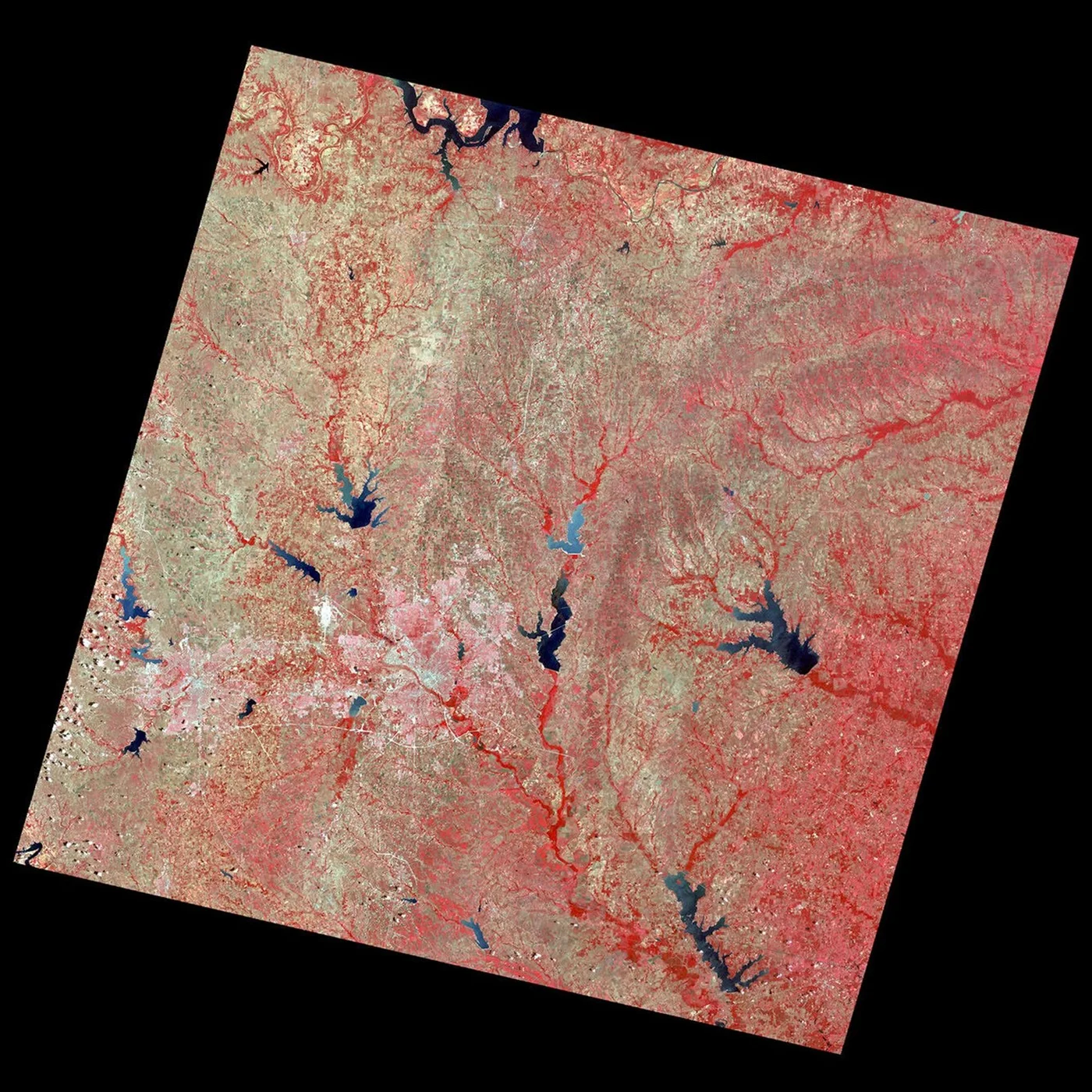
Aerial Photographs vs Satellite Images and When to Use Each
On this page
- What Is Aerial Photography
- 01. Manned aircraft
- 02. Drones (UAVs)
- What Are Aerial Maps
- Aerial Photographs, Satellite Images and Topographic Maps
- What Is Satellite Imagery, in Short
- Aerial Photography vs Satellite Imagery Compared
- Resolution, Which Is Sharper
- Cost, Which Is Cheaper
- Speed and Update Frequency
- Weather Dependence
- Coverage Area, Which Covers More Ground
- Accuracy and Processing Quality
- AI and Automated Feature Extraction
- When to Use Aerial Photography vs Satellite Imagery
- Frequently asked questions
- Sources and further reading
A practical guide to aerial photography vs satellite imagery, how altitude and sensors create the real difference between the two, what an aerial map and a topographic map each actually show, and how resolution, cost, speed, coverage, weather resilience and AI readiness compare in practice.
Quick answer
Aerial photography and satellite imagery both look straight down at Earth's surface, but altitude and sensor placement separate them. Aerial photographs come from a camera on a drone or a manned aircraft flying roughly 60 m to 4,800 m up (200 ft to 16,000 ft), resolving as fine as 1 to 15 cm per pixel over a limited area per flight. Satellite images come from a sensor orbiting 500 km to more than 35,000 km up, covering far more ground per pass, from free 10 to 30 m data down to the sharpest commercial tiers around 15 to 25 cm. An aerial map, usually an orthorectified aerial photograph or orthomosaic, and a topographic map, a surveyed, symbol-based abstraction, are two different products, not the same thing as a raw aerial photograph or satellite image. Aerial photography generally wins on fine resolution, same-day turnaround and weather flexibility over a defined area; satellite imagery wins on coverage, repeat consistency, cost at scale and access to remote or access-restricted ground.
What Is Aerial Photography
Aerial photography is any photograph taken from an airborne platform rather than the ground or an orbiting satellite, and today that means two very different pieces of hardware.
Whether the search is phrased as aerial photography vs satellite imagery, aerial photography vs satellite images, or shorthand like aerial and satellite, satellite and aerials, or aerial & satellite, the underlying question is the same one answered throughout this guide, which data source actually fits the job. Five traits set an aerial photograph apart from a map or a verbal description, it freezes a single moment in time, it can be viewed in stereo pairs for a true three-dimensional perspective, it gives a bird's-eye vantage no ground photo can match, it is comparatively quick and inexpensive to capture over a defined area, and it is sensitive, timing, sun angle, and season all visibly change what the same ground looks like.
Every aerial photograph also falls into one of three angle categories. A vertical photograph is shot with the camera pointed straight down, the standard for mapping and the only angle that orthorectifies cleanly into an aerial map. A low oblique photograph tilts the camera at least 3 degrees off vertical, useful for close-up detail and building facades. A high oblique photograph tilts to roughly 60 degrees, trading mapping accuracy for a wide, landmark-level view of a whole area at once, the style most often used for 3D city modeling when captured from multiple directions around the same target.
01. Manned aircraft
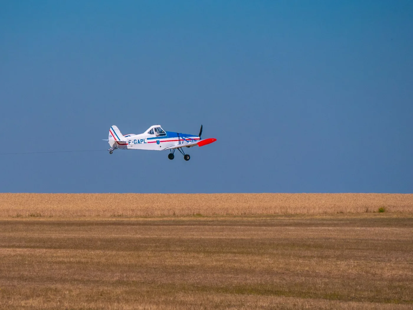
A fixed-wing plane carrying a large-format digital camera, often paired with LiDAR, flies a planned grid pattern at roughly 1,500 to 4,800 m (5,000 to 16,000 ft), the altitude range most aerial survey operators cite for balancing fine resolution against efficient coverage. Beyond the photograph itself, the LiDAR pass produces a digital surface model (DSM), every surface the laser hit, rooftops and treetops included, and a digital terrain model (DTM), the bare ground underneath with vegetation and structures stripped out, the two elevation layers behind most flood, drainage, and earthwork studies. A single flight can cover hundreds of square kilometers in a day, timed around clear weather rather than a fixed orbital pass, which is the platform's real advantage over a satellite tasking order.
02. Drones (UAVs)
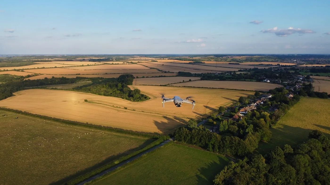
Fixed-wing and rotary-wing drones fly far lower still, commonly around 120 m (about 400 ft) for professional mapping missions, resolving down to roughly 1.5 to 2.5 cm per pixel. That altitude and resolution make a drone the only platform fine enough for single-plant, single-crack, or single-fixture inspection work, at the cost of covering only a single site or field per flight rather than a region.
A third, older category still exists in archives and some specialty work, balloon and kite photography, the platforms that produced the very first aerial images in the 1850s before fixed-wing aircraft took over the job entirely by the early 20th century.
What Are Aerial Maps
An aerial map is not just any aerial photograph, it is a specific product built from one.

A raw aerial photograph, taken straight down (nadir) or at an angle (oblique), is a realistic but geometrically imperfect picture, lens distortion, aircraft tilt, and terrain relief all shift where objects appear relative to their true ground position. An aerial map, more precisely an orthophoto or orthomosaic, is that same photograph run through orthorectification, a process that uses the camera's known position, a terrain model, and ground control points to pull every pixel back to its correct map coordinate. The result keeps the photographic realism of the original image while gaining the geometric accuracy of a map, which is exactly what the USGS's own National Map orthoimagery program is built around, combining orthorectified aerial photographs and satellite images into one nationwide public-domain layer at 1 m resolution or finer.
So when someone asks what an aerial map is, the honest answer is that it is the mapping-grade version of an aerial photograph, not a separate kind of imagery. Satellite imagery goes through the identical orthorectification step before it can be measured reliably too, which is why a "satellite map" and an "aerial map" are built the same way, just from a different altitude.
Aerial Photographs, Satellite Images and Topographic Maps
These three terms get used almost interchangeably in casual search, but each one is a genuinely different kind of product, and understanding the difference is most of what this whole comparison comes down to.
| Factor | Aerial photograph | Satellite image | Topographic map |
|---|---|---|---|
| What it is | A direct photographic capture from an aircraft or drone | A direct photographic or radar capture from an orbiting satellite | A surveyed, symbol-based abstraction, not a photograph |
| How it is made | Camera or sensor on an airborne platform, often orthorectified afterward | Optical or radar sensor on a satellite, orthorectified afterward | Field survey plus cartographic generalization, today built from aerial/satellite data and LiDAR elevation models |
| Scale | Variable, changes with altitude and lens unless orthorectified | Variable, changes with orbit and sensor unless orthorectified | Fixed, standardized scale, e.g. 1:24,000 or 1:50,000 |
| Detail shown | Every visible surface feature, tonal and textural detail included | Every visible surface feature at a coarser pixel size than aerial | Only the features someone chose to symbolize, roads, contours, boundaries, labels |
| Update cycle | On demand, or every few years for public programs like NAIP | Minutes to weeks depending on the satellite and tasking | Redrawn only when someone manually revises it, often years apart |
| Best for | Fine-detail, time-critical capture over a defined area | Repeatable, wide-area or global monitoring | Navigation, elevation reference, and standardized symbology |
What Is Satellite Imagery, in Short
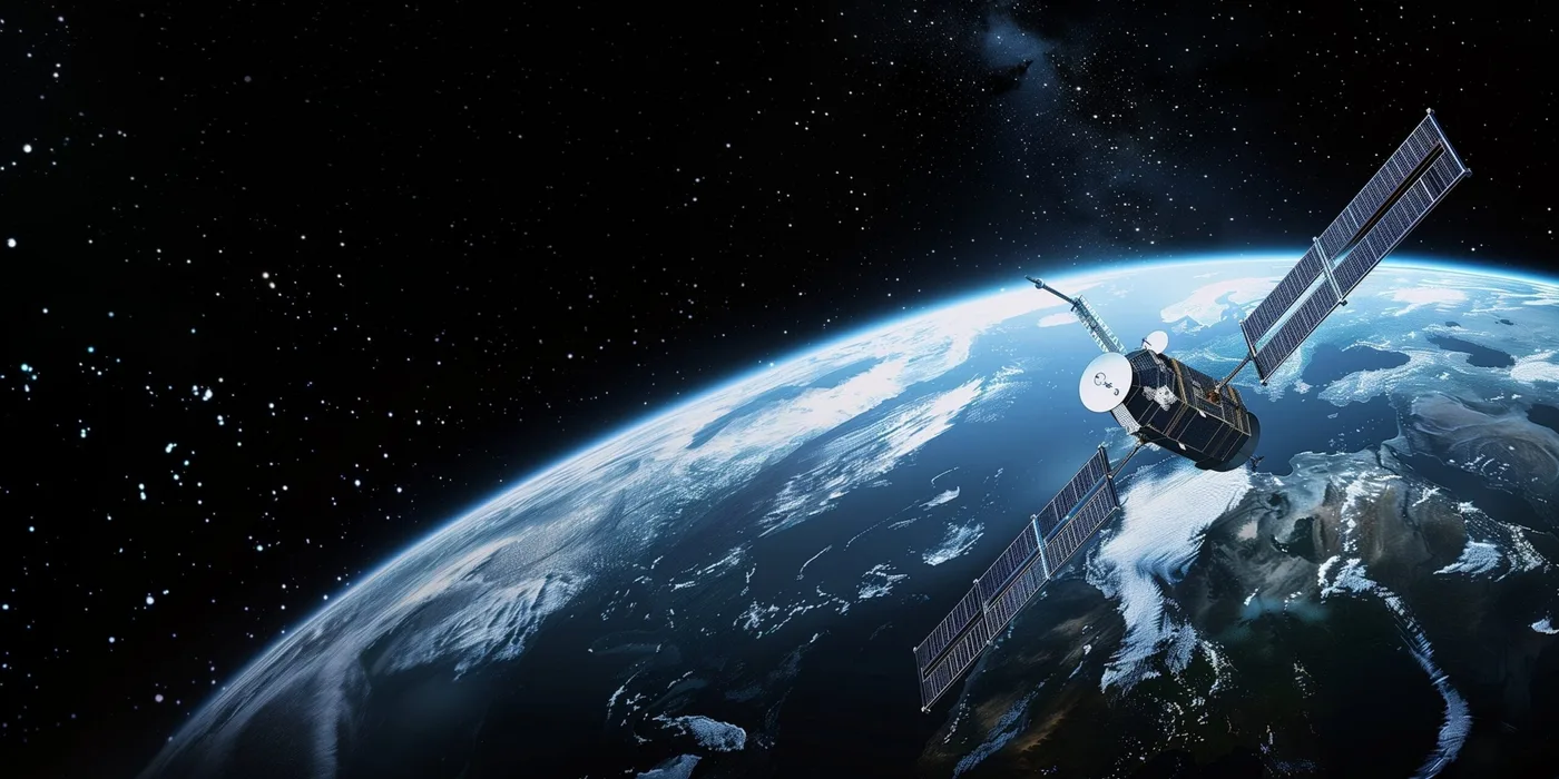
Satellite imagery is the picture or dataset a sensor on an orbiting satellite captures and transmits back to a ground station, either a passive optical sensor recording reflected sunlight or an active radar sensor that works through cloud and darkness. It is worth being precise about one thing here, most satellite sensors are not cameras in the aerial-photography sense at all. Rather than exposing a single frame the way a drone or aircraft camera does, a typical imaging satellite uses a push-broom scanner, a line of detectors that sweeps the ground line by line as the satellite moves along its orbit, assembling the finished image electronically rather than capturing it in one shutter click. The full breakdown of orbits, sensor types, and resolution tiers is covered in our guide to what satellite imagery is and how it works; the version that matters for this comparison is below.
Need the satellite side of this comparison for a real project?
Search free Sentinel-2 and Landsat archive imagery, or task a fresh optical, SAR, or stereo capture directly from this site, no account needed for a first estimate.
Aerial Photography vs Satellite Imagery Compared
Laid out side by side across every factor that actually matters for a buying decision, not just resolution.
| Factor | Aerial photography | Satellite imagery |
|---|---|---|
| Collection altitude | About 60 to 4,800 m (200 to 16,000 ft) | About 500 to 35,786+ km |
| Typical resolution | 1 to 15 cm commercial and drone programs; 30 to 60 cm for free public programs like NAIP | 15 to 25 cm sharpest commercial tiers; 30 cm to 2 m mid tiers; 10 to 30 m free Sentinel-2/Landsat |
| Image products | Nadir and oblique photographs, orthomosaics, LiDAR point clouds, thermal, multispectral | Nadir optical, SAR, multispectral, hyperspectral, stereo pairs for DEM/DSM |
| Collection control | Flight planned and timed by the operator for a specific area and date | Follows a fixed orbital path; tasking reserves the next available pass |
| Weather adaptability | Flight can be rescheduled around a storm system on short notice; optical sensors still need a clear sky to shoot | Optical sensors blocked by cloud the same as aerial; SAR satellites image through cloud, smoke, and full darkness |
| Processing and accuracy | Stitched, color-balanced, and tied to ground control points; LiDAR variants reach centimeter-level vertical accuracy | Varies by provider and tier; stereo satellites like GF-7 produce DEMs accurate to about 0.65 m |
| Update frequency | On demand per flight; public programs like NAIP recapture each state roughly every 2 to 3 years | Minutes (geostationary) to under a day (tasked VHR) to 5 to 16 days (free archive) |
| Coverage per pass | A single field to a few hundred km² per flight day; regional flights can cover 50 to 200+ sq mi (130 to 520+ km²) a day | A single swath up to 800 to 830 km wide; one pass can cross an entire country |
| Cost at scale | Highest per km² for a small site, falls fast as area grows (see cost section below) | Lowest per km² at regional to global scale; free for moderate-resolution archive |
| AI and feature extraction | Consistent fine detail suits property, building, and road-level extraction | Suits landscape or regional-scale trends, urban growth, deforestation, ship and vehicle detection |
Resolution, Which Is Sharper
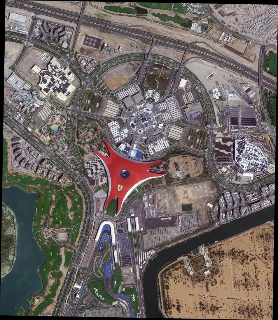
Altitude is the whole story behind the resolution gap, and the numbers make the gap concrete.
| Source | Typical GSD | What becomes visible |
|---|---|---|
| Mapping drone | 1.5 to 2.5 cm | Individual cracks, bolts, plant leaves, roof shingles |
| Commercial aerial photography program | 5 to 15 cm | Roof materials, vehicle types, road markings, individual trees |
| Free public aerial program (NAIP) | 30 to 60 cm | Field boundaries, building footprints, large vehicles |
| Sharpest commercial satellite | 15 to 25 cm | Individual vehicles, small structures, fine urban detail |
| High resolution commercial satellite | 30 cm to 2 m | Buildings, roads, large vehicles |
| Free moderate resolution satellite | 10 to 30 m | Land cover, large fields, broad regional change |
Run the numbers and the real story is more nuanced than "aerial always wins." The finest commercial aerial photography, at 5 to 15 cm, resolves roughly 2 to 3 times finer than the sharpest commercial satellites at 15 to 25 cm, a gap that has shrunk enormously as satellite optics improved. Free public aerial programs like NAIP, at 30 to 60 cm, actually sit between satellite's high and very high commercial tiers, not automatically ahead of them. The big gap opens only against free moderate-resolution satellite data, Sentinel-2 and Landsat at 10 to 30 m, where even a free NAIP pass resolves 15 to 100 times finer. Which comparison matters depends entirely on whether the free or the commercial tier of each source is the one actually in play. One framing worth flagging, some aerial providers advertise their edge as "up to 16 times better resolution," a figure that comes from comparing pixel area rather than pixel width, a 30 cm satellite pixel covers 16 times the ground area of a 7.5 cm aerial pixel. That is a legitimate way to describe how much more detail is packed into the same patch of ground, just a different number than the simpler, more intuitive linear comparison used above, worth knowing so the two claims do not look contradictory.
Cost, Which Is Cheaper
Cost is where the two platforms genuinely trade places depending on how much ground needs covering, not a fixed "one is always cheaper" answer.
| Source | Typical price | Per km² equivalent | Best fit |
|---|---|---|---|
| Drone, basic orthomosaic | $10 to $30/acre | ~$2,500 to $7,400/km² | A single field or site under about 50 acres |
| Drone or aircraft, engineering grade with ground control | $50 to $300/acre | ~$12,000 to $74,000/km² | Engineering deliverables needing survey sign-off |
| Manned aircraft, regional flight at day rate | ~$30,000/day covering 50 to 200+ sq mi | ~$60 to $230/km² | County, utility corridor, or multi-site regional survey |
| Satellite, high resolution tasking | $5 to $10/km² | $5 to $10/km² | Field boundaries, cadastral and topographic mapping |
| Satellite, very high to super high resolution tasking | $13 to $30/km² | $13 to $30/km² | Building footprints, vehicles, fine urban detail |
| Satellite, free moderate resolution archive | $0 | $0/km² | Sentinel-2 and Landsat, regional land cover and trend work |
A drone priced at $10 to $30 an acre sounds cheap until it is converted to the same per-square-kilometer unit satellite tasking uses, where it lands at roughly $2,500 to $7,400/km², mostly because travel, airspace clearance, and crew time are fixed costs spread over a small area. The economics flip once a manned aircraft is flying a full day over a large region, where that same fixed cost spreads across 50 to 200-plus square miles and the effective price per square kilometer drops to roughly $60 to $230, still above satellite tasking but within reach of it. Free satellite archive data beats every aerial option outright whenever 10 to 30 m resolution is good enough for the question being asked, which is why most regional and global monitoring programs default to it rather than commissioning an aerial survey at all.
Speed and Update Frequency
Turnaround depends less on the platform itself than on whether a fresh capture or existing archive data answers the question.
- Drone. Minutes to hours for a single field or site, fully on demand, limited only by battery life and local weather.
- Manned aircraft. Same day to a few days for a regional flight, planned around a clear weather window rather than a fixed schedule.
- Satellite, tasked. Under a day to a few days for very high resolution tasking on fast-revisit commercial satellites; locked to the satellite's next overhead pass rather than an on-demand launch.
- Satellite, archive. Instant, if a recent enough capture of the exact area already exists, which it frequently does for well-covered regions.
- Satellite, geostationary. A new frame every 5 to 15 minutes, continuously, trading resolution entirely for that update rate.
Public aerial programs sit at the other extreme. NAIP recaptures each U.S. state on roughly a 2 to 3 year cycle, which makes free aerial data far more current for fine detail than most people expect, but still nowhere near as fresh as a tasked satellite pass or a same-day drone flight over one specific site.
Weather Dependence
Cloud cover is the one constraint that treats aerial and optical satellite imagery almost identically, with one major exception.
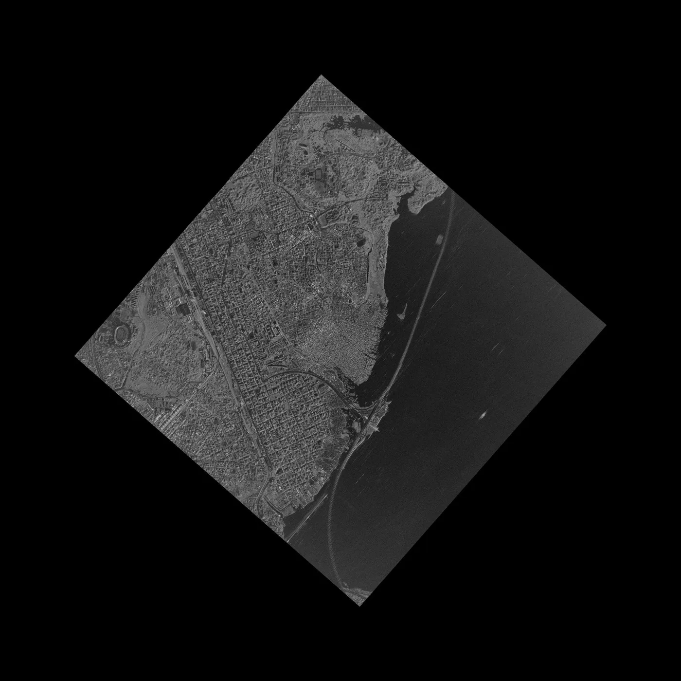
An optical camera, whether it is mounted on a drone, a plane, or a satellite, needs a sunlit, cloud-free sky to produce a usable image, full stop. The practical difference is flexibility, not capability. An aerial operator can watch the forecast and reschedule a flight to the next clear window days or even hours out, or fly beneath a high cloud ceiling that would still block a satellite's view from orbit. A tasked satellite is locked to its next orbital pass over that exact spot, so a cloud-blocked attempt often means waiting for the satellite's next revisit, anywhere from under a day to weeks later depending on the constellation. SAR satellites are the genuine exception to all of this, transmitting their own microwave signal and reading the return, which keeps working through cloud, smoke, rain, and total darkness, a capability no standard aerial camera has at any altitude.
Coverage Area, Which Covers More Ground
This is the factor where satellite imagery's advantage is least ambiguous.
A single drone flight covers a few hundred acres at most before the battery runs out. A manned aircraft flying a planned regional route can cover roughly 50 to 200-plus square miles (130 to 520-plus km²) in a single day, genuinely large by aerial standards but still a fraction of what one satellite pass covers. A single optical satellite swath commonly runs 800 to 830 km wide, meaning one pass can cross an entire country, and the same orbit repeats that coverage automatically on every cycle without anyone chartering a flight. Satellites also reach ground an aircraft legally or physically cannot, a conflict zone, a closed border, open ocean, or polar ice, without needing overflight permission from any government along the way.
Accuracy and Processing Quality
Both sources can be made survey-accurate, the difference is in what that accuracy actually measures.
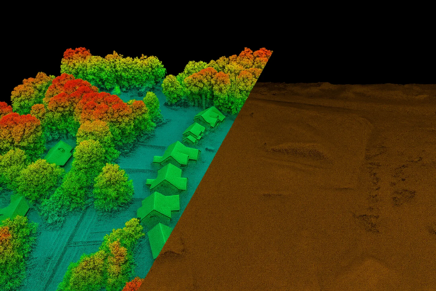
Both aerial photographs and satellite images are orthorectified against ground control points before they are considered map-accurate, and both are commonly evaluated against the ASPRS Positional Accuracy Standards for Digital Geospatial Data, the published industry framework for stating horizontal and vertical accuracy relative to GSD. Where the two genuinely diverge is vertical accuracy. Aerial LiDAR, flown low and close to the ground, resolves elevation to the centimeter level, the standard for engineering-grade digital terrain models. Satellite-derived elevation, built from stereo image pairs rather than a laser pulse, is coarser by comparison, a stereo satellite like GF-7 produces a DEM accurate to roughly 0.65 m, more than adequate for regional terrain analysis but not a replacement for engineering-grade LiDAR on a single site.
AI and Automated Feature Extraction
Machine learning models are only as good as the imagery they are trained and run on, and the two sources suit genuinely different extraction tasks.
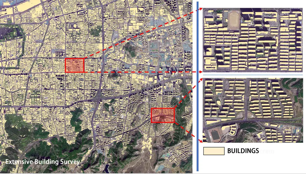
Aerial imagery's edge for AI work is consistency at fine scale, a drone or aircraft program flown to a controlled spec produces uniform resolution and lighting across a property or corridor, ideal for property-, building-, and road-level extraction models. Satellite imagery's edge is repeatable scale, the same sensor revisiting the same orbit path makes it the practical choice for landscape or regional-scale detection work, tracking urban growth, flagging deforestation, or counting vessels in a harbor, the kind of monitoring covered in our guides to change detection for urban growth and forestry canopy monitoring. Most serious AI pipelines end up using both, satellite data for the wide first pass, aerial or drone data for the close follow-up once something worth a closer look is flagged.
When to Use Aerial Photography vs Satellite Imagery
Three questions settle most platform decisions faster than comparing spec sheets line by line.
- For a single property, building, construction site, or short infrastructure corridor that needs the finest possible detail on a specific date, aerial photography or a drone flight is the right call, and it is the only option fine enough for single-plant, single-crack, or single-fixture inspection work.
- For regional, national, or global monitoring on a repeating schedule, especially across a remote, hazardous, or access-restricted area, satellite imagery wins on both coverage and cost, covered in practice in our guide to how satellite imagery prevents mining accidents.
- For a decades-long historical record of the same ground, satellite programs like Landsat, imaging continuously since 1972, hold an archive no aerial survey schedule can retroactively reconstruct, detailed in our guide to the history of satellite imagery.
Most serious operations end up using both rather than picking one permanently, satellite imagery as the standing baseline for broad or repeat monitoring, and a targeted aerial or drone flight only where the satellite data flags a spot that is worth a closer look, the same pattern already standard in agriculture and covered in full in our guide to aerial imagery for crop assessment.
Aerial photography vs satellite imagery, in numbers, 2026
A few figures put the real scale of the gap, and how fast it is closing, into perspective.
How much finer the sharpest commercial aerial photography (5 to 15 cm) resolves than the sharpest commercial satellites (15 to 25 cm) today.
A typical optical satellite swath width, wide enough for a single pass to cross an entire country.
Estimated global aerial imaging market size in 2026, growing at a CAGR near 33%.
The year Landsat began the continuous satellite archive no aerial survey schedule can retroactively reconstruct.
Key takeaways
- Aerial photography comes from a drone or manned aircraft flying roughly 60 m to 4,800 m up; satellite imagery comes from an orbiting sensor 500 km to over 35,000 km up, the altitude gap behind nearly every other difference between them.
- An aerial map is an orthorectified aerial photograph, not a raw photo and not a topographic map; a topographic map is a surveyed, symbol-based abstraction with a fixed scale, built today from aerial or satellite data plus LiDAR elevation.
- Resolution gaps are smaller than most comparisons suggest, commercial aerial photography resolves only about 2 to 3 times finer than the sharpest commercial satellites, though both far outresolve free satellite data.
- Cost flips with area, a small drone job can cost more per square kilometer than satellite tasking, while a full-day regional aerial flight and tasked satellite imagery land in a similar range, and free Sentinel-2/Landsat archive beats both when moderate resolution is enough.
- SAR satellites are the one source that images through cloud, smoke, and darkness; every optical source, aerial or satellite, needs a clear sky.
- Most serious monitoring programs use both, satellite imagery for repeatable wide-area coverage and historical archive, aerial or drone imagery for fine, time-critical detail over a specific site.
Frequently asked questions
What is the difference between aerial photography and satellite imagery?
Aerial photography is captured from a drone or manned aircraft flying roughly 60 m to 4,800 m above the ground, resolving as fine as 1 to 15 cm per pixel over a limited area per flight. Satellite imagery is captured from an orbiting sensor 500 km to over 35,000 km up, covering far more ground per pass at a coarser typical resolution, from free 10 to 30 m data to the sharpest commercial tiers around 15 to 25 cm.
What is an aerial map?
An aerial map is an aerial photograph that has been orthorectified, corrected using the camera's position, a terrain model, and ground control points so every pixel sits at its true map coordinate. That process removes the lens distortion and terrain-relief shift present in a raw aerial photograph, giving it the geometric accuracy of a map while keeping the photographic realism of the original image.
What are aerial maps used for?
Aerial maps are used anywhere a measurable, geometrically accurate picture of the ground is needed, property and parcel boundaries, construction and infrastructure planning, agricultural field mapping, and as a base layer in GIS software, because unlike a raw aerial photograph they can be measured and overlaid reliably.
What is the difference between aerial photographs, satellite images, and topographic maps?
Aerial photographs and satellite images are both direct photographic or radar captures of the ground, from an aircraft or drone and from an orbiting satellite respectively. A topographic map is not a photograph at all, it is a surveyed, symbol-based abstraction at a fixed standardized scale, showing only the features someone chose to draw, such as contour lines, roads, and boundaries, and today it is typically built using aerial or satellite imagery plus LiDAR elevation data rather than field survey alone.
Which is more accurate, aerial photography or satellite imagery?
Both can be made survey-accurate once orthorectified against ground control points, and both are commonly evaluated against the ASPRS Positional Accuracy Standards. Aerial LiDAR reaches centimeter-level vertical accuracy, finer than satellite-derived elevation models, while satellite stereo imagery, such as GF-7, typically produces elevation models accurate to roughly 0.65 m, more than sufficient for regional terrain analysis.
How much does aerial photography cost compared to satellite imagery?
A small drone survey typically costs $10 to $30 per acre, which converts to roughly $2,500 to $7,400 per square kilometer, often more expensive than satellite tasking because travel and crew costs are fixed over a small area. A full-day regional aerial flight spreads that same cost over 50 to 200-plus square miles, landing around $60 to $230 per square kilometer. Commercial satellite tasking runs $5 to $30 per square kilometer depending on resolution tier, and free sources like Sentinel-2 and Landsat cost nothing.
Is aerial photography or satellite imagery faster to obtain?
A drone flight can deliver imagery the same day, limited only by weather and battery life. A manned aircraft regional flight typically takes a few days. Tasked very high resolution satellite imagery can arrive in under a day to a few days depending on the satellite's revisit rate, while satellite archive imagery, if a recent capture already exists, is available instantly.
Does cloud cover affect aerial photography and satellite imagery the same way?
Optical sensors on both aerial platforms and satellites need a clear, sunlit sky and cannot see through cloud cover. The practical difference is flexibility, an aerial flight can often be rescheduled to the next clear window within days or hours, while a tasked satellite is locked to its next orbital pass. SAR satellites are the exception, imaging through cloud, smoke, and full darkness using their own radar signal.
What resolution do aerial photographs and satellite images typically have?
Commercial aerial photography and drone programs typically resolve 1 to 15 cm per pixel, while free public aerial programs like NAIP resolve 30 to 60 cm. Satellite imagery ranges from 15 to 25 cm on the sharpest commercial tiers down to 10 to 30 m on free sources like Sentinel-2 and Landsat.
Is Google Maps satellite or aerial imagery?
Both, blended by zoom level. The copyright notice at the bottom of Google Maps and Google Earth names the imagery source for whatever view is on screen, and it changes as you zoom. The widest, continental or country-scale views are built from free satellite data like Landsat, which is why that credit only shows up when zoomed far out. Zoom in further and Google switches to its purchased commercial imagery, a mix of very high resolution satellite captures and aerial photography depending on the region, which is why street-level detail like individual trees or vehicles looks far sharper close up than it does on a regional view of the same map.
Sources and further reading
The aerial-photography figures used throughout this guide, altitude, resolution, update cycle, and cost, are drawn from the following sources, cited in detail since they are the newest additions to our reference base.
- USDA Farm Production and Conservation Business Center / USGS EROS, National Agriculture Imagery Program (NAIP) Data Dictionary, the source for NAIP's ground sample distance standards, the 2018 changeover from 1-2 m to 0.6 m GSD, and the 2025 acquisition cycle delivering 0.6 m or 0.3 m depending on state
- USGS, The National Map Orthoimagery program documentation, the source for the 1 m-or-finer public-domain orthoimagery standard and the definition of orthorectification combining aerial photograph or satellite image realism with map geometric accuracy
- USGS, "Aerial photograph vs orthoimage" reference media and topographic map symbology documentation, the source for the aerial photograph/topographic map distinction used in the three-way comparison table
- ASPRS (American Society for Photogrammetry and Remote Sensing), Positional Accuracy Standards for Digital Geospatial Data, the published industry framework referenced for aerial and satellite ortho accuracy evaluation
- EagleView and industry aerial-mapping methodology guides, the source for typical manned aircraft flight altitudes of roughly 5,000 to 15,000 ft and regional daily coverage rates of 50 to 200-plus square miles
- Wingtra and published 2026 drone-survey pricing guides, the source for professional drone mapping altitude (about 120 m), typical GSD (1.5 to 2.5 cm), and per-acre pricing tiers for basic, engineering-grade, and survey-grade drone deliverables
- Published 2026 aerial and drone survey cost guides, the source for manned aircraft LiDAR day-rate pricing (around $30,000/day) and large-area corridor survey pricing
- Mordor Intelligence, Aerial Imaging Market Analysis, the source for the 2026 global aerial imaging market size and CAGR figures cited in the benchmark panel
- China Siwei and XRTech Group, GF-7 stereo satellite DEM/DSM accuracy specifications, the source for the roughly 0.65 m satellite-derived elevation accuracy figure
- ESA Copernicus and USGS, Sentinel-2 and Landsat mission specifications, orbit altitude, and continuous archive history since 1972
- University of Virginia Library geospatial resources, documentation of how the Google Maps and Google Earth on-screen copyright notice changes with zoom level between free satellite data and Google's purchased commercial imagery
For the full mechanics of how a satellite image is captured, see our guide to how satellite images are actually taken. For resolution tiers and satellite pricing in full detail, see choosing the right satellite resolution. For a full taxonomy of satellite imagery types with real examples, see real Earth images from space.
Ready to work with real satellite imagery?
Search free and commercial optical, SAR, and stereo archive imagery, or request tasking for a specific date and area. Get a first estimate in minutes, no account required.