Why No Satellite Can Actually Read a Car's License Plate
On this page
- What resolution a satellite would need to read a license plate
- How sharp are today's satellites, commercial vs classified
- Why the gap is bigger than resolution alone
- What satellites can actually detect on a road or in a lot
- How license plates are actually identified, when it matters
- Frequently asked questions
- Sources and further reading
A practical guide to whether satellites can read a license plate from space, the resolution a plate actually needs, how that compares to today's sharpest commercial and classified satellites, and why distance, angle, and orbital speed rule it out no matter how good the camera gets.
Quick answer
No, satellites cannot read a license plate from space, including classified reconnaissance satellites. Reading plate characters reliably needs a resolution of roughly 2 to 3 millimeters per pixel. The sharpest satellites sold commercially today resolve to about 25 to 34 cm per pixel, and the best-documented spy satellites are estimated at 5 to 10 cm, both still 20 to 120 times too coarse. A satellite's near-overhead viewing angle makes it worse, since a plate faces outward rather than up, and low Earth orbit satellites move too fast to hover over one vehicle. License plates are read by ground-level and drone-mounted cameras instead, never from orbit.
What resolution a satellite would need to read a license plate
Spatial resolution, or ground sample distance, is the size of ground one pixel covers, and it's the single number that decides whether any sensor can resolve small text at all. For the full breakdown of every resolution tier and what each one shows, see our guide to choosing the right satellite resolution. For reading a license plate specifically, the industry standard for automatic plate recognition cameras sets the bar fairly precisely, not a guess.
A standard license plate is roughly 30 cm wide. Automatic license plate recognition (ALPR) systems generally need 100 to 150 pixels across that full width for reliable character recognition, with individual character strokes at least 2 pixels wide under perfect conditions, and closer to 4 pixels wide once real-world blur and noise are accounted for. Run the math and a plate needs a ground sample distance of roughly 2 to 3 millimeters per pixel, a quarter of a centimeter at most, before the characters stop being a smear and start being readable text.
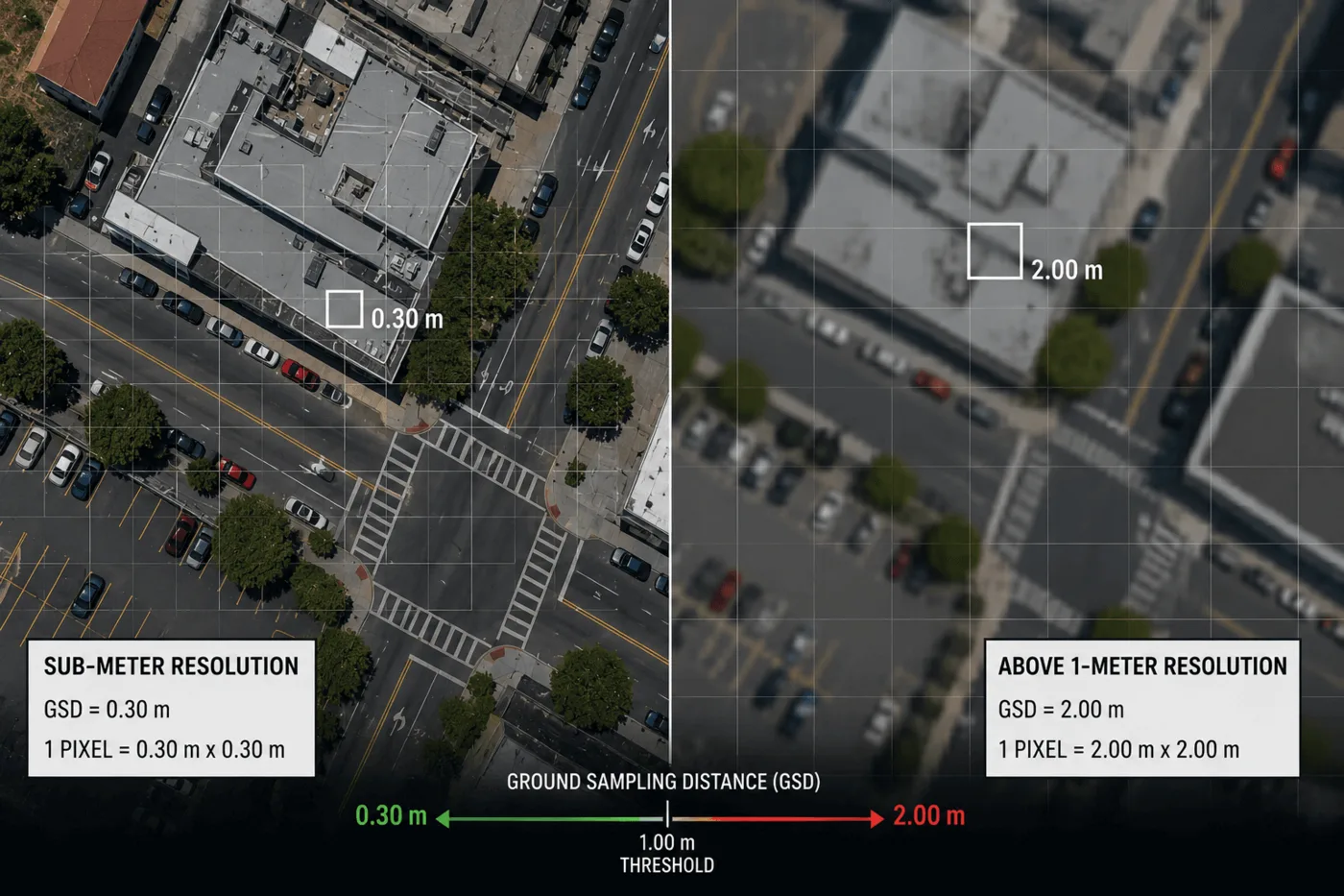
No satellite in orbit, commercial or military, delivers pixels anywhere close to that size. The next section puts the actual numbers next to that 2 to 3 mm requirement.
How sharp are today's satellites, commercial vs classified
Commercial satellite resolution limits loosened considerably over the past few years. NOAA's licensing rules, which govern what U.S. commercial operators can sell, used to keep the finest licensed resolution close to 25 cm through temporary operating conditions. A 2020 rule change tied to Space Policy Directive-2 restructured licensing into tiers, and by 2023 NOAA had lifted dozens of those temporary restrictions, opening the door to sharper licensed resolutions as foreign competition caught up. Albedo Space used that opening to secure a NOAA license for 10 cm imagery and launched its first satellite, Clarity-1, in March 2025, the finest resolution licensed for commercial sale to date.
| Tier | Example | Resolution | Gap vs. a license plate |
|---|---|---|---|
| Widely sold commercial | SuperView Neo-1, WorldView Legion | 25–34 cm | About 120× too coarse |
| Newest licensed commercial | Albedo Clarity-1 | 10 cm | About 40× too coarse |
| Best-documented classified | KH-11 class (estimated) | 5–10 cm | About 20–40× too coarse |
| What a plate needs | — | 0.2–0.3 cm | — |
The classified estimate isn't a rumor. A high-resolution satellite photo released publicly in 2019 let independent satellite trackers reverse-engineer which satellite took it and calculate its resolution, landing at roughly 10 cm per pixel for that image, with a theoretical ceiling around 5 to 7 cm for a sensor of that class. That ceiling isn't a secrecy limit, it's a diffraction limit, the hard physical boundary set by mirror size and orbital altitude that no amount of budget or engineering can beat without a larger mirror or a lower, shorter-lived orbit. A 2.4 meter mirror, the same class used on the Hubble Space Telescope, is already about as large as a satellite can practically launch and point at the ground.
Every tier in that chart sits well to the right of the dashed line marking what a plate requires, and that line doesn't move no matter which satellite improves next.
Why the gap is bigger than resolution alone
Even a satellite that somehow matched the required pixel size would still run into three separate physical problems that have nothing to do with camera quality.
- Atmospheric distortion. Light travels through hundreds of kilometers of turbulent air, moisture, and haze between a satellite and the ground, scattering and blurring fine detail the same way heat shimmer blurs a distant road. This is why ground telescopes need adaptive optics to sharpen images of stars, and why any optical sensor looking down from orbit runs into a soft blur ceiling regardless of how sharp its own optics are.
- Viewing angle and geometry. A license plate is mounted vertically, facing forward or backward, while a satellite photographs from nearly straight overhead or from a shallow oblique angle. Looking straight down, a rear plate is often hidden entirely beneath a trunk lid or rear windshield. From an oblique angle, the plate compresses into a thin diagonal sliver and the light has to travel an even longer, hazier path through the atmosphere, which lowers the effective resolution below the sensor's stated number.
- Orbital speed and no hovering. A low Earth orbit satellite travels at roughly 7.5 km per second, around 27,000 km/h, and crosses a given point in well under a minute. It can't hover over one intersection the way a drone or a fixed road camera can, and it has to be tasked to the exact spot in advance, which rules out "catching" one specific vehicle at the right second. Geostationary satellites can stare at the same region continuously instead, but they trade resolution away to do it; GF-4 sits at 36,000 km and resolves to about 50 m, useful for regional change, not individual objects.
Need to monitor vehicles or site activity, not individual plates?
Our archive covers every resolution tier from 25 cm commercial to 10 m wide-swath, enough to count vehicles, track a fleet, or watch a site's activity change over time.
What satellites can actually detect on a road or in a lot
None of this makes sub-meter satellite imagery useless for anything involving vehicles, it just sets the ceiling honestly. At 25 to 50 cm, a satellite resolves a vehicle's shape, position, and rough type clearly enough to count, classify, and track change over time, which covers most of the real commercial demand for vehicle-related imagery.
| Resolution tier | Vehicle presence and shape | General type and color | License plate |
|---|---|---|---|
| 25–50 cm (sub-meter commercial) | Clearly visible, individually countable | Visible, sedan vs. truck vs. bus distinguishable | Not detectable |
| 51 cm–2 m | Visible as a distinct shape | Approximate at best | Not detectable |
| 2–10 m (wide-swath) | Visible only in dense clusters, like a parking lot | Not detectable | Not detectable |
That sub-meter tier is exactly what gets used for fleet counts in a mining or logistics yard, parking lot occupancy over time, port and marshalling yard vehicle tracking, and before-and-after traffic density comparisons for urban planning. It's a counting and change-detection instrument, not an identification instrument, and every legitimate vehicle-monitoring use case on the market today is built around that distinction rather than around resolving individual plates.
How license plates are actually identified, when it matters
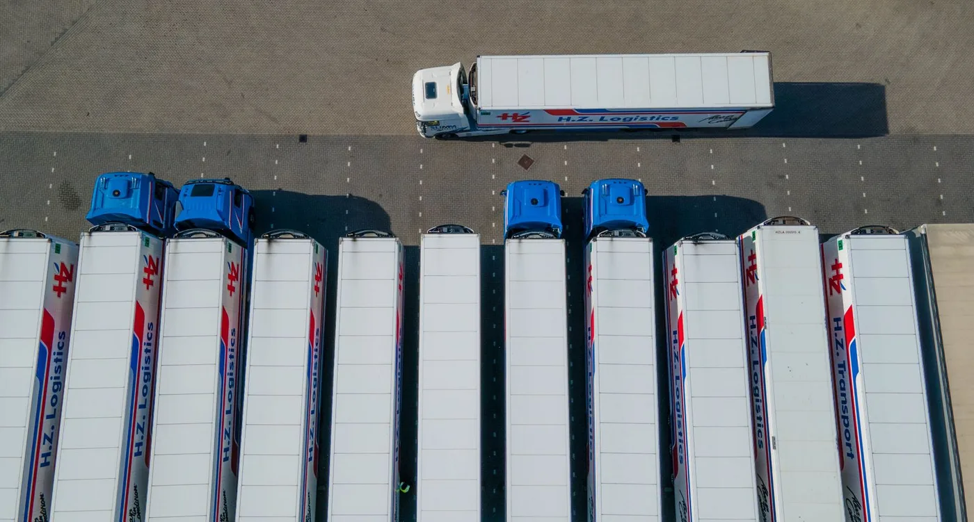
Every real plate-reading system solves the distance and angle problem the same way, by moving the camera close enough to the plate instead of trying to resolve it from far away. Fixed automatic license plate recognition (ALPR) cameras mount 3 to 6 meters up at road edges and intersections, aimed nearly level at an oncoming or departing plate's reflective face, often with an infrared flash tuned to the retroreflective coating plates are made from. Police cruisers carry the same optics on a moving mount, toll plazas and parking garages use fixed versions at the barrier, and low-altitude drones cover temporary or mobile situations a fixed camera can't reach.
It's worth separating this from general aerial survey resolution. Wide-area aerial mapping cameras, the kind used for the broad land surveys covered in our aerial photography vs. satellite imagery comparison, resolve to a few centimeters per pixel across a wide swath, not fine enough for a plate either. A dedicated ALPR lens is a different instrument entirely, narrowing its whole field of view to one plate at a known, short, fixed range, which is how it reaches character-level sharpness that no area-survey figure, aerial or orbital, needs to match.
Closing that distance from hundreds of kilometers down to a few meters is what fixes the resolution, angle, and atmospheric problems all at once, something no amount of orbital camera improvement can substitute for.
Key takeaways
- Reading a license plate needs roughly 2 to 3 millimeters of ground resolution per pixel, finer than any satellite flying today.
- Widely sold commercial satellites resolve to 25–34 cm, the newest licensed commercial satellite resolves to 10 cm, and the best-documented classified satellites are estimated at 5–10 cm, all 20 to 120 times too coarse for a plate.
- The classified-satellite resolution ceiling is a physics limit set by mirror size and orbital altitude, not a secrecy restriction, and it can't be beaten without a bigger mirror or a lower orbit.
- Atmospheric blur, a plate's vertical, outward-facing mounting, and a low Earth orbit satellite's 27,000 km/h ground speed all compound the resolution problem independently.
- Sub-meter satellite imagery is genuinely useful for counting and tracking vehicles, fleets, and site activity. Reading an actual plate is done by fixed, mobile, or drone-mounted ALPR cameras at close range, not from orbit.
Frequently asked questions
Can satellites read a license plate from space?
No. Reading a license plate reliably needs a resolution of roughly 2 to 3 millimeters per pixel. The sharpest satellites sold commercially today resolve to about 25 to 34 cm per pixel, and the best-documented classified satellites are estimated at 5 to 10 cm, both tens to over a hundred times too coarse to resolve plate characters.
Can a satellite read a license plate?
No current satellite, commercial or military, can read a license plate. The finest publicly documented satellite resolution is around 5 to 10 cm per pixel, which is still roughly 20 to 40 times coarser than the 2 to 3 millimeter resolution plate characters require.
Can satellites detect a license plate on a car?
A satellite can detect that a vehicle exists and roughly what type it is at sub-meter resolution, but it cannot detect or resolve the plate itself. A license plate is only a few centimeters tall, far smaller than a single pixel on any orbital sensor.
Can satellites see a car's license plate?
Satellites can see a car as a distinct shape at resolutions of 25 to 50 cm per pixel, enough to count vehicles and tell a sedan from a truck. They cannot see the plate on it, since the plate's lettering is smaller than one pixel at that resolution and far smaller still from orbit at any resolution flown today.
What resolution would a satellite need to read a license plate?
Roughly 2 to 3 millimeters per pixel, based on automatic license plate recognition systems needing 100 to 150 pixels across a plate's 30 cm width for reliable character recognition. No satellite in orbit resolves anywhere close to that.
Can spy satellites read license plates?
No. The best publicly estimated resolution for classified reconnaissance satellites is 5 to 10 cm per pixel, based on analysis of a declassified 2019 image. That resolution is set by a diffraction limit tied to mirror size and orbital altitude, and it is still 20 to 40 times too coarse to resolve a license plate's characters.
How are license plates actually identified if not by satellite?
Fixed automatic license plate recognition cameras mounted 3 to 6 meters up at roadsides, mobile cameras on police vehicles, toll and parking barrier cameras, and low-altitude drones all read plates by getting close enough, usually within a few meters to around 100 meters, to resolve the characters directly.
What is the highest resolution satellite imagery available today?
The newest NOAA-licensed commercial satellite imagery reaches 10 cm per pixel, from Albedo's Clarity-1 satellite launched in 2025. Widely sold commercial imagery, such as SuperView Neo-1 or WorldView Legion, reaches 25 to 34 cm per pixel. Both are well short of the sub-centimeter resolution a license plate requires.
Sources and further reading
- NOAA Office of Space Commerce: commercial remote sensing licensing rule changes, 2020 and 2023
- Live Science and NextBigFuture: resolution analysis of the 2019 declassified KH-11 class satellite image
- SpaceNews and Payload Space: Albedo Space Clarity-1 launch and NOAA 10 cm imagery license, 2023–2025
- Maxar / Apollo Mapping: WorldView Legion satellite resolution specifications
- Adaptive Recognition and Axis Communications: automatic license plate recognition resolution and pixel requirements
- China Siwei and 21AT: SuperView Neo-1 and GF-series satellite specifications
For how a sensor turns reflected light into a pixel grid in the first place, see our guide to how satellite images are taken.
Looking for the finest resolution actually available?
Search archive imagery from 25 cm commercial satellites, or request new tasking, all through one portal with pricing by resolution tier.