

SAR Satellite Imagery for Disaster Response Mapping
On this page
- How SAR imagery keeps disaster monitoring running when every other sensor goes blind
- SAR satellites used for disaster monitoring and emergency response
- Four disaster response applications for SAR imagery
- 01. Flood mapping and waterline extent
- 02. Marine oil spill detection and tracking
- 03. Geological hazards and structural stability (InSAR)
- 04. Wildfire boundary tracking
- SAR vs. optical imagery for disaster response
- How SAR imagery flags flood and building damage inside cities
- Frequently asked questions
- Sources and further reading
When a flood or wildfire is still unfolding, cloud cover and smoke usually blind optical satellites at the exact moment responders need eyes on the ground. Synthetic Aperture Radar (SAR) satellite imagery gets around that by generating its own microwave pulses and reading the echo, so it images straight through weather and darkness on command.
Quick answer
SAR is an active radar sensor that sends out its own microwave pulses instead of relying on sunlight, so it produces usable imagery through cloud, fog, smoke, rain, and full darkness, conditions that stop optical satellites outright. Disaster teams use it to map flood extent, track oil spills, watch ground deformation on dams and slopes, and trace wildfire boundaries, often within hours of a tasking request.
How SAR imagery keeps disaster monitoring running when every other sensor goes blind
- All-weather and nighttime operation: unaffected by darkness or heavy overcast, so emergency response teams get near real-time data through a tropical storm, monsoon, or a crisis that breaks out at night.
- Cloud and smoke penetration: the radar signal cuts through dense cloud layers and thick smoke plumes to read ground conditions directly, closing the gap that usually stalls situational awareness during a fast-moving event.
- Millimeter-level deformation (InSAR): Interferometric SAR compares the phase difference between two passes over the same ground, an early warning signal that picks up surface shifts as small as 1 to 2 mm before they become visible.
- Rapid tasking and delivery: command uploads can reach a satellite within 3 hours globally, and fast-response chains have delivered a first rapid-mapping product in about 1.5 hours with cloud processing done in roughly 1 hour.
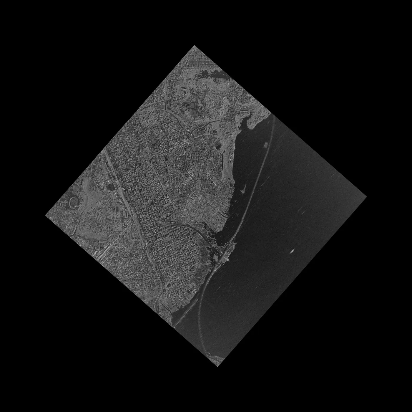
SAR satellites used for disaster monitoring and emergency response
| Satellite / constellation | Band / sensor | Native resolution | Key feature for disaster response |
|---|---|---|---|
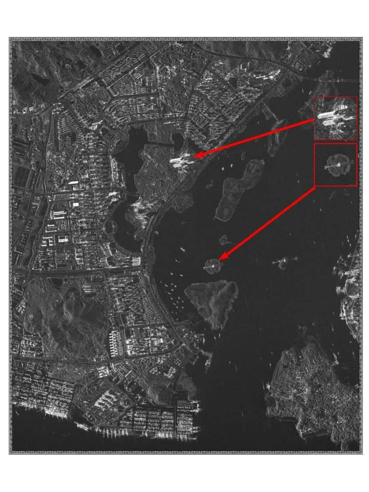
| GF-3 Constellation | C-band SAR | 1 m (Spotlight) to 500 m (ScanSAR) | 12 imaging modes, including Spotlight, Stripmap, and ScanSAR, with high-frequency revisits for flood and oil spill tracking |
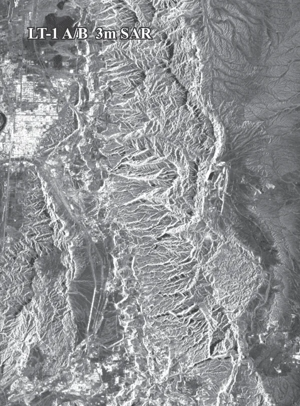
| LT-1 (A & B) | L-band SAR | 3 m | World's first L-band dual-satellite SAR constellation, built for millimeter-level InSAR and global 1:50,000 DEM generation |
| SuperView Neo-2 | SAR | Sub-meter / VHR | Part of the 28-satellite SuperView Neo system, giving high daily revisit capacity |
| Sentinel-1 | C-band SAR | 5 to 20 m | Open-access Copernicus constellation for systematic, all-weather global coverage |
| HJ-1C | S-band SAR | 5 m / 20 m | Purpose-built disaster monitoring satellite, also carrying optical and infrared instruments |
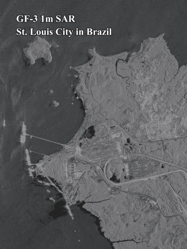
Four disaster response applications for SAR imagery
01. Flood mapping and waterline extent
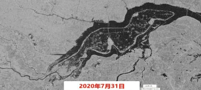
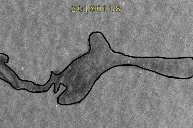
Water reflects radar signals away from the sensor instead of back to it, so flooded ground shows up as a dark, low-backscatter patch. AI algorithms trace that dark boundary automatically, even while rain is still falling, mapping flood zones in real time, tracking rising water, and feeding evacuation and supply-routing decisions.
During the 2020 flood season in China, GF-3 was tasked to continuously monitor flood-hit regions through persistent cloud cover, giving responders situational awareness when optical sensors were unusable.
02. Marine oil spill detection and tracking
An oil film smooths the ocean surface and dampens capillary waves, which shows up as a distinct low-backscatter patch against the rougher open water around it. That lets analysts locate a spill, size the slick, and combine the radar read with current models to forecast where it's heading and where to place containment booms.
Following a major maritime oil spill, GF-3 delivered close to 200 scenes of radar imagery within 4 days to track how the slick was evolving and guide the cleanup on site.
03. Geological hazards and structural stability (InSAR)
Multi-temporal InSAR compares many radar passes over the same ground to flag instability in natural slopes and critical infrastructure as an early warning signal, well before it becomes visible from the surface. That covers landslides, volcanic swelling, earthquake fault lines, and urban ground subsidence, along with the structural health of dams, bridges, pipelines, and tailings dams, both before an event and in post-disaster damage assessment afterward.
InSAR has run quarterly structural deformation checks on the Aswan Dam in Egypt, and supported rapid landslide assessment during the 2022 Venezuelan landslide response.
04. Wildfire boundary tracking
Microwave signals pass straight through the smoke and haze a fire generates, so responders can track the active fire front, map the burn scar, and assess post-fire landslide risk on the surrounding terrain without waiting for the smoke to clear.
SAR vs. optical imagery for disaster response
Neither replaces the other. The two are usually tasked together, SAR first if weather is uncertain, optical once skies clear enough for a sharper, more interpretable look.
| Factor | SAR | Optical |
|---|---|---|
| Cloud, smoke, rain | Sees straight through | Blocked |
| Night operation | Yes, radar generates its own signal | No, needs reflected sunlight |
| Ground deformation | Millimeter-level via InSAR | Not measurable |
| Visual interpretability | Requires training to read backscatter patterns | Reads like a photo, easy for non-specialists |
| Building-level damage assessment | Coherence loss flags which structures likely changed or collapsed | Visually confirms the type and severity of the damage |
| Best role | First look during active weather or darkness | Follow-up confirmation once conditions clear |
How SAR imagery flags flood and building damage inside cities
Open ground is straightforward: floodwater is smooth, so it reflects radar away from the sensor and shows up dark. Dense city blocks behave differently. When water sits against a building wall, the radar signal bounces off the water and then the wall, a double-bounce path that sends an unusually strong return back to the satellite, so a flooded street can actually look brighter than a dry one instead of darker.
That is why urban flood and building-damage change detection increasingly leans on coherence rather than brightness alone. Coherence measures how similar the radar signal stays between two passes over the same spot. A stable, undisturbed building keeps a consistent signal from one pass to the next; a collapsed wall, a shifted roofline, or a street now sitting under water breaks that consistency. Comparing coherence before and after an event produces a damage proxy map, a fast, quantitative read on which city blocks changed, that holds up in dense urban terrain where a simple brightness comparison alone would miss it.
Key takeaways
- SAR generates its own microwave signal, so it images through cloud, smoke, rain, and full darkness, conditions that stop optical satellites entirely.
- InSAR compares repeat radar passes to detect ground movement as small as 1 to 2 mm, catching dam, slope, and fault instability before it becomes visible on the surface.
- GF-3 has tracked flood extent through persistent cloud cover during China's 2020 flood season and delivered nearly 200 scenes in 4 days during a major oil spill response.
- A SAR tasking order can reach a satellite in about 3 hours, with some response chains delivering a first processed look in roughly 1.5 to 2.5 hours total.
- Inside cities, flooded ground can look bright instead of dark due to double-bounce scattering off building walls, so urban flood and damage maps rely on coherence change, not brightness alone.
- SAR and optical imagery work best together: radar for the first look through bad weather, optical for sharper follow-up confirmation once skies clear.
Frequently asked questions
What is SAR and how does it work for disaster response?
SAR, Synthetic Aperture Radar, is an active sensor that sends out its own microwave pulses and records the returned echo, rather than relying on reflected sunlight like an optical camera. Because it supplies its own signal, it produces usable imagery through cloud, smoke, rain, and full darkness, which is exactly when disaster response teams need data most.
Why does SAR see through clouds and smoke when optical satellites can't?
Optical satellites depend on visible light reflected off the ground, which cloud, smoke, and haze block. SAR's microwave wavelengths pass through those same particles largely unaffected, so the radar signal reaches the ground and returns to the sensor regardless of weather or smoke cover.
What is InSAR and why does it matter for disasters?
InSAR, Interferometric SAR, compares the phase difference between two radar passes over the same ground to detect surface movement as small as 1 to 2 mm. It is used to monitor landslide-prone slopes, volcanic swelling, fault lines, urban subsidence, and the structural health of dams, bridges, and tailings dams, often before instability becomes visible.
How fast can a SAR satellite be tasked during an active disaster?
Command uploads can reach a satellite within about 3 hours globally. Fast-response chains have delivered a first processed image in roughly 1.5 hours, with cloud and speckle processing adding about another hour on top of that.
Can SAR detect oil spills at sea?
Yes. An oil film smooths the ocean surface and dampens small capillary waves, which appears as a distinct low-backscatter patch on SAR imagery. Analysts use that signature to locate a spill, measure the slick, and combine it with ocean current models to forecast its movement and direct containment efforts.
Can SAR replace optical satellite imagery for damage assessment?
No. SAR is best at giving a fast first look through bad weather or darkness and at detecting ground deformation optical sensors cannot measure at all. Optical imagery is easier to interpret visually and better at confirming damage to a specific building, so the two are typically tasked together rather than as substitutes.
Which satellites provide SAR imagery for disaster monitoring?
Common platforms include the GF-3 constellation, which offers resolutions from 1 m Spotlight to 500 m ScanSAR across 12 imaging modes, the LT-1 A/B L-band pair built for InSAR deformation and DEM generation, SuperView Neo-2, the open-access Sentinel-1 constellation, and HJ-1C, a dedicated disaster monitoring satellite.
Can SAR monitor dam and tailings dam safety?
Yes. Multi-temporal InSAR tracks structural deformation on dams, bridges, pipelines, and tailings dams over time, flagging early movement before it becomes a visible failure. This kind of monitoring has been run as a recurring quarterly check on infrastructure such as the Aswan Dam in Egypt.
Does flooded ground always look dark in SAR imagery?
Not in cities. Open floodwater is smooth and reflects radar away from the sensor, so it looks dark. But when water sits against a building wall, the signal bounces off the water and then the wall, a double-bounce effect that sends a strong return back to the satellite, so the flooded area can look brighter instead. That is why urban flood and building-damage mapping relies on coherence change between passes rather than brightness alone.
Sources and further reading
- China Siwei and CNSA: GF-3 constellation imaging mode and resolution specifications
- China Siwei and 21AT: LT-1 A/B L-band SAR and SuperView Neo-2 sensor specifications
- ESA Copernicus: Sentinel-1 C-band SAR mission specifications
- XRTech Group: field deployments across China's 2020 flood season, the Aswan Dam InSAR program, and the 2022 Venezuela landslide response
- Peer-reviewed remote sensing research on InSAR coherence for urban flood and building-damage detection
Need eyes on a disaster zone right now?
Task SAR or optical imagery over your area of interest, day or night, rain or clear. No account needed to get a first estimate.


