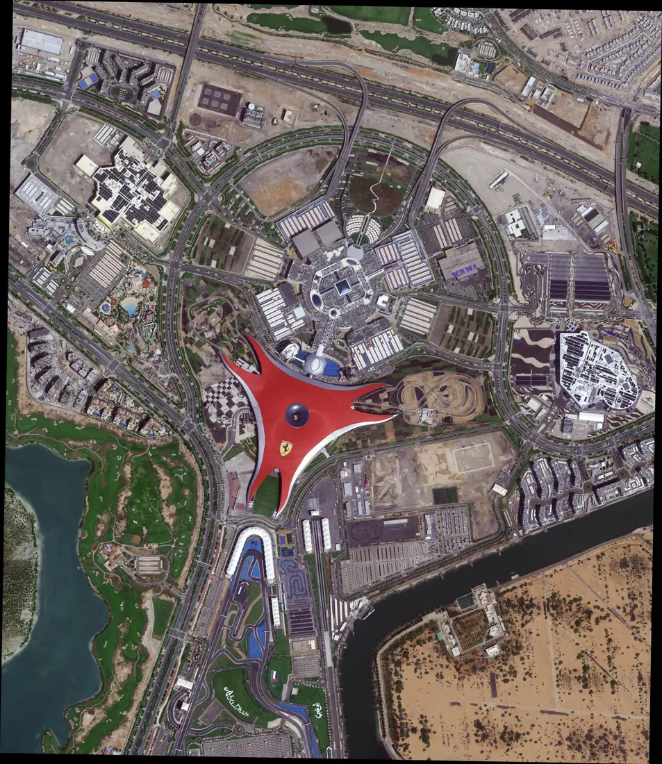
How Satellite Imagery Has Evolved Since Sputnik
On this page
- What Counts as Satellite Imagery, and What Doesn't
- What Makes a Satellite an Imaging Satellite
- 1: Cold War Reconnaissance Produces the First Imaging Satellites and the First Satellite Maps
- 2: Landsat Opens Civilian Earth Observation and the First Public Satellite Maps
- 3: Commercial Satellite Imagery Takes Off
- 4: Smallsats and Daily Constellations Bring Satellite Imagery to Everyone
- Satellite Imagery History at a Glance
- How Satellite Imagery Is Used Today
- Frequently asked questions
- Sources and further reading
A practical guide to the history of satellite imagery, covering what satellite imagery and satellite imaging actually mean, how an imaging satellite differs from an ordinary satellite like Sputnik, the first satellite photographs and maps ever captured, and how resolution and coverage have advanced from one grainy Cold War frame to today's near-daily commercial archive.
Quick answer
Satellite imagery is any picture or digital dataset captured by a sensor riding on an orbiting satellite and transmitted back to Earth, distinct from a photograph of a satellite itself. The first satellite ever launched, Sputnik 1 on October 4, 1957, carried no camera and produced no imagery at all. The first actual satellite image came almost two years later, a crude scan from NASA's Explorer 6 on August 14, 1959, and the first satellite built to operate as a dedicated imaging system was NASA's TIROS-1 weather satellite on April 1, 1960. The first high-resolution satellite photographs came from the US Air Force and CIA's classified Corona program, whose first successful mission photographed a Soviet airfield on August 18, 1960, imagery that stayed secret until 1995. Landsat 1, launched July 23, 1972, became the first satellite built purely for continuous civilian Earth observation, and the land-use maps built from its data are generally considered the first satellite-derived maps released to the public. Commercial satellite imagery followed in 1986 with France's SPOT 1, reached sub-meter resolution with IKONOS in 1999, and today large constellations like Planet Labs' Dove fleet photograph the planet's entire landmass every single day.
What Counts as Satellite Imagery, and What Doesn't
Satellite imagery, in short, is the picture a satellite's sensor captures of Earth and transmits home. That's the short version; the full breakdown of what satellite imagery and satellite imaging mean, how a satellite image is captured, the main imagery types, and why it's worth using, is covered in our dedicated guide to what satellite imagery is and how it works. What matters for the history below is simpler, not every satellite counts, and the first one didn't.
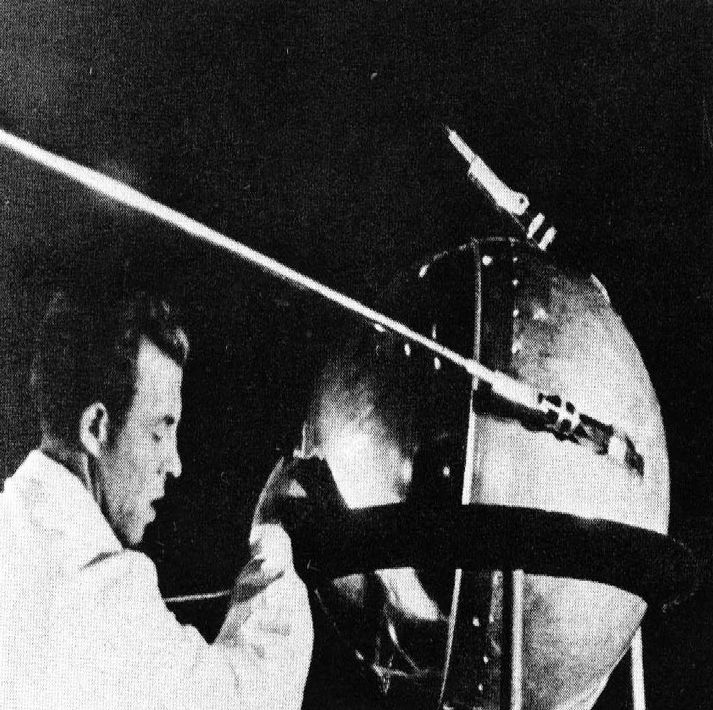
A common misconception is that Sputnik 1, the Soviet Union's pressurized aluminum sphere launched October 4, 1957 and humanity's first artificial satellite, is also the source of the first satellite imagery. It isn't. Sputnik carried a radio transmitter and instruments to study atmospheric density and radio propagation, not a camera, and produced no imagery of any kind in its three months in orbit. The first satellite imaging milestone came separately, almost two years later, when NASA's Explorer 6 radioed down a crude scanned image of sunlit cloud cover over the Central Pacific on August 14, 1959, the full story of which, along with every other milestone real Earth photo since, is covered in our guide to real Earth images from space.
What Makes a Satellite an Imaging Satellite
An imaging satellite is any satellite built specifically to capture pictures or scientific data of Earth, another planet, or space, as opposed to the much larger population of satellites built for communications, navigation, or other non-imaging missions. The core components barely changed in concept across seven decades, a sensor (a passive optical camera or an active radar transmitter), a pointing and stabilization system to aim it, onboard storage to hold the captured data between ground station passes, and a downlink radio to transmit it home, all covered step by step in our guide to how satellite images are actually taken.
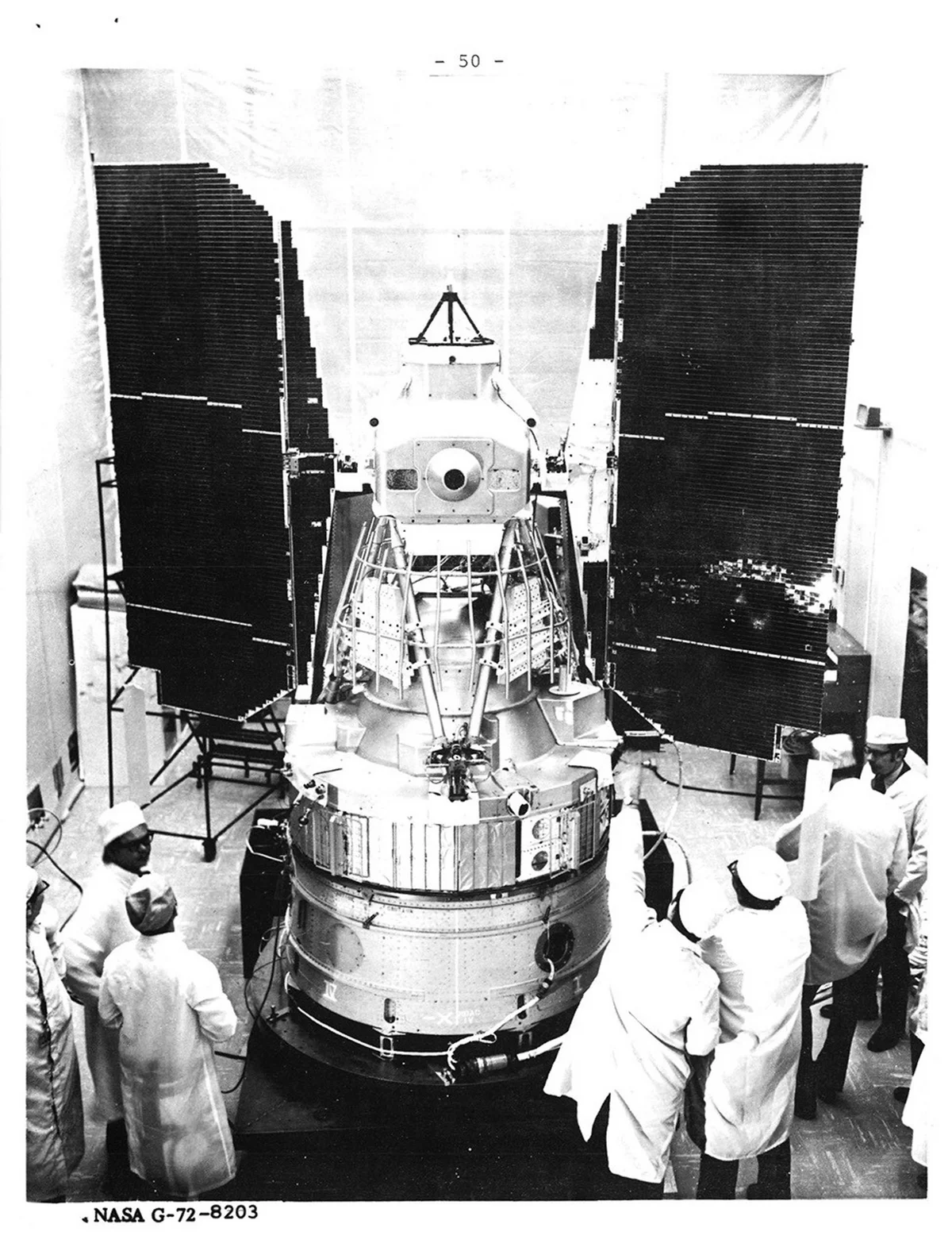
It's worth separating two phrases that search engines and people alike often blur together. A photo of a satellite or a picture of a satellite usually means an actual photograph of the spacecraft hardware, taken on the ground before launch, in a test chamber, or occasionally by another spacecraft in orbit, like the prelaunch photo below. A satellite photo, satellite image, or satellite picture instead means an image the satellite itself captured looking down at Earth, the sense used everywhere else in this guide and across this site.
1: Cold War Reconnaissance Produces the First Imaging Satellites and the First Satellite Maps
Four nations entered orbit in rapid succession after Sputnik, but none of those early launches carried a camera. That changed in 1960, within months two separate US programs each claimed a genuine first. NASA's TIROS-1, launched April 1, 1960, became the first satellite built specifically as an operational imaging system, an electronic television camera that radioed down pictures of Earth's cloud cover the same day it reached orbit, work covered in detail alongside Explorer 6 in our real Earth images from space guide. TIROS-1's pictures were useful for weather forecasting but coarse, since an electronically scanned TV image of the 1960s couldn't resolve anything on the ground smaller than a cloud system.
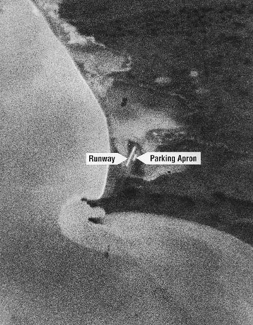
A second, classified program solved that resolution problem a few months later using an entirely different method, physically returning exposed film to Earth rather than transmitting a scanned picture. The US Air Force and CIA's Corona program, after a string of failed attempts through 1959, achieved its first successful mission on August 18 to 19, 1960, when Discoverer 14's reentry capsule was snagged in midair by a C-119 aircraft over the Pacific, the first successful recovery of film from an orbiting satellite. The developed film held the first satellite imagery sharp enough to make out individual buildings, a photograph of the Mys Shmidta airfield in the Soviet Far East at roughly 40-foot (12 m) resolution, pictured below, more coverage of the USSR in one mission than every prior U-2 spy plane flight combined. Corona flew until 1972, returning more than 800,000 images, all of it classified until an executive order declassified the entire program in 1995 and transferred the film to USGS and the National Archives.
Corona also answered the first satellite map question, just not in a form the public could see for another three decades. A mapping-focused sister program called Argon (KH-5) adapted Corona's film-return capsule to a wide-footprint survey camera starting in 1961, purpose-built for cartography and geodesy rather than close-look spying, trading resolution (about 460 ft, 140 m) for broad, overlapping coverage that let Army cartographers triangulate accurate coordinates and update topographic charts of Soviet territory no ground surveyor could reach. Argon's first successful imagery, collected from 1962 onward, became the basis for the first satellite-derived maps ever produced, classified US military charts that stayed secret right alongside the Corona photographs that inspired them.
2: Landsat Opens Civilian Earth Observation and the First Public Satellite Maps
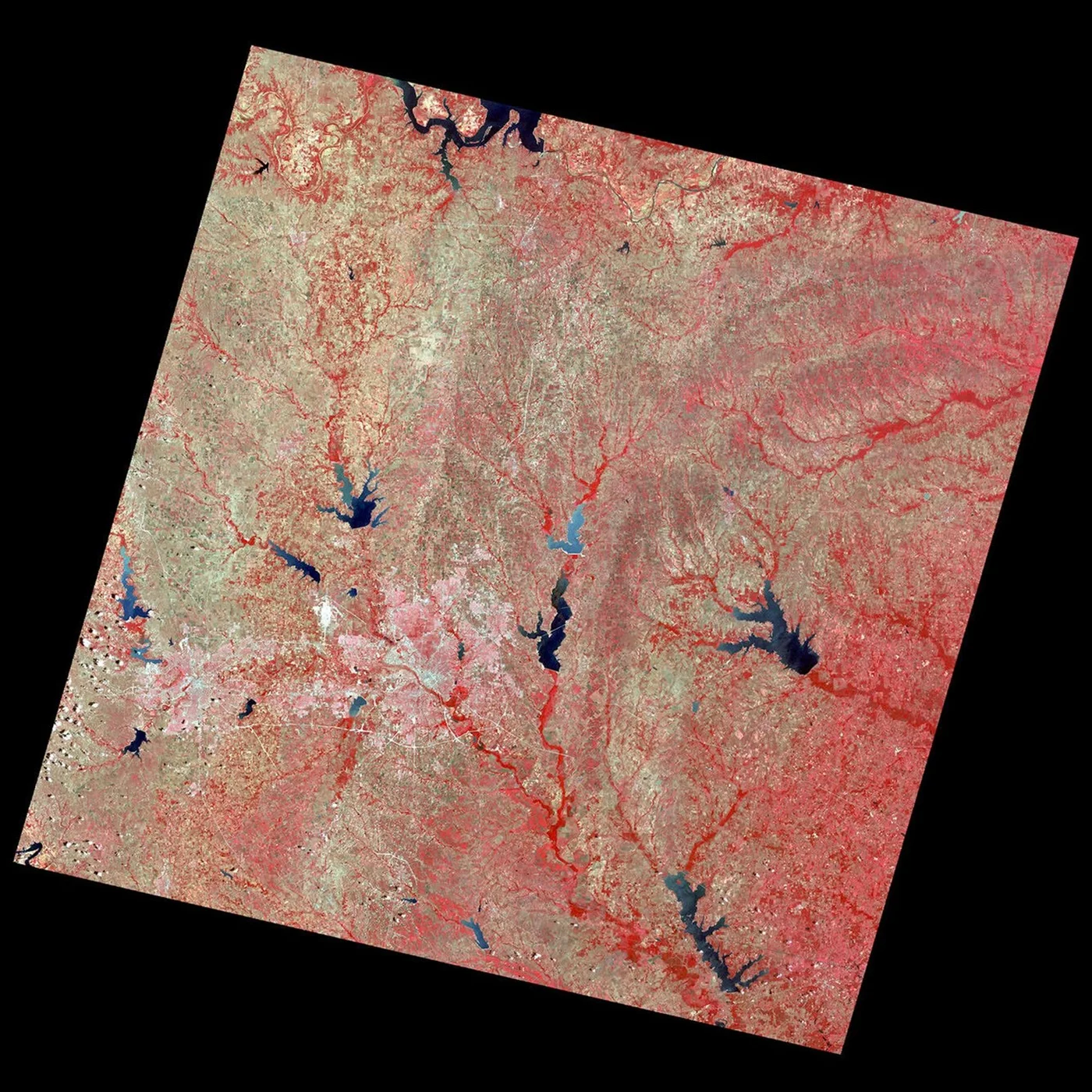
Everything imaging satellites had done up to this point, TIROS-1's weather pictures aside, was either classified or a one-off scientific experiment. That changed on July 23, 1972, when NASA launched the Earth Resources Technology Satellite, renamed Landsat 1 in 1975, the first satellite built from the ground up for continuous, public, repeatable imaging of Earth's land surface rather than a single mission or a secret one. Its Multispectral Scanner System returned its first light image just two days later, on July 25, 1972, a false-color scene of Dallas-Fort Worth, Texas at 60 meters per pixel, pictured below, the beginning of what's now the longest continuously running Earth observation program on record.
Landsat's public, repeated coverage made it possible to do something Corona and Argon's classified charts never could, build a map from satellite data that anyone could use. Starting in the mid-1970s, USGS scientists paired Landsat's multispectral data with a new, standardized classification scheme, the Anderson Land Use and Land Cover Classification System, published in 1976, to produce the first nationally consistent land-use maps of the United States. Most of the lower 48 states were mapped from aerial photography rather than satellite data directly, but roughly 75% of Alaska, far too vast and remote to photograph from aircraft economically, was mapped using Landsat imagery itself, making it the first large-scale area mapped primarily from satellite data and released publicly rather than kept classified. The multispectral band math and false-color technique Landsat pioneered is covered in full in our guide to what multispectral imaging actually captures.
Curious how a modern satellite image compares to 1972's first light?
Search free, current Sentinel-2 and Landsat archive imagery over any area, or task a fresh high-resolution capture from today's commercial fleet.
3: Commercial Satellite Imagery Takes Off
Through the 1970s and early 1980s, every imaging satellite in orbit belonged to a government, military or civilian. That changed on February 22, 1986, when France's space agency CNES launched SPOT 1 from Kourou, the first satellite purpose-built to sell Earth observation imagery as a commercial product. SPOT 1's steerable mirrors let it point off to either side of its ground track, which cut its revisit time to as little as 5 days over any chosen site and enabled the stereo passes needed for elevation data, a capability covered in more depth in our guide to building 3D models from satellite stereo imagery. Resolution stayed modest, 10 m panchromatic and 20 m multispectral, well short of Corona's classified capability a quarter-century earlier, but it was the first time anyone outside a government could simply buy a satellite image.
Resolution caught up to, then passed, the old spy-satellite benchmark on September 24, 1999, when Space Imaging's IKONOS reached orbit from Vandenberg Air Force Base as the first commercial satellite to deliver sub-meter imagery, about 0.82 m panchromatic alongside 4 m four-band color. IKONOS proved a private company could sell imagery sharp enough to make out individual vehicles and building footprints, and the high-resolution commercial industry that followed, QuickBird in 2001 and the GeoEye and WorldView satellites through the 2000s, traces directly back to it.
| Satellite | Launched | Operator | Resolution | Why it mattered |
|---|---|---|---|---|
| SPOT 1 | Feb 22, 1986 | CNES (France) | 10 m panchromatic, 20 m multispectral | First satellite built to sell Earth observation imagery commercially |
| IKONOS | Sep 24, 1999 | Space Imaging (US) | 0.82 m panchromatic, 4 m multispectral | First commercial satellite with sub-meter resolution |
Satellite image resolution, then and now
The same core measurement, the smallest object a satellite's camera can resolve, improved by roughly two orders of magnitude across these seven milestones.
Corona's first successful spy-satellite photograph, 1960, classified until 1995.
Landsat 1's first public civilian satellite image, 1972.
SPOT 1, the first commercially sold satellite imagery, 1986.
IKONOS, the first sub-meter commercial satellite, 1999.
Finest native panchromatic pixel size commercially available today, from satellites like SuperView Neo-1.
4: Smallsats and Daily Constellations Bring Satellite Imagery to Everyone
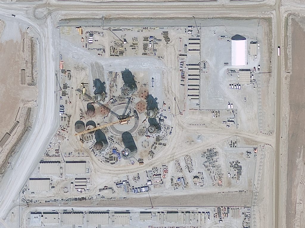
The next shift wasn't about resolution at all, it was about how many satellites could be put in orbit at once. GeoEye-1, launched in 2008 and pictured below capturing a construction site, pushed commercial resolution to 0.41 m, but a single large, expensive satellite can still only pass over any given spot on Earth once every few days. Planet Labs, founded in 2010, took the opposite approach, mass-producing shoebox-sized Dove cubesats built largely from smartphone-grade components and launching them by the dozen rather than building one satellite at a time. By 2018, Planet's constellation had grown large enough to image the entire landmass of Earth every single day, a scale of daily revisit no previous generation of imaging satellite, government or commercial, had ever reached.
That combination, sub-meter resolution from large dedicated satellites and daily revisit from smallsat constellations, is roughly where satellite imagery stands today. XRTech's own fleet reflects the same split, optical satellites like the SuperView and Beijing-3 series for fine detail, radar satellites that see through cloud regardless of the time of day, and geostationary satellites that stare at one region continuously, all searchable or tasked directly rather than requested through a government agency, the way every image in this guide's first fifteen years had to be.
Satellite Imagery History at a Glance
| Date | Milestone | Satellite |
|---|---|---|
| Oct 4, 1957 | First artificial satellite (no camera, no imagery) | Sputnik 1 |
| Aug 14, 1959 | First satellite image of Earth | Explorer 6 |
| Apr 1, 1960 | First dedicated operational imaging satellite | TIROS-1 |
| Aug 18, 1960 | First successful photographic reconnaissance satellite | Corona (Discoverer 14) |
| 1962 | First satellite-derived maps (classified) | Argon (KH-5) |
| Jul 23, 1972 | First civilian Earth observation satellite | Landsat 1 (ERTS-1) |
| 1976 | First public, nationally consistent satellite-informed land maps | Landsat 1-2 / USGS Anderson system |
| Feb 22, 1986 | First commercially sold satellite imagery | SPOT 1 |
| Sep 24, 1999 | First sub-meter commercial satellite | IKONOS |
| 1995 | Corona program declassified, 800,000+ images released | Corona / Argon / Lanyard |
| 2018 | First daily imaging of Earth's entire landmass | Planet Labs Dove constellation |
| Today | Sub-meter and daily revisit combined, searchable or tasked directly | Commercial optical, radar, and geostationary fleets |
How Satellite Imagery Is Used Today
The same technology that once took three decades to declassify is now ordered directly through a web portal in minutes. A few of the ways today's satellite imagery gets used.
- Agriculture. Repeated multispectral passes track crop health and irrigation across entire growing seasons, covered in our guide to precision agriculture satellite imagery.
- Mining. Regular imagery monitors tailings dams, pit expansion, and reclamation, detailed in our guide to how satellites monitor mining.
- Disaster response. Radar imagery maps flooding and storm damage through cloud cover that blocks optical sensors entirely, covered in our guide to SAR imagery for disaster response.
- Insurance. Time-stamped before-and-after imagery verifies storm and flood claims without a site visit, covered in our guide to satellite imagery as insurance evidence.
- Urban planning and infrastructure. Change detection across repeated passes catches unapproved construction and tracks city growth over years, detailed in our guide to change detection for urban growth.
For the full list of where to access imagery like this, free or commercial, see our guide to 14 free satellite imagery sources, and for matching a resolution tier to a specific project, see choosing the right satellite resolution.
Key takeaways
- Satellite imagery is any picture or dataset a satellite's sensor captures of Earth, not a photo of the satellite itself. Sputnik 1 (1957) carried no camera; the first actual satellite image came from Explorer 6 on August 14, 1959.
- NASA's TIROS-1 (April 1, 1960) was the first satellite built as a dedicated operational imaging system, while the classified Corona program's first success four and a half months later, August 18, 1960, delivered the first high-resolution satellite photographs, kept secret until 1995.
- The first satellite-derived maps were classified military products from Corona's mapping offshoot, Argon, starting in 1962. The first publicly available, nationally consistent satellite-informed maps came over a decade later, from Landsat 1 data and the USGS's 1976 Anderson classification system.
- Landsat 1, launched July 23, 1972, was the first satellite built purely for continuous civilian Earth observation and remains the basis for the longest-running Earth observation record on file.
- Commercial satellite imagery began with SPOT 1 in 1986, passed Corona's old resolution benchmark with IKONOS's sub-meter imagery in 1999, and reached daily imaging of Earth's entire landmass through Planet Labs' smallsat constellation by 2018.
- Resolution has improved roughly two orders of magnitude since 1960, from Corona's ~12 m to about 25 cm on the sharpest commercial satellites flying today.
Frequently asked questions
How old is satellite imagery?
Satellite imagery is about 66 years old as of 2026. The first actual satellite image came from NASA's Explorer 6 on August 14, 1959, two years after Sputnik 1 (1957), which carried no camera. The first high-resolution satellite photograph followed a year later, from the classified Corona program on August 18, 1960.
What is the difference between a photo of a satellite and a satellite photo?
A photo of a satellite or picture of a satellite is a photograph of the spacecraft hardware itself, usually taken on the ground before launch or occasionally by another spacecraft in orbit. A satellite photo or satellite image instead means a picture the satellite captured looking down at Earth, which is what most people searching for satellite imagery actually mean.
What was the first satellite image ever taken?
The first actual satellite image was a crude scanned photo of sunlit cloud cover, radioed down from NASA's Explorer 6 on August 14, 1959. Sputnik 1, launched in 1957, is often mistaken for the source of the first satellite imagery, but it carried no camera and produced none. The first dedicated imaging satellite was NASA's TIROS-1 on April 1, 1960, and the first high-resolution satellite photograph came from the classified Corona program on August 18, 1960.
What was the first satellite map?
The first satellite-derived maps were classified US military topographic charts, built from Argon (KH-5), a mapping-focused offshoot of the Corona reconnaissance program, starting with its first successful imagery in 1962. The first satellite-informed maps released to the public came later, in the mid-1970s, when USGS paired Landsat 1 data with its new Anderson Land Use and Land Cover Classification System, published in 1976, to map land use across the United States.
What is an imaging satellite?
An imaging satellite is a satellite built specifically to capture pictures or scientific data of Earth, another planet, or space, as opposed to the larger population of satellites built for communications, navigation, or other non-imaging purposes. Its core components are a sensor, either a passive optical camera or an active radar transmitter, a pointing system, onboard data storage, and a downlink radio to transmit captured imagery back to Earth.
Was Sputnik the first satellite to take pictures?
No. Sputnik 1, launched October 4, 1957, was the first artificial satellite of any kind, but it carried a radio beacon and atmospheric instruments, not a camera, and captured no imagery during its three months in orbit. The first actual satellite image came almost two years later, from NASA's Explorer 6 on August 14, 1959.
How has satellite imagery resolution changed over time?
Resolution has improved roughly two orders of magnitude since the first reconnaissance satellites. Corona's first successful 1960 photograph resolved about 12 m (40 ft), Landsat 1's first civilian image in 1972 resolved 60 m, SPOT 1's first commercial imagery in 1986 resolved 10 m, IKONOS became the first sub-meter commercial satellite in 1999 at about 0.82 m, and the sharpest commercial satellites flying today reach about 25 cm.
When did commercial satellite imagery become available?
Commercial satellite imagery became available starting February 22, 1986, when France's CNES launched SPOT 1, the first satellite purpose-built to sell Earth observation imagery. Sub-meter commercial imagery followed in 1999 with IKONOS, and daily imaging of Earth's entire landmass arrived in 2018 through Planet Labs' smallsat constellation.
How often is satellite imagery updated today?
It depends on the satellite or constellation. A single large commercial satellite typically revisits the same site every few days, while large smallsat constellations like Planet Labs' Dove fleet image the entire landmass of Earth daily. Geostationary satellites built for weather or wildfire monitoring can refresh the same fixed region as often as every few minutes to 20 seconds.
Sources and further reading
- NASA History Office, Sputnik launch record and GPN-2002-000166 assembly photograph, credit NASA/Asif A. Siddiqi
- NASA, Explorer 6 and TIROS-1 mission records, 1959 and 1960
- National Reconnaissance Office, Corona program declassification under Executive Order 12951 (1995); first successful mission imagery, Discoverer 14, August 18 1960
- The Space Review, KH-5 Argon geodetic satellite program history
- NASA / USGS, Landsat 1 (ERTS-1) launch and first light image, Dallas-Fort Worth, July 25 1972
- Anderson, J.R., Hardy, E.E., Roach, J.T. and Witmer, R.E. (1976), A Land Use and Land Cover Classification System for Use with Remote Sensor Data, USGS Professional Paper 964
- CNES, SPOT 1 launch and mission specifications, February 22 1986
- Space Imaging / eoPortal, IKONOS launch and sensor specifications, September 24 1999
- Planet Labs, Mission 1 daily global landmass imaging milestone, 2017 to 2018
From Cold War film canisters to a live portal
Search current Sentinel-2 and Landsat archive imagery for free, or task a fresh high-resolution or radar capture from today's commercial satellite fleet.