How Many Images Does One Satellite Pass Actually Capture
On this page
Quick answer
A satellite doesn't take a single "picture" the way a camera does. It scans the ground in a continuous strip as it flies overhead, and that strip gets cut into images afterward based on what was actually tasked. For one small target in plain mono mode, that's 1 image. Stereo mode captures the same spot twice from two different angles in the same pass, 2 images. Tri-stereo adds a third, straight-down look, 3 images, used to build 3D elevation models. If the area you need is wider than the satellite's swath, an agile satellite slews side to side during the same pass and captures several adjacent strips, one image per strip, so the count scales with how many strips your area needs, not a fixed number.
Why a Single Pass Isn't One Photo
Most Earth-imaging satellites use what's called a push-broom sensor. Instead of a shutter that opens once and closes, a thin line of detectors stares straight down and records one line of ground at a time, over and over, as the satellite's own motion drags that line across the surface below. Stack thousands of those lines together and you get one long, continuous strip, not a single frame.
That strip only becomes "an image" once it's cut into a piece sized to what was ordered. NASA's Landsat program is a clean public example of this, it divides every orbit into up to 248 fixed row positions (called the Worldwide Reference System), and each path/row intersection becomes one named scene. A commercial tasking order works the same way in principle, the satellite's raw strip for your pass gets cut down to the exact area you drew, which is why the honest answer to "how many pictures" is "however many separate pieces your request actually needed," not a number baked into the satellite itself.
Mono, Stereo, and Tri-Stereo, How Many Images of the Same Spot
For a plain mono order, the answer is 1 image, one look straight down (or close to it) at your area. Stereo and tri-stereo change that number on purpose, because they need more than one look to work.
- Mono, 1 image. A single look at the target. This covers the large majority of archive and tasking orders, where the goal is just a current picture of a place.
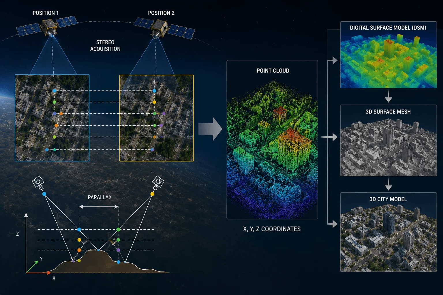
- Stereo, 2 images. The same ground is captured twice in the same pass, once looking slightly forward and once slightly aft, by rotating the satellite body between the two looks. The tiny shift between those two views, called parallax, is what lets software calculate height.
- Tri-stereo, 3 images. A third, straight-down look is added between the forward and aft pair, giving three images of the same spot from one orbit. The extra look adds redundancy and holds up better in tall, shadow-heavy cities where two looks alone can lose track of a rooftop edge.
In XRTech's own fleet, GF-7 and ZY-3 are built to capture native stereo and tri-stereo geometry on every pass, while agile platforms like SuperView-2 and SuperView Neo-1 can be tasked for stereo collection on demand rather than by default. That parallax math, and what it turns into (DEMs, DSMs, 3D city models), is covered in full in our guide to building 3D models from satellite stereo imagery, this section is only about the image count itself.
Need more than a flat image?
Order stereo (2 images) or tri-stereo (3 images) tasking on GF-7, ZY-3, SuperView-2, or SuperView Neo-1, priced instantly before you order.
When Your Area Needs More Than One Strip in the Same Pass
Every satellite has a fixed swath width, the width of ground its sensor actually covers on a single straight pass. SuperView Neo-1 images a 12 km-wide strip at a time, Beijing-3B covers 22 km, and the DMC3 satellites cover 24 km. Draw an area wider than that swath, and one straight pass can't cover it in a single strip.
An agile, three-axis satellite doesn't need a second day to finish the job, though. It can roll slightly between strips during the same overhead pass, image one strip, re-point, image the adjacent strip, and repeat, stitching several side-by-side strips into one combined capture before it moves out of range. Each strip is counted as one image, so a wide area still produces several images from that single pass, the count is simply however many strips the width requires, with a small overlap between them so nothing gets missed at the seam. This is exactly how an automated tasking order under 1,000 km² gets planned on our own platform, the system works out the strip count from your drawn area and the satellite's swath before it ever schedules the pass.
Burst and Video-Rate Capture, Many Frames of One Target
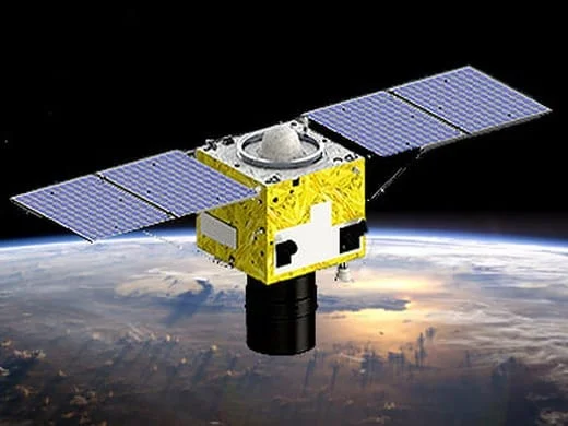
A small number of agile very-high-resolution satellites can also hold the sensor on one fixed target and fire off many frames in quick succession, closer to a video clip than a single scene. Planet's SkySat satellites are the best-documented public example, rated to capture up to 50 frames a second during a short collect, often around 1,000 total frames in one pass over one target. That's a different product entirely from a standard still scene, it's built for watching movement, vehicles on a road, ships in a harbor, rather than for mapping or measurement, and it isn't part of XRTech's own resold fleet. It's worth knowing about mainly so a "how many images" answer doesn't feel incomplete, the ceiling for a single pass over a single point, in the right sensor, is in the hundreds of frames, not just 1 to 3.
How XRTech Solves This
Every tasking order on XRTech's own platform asks for exactly this upfront, mono, stereo, or tri-stereo, and the price reflects the extra images a stereo or tri-stereo order actually needs.
- Mono tasking starts at $8 per km² for 100 cm resolution, up to $25 per km² for 30 cm, one image.
- Stereo tasking runs $40 per km² at 50 cm or $50 per km² at 30 cm, two images of the same spot, available on GF-7, ZY-3, SuperView-2, and SuperView Neo-1.
- Tri-stereo tasking runs $60 per km² at 50 cm or $75 per km² at 30 cm, three images, the same resolution tiers, for projects that need DEM, DSM, or 3D city model accuracy.
- Wide areas up to 1,000 km² are planned automatically, the platform works out how many adjacent strips your area needs from the satellite's real swath width before confirming your collection window.
Every order shows the exact instant price, satellite, and strip or image count before you confirm it, no separate quote step, delivered as standard GeoTIFF imagery or as DEM/DSM elevation data for stereo and tri-stereo orders. See the full breakdown on our pricing page, or go straight to order new satellite tasking.
See your own pass count before you order
Draw your area, pick mono, stereo, or tri-stereo, and the platform shows the real image count and price instantly.
Key takeaways
- A satellite doesn't take discrete photos, it scans a continuous strip, which gets cut into one or more scenes based on what was actually tasked.
- Mono mode is 1 image per pass. Stereo mode captures the same spot twice from different angles for 2 images. Tri-stereo adds a third look for 3 images, used for 3D elevation models.
- If an area is wider than a satellite's swath, 12 km for SuperView Neo-1, 22 km for Beijing-3B, 24 km for the DMC3 satellites, an agile satellite captures several adjacent strips in the same pass, one image per strip.
- Specialized agile satellites like Planet's SkySat can capture up to 50 frames a second of one fixed target, around 1,000 frames in a single pass, a separate video-style product, not standard tasking.
- XRTech's own tasking order lets you pick mono, stereo, or tri-stereo directly, with wide areas automatically planned into the right number of strips and priced instantly before you confirm.
Frequently asked questions
How many pictures does a satellite take in one pass?
It depends on what was tasked. A plain mono order produces 1 image. Stereo mode produces 2 images of the same spot from different angles, and tri-stereo produces 3. If the area is wider than the satellite's swath, an agile satellite can capture several adjacent strips in the same pass, one image per strip.
Does a satellite take one photo or record a continuous strip?
A satellite records a continuous strip using a push-broom sensor, a line of detectors that scans the ground line by line as the satellite moves. That strip only becomes a separate image once it's cut to the size of the area actually tasked.
How many images does stereo satellite imagery capture?
Stereo imagery captures 2 images of the same ground area in a single pass, one looking slightly forward and one slightly aft. The small shift between the two views lets software calculate height, which is how stereo imagery produces elevation data.
What is tri-stereo imagery and how many images does it use?
Tri-stereo imagery captures 3 images of the same spot in one pass, forward, straight down, and aft. The third look adds redundancy and holds up better than a stereo pair in tall, shadow-heavy areas, which is why it's used for more demanding 3D city models.
Can a satellite capture more than one strip of my area in a single pass?
Yes, if an agile satellite can roll between strips fast enough while still in range. Each strip covers one swath width, SuperView Neo-1's is 12 km, so an area several times that wide can still be fully covered in one pass as several adjacent strips.
How many frames can an agile satellite capture of the same target?
A small number of specialized satellites, such as Planet's SkySat, can capture up to 50 frames a second of a single fixed target, often around 1,000 frames in one short pass. This is a separate video-style product built for tracking movement, not a standard mapping scene.
How much does stereo or tri-stereo tasking cost compared to a single image?
On XRTech's platform, stereo tasking runs $40 to $50 per km² and tri-stereo runs $60 to $75 per km², against $8 to $25 per km² for standard mono tasking, roughly scaling with the extra images each mode actually captures.
For how a captured strip turns into a finished, delivered image, see our guide to how satellite images are taken. For total daily output across a whole fleet rather than one pass, see how many pictures satellites take per day.
Sources and further reading
- NASA Landsat Science, the Worldwide Reference System, path/row scene structure, 248 rows per orbit
- eoPortal, Pléiades High-Resolution Optical Imaging Constellation mission profile, tri-stereo triplet acquisition geometry
- Planet, SkySat All-Frames Asset documentation, frame rate and frames-per-collect specifications
- XRTech Group, SuperView Neo-1, Beijing-3B, and DMC3 satellite swath width and stereo tasking specifications
- XRTech Group, tasking pricing schedule, mono, stereo, and tri-stereo rates by resolution
From one scene to a full multi-strip capture
Order mono, stereo, or tri-stereo tasking across XRTech's optical fleet, with the real image count and price shown before you confirm.