
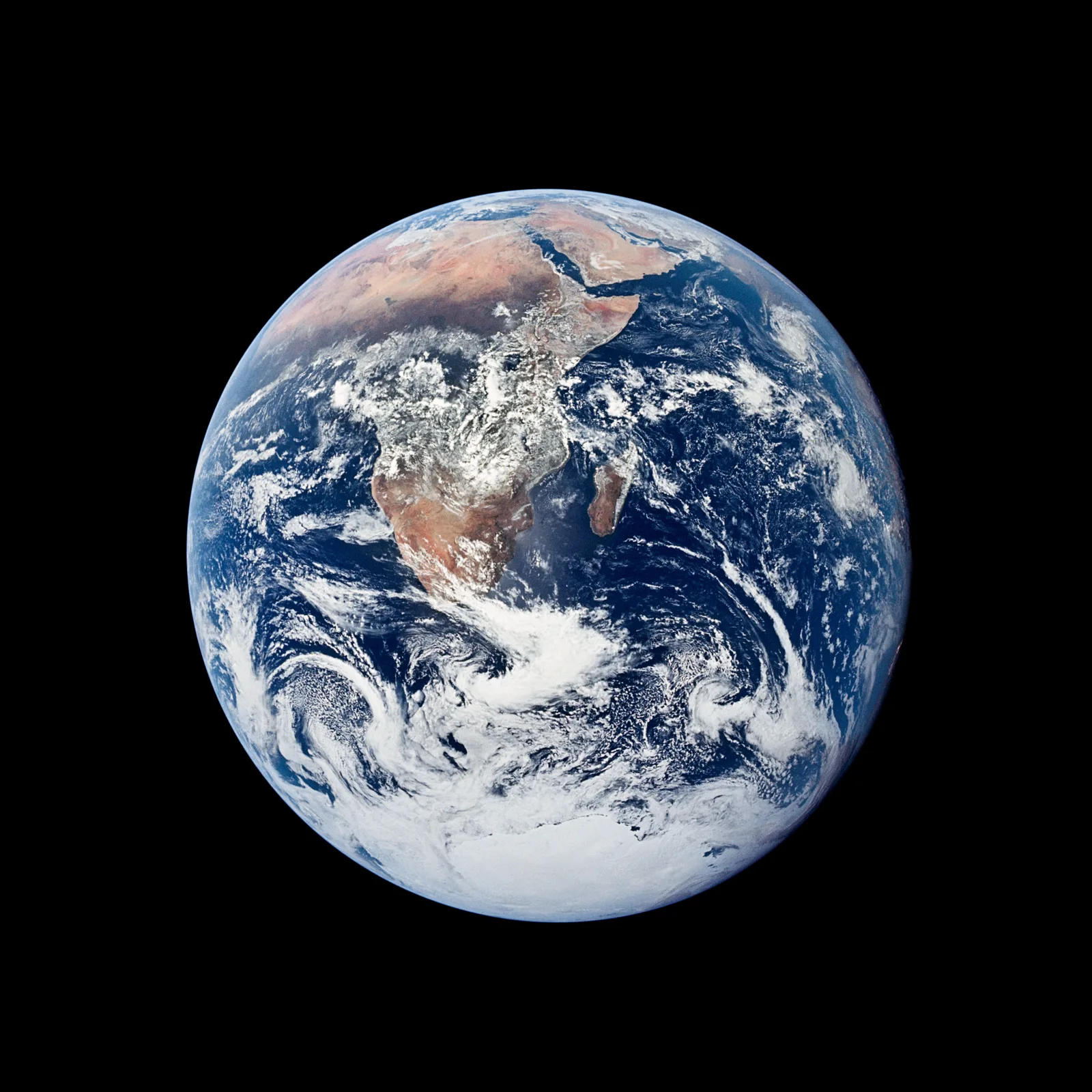
Real Earth Images From Space, With NASA Photo Credits
On this page
- What makes an Earth photo real rather than a render or a stock graphic
- Real Earth photos from NASA and NOAA satellites and missions
- Which NASA and NOAA satellites and missions took these real Earth photos
- How a composite real Earth photo like Blue Marble gets built
- Why satellite imagery of Earth from space is important
- Types of satellite imagery of Earth from space
- Applications of satellite imagery of Earth from space
- How to find and download real Earth images from NASA yourself
- How often a satellite photographs the whole real Earth
- Frequently asked questions
- Sources and further reading
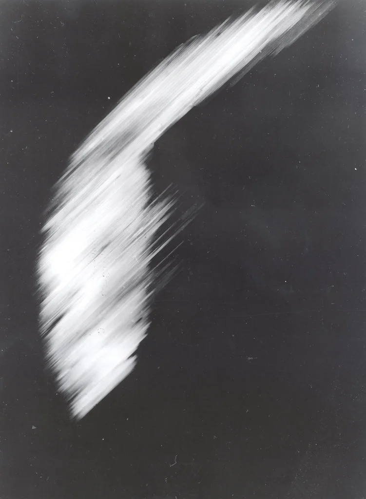
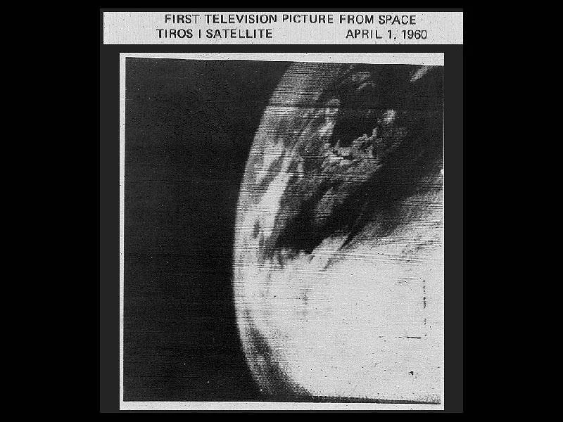
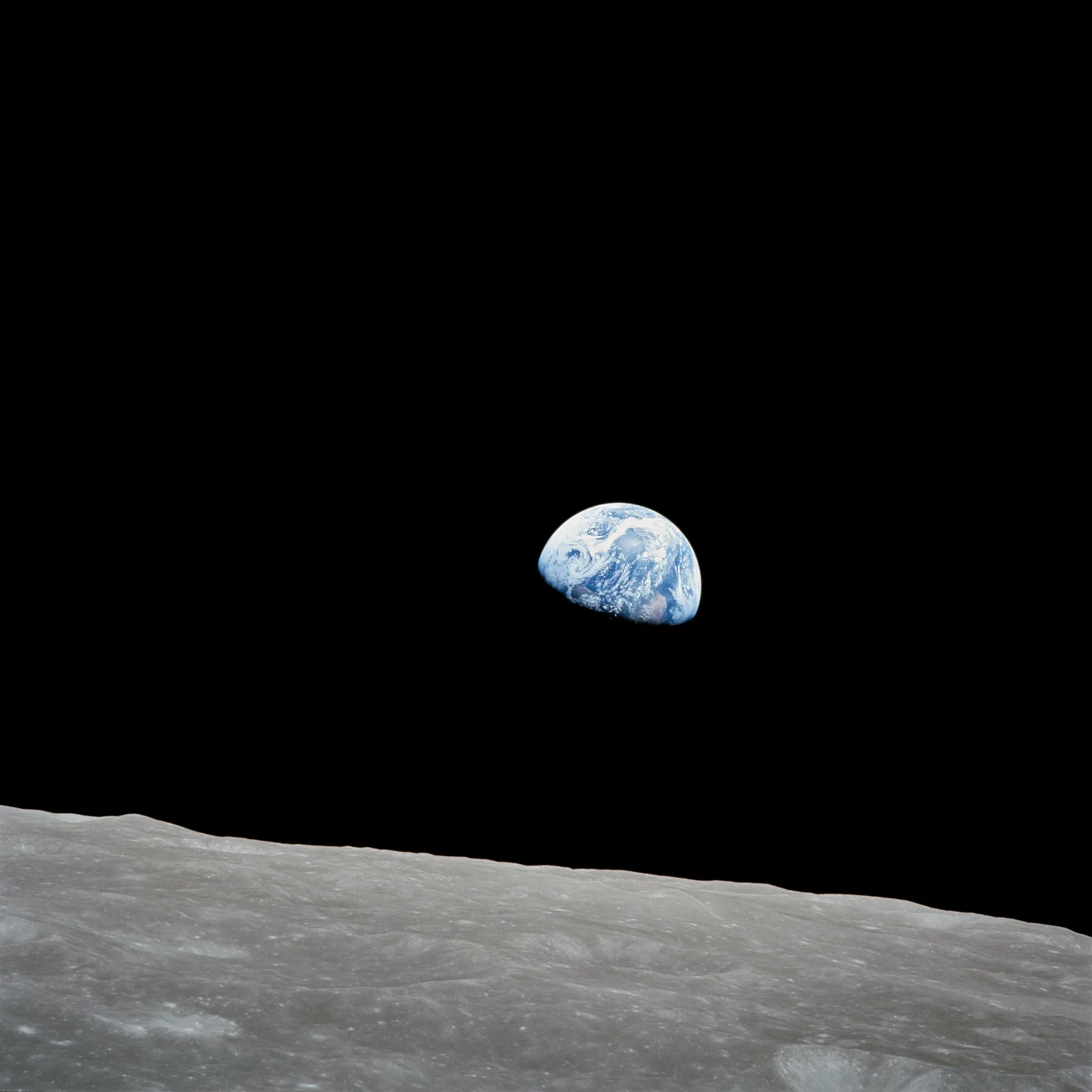
A real image of Earth from space is a genuine photograph, not a rendering, a rendering fills in the gaps with a computer artist's guesswork while a real photo captures whatever sunlight, cloud, and orbital position actually existed at the moment the shutter opened. Every image in this guide is a real photo of Earth taken by a NASA or NOAA satellite, spacecraft, or astronaut, pulled directly from public NASA archives, each one dated and credited to the mission that captured it. Together they span from Explorer 6's crude first satellite scan of Earth in 1959 and TIROS-1's first television picture in 1960, through Earthrise, the Blue Marble, and today's DSCOVR and GOES weather satellites, right up to the Artemis II crew's 2026 lunar flyby, so you can see how the real photo of Earth has changed, and how it hasn't, across nearly seven decades of spaceflight.
Quick answer
The most widely recognized real images of Earth from space are Earthrise, taken by the Apollo 8 crew on December 24, 1968, and The Blue Marble, taken by the Apollo 17 crew on December 7, 1972, both genuine photographs from human-crewed spacecraft. The very first real photo of Earth from a satellite is older and far cruder, a scanned image radioed down from NASA's Explorer 6 on August 14, 1959. The most recent addition is Artemis II's Earthset, photographed on April 6, 2026 as the crew's Orion spacecraft passed behind the Moon, deliberately echoing Earthrise 58 years later. Modern real-time views of the whole sunlit Earth come from NASA's DSCOVR satellite, orbiting about a million miles away at the Sun-Earth L1 point, while geostationary weather satellites like NOAA's GOES capture a real photo of Earth every 10 to 15 minutes from 22,300 miles up. All of these are public domain NASA and NOAA images, free to view, download, and reuse with credit.
What makes an Earth photo real rather than a render or a stock graphic
A huge share of "Earth from space" images online are not photographs at all. Search results and stock libraries are full of 3D renders, video game screenshots, and AI-generated planet graphics built from a texture map rather than actual sunlight hitting an actual camera sensor on a given day. A real photo of Earth, by contrast, comes from an actual instrument in orbit or in space, on a specific date, viewing a specific side of the planet under whatever weather and lighting happened to exist at that exact moment, which is why real Earth photos always show partial cloud cover, a visible day-night terminator, or a specific season's ice extent, details a generic stock render rarely bothers to include.
Even genuine NASA and NOAA imagery falls into two different categories worth telling apart. A single-orbit photograph, like Earthrise or the original Blue Marble, is exactly one exposure from exactly one camera at exactly one moment. A composite image, like the newer Blue Marble releases or the Black Marble night-lights maps further down this page, stitches together multiple orbital passes, sometimes taken days or months apart, into one seamless view of the full globe. Both are real satellite or spacecraft photography of the real Earth, built from real captured data rather than illustration, the difference is only whether the final image is one exposure or many combined into one.
Real Earth photos from NASA and NOAA satellites and missions
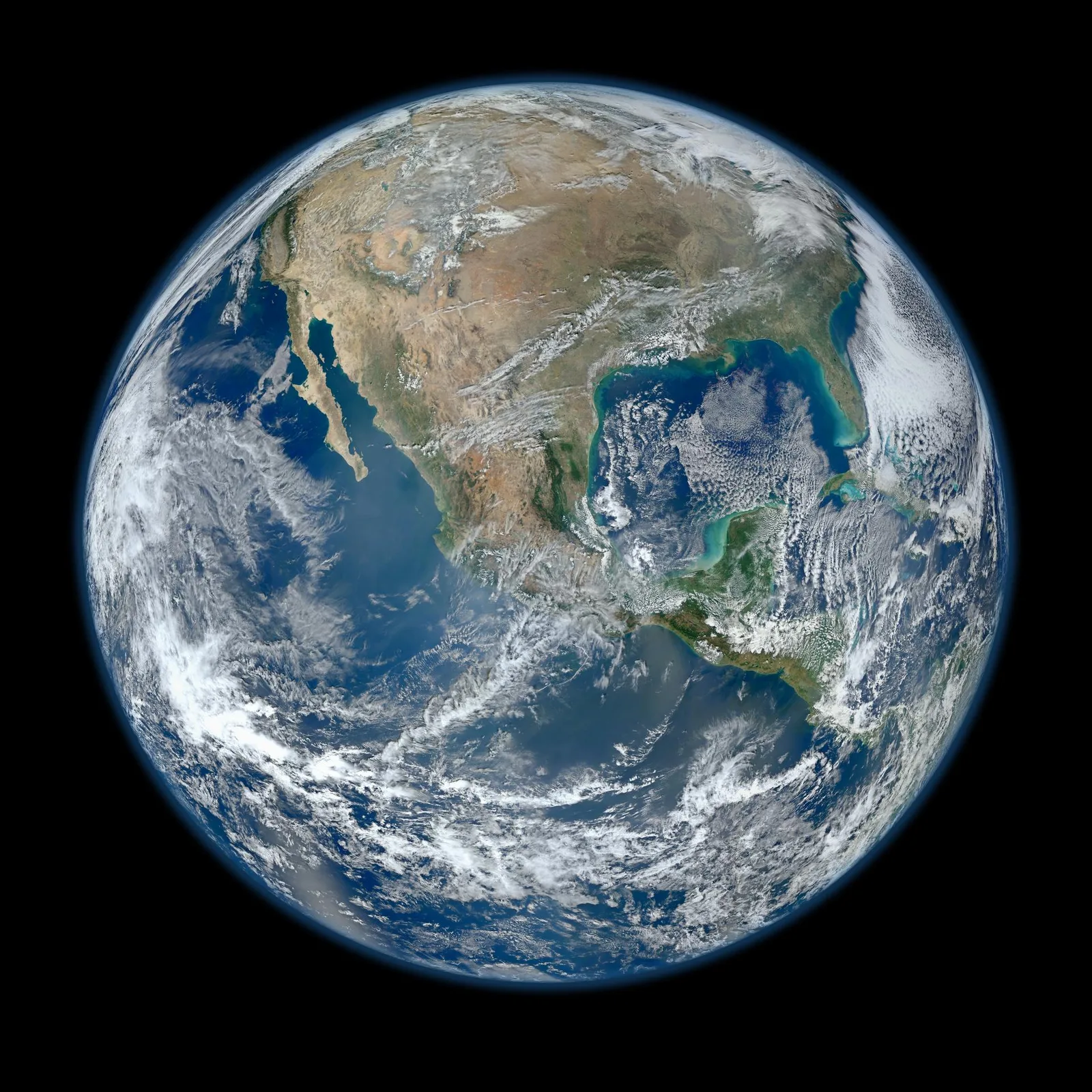
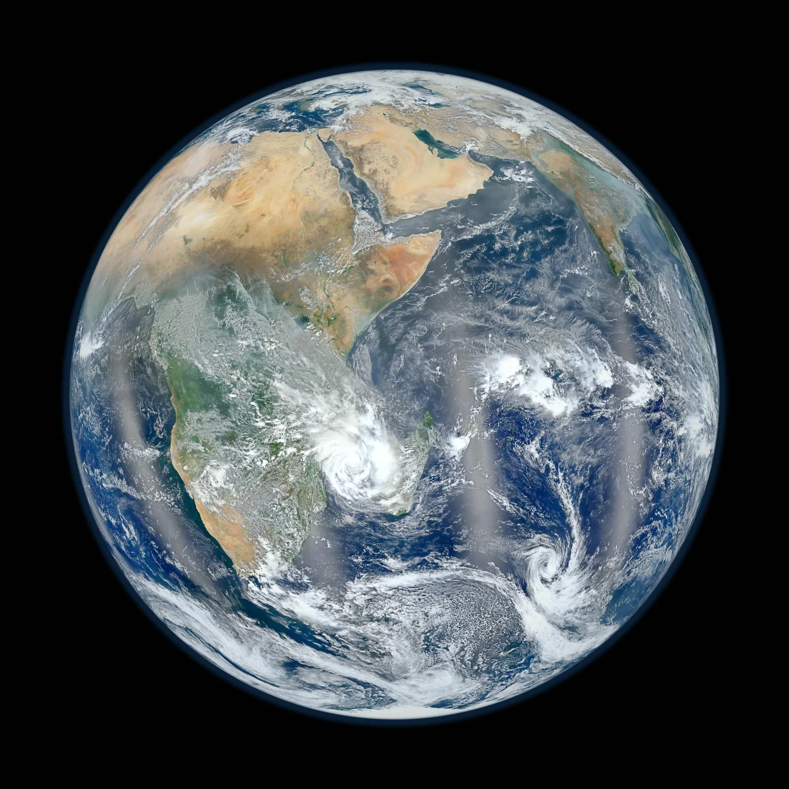
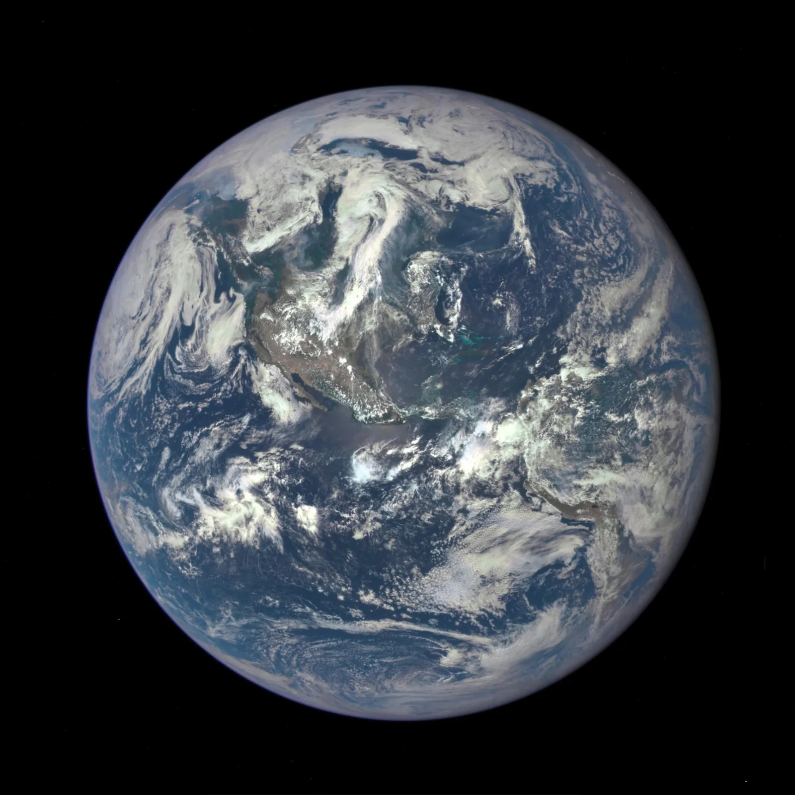
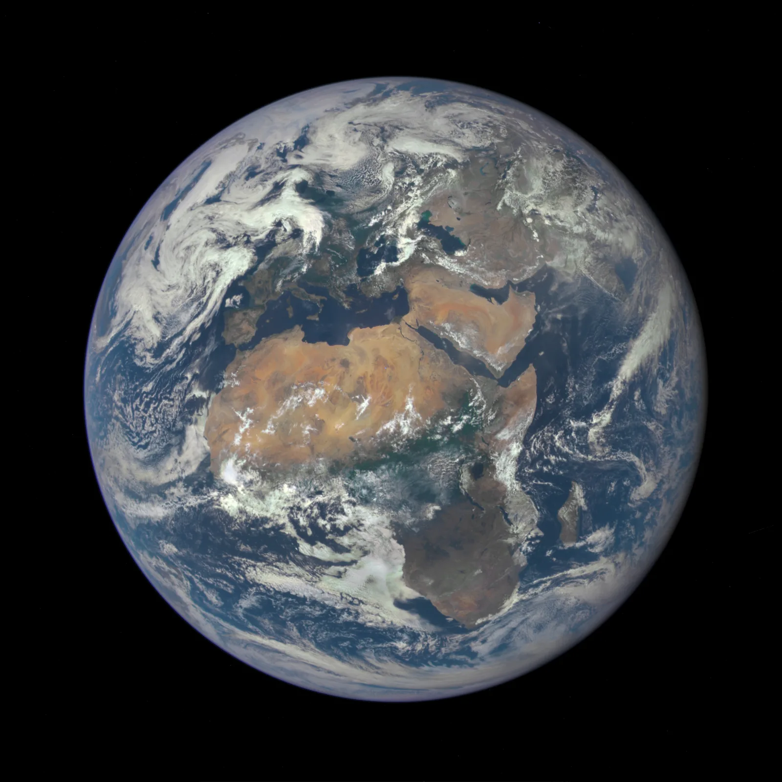
Every photo below is public domain, credited to the NASA or NOAA mission and instrument that captured it, with the date the shutter actually opened (or, for a multi-orbit composite, the date range the source data was collected). The set runs chronologically, from the first-ever satellite photo of Earth in 1959 to the most recent addition from the Artemis II crew in 2026. Click any image to open it full-size, with next and previous arrows to move through the whole set and a zoom button to see it at full resolution.
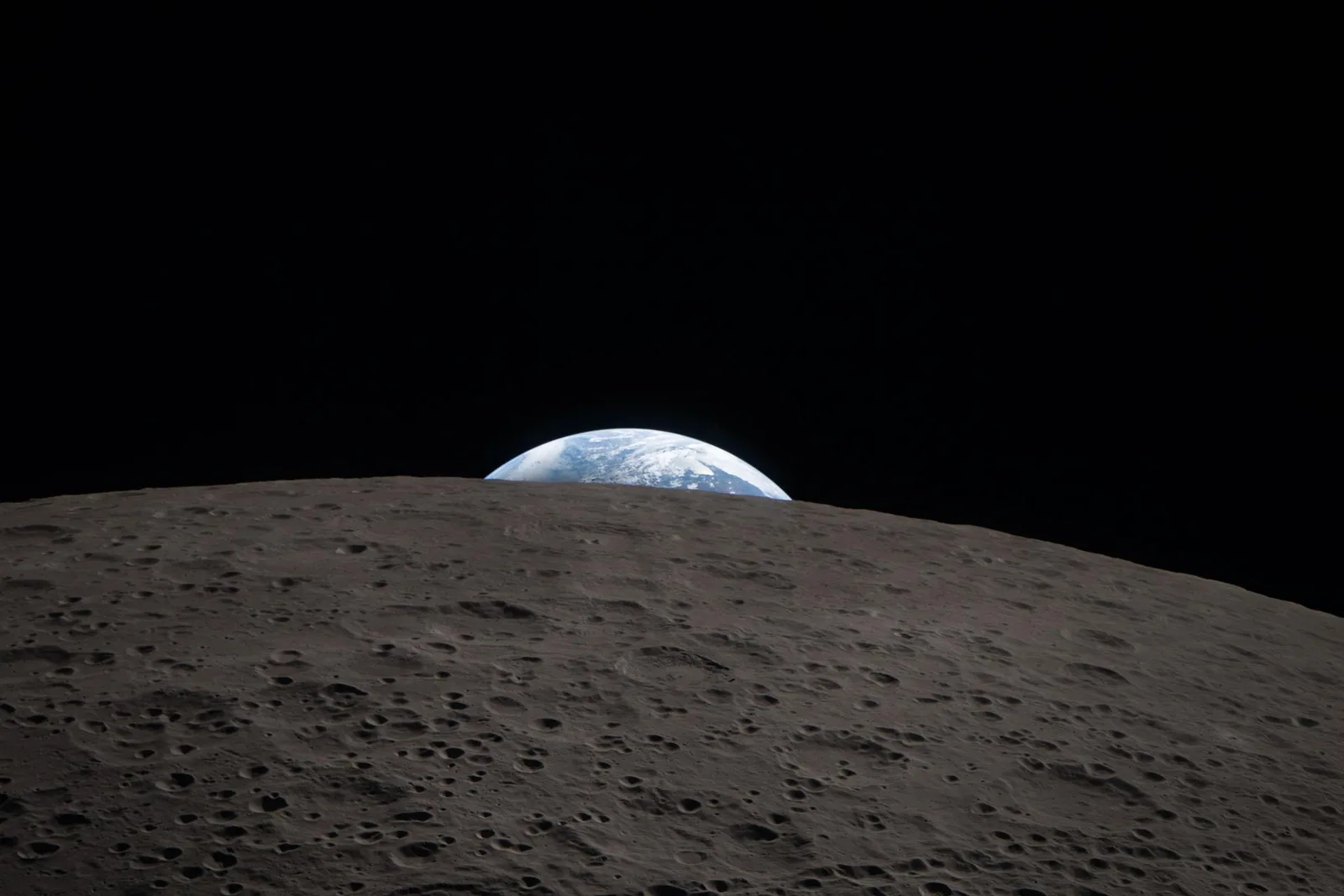
Which NASA and NOAA satellites and missions took these real Earth photos
These real Earth photos span three very different kinds of vantage point, namely a crewed spacecraft in transit, a low Earth orbit satellite passing overhead every 90 minutes or so, and a spacecraft parked much farther out where it can see the whole sunlit planet at once.
| Mission | Agency | Notable real Earth photo | Vantage point |
|---|---|---|---|
| Explorer 6 | NASA (robotic) | First satellite photo of Earth, Aug 14, 1959 | Low Earth orbit, about 27,000 km out |
| TIROS-1 | NASA (robotic weather satellite) | First TV picture from space, Apr 1, 1960 | Low Earth orbit, about 700 km up |
| Apollo 8 | NASA (crewed) | Earthrise, Dec 24, 1968 | Lunar orbit, about 380,000 km out |
| Apollo 17 | NASA (crewed) | The Blue Marble, Dec 7, 1972 | Trans-lunar coast, about 45,000 km out |
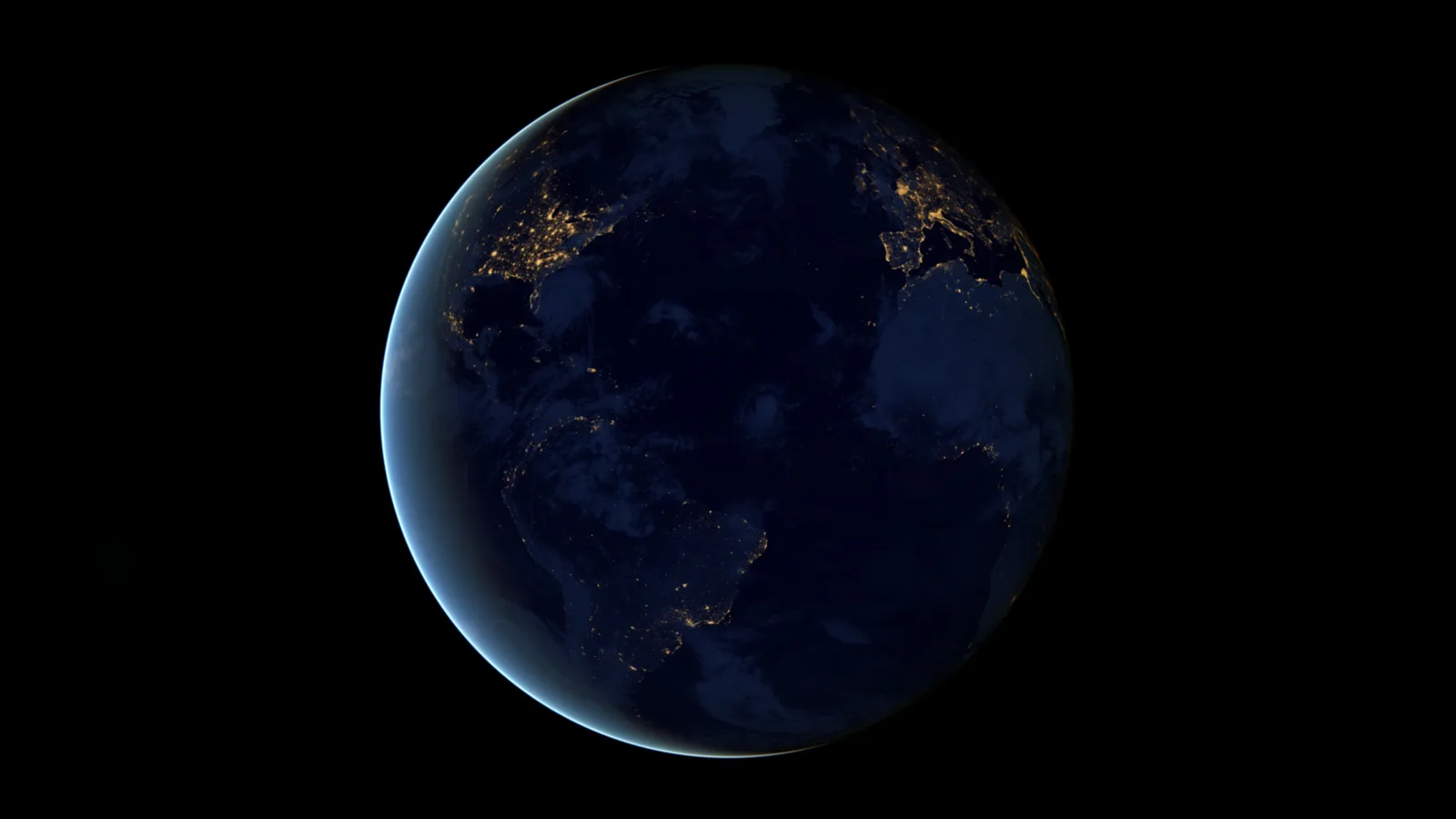
| Suomi NPP (VIIRS) | NASA/NOAA | Blue Marble 2012 and Black Marble | Polar low Earth orbit, 824 km up |
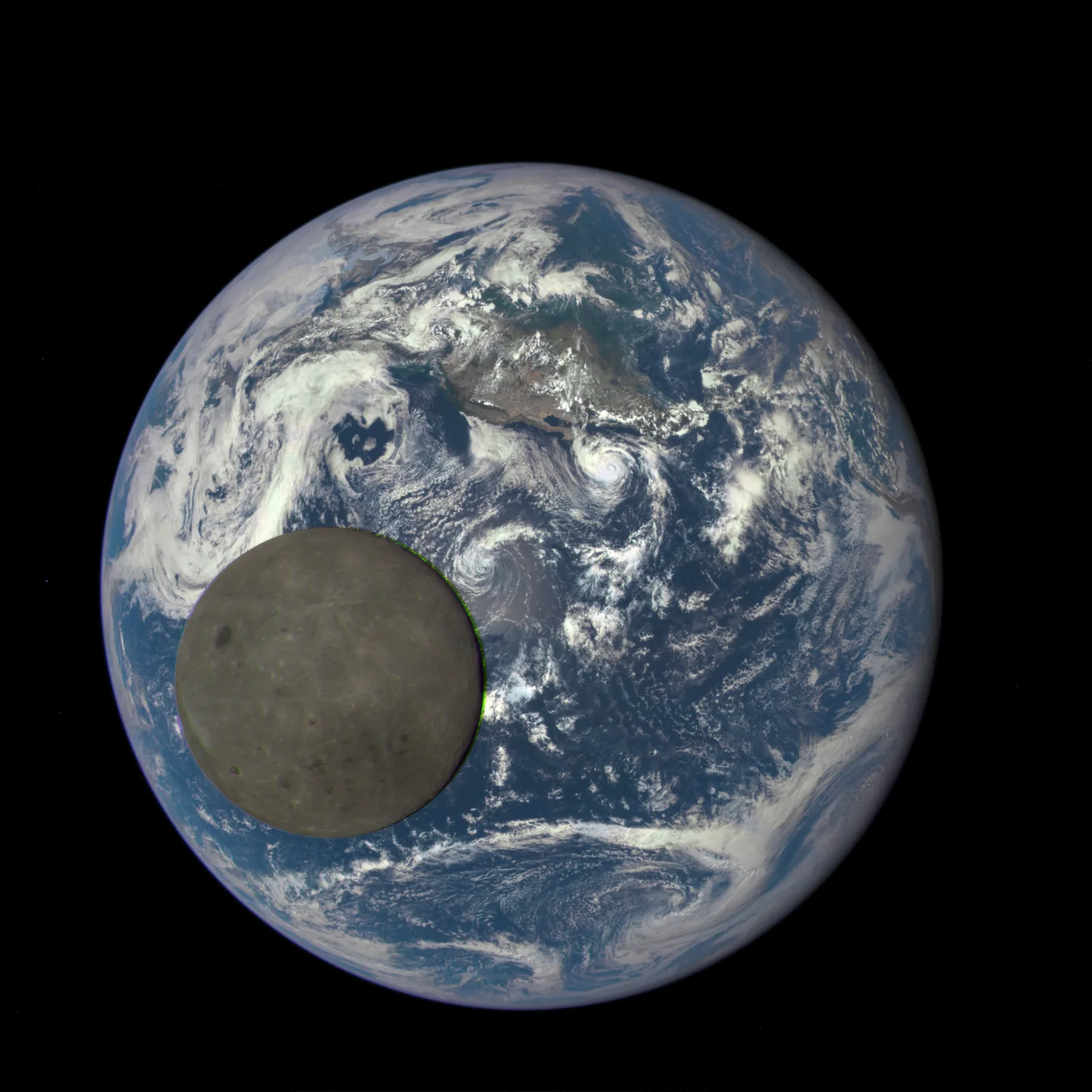
| DSCOVR (EPIC) | NASA/NOAA/US Air Force | First EPIC full Earth image, Jul 6, 2015 | Sun-Earth L1 point, about 1.5 million km out |
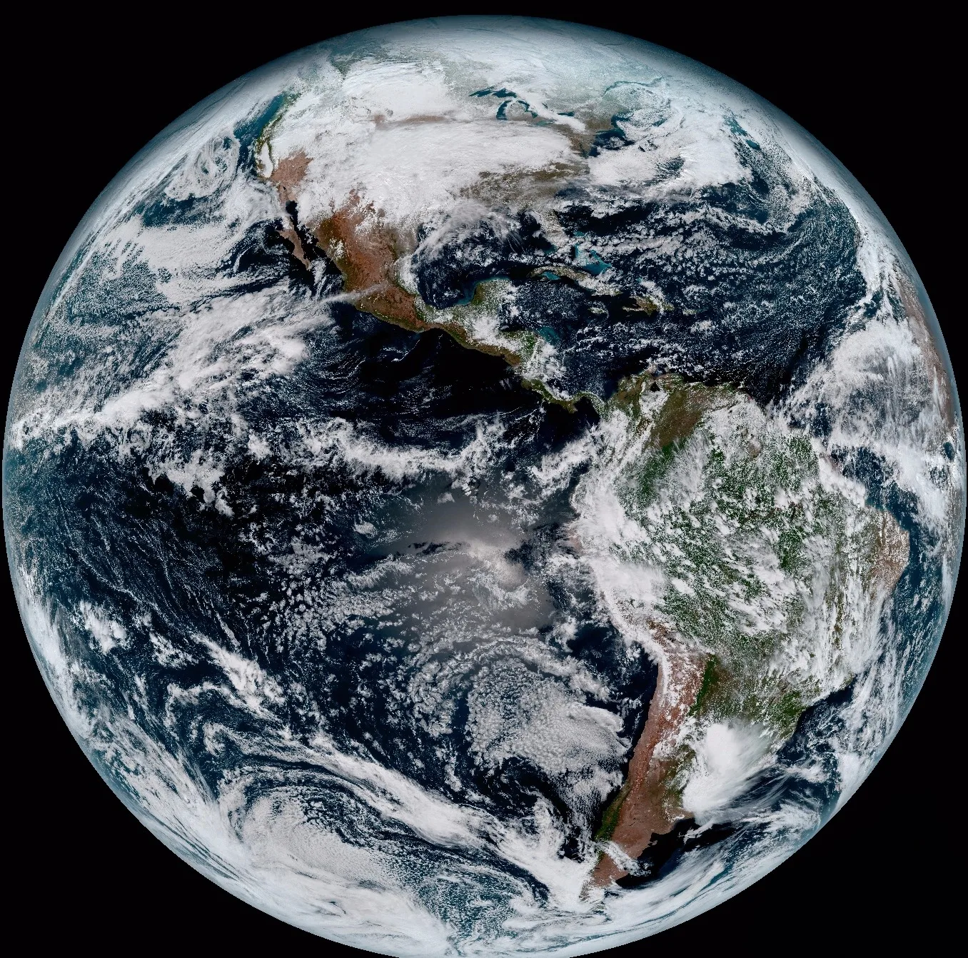
| GOES-16 / GOES-East (ABI) | NOAA/NASA | First full disk color image, Jan 15, 2017 | Geostationary orbit, 22,300 miles up |
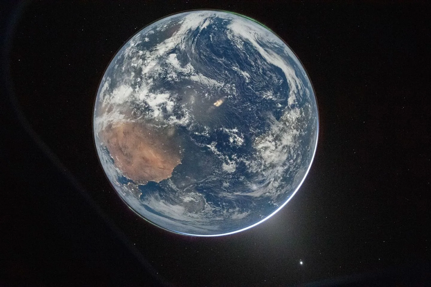
| International Space Station | NASA and international partners | Ongoing astronaut Earth photography since 2000 | Low Earth orbit, about 400 km up |
| Artemis II (Orion) | NASA (crewed) | Earthset, Apr 6, 2026 | Lunar flyby, about 370,000 km out |
How a composite real Earth photo like Blue Marble gets built
Earthrise and the original 1972 Blue Marble are each a single frame from a single camera, nothing more. The newer Blue Marble and Black Marble releases work differently, since no single satellite pass can capture the entire globe cloud-free and evenly lit at once, so NASA scientists instead pull months of individual swaths from a polar-orbiting satellite like Suomi NPP, select the clearest pass over each stretch of land, and mosaic them together into one seamless global view. Every pixel in the finished image still traces back to a real satellite measurement of real sunlight reflecting off real land, ocean, or cloud, the compositing step only decides which real pass gets used where, it never invents or smooths over missing detail the way a rendered graphic would.
Black Marble takes this a step further for its night-lights view, combining 312 separate Suomi NPP orbits collected over 22 days in 2012 using the satellite's day-night band sensor, sensitive enough to pick out individual city lights, wildfires, and auroras from 824 km up. The result reads almost like a single photograph of a fully lit night Earth, but it represents real light measurements gathered across nearly a month, not one instant.
Why satellite imagery of Earth from space is important
The photos in the gallery above are milestones precisely because a single real image of the whole Earth is rare, most satellite imagery does the opposite, returning to the same small patch of ground again and again so change over time becomes measurable rather than anecdotal. That repetition is what makes satellite imagery genuinely important rather than just visually striking, since a farmer, an insurer, or a disaster response team doesn't need one beautiful photo of the planet, they need a reliable, repeated record of one specific place. Around 200 optical Earth-observation satellites from a single commercial operator alone now image the planet's entire landmass daily, on top of the government missions covered in this guide, a scale of coverage no ground survey could match.
Satellite imagery also gives every user, regardless of country or budget, the same consistent, objective measurement of a place, which is why it underpins climate research, crop monitoring, flood and wildfire response, and treaty verification alike. A single Blue Marble or Earthrise photo captures the imagination, but it's this quieter, repeated coverage that satellite imagery is actually built for.
Types of satellite imagery of Earth from space
Not every real Earth photo is captured the same way, and the sensor behind an image decides what it can and can't show. Several of these types appear in the gallery above, each chosen for what it was built to reveal.
| Type | What it captures | Example in this guide | Best for |
|---|---|---|---|
| True color optical | Visible red, green, and blue light, the same range the human eye sees | Earthrise, The Blue Marble | General reference, mapping, education |
| Multispectral / false color | Visible light plus near-infrared and other non-visible bands | Not pictured above, used for NDVI and similar indices | Vegetation health, land cover classification |
| Low-light / night band | Faint visible light such as city lights, wildfires, and auroras | Black Marble | Population and infrastructure mapping, power-outage tracking |
| Radar (SAR) | Microwave signals that pass through cloud cover and work in total darkness | Not pictured above, covered in our SAR disaster response guide | All-weather and nighttime monitoring, flood and ship detection |
| Thermal infrared | Surface heat rather than reflected light | Not pictured above | Wildfire detection, urban heat islands |
| Geostationary weather | Visible and infrared light from a fixed point over the equator | GOES-16 first full disk image | Weather forecasting, storm tracking |
| Polar-orbiting composite | True color data from many individual orbital passes, mosaicked together | Blue Marble 2012, Black Marble | Cloud-free global basemaps |
Applications of satellite imagery of Earth from space
Once a satellite is imaging a place repeatedly rather than once, that steady stream of real photos turns into a practical tool across a wide range of industries.
- Agriculture. Multispectral and true color imagery tracks crop health, irrigation, and yield across entire fields; see our guides to precision agriculture satellite imagery and satellite imagery for agriculture.
- Disaster response. Radar imagery keeps working through cloud cover and at night, letting responders map flooding, storm damage, and wildfires when optical satellites can't see through the weather, covered in our guide to SAR satellite imagery for disaster response.
- Urban planning. Repeated imagery over the same city catches unapproved construction and tracks growth over years, detailed in our guide to change detection for urban growth.
- Insurance. Time-stamped before-and-after imagery verifies storm and flood damage claims without waiting for a site visit, covered in our guide to satellite imagery as insurance evidence.
- Forestry. Multispectral imagery measures canopy cover and flags deforestation as it happens, detailed in our guide to forestry canopy monitoring.
- Maritime monitoring. Radar imagery detects and tracks vessels at sea regardless of weather or darkness, covered in our guide to SAR for maritime monitoring.
- Mining and mineral exploration. Hyperspectral imagery identifies mineral signatures on the surface long before any ground survey, detailed in our guide to hyperspectral imagery for mineral exploration.
- Oil and gas. Regular imagery monitors pipeline corridors, well pads, and facility sites over large, often remote areas, covered on our satellite imagery for oil and gas page.
- Climate and environmental research. Long-running archives like Landsat and composites like Black Marble let researchers track ice extent, deforestation, and light pollution over decades, not just a single snapshot.
Want current imagery over your own area of interest?
These archival NASA and NOAA photos show the whole planet. Search free Sentinel-2 and Landsat archive imagery, or task a fresh, high-resolution capture, over any specific location on our portal.
How to find and download real Earth images from NASA yourself
Every image on this page came from a NASA or NOAA archive that is open to the public at no cost, and finding more real Earth photos yourself takes only a few extra steps beyond a generic search.
- NASA Image and Video Library, at images.nasa.gov, is searchable by mission name or photo ID (Earthrise's original file is catalogued as AS08-14-2383) and returns the full-resolution original alongside its date and credit line.
- NASA Visible Earth and NASA Earth Observatory host the Blue Marble and Black Marble series with full write-ups on how each composite was assembled and which instrument supplied the data.
- DSCOVR EPIC's own gallery, at epic.gsfc.nasa.gov, posts a new real photo of the full sunlit Earth every day, available within about 12 to 36 hours of capture, the closest thing to a live real Earth photo feed that exists.
- NOAA's GOES image viewer posts a fresh full-disk real Earth photo from geostationary orbit roughly every 10 to 15 minutes, though only recent captures stay archived at full resolution.
- For a fuller list of open archives, including ones covering a specific location rather than the whole globe, our guide to free satellite imagery sources compares 14 platforms by resolution and update frequency.
Every source above releases its Earth imagery into the public domain or under an open license, so a real Earth photo used in a school project, a presentation, or an article generally just needs the mission and photographer credited, exactly as the captions on this page do.
How often a satellite photographs the whole real Earth
How often a fresh, real photo of the whole Earth appears depends entirely on where the camera sits. A geostationary satellite like GOES stays locked over one point on the equator and can photograph its full hemisphere every 10 to 15 minutes, though it never sees the far side of the planet. DSCOVR, parked much farther out at the Sun-Earth L1 point, sees the entire sunlit globe at once but only captures a new full Earth image every one to two hours as it rotates through its own imaging sequence. A polar-orbiting satellite like Suomi NPP crosses the whole planet twice a day but only images a narrow strip on each pass, which is why a genuinely cloud-free, single-pass photo of the entire globe essentially doesn't exist, and why composites like Blue Marble and Black Marble remain the standard way to show the whole real Earth in one image.
Key takeaways
- The first real photo of Earth from a satellite is a crude scan from NASA's Explorer 6 on August 14, 1959, followed eight months later by TIROS-1's first television picture from space on April 1, 1960, the first from a dedicated weather satellite. Earthrise (December 24, 1968) and The Blue Marble (December 7, 1972) followed as the two most widely recognized real photos of Earth from space, both taken by Apollo astronauts, not rendered or generated.
- A real Earth photo is either a single exposure, like Earthrise, or a composite of multiple real orbital passes stitched together, like the Blue Marble 2012 and Black Marble releases, every pixel in both cases traces back to an actual satellite measurement.
- NASA's DSCOVR satellite, at the Sun-Earth L1 point about a million miles out, has photographed the entire sunlit Earth roughly every one to two hours since 2015, including a rare image of the Moon crossing in front of the planet on July 16, 2015.
- NOAA's geostationary GOES satellites capture a real photo of their hemisphere of Earth every 10 to 15 minutes, the fastest update cycle of any source in this guide, though each satellite only ever sees one side of the planet.
- Every image in this guide is public domain NASA or NOAA imagery, free to view, download, and reuse with credit to the mission and instrument that captured it.
- The most recent image in this guide is Earthset, photographed by the Artemis II crew on April 6, 2026 as their Orion spacecraft passed behind the Moon's far side, a deliberate echo of Earthrise taken from nearly the same vantage point 58 years earlier.
Frequently asked questions
What is a real image of Earth from space?
A real image of Earth from space is an actual photograph captured by a camera on a satellite, spacecraft, or by an astronaut, showing exactly the sunlight, cloud cover, and orbital position that existed at the moment it was taken, unlike a computer-generated render or illustration built from a texture map. Earthrise and the Blue Marble are the two most widely recognized examples, both genuine photographs taken during NASA's Apollo missions.
Is the Blue Marble photo of Earth real or computer generated?
The original 1972 Blue Marble is a single real photograph taken by the Apollo 17 crew. The newer Blue Marble 2012 release is a composite built from multiple real satellite passes captured by the Suomi NPP satellite's VIIRS instrument, stitched together to show the full globe at once. Every pixel in both versions comes from actual captured sunlight, not a computer-generated illustration.
How often do satellites take a real photo of the whole Earth?
It depends on the satellite's position. NASA's DSCOVR satellite, parked about a million miles from Earth, photographs the entire sunlit globe roughly every one to two hours. Geostationary weather satellites like NOAA's GOES photograph their visible hemisphere every 10 to 15 minutes but never see the far side of the planet. Polar-orbiting satellites cross the globe twice a day but only capture a narrow strip per pass, which is why full-globe images are usually composites of several passes.
Can I download real NASA images of Earth for free?
Yes. NASA's Image and Video Library at images.nasa.gov, NASA Visible Earth, and NASA Earth Observatory all host full-resolution real Earth photos in the public domain, free to download and reuse with credit to the mission and instrument. DSCOVR's EPIC camera also posts a new real Earth photo daily through its own public gallery.
Why does Earth look different in every real satellite photo?
Cloud cover, the time of day, the season, and the satellite's exact position all change what a real photo of Earth shows at any given moment, the same way a photo of any landscape looks different depending on when it's taken. A single-orbit photo like Earthrise also only shows whichever side of Earth was facing the camera at that instant, while a composite like Blue Marble blends multiple dates together to show the whole globe at once.
What was the first real photograph of Earth from space?
The first photograph of Earth from actual space (above the Karman line) is generally credited to a V-2 rocket camera launched by the US in 1946, a suborbital flight rather than a satellite. The first real photograph of Earth taken by a satellite came later, a crude scanned image radioed down from NASA's Explorer 6 on August 14, 1959. TIROS-1 added a separate first on April 1, 1960, the first television picture from space and the first image from a dedicated weather satellite. The first widely recognized full-color image of the whole Earth from space is Earthrise, taken by the Apollo 8 crew on December 24, 1968, the first time humans photographed Earth rising over another celestial body.
What is the most recent real photo of Earth from a NASA mission?
The most recent widely publicized real photo of Earth is Earthset, photographed by the Artemis II crew on April 6, 2026 as their Orion spacecraft passed behind the Moon's far side during its lunar flyby. NASA and the crew deliberately framed it to echo the original Apollo 8 Earthrise photo, taken from nearly the same vantage point 58 years earlier. DSCOVR's EPIC camera and NOAA's GOES satellites continue to add new real Earth photos daily, but Earthset is the newest single image widely covered as a milestone.
Do satellites take real color photos of Earth or false color?
Both exist, and most of the well-known Earth photos in this guide, including Earthrise, the Blue Marble series, and DSCOVR's EPIC images, are true, natural color, built from the same red, green, and blue wavelengths the human eye sees. Many scientific satellite instruments also capture false-color images using infrared or other non-visible bands to reveal vegetation health, temperature, or moisture, which are real measurements too, just displayed in colors that don't match what a person would see with the naked eye.
Which satellite took the most famous real photo of Earth?
The single most famous real photo of Earth is generally considered to be The Blue Marble, taken by the Apollo 17 crew on December 7, 1972, not from a robotic satellite but from the crewed spacecraft itself as it traveled toward the Moon. Among robotic missions, NASA's DSCOVR satellite and its EPIC camera are the most consistent modern source of full-Earth real photos, capturing the entire sunlit globe on a regular schedule since 2015.
Sources and further reading
- NASA: Explorer 6 first satellite photo of Earth, image 59-EX-16A-VI, August 14, 1959
- NASA: TIROS-1 first television picture from space, April 1, 1960
- NASA Image and Video Library: images.nasa.gov, image records AS08-14-2383, AS17-148-22727
- NASA Earth Observatory and Visible Earth: Blue Marble 2012 and Black Marble release notes, credits to Norman Kuring and Robert Simmon, NASA/GSFC
- NASA/NOAA DSCOVR EPIC: epic.gsfc.nasa.gov, first light and lunar transit gallery releases, 2015
- NOAA/NASA GOES-16 (GOES-East): first full disk image release, January 15, 2017
- NASA Johnson Space Center: Artemis II crew photography, images art002e000192 and art002e021278, April 2026
From archival Earth photos to current imagery of your site
These NASA and NOAA photos show the whole planet on a given day. Search free archive imagery or request a fresh, tasked capture over your specific area of interest.


