
Tracking Urban Growth With Satellite Change Detection
On this page
- What satellite change detection actually measures
- AI-driven change detection and extraction workflows
- 01. Building contour extraction
- 02. Adhesion segmentation and elevation correction
- 03. Building white models and digital twins
- 04. Illegal construction and violation monitoring
- Satellite constellations for urban monitoring
- InSAR: monitoring what optical imagery can't see
- Getting an accurate comparison: what the AI needs from the imagery
- Common indices used alongside AI change detection
- Real-world applications and case studies
- Beijing: InSAR deformation monitoring across transit corridors
- Asia: sub-meter optical imagery powering smart city digital twins
- MENA region: tracking urban sprawl and land-use compliance
- Africa: rapid-turnaround imagery for infrastructure rollouts
- Beyond city limits: what else change detection tracks
- Pricing and cloud delivery
- Frequently asked questions
- Sources and further reading
A city doesn't grow all at once, it grows one rooftop, one road, one rezoned plot at a time. Satellite change detection is how that accumulation gets tracked at scale: compare two dates of imagery, run the difference through AI, and get back exactly what was built, where, and whether anyone approved it.
Quick answer
Satellite change detection tracks urban growth by comparing multi-temporal imagery, optical scenes and radar, taken over the same area at different dates, and running the difference through AI to extract new building footprints, flag unauthorized construction, and measure ground subsidence. Optical satellites down to 25 cm resolution capture the horizontal sprawl, while InSAR radar measures vertical structural movement as small as 1 to 2 mm, giving planners and municipal authorities a continuous, near real-time record of how a city is actually changing.
What satellite change detection actually measures
Every change detection analysis boils down to comparing the same location at two points in time and describing what's different. In practice, that difference always falls into one of four categories:
- Shape change: a structure's outline is different, such as a warehouse footprint that gained a new wing.
- Size change: the same feature got bigger or smaller, like a construction site expanding across a formerly vacant lot.
- Position change: something moved, such as a temporary site office relocated across a compound.
- Use change: the object is unchanged in outline but serving a different purpose, like a former industrial yard now holding residential blocks. This category can't be confirmed from imagery alone; it needs a permit record or field note to verify.
Urban growth tracking mainly lives in the first two categories, new shapes and new sizes appearing where there used to be bare land, but the AI workflows below extract far more than a simple before-and-after difference.
AI-driven change detection and extraction workflows
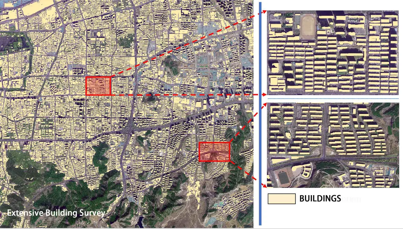
Automated platforms use semantic segmentation to extract urban features directly from optical imagery and keep foundational city maps current without manual digitizing.
01. Building contour extraction
Deep learning models pull building footprints directly out of optical imagery. The raw contours then go through regularization, principal-direction adjustment, redundant point simplification, and sharp-angle elimination, so the extracted outline matches the building's actual geometric form instead of a jagged pixel edge.
02. Adhesion segmentation and elevation correction
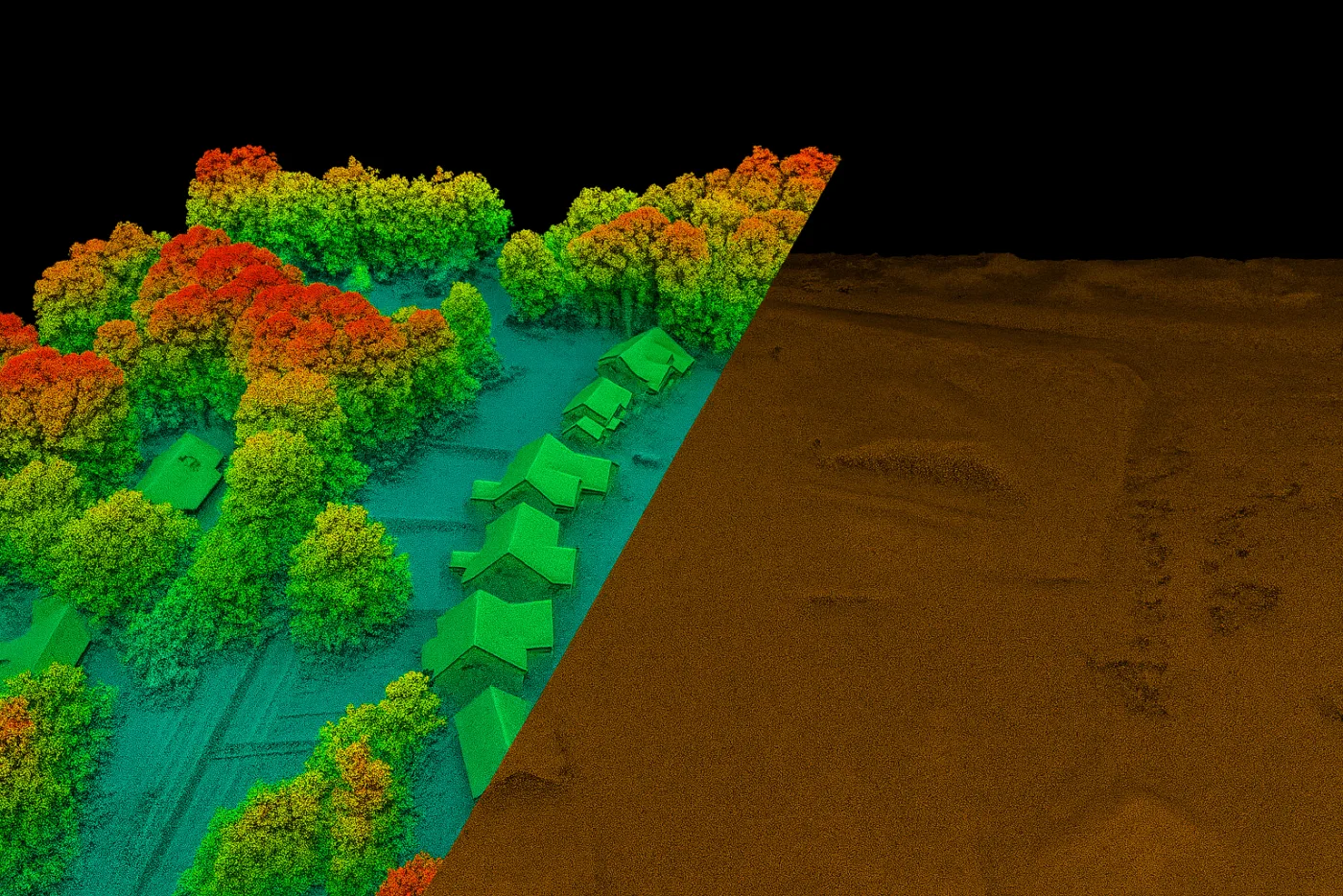
Buildings that sit close together get separated through height-difference segmentation or common-edge splitting, so two adjacent structures aren't extracted as one blob. Pairing homonymous contours across left and right stereo images then calculates top elevation and building height directly, no ground survey required.
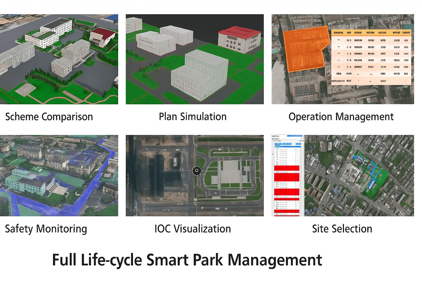
03. Building white models and digital twins
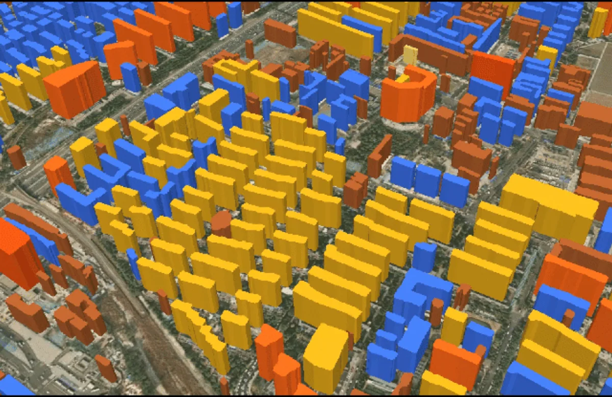
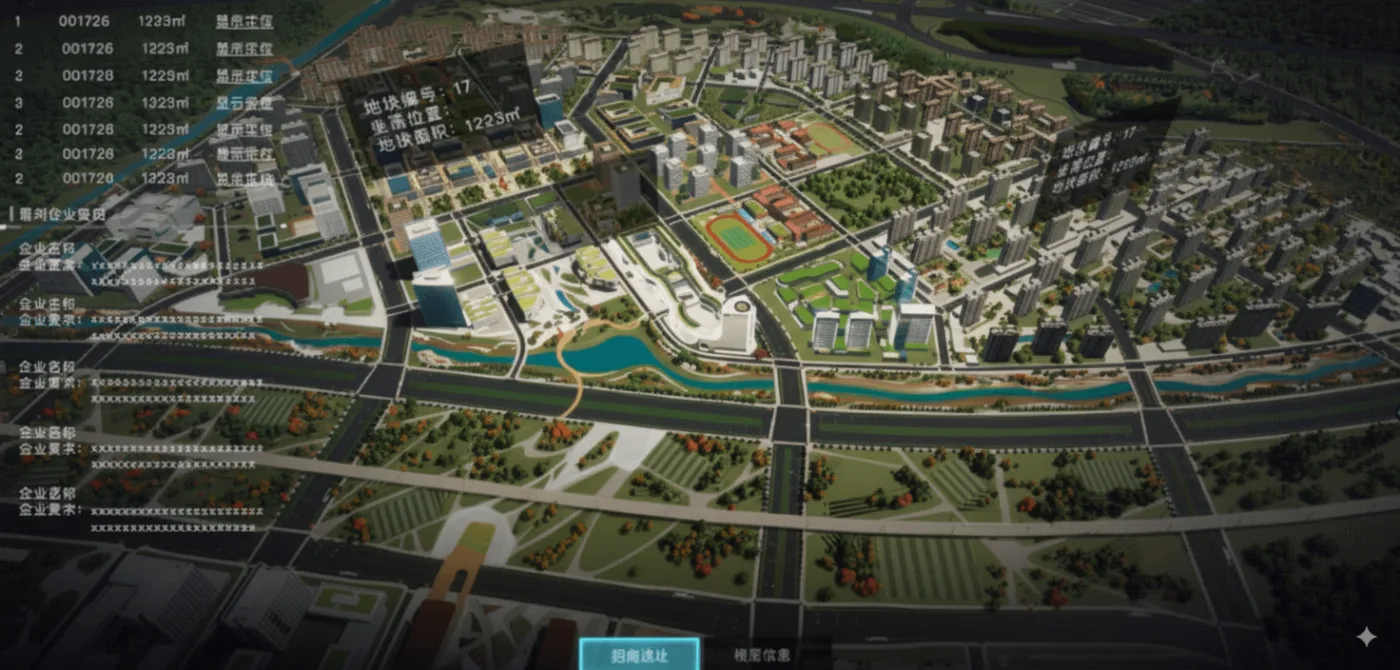
Extracted contours and height measurements generate simplified 3D "white models," box models that reflect each building's footprint and height. Stacked across a city, these become the foundational base layer for large-scale 3D displays and digital twins used in planning and traffic routing.
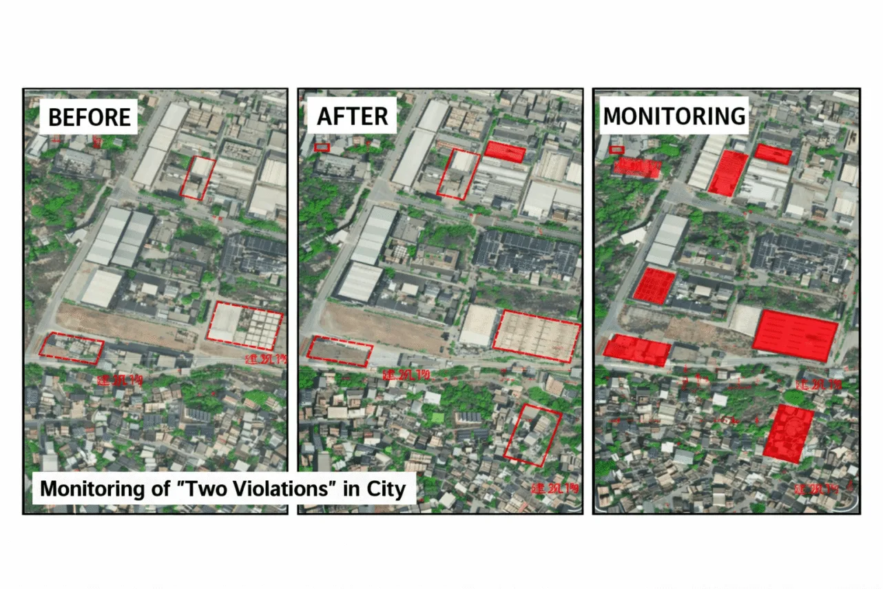
04. Illegal construction and violation monitoring
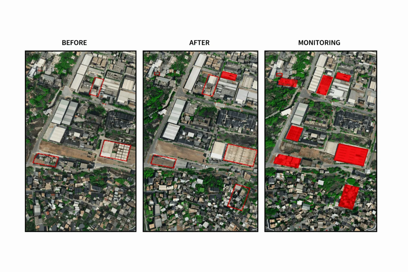
Running the same AI comparison on a schedule automatically flags unauthorized building, illegal land appropriation, unapproved expansion into protected zones, and encroachment onto cultivated land, catching a violation within one revisit cycle instead of waiting for a manual inspection.
Satellite constellations for urban monitoring
Tracking urban development calls for ultra-high spatial resolution to catch fine structural detail, combined with a revisit frequency fast enough to catch construction as it happens.
| Satellite / constellation | Sensor | Resolution (GSD) | Key capability for urban tracking |
|---|---|---|---|
| SuperView Neo-1 (03/04) | Optical | 0.25 m PAN / 1 m MS | Industry-first 25 cm resolution for fine-detail infrastructure and building monitoring |
| SuperView Neo-1 | Optical | 0.3 m PAN / 1.2 m MS | Daily revisit for tracking high-frequency urban shifts and construction progress |
| BJ3N (Beijing-3B) | Optical, onboard AI | 0.3 m PAN / 1.2 m MS | In-orbit AI processing for faster change detection turnaround |
| SuperView-2 (GFDM) | Optical | 0.42 m PAN / 1.68 m MS | Agile attitude control for stereo and tri-stereo urban canyon modeling |
| Beijing-3A | Optical | 0.5 m PAN / 2 m MS | 23.5 km swath supporting mono, stereo, and tri-stereo 3D mapping |
| GF-7 | Optical stereo | 0.65 m PAN / 2.6 m MS | Dual-linear CCD camera and laser altimeter for 1:10,000 scale mapping |
| GF-2 / TripleSat / ZY-3 | Optical | 0.8–2.1 m | Baseline imagery for regional land-use surveys and 1:50,000 topographic mapping |
InSAR: monitoring what optical imagery can't see
Optical satellites track horizontal sprawl and surface land cover. Synthetic Aperture Radar, through Interferometric SAR (InSAR), covers the dimension optical imagery misses entirely: vertical structural health.
- Millimeter-level accuracy: GF-3 SAR (1 m Spotlight resolution) and the LT-1 A/B L-band constellation measure surface displacement and ground subsidence down to 1–2 mm between passes.
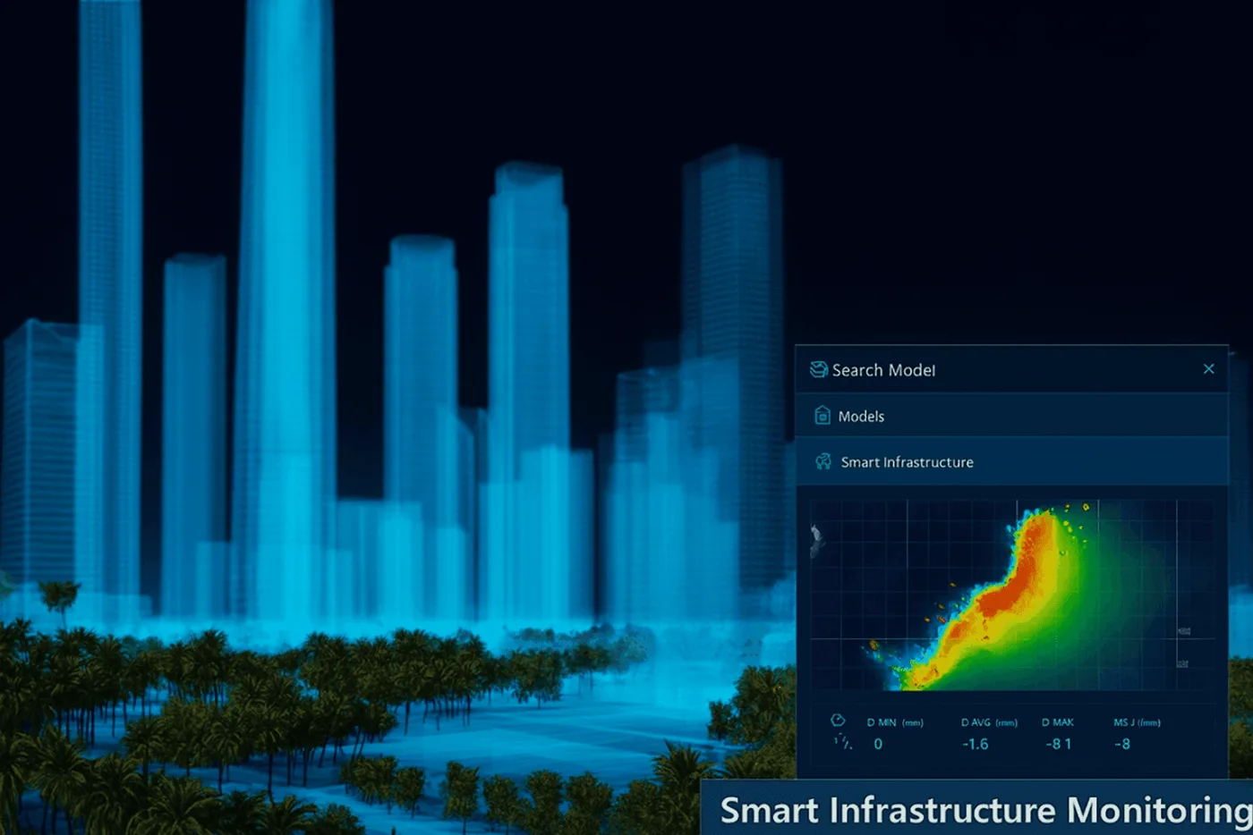
- Infrastructure safety: continuous InSAR monitoring checks structural deformation on bridges, expressways, high-rise buildings, urban railways, and underground utilities, catching hidden subsidence before it becomes structural failure.
- All-weather surveillance: active microwave radar penetrates cloud, fog, heavy haze, and total darkness, keeping monitoring uninterrupted through a monsoon season or a stretch of overcast weeks.
Getting an accurate comparison: what the AI needs from the imagery
A change detection result is only as reliable as the two images feeding it. Three things have to line up before the AI comparison is trustworthy:
- Same sensor type and processing level: comparing a panchromatic scene against a multispectral one, or two different satellites with different radiometric calibration, introduces false differences that have nothing to do with real change on the ground.
- Atmospheric correction: haze, thin cloud, and seasonal lighting differences between the two acquisition dates need to be normalized out first, otherwise the algorithm flags a sunnier day as a land-cover change.
- Consistent look angle and season: shadows fall differently depending on sun angle and time of year, which can make an unchanged building look like it grew or shrank if the two dates aren't reasonably matched.
Common indices used alongside AI change detection
Building extraction handles structures directly, but spectral indices are still the fastest way to flag change in vegetation, water, and burned ground before running deeper analysis.
| Index | What it tracks | Typical use |
|---|---|---|
| NDVI / GCI | Vegetation vigor and chlorophyll content | Flagging cleared land before construction begins, crop stress |
| NDWI | Surface water extent | Reservoir levels, flood boundary change, drainage encroachment |
| NBR | Burn severity | Wildfire damage assessment, land clearing by burning |
Real-world applications and case studies
Beijing: InSAR deformation monitoring across transit corridors
InSAR deformation analysis deployed across urban transportation corridors and bridges has maintained a long-term structural safety record, catching subsidence trends on critical infrastructure well before they reach a visible threshold.
Asia: sub-meter optical imagery powering smart city digital twins
Sub-meter optical imagery, building white models, and 3D elevation scenes have been integrated into digital twins used for city planning, traffic routing, and disaster resilience modeling.
MENA region: tracking urban sprawl and land-use compliance
High-resolution change detection applied across the MENA region has monitored urban sprawl, enforced municipal zoning laws, and tracked land-use compliance across fast-growing metro areas.
Africa: rapid-turnaround imagery for infrastructure rollouts
Rapid-turnaround satellite imagery has provided updated basemaps for municipal road networks and transit expansion projects, keeping planning data current in regions where field survey cycles are slow.
Beyond city limits: what else change detection tracks
The same before-and-after AI comparison that flags a new building extends naturally to land that isn't urban yet. High-frequency, geostationary sensors take this furthest, some re-image the same spot every 20 seconds, fast enough to track a wildfire front spreading in near real time rather than just a monthly land-cover shift.
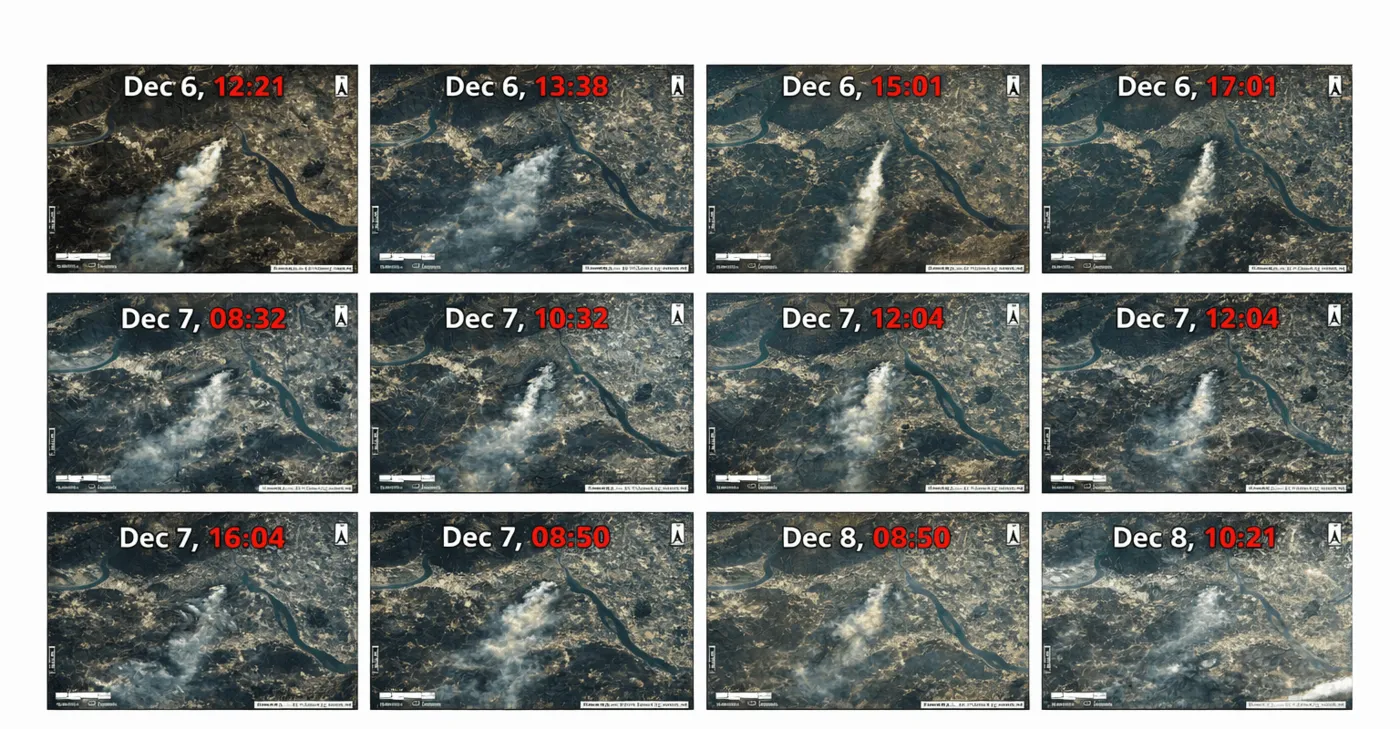
Beyond disaster monitoring, the same core technique supports crop stress detection in agriculture, deforestation tracking in forestry, and pre- and post-event damage assessment for insurance claims, all built on the same principle of comparing two dates and measuring what changed.
Pricing and cloud delivery
Urban imagery and value-added products are delivered through a cloud service that processes up to 50 TB of data daily, with command uploads reaching a satellite within 3 hours globally, a 1.5-hour response time, and 1-hour cloud data delivery. Deliverables come in GeoTIFF, SHP, DWG, and UTM formats.
| Resolution tier | Archive (90+ days) | New tasking | Minimum order |
|---|---|---|---|
| Super high (25–30 cm) | $20/km² | $30/km² | 25 km² archive / 100 km² tasking |
| Very high (31–50 cm) | $13–14/km² | $20–22/km² | 25 km² archive / 100 km² tasking |
| High (51–80 cm) | $5/km² | $8–10/km² | 25 km² archive / 100 km² tasking |
| Moderate (2 m) | $1/km² | $2/km² | Flexible |
Key takeaways
- Every change detected on satellite imagery falls into one of four categories: a shape change, a size change, a position change, or a use change that needs outside confirmation.
- AI extraction pipelines pull building footprints, height, and 3D white models directly from optical imagery, and can flag unauthorized construction within a single revisit cycle.
- Optical satellites track horizontal urban sprawl down to 25 cm resolution; InSAR radar tracks vertical ground and structural movement down to 1–2 mm, a dimension optical imagery cannot measure at all.
- An accurate comparison depends on matching sensor type, processing level, atmospheric correction, and acquisition season between the two dates being compared.
- The same time-series technique that tracks a new building also tracks wildfire spread, crop stress, and flood extent, just applied to a different feature and revisit cadence.
Frequently asked questions
What is satellite change detection?
Satellite change detection compares imagery of the same location taken at different dates to identify what changed, new construction, a shrinking water body, a moved structure, or a land-use conversion. AI algorithms automate the comparison, extracting building footprints and flagging differences instead of requiring a manual side-by-side review.
How does AI detect illegal or unauthorized construction from satellite imagery?
AI models extract building footprints from each new satellite pass and compare them against the previous baseline and known permit boundaries. A footprint that appears where none was approved, or one that extends beyond an approved boundary, gets flagged automatically, often within the same revisit cycle the construction happened in.
What resolution do I need to track urban growth with satellite imagery?
25 to 50 cm resolution is standard for building-level change detection, fine enough to extract individual building footprints and catch new construction. Regional land-use and sprawl tracking across a wider area can work with 2 m resolution, trading fine detail for coverage.
Can change detection work through cloud cover?
Optical change detection cannot, since cloud blocks the sensor the same way it would a photo. Synthetic Aperture Radar (SAR) and InSAR generate their own signal and penetrate cloud, fog, and darkness, making them the reliable option for continuous monitoring in persistently overcast regions.
How accurate is InSAR for detecting ground subsidence?
InSAR can detect surface displacement and ground subsidence as small as 1 to 2 millimeters between satellite passes, accurate enough to flag early structural movement on bridges, high-rises, and underground utilities well before it becomes visible or measurable by other means.
Do the two satellite images need to come from the same sensor for accurate change detection?
Ideally yes. Comparing images from different sensors or processing levels introduces differences in radiometric calibration that can look like real change but aren't. Matching sensor type, resolution, atmospheric correction, and acquisition season keeps the comparison accurate.
What is a building white model in urban change detection?
A building white model is a simplified 3D box model that reflects a building's footprint and height, generated automatically from extracted contours and stereo elevation data. Stacked across a city, white models form the base layer for 3D digital twins used in planning and traffic routing.
Can satellite change detection be used outside of urban planning?
Yes. The same before-and-after comparison technique tracks wildfire spread, crop stress, deforestation, and flood extent, using spectral indices like NDVI, NDWI, and NBR instead of building footprint extraction, but built on the same underlying principle.
Sources and further reading
- China Siwei and 21AT: SuperView Neo, SuperView-1/2, Beijing-3, and GF-7 satellite specifications
- CNSA and CRESDA: GF-2, GF-3, ZY-3, and GF-4 mission specifications
- China Siwei: LT-1 A/B L-band InSAR mission specifications
- XRTech Group: AI change detection and building extraction case studies across Beijing, Asia, MENA, and Africa, 2026
Need to track growth or catch violations in your city?
Task optical or SAR imagery over your area of interest and get AI-flagged building change back through GeoTIFF, SHP, or DWG. No account needed to get a first estimate.


