How Many Satellites Are Orbiting Earth Right Now
On this page
- How Many Satellites Are in Orbit Right Now
- Why Do Satellite Counts Differ Between Sources
- How Many Satellites Are in Each Type of Orbit
- Which Country Has the Most Satellites
- Who Actually Operates These Satellites
- How Many of These Satellites Actually Take Pictures of Earth
- How Fast Is the Number of Satellites Growing
- How Much Space Debris Is in Orbit
- How Many Satellites Will There Be by 2030
- Frequently asked questions
- Sources and further reading
A practical guide to how many satellites are in space in 2026, covering the current active count and why trackers disagree on it, how satellites split across low, medium, and geostationary orbit, which countries and companies actually operate the fleet, how many of them are built to photograph Earth rather than carry internet or GPS signals, and how fast the total is growing toward the next decade.
Quick answer
As of early October 2026, there are about 16,900 active satellites in Earth orbit, according to Jonathan McDowell's General Catalog, one of the most widely cited independent satellite trackers. Other trackers put the figure anywhere from roughly 16,600 to 17,900 depending on counting methodology and update lag, but all agree on the shape of the picture, roughly 95% of active satellites sit in low Earth orbit, SpaceX's Starlink constellation alone accounts for about two in every three, and the United States operates more active satellites than every other country combined. Including dead satellites still in orbit, debris, and spent rocket stages, the total catalogued object count climbs past 47,000.
How Many Satellites Are in Orbit Right Now
The best single answer is about 16,900 active satellites, the figure from Jonathan McDowell's General Catalog as of September 30, 2026, an astrophysicist-maintained database widely treated as the reference standard by space-tracking sites, journalists, and researchers alike. Of those, McDowell's data splits the fleet into roughly 14,500 in lower low Earth orbit and 1,400 in upper low Earth orbit, with the remainder spread across medium and geostationary orbit.
That number represents a staggering jump from just a few years ago. In 2019, before SpaceX began deploying Starlink at scale, there were only around 2,200 active satellites in orbit. The population has grown roughly sevenfold in seven years, and almost all of that growth traces back to a handful of broadband mega-constellations, covered in the growth section below.
Why Do Satellite Counts Differ Between Sources
Search for this topic and you'll see numbers ranging from about 16,600 to nearly 18,000, which can look like conflicting data but usually isn't. Three things drive the spread. First, status lag, a satellite that stops responding takes time to get reclassified from active to defunct across every tracker, so a database updated an hour ago can disagree with one updated yesterday. Second, definition boundaries, some counts include every payload that has ever reached a stable orbit regardless of whether it still communicates, while others count only satellites confirmed to be maneuverable or actively transmitting. Third, source lineage, CelesTrak draws from US Space Force tracking data, McDowell's catalog cross-references multiple government and amateur tracking networks by hand, and the Union of Concerned Scientists database is updated quarterly from operator-submitted filings rather than continuous tracking. None of these approaches is wrong, they're just measuring slightly different things, which is why this guide cites a specific source and date next to every figure rather than one unqualified headline number.
How Many Satellites Are in Each Type of Orbit
Nearly all active satellites fly in one of three orbital regimes, and the split between them has shifted dramatically as low-orbit broadband constellations have scaled up.
| Orbit | Altitude | Active satellites | Share |
|---|---|---|---|
| Low Earth orbit (LEO) | 160 to 2,000 km | 15,819 | 95% |
| Geostationary orbit (GEO) | 35,786 km | 562 | 3% |
| Medium Earth orbit (MEO) | 2,000 to 35,000 km | 207 | 1% |
| Highly elliptical and other | Variable | 45 | <1% |
Most of that LEO crowd isn't looking down at Earth
Search live archive imagery or task a fresh capture from the satellites actually built to image the ground, from 25 cm panchromatic to multispectral and all-weather SAR.
Which Country Has the Most Satellites
The United States operates far more active satellites than any other nation, driven almost entirely by commercial constellations rather than government programs. Counting only satellites still operating today rather than every satellite ever launched, the ranking looks like this.
| Rank | Country | Active satellites | Share |
|---|---|---|---|
| 1 | United States | 12,925 | 76% |
| 2 | China | 1,548 | 9% |
| 3 | United Kingdom | 698 | 4% |
| 4 | Russia | 385 | 2% |
| 5 | Japan | 154 | 1% |
| 6 | Italy | 81 | <1% |
| 7 | India | 80 | <1% |
| 8 | European Space Agency | 78 | <1% |
| 9 | France | 76 | <1% |
| 10 | Germany | 74 | <1% |
The US figure is almost entirely a Starlink effect, remove SpaceX's roughly 11,100 satellites and the United States' own non-Starlink fleet is closer to China's. The United Kingdom's third place is also a single-company story, Eutelsat OneWeb is registered there. One source of real confusion worth clearing up, older rankings that count every satellite ever placed in orbit, active or not, often still show Russia ahead of China, a leftover from the Soviet Union's Cold War launch volume, most of which is long since defunct. Counting only satellites that are actually working today, China overtook Russia for second place years ago and has pulled further ahead since Guowang and Qianfan began mass deployment.
Who Actually Operates These Satellites
A handful of broadband mega-constellations now account for the overwhelming majority of everything in orbit, a concentration of ownership that didn't exist a decade ago.
Active satellites by operator or constellation
Starlink (SpaceX, United States), about 67% of all active satellites.
OneWeb (Eutelsat, United Kingdom), broadband for aviation, maritime, and remote connectivity.
Kuiper (Amazon, United States), licensed for 3,236 satellites total.
Qianfan (Shanghai Spacecom, China), mid-2026, planned for thousands more.
Guowang (China SatNet, China), mid-2026, China's state-backed rival constellation.
All GPS, Galileo, GLONASS, and BeiDou navigation satellites combined.
China's two state-linked constellations, Guowang and Qianfan, are planned to put more than 29,000 satellites into low Earth orbit combined by the mid-2030s, but as of mid-2026 they had roughly 350 to 380 satellites in orbit between them, still a fraction of Starlink's head start. Whether that gap closes is one of the more closely watched questions in the industry heading into 2027 and 2028.
How Many of These Satellites Actually Take Pictures of Earth
This is the number most satellite-count articles skip, and it's the one that matters most here. The vast majority of the roughly 16,900 active satellites in orbit were never built to image the ground at all. Most of the total is broadband relays like Starlink and OneWeb, plus roughly 130 navigation satellites across GPS, Galileo, GLONASS, and BeiDou, none of which carry an Earth-imaging sensor. The satellites built specifically to photograph Earth, commonly called Earth observation satellites, are a much smaller, specialized slice of the total, numbering in the low hundreds among commercial operators alone, plus government programs like Landsat, Sentinel, and various national defense and mapping fleets.
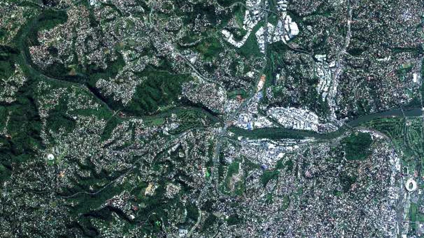
A few of the named fleets actually doing this work, by operator.
- Planet Labs (United States). About 200 SuperDove satellites imaging Earth's entire landmass daily at 3 to 4 m resolution, plus roughly 21 higher-resolution SkySat satellites, the largest commercial Earth-imaging fleet by satellite count.
- Maxar Technologies (United States). A smaller fleet, around 8 satellites including WorldView Legion and WorldView-3, built for very high resolution rather than daily global coverage.
- Airbus (France and Germany). The 4-satellite Pléiades Neo constellation, 30 cm native resolution, with a next-generation follow-on, Pléiades Neo Next, due to begin launching in 2028.
- ICEYE (Finland). Around 18 X-band SAR satellites, imaging through cloud cover and at night, a capability no optical constellation has.
- China Siwei and the XRTech-accessible fleet (China). Dozens of satellites across resolution tiers, from the 0.25 m SuperView Neo series down to wide-swath 16 m GF-series imagers, plus C-band and L-band SAR satellites, the fleet this site's own portal searches and tasks directly.
In short, somewhere around 2% or less of everything currently in orbit is actually pointed at the ground taking pictures. Everything else is routing internet traffic, broadcasting a navigation signal, or doing something else entirely.
How Fast Is the Number of Satellites Growing
The jump from a few thousand active satellites to nearly 17,000 happened almost entirely in the last six years, a growth curve with no real precedent in the history of spaceflight.
For context on how far back this goes, the first satellite of all, Sputnik 1, reached orbit in 1957, and the active population didn't pass 1,000 until around 2010, more than 50 years later. It then took another 9 years to reach 2,200, and only 7 more to reach nearly 16,900. The full backstory of how imaging satellites specifically evolved over that time, from Cold War reconnaissance to today's daily-revisit constellations, is covered in our history of satellite imagery guide.
More satellites in orbit means more imagery options on the ground
With dozens of imaging satellites now searchable in one place, tasking a fresh capture or pulling archive imagery over your exact area of interest takes minutes, not weeks.
How Much Space Debris Is in Orbit
Active satellites are only part of what's actually up there. The European Space Agency's Space Debris User Portal tracks roughly 47,000 catalogued objects in orbit as of July 31, 2026, a figure that includes defunct satellites, spent rocket bodies, and fragments large enough to track individually. ESA's statistical debris model estimates the picture gets far more crowded once you count what's too small to track directly.
Tracked and modeled objects in orbit, ESA, February 2026 reference epoch
Objects individually tracked and catalogued by space-surveillance networks.
Modeled objects larger than 10 cm, including active and defunct satellites.
Modeled debris fragments between 1 and 10 cm, too small to track individually.
Modeled debris fragments between 1 mm and 1 cm, invisible to current sensors.
Even a 1 cm fragment carries enough energy at orbital speed, roughly 7 to 8 km per second, to disable a satellite outright, which is why operators of large constellations are now required to deorbit dead satellites within 5 years of mission end under current FCC rules, and why conjunction-avoidance maneuvers have become a routine, not occasional, part of running a mega-constellation.
How Many Satellites Will There Be by 2030
Every major constellation operator has more satellites in the pipeline than in orbit today. Amazon's Kuiper is licensed for 3,236 satellites against roughly 390 flying now. China's Guowang and Qianfan constellations are planned to reach more than 29,000 satellites combined by the mid-2030s against roughly 375 flying as of mid-2026. Across every filed constellation proposal worldwide, regulatory filings now total more than 1.2 million planned satellites, though historically only a fraction of filed mega-constellation plans are ever fully built. Analysts' working estimates for the actual active population by 2030 range from about 30,000 on the conservative end to over 60,000 on the more aggressive end, still well short of every filing being realized, but roughly double to quadruple today's already record-high count.
Key takeaways
- About 16,900 satellites are active in Earth orbit as of early October 2026, per Jonathan McDowell's General Catalog. Other trackers report figures from roughly 16,600 to 17,900 due to status lag and differing definitions of "active."
- Roughly 95% of active satellites fly in low Earth orbit, up from about 85% a decade ago, with about 3% in geostationary orbit and 1% in medium Earth orbit.
- The United States operates about 76% of all active satellites, almost entirely because of Starlink. China is second with roughly 1,550 active satellites, ahead of Russia, the United Kingdom, and Japan.
- Starlink alone accounts for about two in every three active satellites in orbit. China's state-backed Guowang and Qianfan constellations had a combined 350 to 380 satellites in orbit as of mid-2026, planned to exceed 29,000 by the mid-2030s.
- Only a small fraction of all active satellites, roughly 2% or less, are dedicated Earth-imaging satellites. The rest carry broadband, navigation, or other non-imaging payloads.
- Including debris and defunct hardware, ESA tracks about 47,000 catalogued objects in orbit, with models estimating 68,450-plus fragments larger than 10 cm and well over a million smaller ones.
Frequently asked questions
How many satellites are in space in 2026?
About 16,900 satellites are active in Earth orbit as of early October 2026, based on Jonathan McDowell's General Catalog. Other trackers report figures ranging from roughly 16,600 to 17,900, depending on when the data was last updated and how strictly each source defines an active satellite.
How many active satellites are in orbit right now?
Roughly 16,900, per the most recent General Catalog update from astrophysicist Jonathan McDowell, dated September 30, 2026. CelesTrak's live catalog, which updates continuously from US Space Force tracking data, reported about 16,633 active satellites on October 5, 2026.
Which country has the most satellites?
The United States, with about 12,925 active satellites as of September 2026, roughly 76% of the global total, driven almost entirely by SpaceX's Starlink constellation. China is second with about 1,548 active satellites, ahead of the United Kingdom, Russia, and Japan.
How many Starlink satellites are there?
Starlink had roughly 11,100 active satellites in orbit as of early October 2026, about two-thirds of all active satellites worldwide, making it by far the largest satellite constellation ever deployed.
How many satellites does China have in orbit?
China operated roughly 1,548 active satellites as of September 2026, second only to the United States. That total is growing quickly as China's two state-backed broadband constellations, Guowang and Qianfan, ramp up deployment, with a combined 350 to 380 satellites in orbit as of mid-2026 against a planned total above 29,000 by the mid-2030s.
How many satellites are actually used for Earth imagery?
A small fraction of the total, roughly 2% or less. Most active satellites carry broadband or navigation payloads, not imaging sensors. The largest dedicated Earth-imaging fleets include Planet Labs (around 200 SuperDove plus 21 SkySat satellites), Maxar (about 8), Airbus's Pleiades Neo (4), ICEYE's SAR constellation (around 18), and China's Siwei fleet of optical and SAR satellites.
How much space debris is in orbit?
The European Space Agency tracks about 47,000 catalogued objects in orbit as of July 2026, including defunct satellites, rocket bodies, and large fragments. Statistical models estimate the real population is far larger, over 68,000 objects bigger than 10 cm, about 1.5 million objects between 1 and 10 cm, and roughly 230 million objects between 1 mm and 1 cm that current sensors cannot track individually.
How many satellites will there be by 2030?
Estimates range from about 30,000 to over 60,000 active satellites by 2030, roughly double to quadruple today's count. Regulatory filings for proposed future constellations now total more than 1.2 million satellites worldwide, though only a fraction of filed mega-constellation plans historically get fully built.
Sources and further reading
- Jonathan McDowell, General Catalog of Active Satellites, planet4589.org, accessed September 30 2026
- CelesTrak active satellite catalog, US Space Force tracking data, snapshot via azmth.space, October 5 2026
- gocosmik.com, satellites by country aggregation drawing on UCS Satellite Database methodology, September 2026
- European Space Agency, Space Debris User Portal statistics and Space Environment Report 2025, esa.int
- orbitalradar.com, historical active satellite growth timeline and operator breakdowns
- 5gworldpro.com and CGTN, Guowang and Qianfan constellation deployment progress, 2026
- Federal Communications Commission, post-mission disposal rules for satellites in low Earth orbit
Nearly 17,000 satellites, and only a fraction take pictures
Search our live archive or task new imagery from the satellites actually built to photograph Earth, optical, multispectral, and SAR, with resolutions from 25 cm up.