14 Free Satellite Imagery Sources for Recent, High-Res
On this page
- Try a free satellite imagery search tool right here
- Best free satellite imagery source by need at a glance
- What actually counts as "free" satellite imagery?
- What can satellite imagery actually be used for?
- The most popular free satellite imagery sources
- 01. Copernicus Data Space Ecosystem (Sentinel Hub)
- 02. NASA-ISRO NISAR
- 03. USGS EarthExplorer
- 04. NASA Earthdata Search
- 05. NASA Worldview and GIBS
- 06. Google Earth
- 07. Bing Maps
- 08. Vantor (formerly Maxar) Open Data Program
- 09. ArcGIS World Imagery Wayback
- 10. NOAA Data Access Viewer
- 11. Earth on AWS
- 12. Zoom.Earth
- 13. Soar Atlas (formerly Soar)
- 14. Buy Satellite Images (XRTech Group)
- Which free source has the highest resolution satellite imagery?
- What does "high resolution" actually mean at each scale?
- Which free satellite imagery can you actually download?
- Is free satellite imagery free to use commercially?
- Google Earth compared with Sentinel-2 and Landsat
- Where can you get the latest satellite imagery for free?
- Recent imagery and high-resolution imagery are not the same thing
- Free satellite imagery sources compared by resolution and update frequency
- Tips for making the most of free satellite imagery sources
- Free vs. commercial satellite imagery and when to upgrade
- Frequently asked questions
- Sources and further reading
Try a free satellite imagery search tool right here
This live tool searches Sentinel-2 and Landsat's open archive directly, so you can draw an area, paste coordinates, search a place name, or upload a KML or KMZ file, then preview real, recent scenes before reading through all 14 sources below.
Live tool
LICENSE: Open / Public Domain
Use the toolbar in the map's top-left corner to draw a polygon, rectangle, or circle. Draw as many shapes as needed, they combine into one search.
Or paste a bbox as west, south, east, north below.
Geocoding via OpenStreetMap Nominatim.
The shape's bounding footprint is used as the search extent.
Applies to optical sensors only. SAR (Sentinel-1) is unaffected by clouds.
Nothing scanned yet
Set an area of interest, pick a date range, and run a search to pull real Sentinel-2, Landsat, Sentinel-1, and NAIP scenes from the open archive.
Note
These 14 sources cover most needs, and the live tool above searches two of the biggest open archives, Sentinel-2 and Landsat, directly. If you want a single search across every resolution tier, including sharper commercial archives, or a specific, recent capture over a precise area, check our portal for clearer, more to-the-point results.
Free satellite imagery is more available today than at any point before, but "free" covers a wide range of things, including open government archives, research portals, and free sample tiles from otherwise-paid commercial providers. This guide brings the most widely used free sources together in one place, from the European Space Agency's Sentinel missions to the NASA-ISRO NISAR radar mission that only opened to the public in 2026, so you can find the most up to date satellite imagery, the highest resolution satellite imagery free sources actually offer, and the right platform for the job, without hunting through a dozen separate websites.
Last verified September 2026. Every entry below was checked for availability, resolution, update frequency and access method as of that date, since a couple of these platforms (NISAR and Vantor's Open Data Program in particular) have changed status within the last few months.
Quick answer
The best free satellite imagery comes from government and research programs like Copernicus Data Space Ecosystem (Sentinel-1 radar and Sentinel-2 optical, 10 m), USGS EarthExplorer (Landsat, 40+ years of archive), NASA Worldview (near real-time, updated every few hours), and the newly public NASA-ISRO NISAR radar mission (5-10 m, released in 2026). Google Earth, Bing Maps and ArcGIS Wayback add easy-to-browse visual basemaps with far sharper imagery in places, though resolution and image date vary by location.
Which one is "best" depends on what actually matters for the job. Sentinel-2 wins on a balance of resolution and revisit; NASA Worldview wins on speed; EarthExplorer wins on historical depth; Bing Maps and ArcGIS Wayback win on raw sharpness in well-covered cities; and none of them beats a paid tasked order when the requirement is a specific, recent, sub-meter capture over a precise area.
Best free satellite imagery source by need at a glance
Fastest way to pick, before reading the full list
| If you need... | Best free source | Resolution |
|---|---|---|
| Best all-round optical imagery | Copernicus / Sentinel-2 | 10 m |
| Free radar (SAR) data | NASA-ISRO NISAR | 5-10 m |
| Longest historical archive | USGS EarthExplorer (Landsat) | 15-30 m |
| Near real-time / live events | NASA Worldview | ~30 m-250 m |
| Highest resolution, no cost | Bing Maps Bird's Eye / ArcGIS Wayback | Sub-10 cm-15 cm |
| Free sample of paid high-res imagery | Buy Satellite Images | Native resolution |
What actually counts as "free" satellite imagery?
Free satellite imagery splits into three categories that all get marketed under the same word. Open satellite data is imagery a government or research program releases to anyone, no purchase ever required, and Sentinel, Landsat, and NISAR all fall into this group, updating on a fixed satellite schedule you can't change. Free-to-view basemaps like Google Earth, Bing Maps and ArcGIS Wayback are different again, since much of what they show is a blended mosaic that mixes true satellite passes with aircraft-captured aerial imagery, especially in the sharpest, sub-meter views over major cities, so it's more accurate to call these "satellite and aerial basemaps" than raw satellite data. Free commercial samples are the third category, where a paid provider lets you preview or download a limited amount of its normally paid, higher-resolution imagery, as a way to demonstrate quality before you buy, usually capped by area, resolution, or how many you can request.
One more thing worth clearing up is that, despite how it's often marketed, free satellite imagery is almost never a live video feed of your house. Most free optical imagery is between a few days and a few years old, and the sharpest, most current data is reserved for paid tasking. If you need imagery captured within the last 24 hours, that is a paid, tasked order, not something any free source on this list provides.
What can satellite imagery actually be used for?
Satellite imagery is a way to see and measure the Earth's surface from orbit, repeatedly, over the same location, without sending anyone there in person, and that single capability drives a wide range of real work, which shapes which free source is worth your time. Farmers and agronomists use it to track crop health and irrigation needs across entire fields, city planners and surveyors use it to catch unapproved construction and track how fast a city is growing, and insurers use time-stamped imagery to verify storm and flood damage claims without waiting for roads to reopen. Environmental researchers use it to track deforestation, coastline erosion, and glacier retreat over years or decades, something no ground survey could realistically repeat. Governments and humanitarian groups use it to map disasters as they unfold. Even hobbyists and students use it just to explore how a place has physically changed over time.
Free sources cover a real slice of this work well, land cover, vegetation trends, long-term change, and disaster response in particular. Where free data runs out of runway is anywhere a project needs sub-meter detail on a specific, recent date over a specific, small area; that's the gap paid tasking exists to close, and it's covered further down in this guide.
The most popular free satellite imagery sources
These fourteen sources cover the large majority of what anyone searching for free satellite imagery actually needs, chosen because they're the platforms people actually use and search for, not the longest possible list of niche portals.
01. Copernicus Data Space Ecosystem (Sentinel Hub)
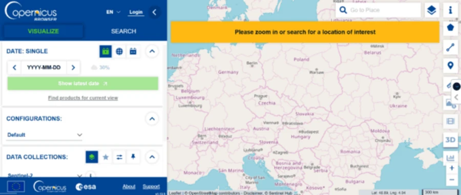
The Copernicus Data Space Ecosystem, accessed through the Copernicus Browser, is the official home for free satellite imagery from every Sentinel mission, including Sentinel-1 C-band radar (SAR) at down to 5 m, revisiting the whole planet roughly every 6 days in any weather; Sentinel-2 optical and multispectral imagery at 10 m, refreshed every 5 days and the standard free source for NDVI and vegetation analysis; Sentinel-3 for land and ocean monitoring; and Sentinel-5P for atmosphere and air quality. It replaced the older Copernicus Open Access Hub in January 2023, and the near-identical Sentinel Hub interface offers the same underlying data. Beyond basic search, the browser includes false-color infrared and NDVI processing, a side-by-side compare tool, a drawing and measuring toolkit, timelapse generation, a 3D viewer, and full-tile downloads, all free and in the browser, with no separate desktop software needed.
Resolution: 5 m (SAR), 10 m (optical) · Revisit: 5-6 days · Cost: Free
02. NASA-ISRO NISAR
NISAR is a joint NASA-ISRO radar satellite mission delivering free satellite radar imagery; its L-band SAR data became publicly available through NASA's Alaska Satellite Facility DAAC in July 2026, covering every landmass on Earth every 12 days at 5 to 10 m resolution, the newest major addition to the free data landscape. Unlike Sentinel-1's C-band radar, NISAR's L-band signal penetrates deeper into vegetation and soil, making it especially valuable for free biomass, soil moisture, and ground-deformation monitoring that previously required a paid SAR subscription.
Resolution: 5-10 m (SAR) · Revisit: 12 days · Cost: Free (public since July 2026)
03. USGS EarthExplorer
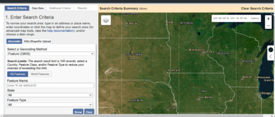
EarthExplorer, run by the US Geological Survey, is the free archive for the Landsat program, over 40 years of continuous 30 m optical imagery (15 m panchromatic), the longest satellite record of Earth's surface that exists. It also carries free data from MODIS, ASTER, and SRTM elevation models, historical commercial imagery like IKONOS and early SPOT scenes, digital elevation data, and even some declassified spy satellite imagery. Browsing is free for anyone, but a free account is required to actually download files. A practical workflow starts with drawing your area of interest (or using the "Use Map" shortcut for whatever's on screen), turning on the Dataset Prefilter so only datasets that actually cover your area show up, then checking Results. If the exact scene you want hasn't been scanned into the online archive yet, EarthExplorer lets you request on-demand scanning for $30 per scene plus a $5 order fee, though delivery typically takes 3 to 4 weeks with no priority option.
Resolution: 15-30 m · Archive: 40+ years (since 1972) · Cost: Free (account required to download)
04. NASA Earthdata Search
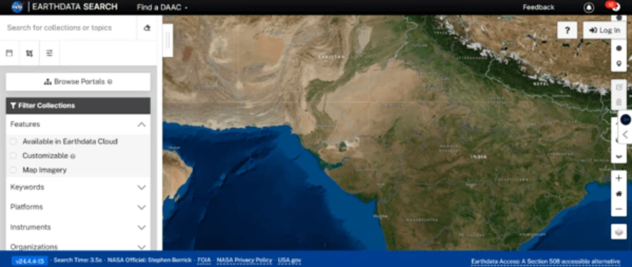
Earthdata Search is the browsing front end for NASA's entire EOSDIS archive, hundreds of free datasets spanning atmosphere, ocean, land cover, ice, and vegetation, collected by dozens of NASA missions beyond Landsat, including Terra, Aqua, ICESat-2, and more. It has no built-in analysis tools and a real learning curve, since finding the right dataset among hundreds of "collections" takes some digging, but for research-grade free satellite imagery and Earth-science data, it has few equals.
Coverage: Hundreds of NASA EOSDIS datasets · Cost: Free
05. NASA Worldview and GIBS
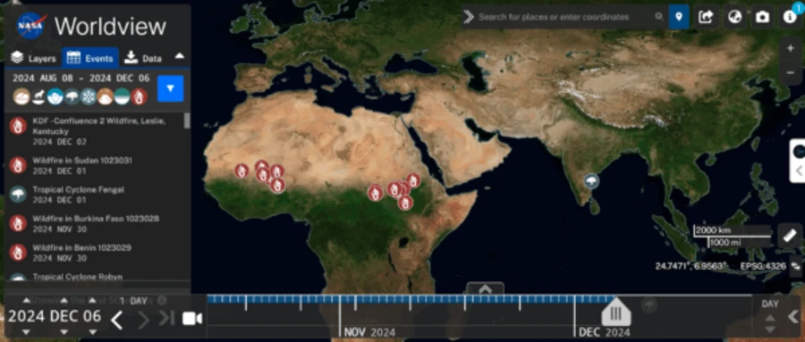
NASA Worldview is the closest free source gets to an updated satellite view of a live event. It displays imagery within about 3 hours of satellite capture, pulled from MODIS, VIIRS, and other NASA sensors, and lets you browse by event, with wildfires, floods, dust storms, and tropical cyclones pre-tagged with markers on the map. The Global Imagery Browse Services (GIBS) behind it offers the same imagery through an API, for developers who want to pull the most up to date satellite imagery programmatically instead of clicking through a browser. For a curated set of the most iconic full-Earth photos these same NASA archives hold, from the first 1959 satellite scan to the newest Artemis II images, see our guide to real Earth images from space.
Resolution: ~30 m-250 m (sensor-dependent) · Update: ~3 hours · Cost: Free
06. Google Earth
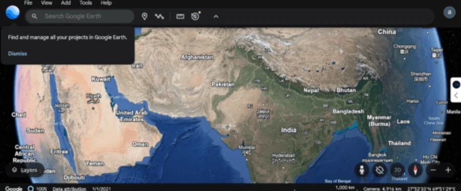
Google Earth remains the most familiar free satellite imagery source, with a simple, no-account-needed interface covering the entire globe on web, desktop, and mobile. Spatial resolution varies sharply by location, since most of the world sits well below 1 m, while major cities and infrastructure sites across the US, Western Europe, and East Asia reach as sharp as 15 cm, though that detail comes from aircraft, not satellites. Coverage is a patchwork of ages, some areas refresh every few years, others are older, and Google Earth Engine, a separate free platform for researchers, adds the analysis tools the consumer app lacks.
Resolution: Down to 15 cm (select cities, aerial) · Update: Rolling, varies by area · Cost: Free
07. Bing Maps
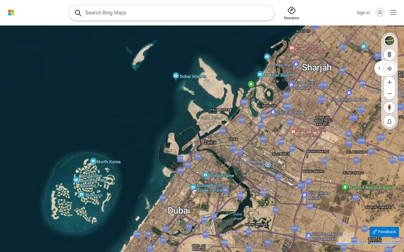
Bing Maps is Microsoft's free, no-account-needed satellite and aerial imagery map, covering the entire globe. Standard aerial imagery reaches 30 cm across most of the US and Western Europe and down to 15 cm in dense urban areas, and Bird's Eye View adds angled, near-oblique imagery at sub-10 cm detail across several hundred cities, a genuinely different way to inspect a building or block than the straight-down view every other source on this list uses. There's no fixed refresh schedule, Microsoft rolls out new aerial and Bird's Eye coverage in ongoing waves rather than on a set cycle, and it's worth knowing Microsoft is only retiring the separate, paid Bing Maps for Enterprise developer platform (folding it into Azure Maps by 2028); the free public site isn't going anywhere.
Resolution: 30 cm (aerial), sub-10 cm (Bird's Eye) · Update: Rolling, no fixed cycle · Cost: Free
08. Vantor (formerly Maxar) Open Data Program
Vantor's Open Data Program (built and still widely known under the earlier Maxar brand) releases free, high-resolution pre- and post-disaster satellite imagery for major hurricanes, earthquakes, floods, and wildfires, sharp enough to assess individual structures, licensed under a non-commercial Creative Commons license (CC BY-NC 4.0) for rapid humanitarian use. Coverage is limited to declared disaster events rather than the whole planet, but for those events it is some of the best free high resolution imagery available anywhere. It pairs naturally with the radar-based disaster mapping described in our guide to SAR satellite imagery for disaster response.
Resolution: Sub-meter · Coverage: Declared disasters only · Cost: Free (CC BY-NC 4.0)
09. ArcGIS World Imagery Wayback
Wayback is Esri's free digital archive of every version of the World Imagery basemap going back to February 2014, over 150 versions in total, letting you scrub through time to see how a location has changed. Current World Imagery resolution reaches 1 m or better across most of the world's landmass, and Vantor's newer Vivid Mosaic layer pushes the global basemap to 30 cm, with pockets down to 15 cm in the most actively updated regions, making it one of the sharpest free satellite imagery maps available for browsing. Two features make it more than a static archive, namely Swipe Mode, which lets you drag a slider to compare two dates of imagery over the same spot side by side, and Animate mode, which turns a location's full history into a timelapse you can export and download as a GIF to share anywhere.
Resolution: Down to 15-30 cm · Archive: 150+ versions since 2014 · Cost: Free
10. NOAA Data Access Viewer
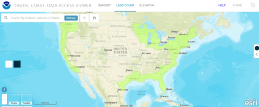
NOAA's Data Access Viewer is the agency's main free archive for high-resolution imagery, land cover, and lidar/elevation data across the coastal United States, Alaska, Hawaii, and the territories, backed by a broader environmental satellite library (NOAA CLASS) covering weather and climate data nationwide. Neither offers real-time imagery on its own, but NOAA's geostationary GOES satellites separately refresh a free, low-resolution (roughly 250 m to 2 km) satellite imagery view of the full Western Hemisphere about every 15 minutes, the fastest update cycle of any free source on this list, just traded off against very coarse detail.
Coverage: US coastal states, Alaska, Hawaii, territories · Update: ~15 min (GOES) · Cost: Free
11. Earth on AWS
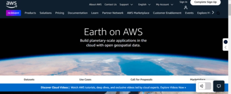
Earth on AWS is Amazon's free, cloud-native way to access most major open satellite imagery datasets, including Sentinel-2, Landsat-8, and NAIP, hosted directly on Amazon Web Services. It isn't browsable the way Google Earth is; it's built for people who already know which dataset they need and want to process it at scale, in the cloud, without downloading terabytes to a local machine first. AWS also offers free cloud credits to students and researchers to help cover that processing.
Coverage: Sentinel-2, Landsat-8, NAIP, more · Cost: Free (compute charged separately)
12. Zoom.Earth
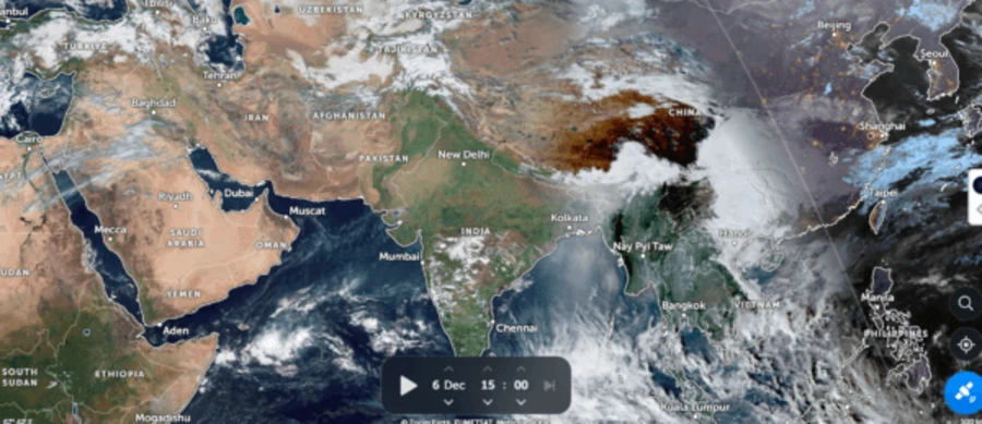
Zoom.Earth is a fast, zoomable global map that pulls new satellite imagery every 10 minutes from NOAA GOES and JMA Himawari, and every 15 minutes from EUMETSAT Meteosat, with a typical 20 to 40 minute lag between capture and availability, making it one of the more genuinely current free satellite view tools available, alongside historical high-resolution basemap tiles from Bing and Esri that update every few months when you zoom in closer. It layers in storm tracks and forecast data automatically, which makes it a popular free option for watching a hurricane or typhoon develop in near real time.
Resolution: 250 m-2 km · Update: Every 10 min (~20-40 min lag) · Cost: Free
13. Soar Atlas (formerly Soar)
Soar Atlas, rebranded from Soar in 2026, is a community map-sharing platform, closer to a social network for maps than a traditional archive, hosting over a million user-uploaded maps and free satellite imagery alongside a built-in viewer for Sentinel-2 and Landsat 8/9 imagery. It works well on mobile, needs only a free account, and now includes a 3D mode that turns georeferenced maps and imagery into explorable landscapes directly in the browser. It also markets itself as a free resource for journalists covering breaking news and investigations, on top of the original hobbyist and GIS-community use case.
Coverage: Sentinel-2 + Landsat 8/9 viewer · Cost: Free account
14. Buy Satellite Images (XRTech Group)
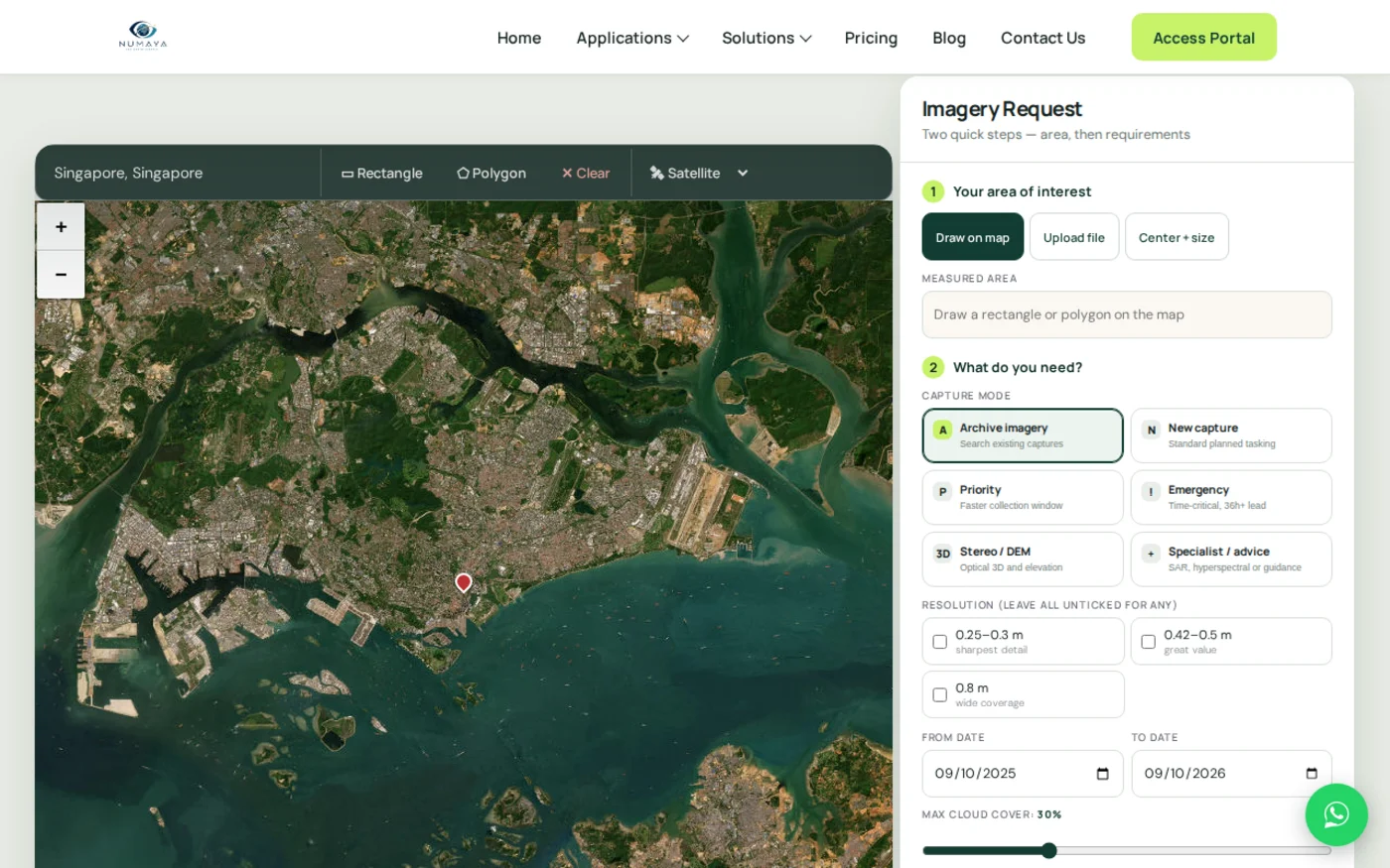
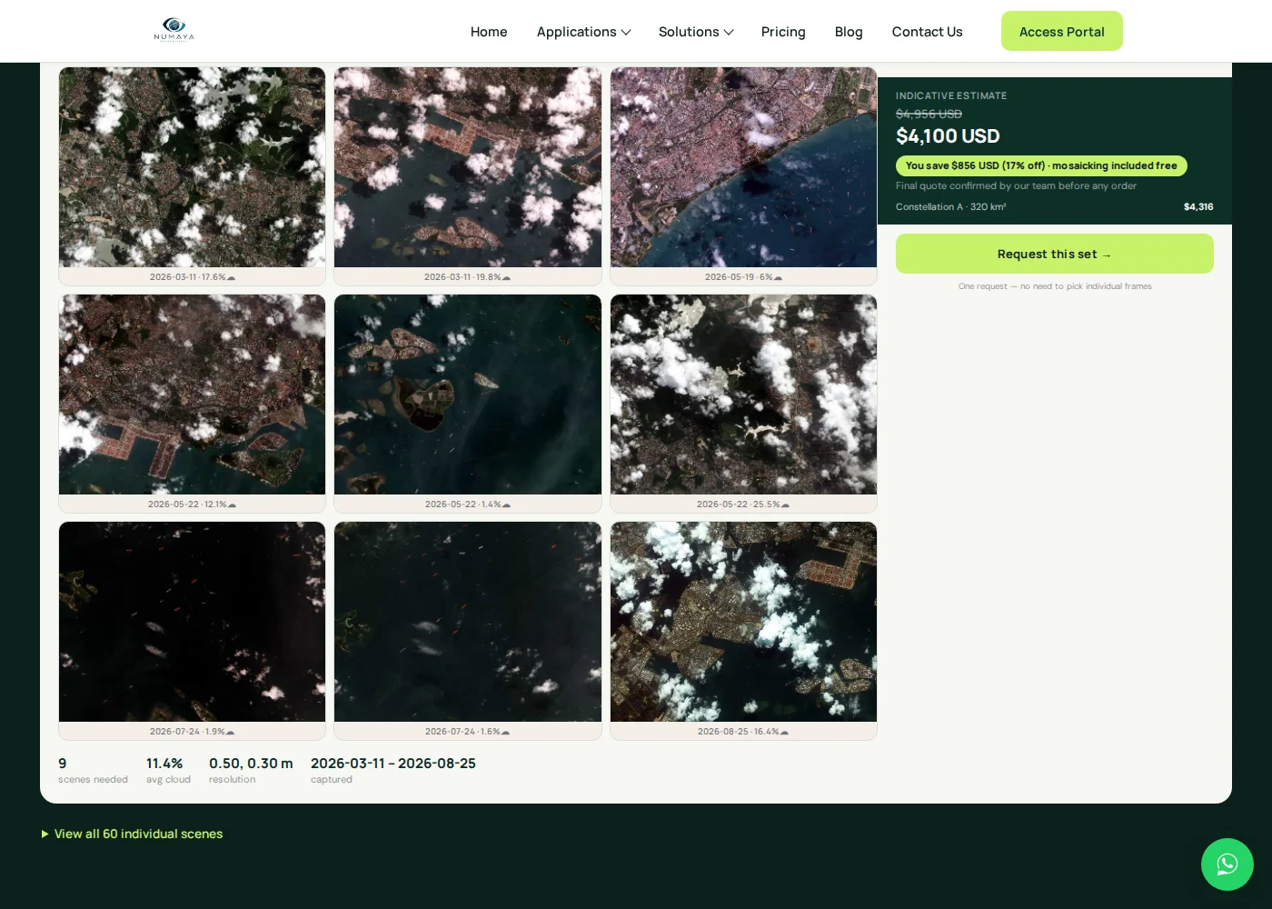
Buy Satellite Images offers two genuinely free tools built directly into its commercial satellite imagery portal. Search any area and free archive search returns thumbnail previews spanning every resolution tier the portal carries, from open Sentinel-2 (10 m) and Landsat (30 m) data up through the sharper commercial 21AT and SuperView constellation archives, so you can see what's actually available over your area before committing to anything. And every new tasking order comes with a free sample tile at the requested resolution, so you see real image quality over your actual area before you pay for the full capture. It's the same free-preview model other commercial providers use to let buyers evaluate quality before purchase, just built directly into the ordering flow instead of a separate step. We're a commercial provider, so it's fair to say plainly that most of what we sell isn't free, these two tools are the exception.
Free tier: Archive thumbnails across all resolutions (Sentinel-2, Landsat, 21AT, SuperView) · Plus: free sample tile per tasking order
One update worth flagging on the Google Earth entry above is that Google announced in July 2026 the Google Earth Pro desktop app is being discontinued, downloads and updates stop on June 25, 2027, though copies already installed keep working after that date. The free Google Earth on web and mobile, listed as source #6, is unaffected and remains Google's ongoing free option.
Search free archive imagery, or preview a paid tile first
Search Sentinel-2 and Landsat archive imagery on our portal at no cost, or request new tasking and get a free sample tile at your target resolution before you order the full capture.
Which free source has the highest resolution satellite imagery?
True open data, the kind released on a fixed schedule with no strings attached, tops out at 10 m with Sentinel-2 and 5-10 m with the newly public NISAR radar data. Anything sharper than that comes from one of three exceptions, starting with a historical basemap archive like ArcGIS World Imagery Wayback, now reaching 30 cm globally and 15 cm in actively updated regions; a regional exception like Google Earth's 15 cm aerial coverage of major cities or Bing Maps' Bird's Eye imagery, which goes sub-10 cm across several hundred cities from an angled viewpoint; or a free sample or preview of otherwise-paid commercial imagery, like the native-resolution sample tile Buy Satellite Images includes with every new tasking order. If a project genuinely needs sub-meter detail everywhere, not just in a handful of well-covered cities, a free sample tile or a paid commercial order is the realistic path, not an open archive.
What does "high resolution" actually mean at each scale?
Resolution numbers only matter once you know what they translate to on the ground. A pixel's ground sample distance sets the smallest feature a scene can realistically show, and it climbs fast between the free tiers below.
| Resolution | What you can generally make out | Where it shows up free |
|---|---|---|
| 30 m | Broad land cover and terrain shape | Landsat |
| 10 m | Fields, roads, large buildings | Sentinel-2, NISAR |
| 1 m | Individual buildings, vehicles | ArcGIS World Imagery (most of the world) |
| 30-50 cm | Building outlines, larger vehicles, trees | Bing Maps aerial, ArcGIS Wayback (updated regions) |
| 15 cm or sharper | Individual vehicles, rooftop detail | Google Earth and Bing Bird's Eye (select cities) |
Resolution alone doesn't decide whether an image is actually useful for a given task, though. Acquisition date, cloud cover, viewing angle and whether the scene lines up with the exact area of interest all matter just as much as the raw pixel size.
Which free satellite imagery can you actually download?
Viewing a map in a browser and downloading the underlying imagery are two different things, and free sources vary a lot on the second one.
| Source | Browse in app | Download raw imagery | Account needed |
|---|---|---|---|
| Copernicus / Sentinel Hub | Yes | Yes, full scenes and bands | Usually, for download |
| USGS EarthExplorer | Yes | Yes, full scenes | Yes |
| NASA-ISRO NISAR (via ASF) | Yes | Yes | Yes |
| NASA Worldview / GIBS | Yes | Depends on the dataset | Not for browsing |
| Earth on AWS | No dedicated viewer | Yes, cloud-native access | AWS account |
| Google Earth | Yes | Limited, no raw archive export | No |
| Bing Maps | Yes | Limited | No |
| ArcGIS World Imagery Wayback | Yes | Depends on licensing/service used | No, for browsing |
| Vantor Open Data Program | Yes | Yes, for declared disaster events | No |
| Buy Satellite Images | Yes | Thumbnails free; full tiles with order | No, for browsing |
As a rule, the government and research portals built around raw data, Copernicus, EarthExplorer, NISAR's Alaska Satellite Facility archive, and Earth on AWS, all support genuine downloads. The consumer basemaps, Google Earth, Bing Maps, and ArcGIS Wayback, are built for browsing and comparison first, with export options that are limited or absent.
Is free satellite imagery free to use commercially?
Free to view is not the same as free to download, and free to download is not automatically free to use commercially or redistribute, so it's worth checking the license attached to a specific dataset before a project depends on it. Open-data programs like Sentinel and Landsat are released under open, largely unrestricted licenses that permit commercial use with attribution. Vantor's Open Data Program is the opposite case worth flagging, its post-disaster imagery is released under a Creative Commons CC BY-NC 4.0 license, meaning non-commercial use only, so it isn't a legal source for a paid product or a client deliverable even though the imagery itself is free. Google Earth and Bing Maps imagery falls under each platform's own terms of service, which generally restrict bulk downloading, scraping and redistribution even though casual viewing and screenshotting for reference are fine. When a project's output will be sold, published commercially or delivered to a paying client, checking the exact license attached to that specific image, not just the word "free," is the step that avoids a problem later.
Google Earth compared with Sentinel-2 and Landsat
These three come up constantly as alternatives to each other, but they're built for different jobs.
| Feature | Google Earth | Sentinel-2 | Landsat |
|---|---|---|---|
| Ease of use | Excellent, no account | Moderate, browser-based | Moderate, account required |
| Resolution | Varies, down to 15 cm in select cities | 10 m | 15-30 m |
| Historical depth | Location-dependent, patchy | Since 2015 | Since 1972 |
| Raw data download | Limited | Yes | Yes |
| Built-in analysis tools | Limited (Earth Engine separately) | NDVI, compare, timelapse | Requires external GIS software |
| Guaranteed latest image | No | No, 5-day revisit at best | No, 8-16 day revisit |
Google Earth wins on accessibility and visual browsing. Sentinel-2 wins when a project needs recent, analysis-ready, downloadable data at a useful resolution. Landsat wins when the question is how a place has changed over decades rather than what it looks like right now.
Where can you get the latest satellite imagery for free?
There is no single free source that is always the newest everywhere; the most recent free imagery depends on the satellite, sensor, location and update cycle you're pulling from. NOAA's GOES satellites and the Zoom.Earth viewer built on them refresh roughly every 10 minutes (with a further 20 to 40 minute lag before it's available to view), the fastest free cycle available, but at coarse, weather-satellite resolution (250 m to 2 km). NASA Worldview and GIBS sit in the middle, near real-time within about 3 hours, at resolutions from 250 m down to about 30 m depending on the sensor. Sentinel-1 and Sentinel-2 revisit every 5 to 6 days at 5-10 m, and NISAR covers the planet every 12 days at 5-10 m radar resolution. Google Earth and Bing Maps sit outside this pattern entirely, their basemap imagery is updated on a rolling, location-dependent schedule rather than a fixed orbital revisit, so a given spot might be a few months old or several years old with no way to know in advance without checking the platform's own date stamp. Disaster-triggered sources like the Vantor Open Data Program or a paid tasking order also sit outside the pattern, since they're captured on demand around a specific event or request. The full source-by-source breakdown further down this guide lines up resolution against update frequency for all 14 platforms side by side.
Recent imagery and high-resolution imagery are not the same thing
It's tempting to assume the newest free satellite imagery is also the sharpest, but the two trade off against each other more often than not. NOAA GOES updates about every 10 minutes but only resolves down to roughly 250 m to 2 km, useless for spotting anything smaller than a weather system. NASA Worldview is genuinely recent, within hours for many datasets, but most of its sensors max out between 30 m and 250 m. Sentinel-2 is the practical middle ground, 10 m resolution with a five-day revisit. Landsat trades recency for depth, 15 to 30 m resolution but an archive stretching back to 1972. And the sharpest free imagery on this list, Google Earth's and Bing Maps' sub-meter city coverage or ArcGIS Wayback's basemap tiles, isn't captured on any predictable schedule at all, so a razor-sharp image might sit next to one that's several years old with no way to tell without checking. Picking a free source starts with deciding which of the two, freshness or sharpness, actually matters more for the task at hand, because very few free sources offer both at once.
Free satellite imagery sources compared by resolution and update frequency
All 14 sources, side by side
| Source | Data type | Best resolution | Update frequency |
|---|---|---|---|
| Copernicus / Sentinel Hub | Optical + SAR | 5-10 m | Every 5-6 days |
| NASA-ISRO NISAR | SAR (radar) | 5-10 m | Every 12 days |
| USGS EarthExplorer (Landsat) | Optical | 15-30 m | Every 8-16 days |
| NASA Earthdata Search | Optical, SAR, atmosphere (multi-mission) | Varies by dataset | Varies by dataset |
| NASA Worldview / GIBS | Optical (multi-sensor) | ~30 m-250 m | ~Every 3 hours |
| Google Earth | Optical + aerial | Down to 15 cm (select cities) | Every few years, varies by area |
| Bing Maps | Optical + aerial (Bird's Eye) | Sub-10 cm (Bird's Eye, select cities) | Ongoing rolling updates, no fixed cycle |
| Vantor Open Data Program | Optical (sub-meter) | Sub-meter | Event-based, declared disasters only |
| ArcGIS World Imagery Wayback | Optical basemap | Down to 15-30 cm | Periodic (150+ archived versions since 2014) |
| NOAA Data Access Viewer / GOES | Optical (weather + coastal) | 250 m-2 km (GOES); higher-res coastal lidar | ~Every 15 minutes (GOES) |
| Earth on AWS | Optical + SAR (hosted datasets) | Matches hosted dataset (Sentinel-2, Landsat, NAIP) | Matches hosted dataset |
| Zoom.Earth | Optical (weather) | 250 m-2 km | Every 10 minutes |
| Soar Atlas | Optical (Sentinel-2 / Landsat viewer) | 10-30 m | Every 5-16 days |
| Buy Satellite Images | Optical + SAR (free tier) | Archive thumbnails at every resolution; native resolution on free sample tiles | Varies by source; on-demand for samples |
Tips for making the most of free satellite imagery sources
A few habits separate a quick, useful search from an afternoon lost in the wrong interface:
- Match the source to the need. A regional land-cover question suits Sentinel-2 or Landsat; a specific past disaster suits the Vantor Open Data Program; a live-developing storm suits Zoom.Earth or NASA Worldview.
- Check the resolution and license before you build a project around it. Free platforms often cap resolution, historical depth, or commercial usage rights, worth confirming before real work depends on the data.
- Narrow the search first. Set the area of interest, date range, and cloud-cover filter before browsing results; it turns a slow scroll through hundreds of tiles into a short list.
- Use built-in analysis tools where they exist. The Copernicus Browser's NDVI and compare tools, or Google Earth Engine, save real time over exporting raw imagery into separate GIS software for a simple index or comparison.
- Download selectively. Pull the specific tiles or bands needed rather than an entire dataset; most free sources charge nothing for the data but still meter your own storage and time.
- Credit the source. Most free platforms ask for attribution when their imagery is reused publicly; it costs nothing and keeps free data programs sustainable for everyone.
Free vs. commercial satellite imagery and when to upgrade
Free sources answer most broad, regional, or historical questions well, land-cover change, vegetation trends, they're built for exactly this. Commercial imagery earns its cost when a project needs three things free data can't reliably deliver at once, namely sub-meter detail everywhere (not just in a handful of well-covered cities), a specific, recent capture date rather than whatever the archive happens to have, or same-week tasking over a precise area. Our guide to choosing the right satellite image resolution walks through how to match resolution to a specific task once free data stops being enough, so the upgrade, when it happens, is spent on the resolution actually needed rather than the highest number available.
Key takeaways
- "Free" satellite imagery splits into three types, namely open data (Sentinel, Landsat, NISAR, no purchase ever required), free-to-view basemaps (Google Earth, Bing Maps, ArcGIS Wayback, often blending satellite and aerial imagery), and free commercial samples (a limited, free preview of otherwise-paid imagery).
- NASA-ISRO's NISAR radar mission became publicly available in July 2026, offering free 5-10 m SAR data over every landmass every 12 days, the newest major addition to the free data landscape.
- True open-data resolution tops out around 10 m (Sentinel-2); sharper free imagery, down to sub-10 cm, comes from historical basemap archives like ArcGIS Wayback, Bing Maps' Bird's Eye imagery, or free commercial sample tiles, not raw open archives.
- Recency and resolution trade off directly: NOAA GOES and Zoom.Earth refresh every 10 minutes at coarse resolution, while Sentinel and NISAR revisit every 5-12 days at much finer detail, so few free sources deliver both at once.
- Free to view isn't the same as free to use commercially; Vantor's disaster imagery, for example, is released under a non-commercial CC BY-NC 4.0 license, so checking the license on a specific dataset matters before it goes into a paid deliverable.
- Buy Satellite Images offers free archive thumbnail search across every resolution tier on its own portal, from Sentinel-2 and Landsat up through 21AT and SuperView, plus a free sample tile at native resolution with every new tasking order.
Frequently asked questions
What is the highest resolution satellite imagery available for free?
True open data tops out around 10 m with Sentinel-2 and 5-10 m with the newly public NISAR radar mission. Sharper free imagery exists but comes from exceptions, such as ArcGIS World Imagery Wayback reaching 15-30 cm in actively updated regions, Google Earth reaching 15 cm in select major cities via aerial imagery, Bing Maps' Bird's Eye imagery reaching sub-10 cm across several hundred cities from an angled viewpoint, and free sample tiles from commercial providers, including Buy Satellite Images, reaching native commercial resolution for a limited preview area.
Which free satellite imagery source updates most often?
NOAA's GOES satellites and the Zoom.Earth viewer built on them refresh roughly every 10 minutes (with a further 20 to 40 minute lag before it's available to view), the fastest free update cycle available, though at coarse, weather-satellite resolution of 250 m to 2 km. NASA Worldview offers a sharper near real-time view, updated within about 3 hours, and Sentinel-1 and Sentinel-2 revisit every 5 to 6 days at much finer 5-10 m resolution.
Can I get today's satellite image for free?
Sometimes, but usually not at high resolution. Free weather satellites like NOAA GOES can provide imagery from within the last few hours, and NASA Worldview can offer relatively recent global imagery within about 3 hours for many datasets. Higher-resolution free sources like Sentinel-2 have a longer revisit cycle, typically 5 to 6 days, so a same-day image at 10 m detail isn't guaranteed for a given spot, and the newest sub-meter commercial imagery generally isn't available as free open data at all.
Can I get a free recent satellite image of my house or property?
You can view most properties using free basemaps like Google Earth, Bing Maps or ArcGIS World Imagery Wayback, but the image date and resolution both vary by location and aren't something you can choose. If a specific, newly captured, high-resolution image of a particular property is needed, free public archives generally can't guarantee that, and a paid tasked order or a free sample tile from a commercial provider is the more reliable route.
Is Google Earth satellite imagery real-time?
No. Google Earth imagery is not real-time; most of it is anywhere from a few months to several years old, and coverage age varies significantly by location. Major cities and infrastructure sites are refreshed more often and at higher resolution, up to 15 cm in some areas, while less-visited regions may show imagery that is considerably older.
What is the difference between Google Earth and Bing Maps?
Both are free, need no account, and cover the entire globe. Google Earth's sharpest imagery reaches about 15 cm in major cities and includes a 3D globe view and Google Earth Engine for researchers. Bing Maps matches that with 15 cm aerial imagery in dense urban areas and adds Bird's Eye View, angled imagery at sub-10 cm detail across several hundred cities, a genuinely different perspective than the straight-down view most sources use.
Can I get free high resolution satellite images?
Yes, but usually through a free sample or preview rather than an open archive. Providers like Buy Satellite Images offer free sample tiles at native commercial resolution, letting you evaluate real image quality before committing to a paid order. Open archives like Sentinel-2 top out at 10 m.
What is the difference between Sentinel-2 and Landsat?
Sentinel-2, from the European Space Agency, offers 10 m resolution with a 5-day revisit, while Landsat, from NASA/USGS, offers 30 m resolution (15 m panchromatic) with an 8 to 16-day revisit but over 40 years of historical archive, far longer than Sentinel-2's data, which only began in 2015. Sentinel-2 suits recent, detailed monitoring; Landsat suits long-term historical change analysis.
Is there a free source for radar (SAR) satellite imagery?
Yes. Sentinel-1, available through the Copernicus Data Space Ecosystem, offers free C-band radar data down to 5 m resolution. NASA-ISRO's NISAR mission, made public in July 2026, adds free L-band radar at 5-10 m resolution, covering every landmass every 12 days, an even deeper-penetrating option for vegetation and soil monitoring.
Does Buy Satellite Images offer free satellite imagery?
Yes. Free archive search is built directly into the Buy Satellite Images portal, returning thumbnail previews across every resolution tier for a searched area, from Sentinel-2 (10 m) and Landsat (30 m) up through the sharper 21AT and SuperView constellation archives, at no cost. Every new tasking order also includes a free sample tile at the requested resolution over the actual area of interest, so image quality can be checked before paying for the full capture.
What is the best satellite imagery map for beginners?
Google Earth and Zoom.Earth are the easiest starting points, both are browsable with no account and no GIS knowledge required. For anyone who wants free analysis tools like NDVI alongside the imagery, the Copernicus Browser is a strong next step, and Soar Atlas is a good mobile-friendly option for casually comparing recent Sentinel-2 and Landsat captures.
Sources and further reading
- NASA Earthdata: NISAR L-band data release and mission overview, 2026
- ESA Copernicus: Data Space Ecosystem and Sentinel mission specifications
- USGS: EarthExplorer and Landsat program archive documentation
- Esri: ArcGIS World Imagery Wayback release notes and resolution specifications, 2026
- NOAA: Digital Coast Data Access Viewer and GOES satellite documentation
From free archive search to high-resolution tasking
Start with free Sentinel-2 and Landsat archive search, then request a free sample tile the moment a project needs sharper, more current detail than open data can offer.