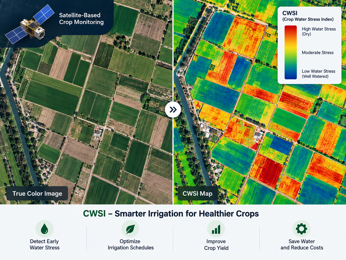
A Complete Guide to Buying and Tasking Satellite Imagery
On this page
- How to order satellite images in four steps
- 01. Mark your area of interest
- 02. Tell it what you need
- 03. Click "Search available imagery"
- 04. Review your price and place the order
- How to choose satellite image resolution
- How to choose the right sensor type and band for your order
- Optical panchromatic and multispectral imagery
- Hyperspectral imagery
- SAR, radar imagery that works through cloud
- Spectral bands, what each one actually shows
- Mono, stereo, and tri-stereo imagery, plus DEM, DSM, DTM, and DOM products
- SAR and InSAR, ordering all-weather monitoring
- Archive imagery vs new tasking, and when to order emergency capture
- Archive or new tasking, which should you actually buy?
- Satellite image pricing, what an order actually costs
- Which satellites and sensors you can order
- Real satellite imagery samples from 30 cm to 2 m resolution
- What processing and AI analytics come with your order
- 01. Building footprint and 3D model extraction
- 02. Semantic segmentation and change detection
- 03. Agriculture Watch crop classification
- Ordering mineral exploration and prospectivity data
- Licensing, what you can actually do with imagery you order
- Who orders satellite images and why
- Businesses
- Government and public agencies
- NGOs and research organizations
- First responders and disaster response teams
- Insurance carriers and individuals
- Mistakes to avoid when ordering satellite images for the first time
- Frequently asked questions
- Sources and further reading
A practical guide to how to order satellite images, covering how to mark your area of interest, how to purchase satellite imagery at the right resolution and sensor band, how to order high resolution satellite imagery step by step, how per-square-kilometer pricing works, and how archive, tasking, and emergency capture compare for a first-time buyer.
Quick answer
To order satellite images, mark your area of interest on a map or upload a boundary file, choose a resolution and sensor type such as optical, multispectral, or SAR, pick archive imagery or new tasking, then search to see real sample scenes and a live price before you buy. Most platforms, including ours, calculate the price per square kilometer as you build the order, so the total cost is never a surprise. Delivery arrives as analysis-ready files through a secure cloud link, or on a physical drive for very large areas.
How to order satellite images in four steps
Ordering satellite imagery, or tasking a brand new capture, is not much different from ordering anything else online once you know what a platform needs from you, where, what, how fast, and how much. Our own satellite imagery portal walks buyers through exactly these four steps, searches real constellation archives live, and shows the price updating on screen as you go.
01. Mark your area of interest
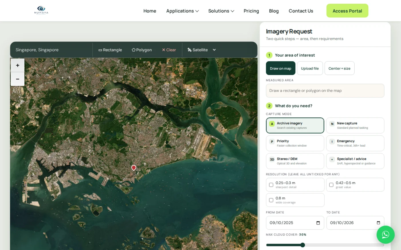
Draw a rectangle or polygon straight on the map, upload a boundary file in KML, KMZ, or shapefile format, or type in a center point plus a size. The portal measures the area in square kilometers automatically, which is the unit every price on this page is built around.
02. Tell it what you need
Pick a capture mode, archive imagery, new capture, priority, emergency, stereo or DEM, or specialist advice for SAR and hyperspectral requests. Tick a resolution band, or leave every box unticked to see all options. Set a from and to date, and drag the cloud cover slider to the maximum you can accept.
03. Click "Search available imagery"
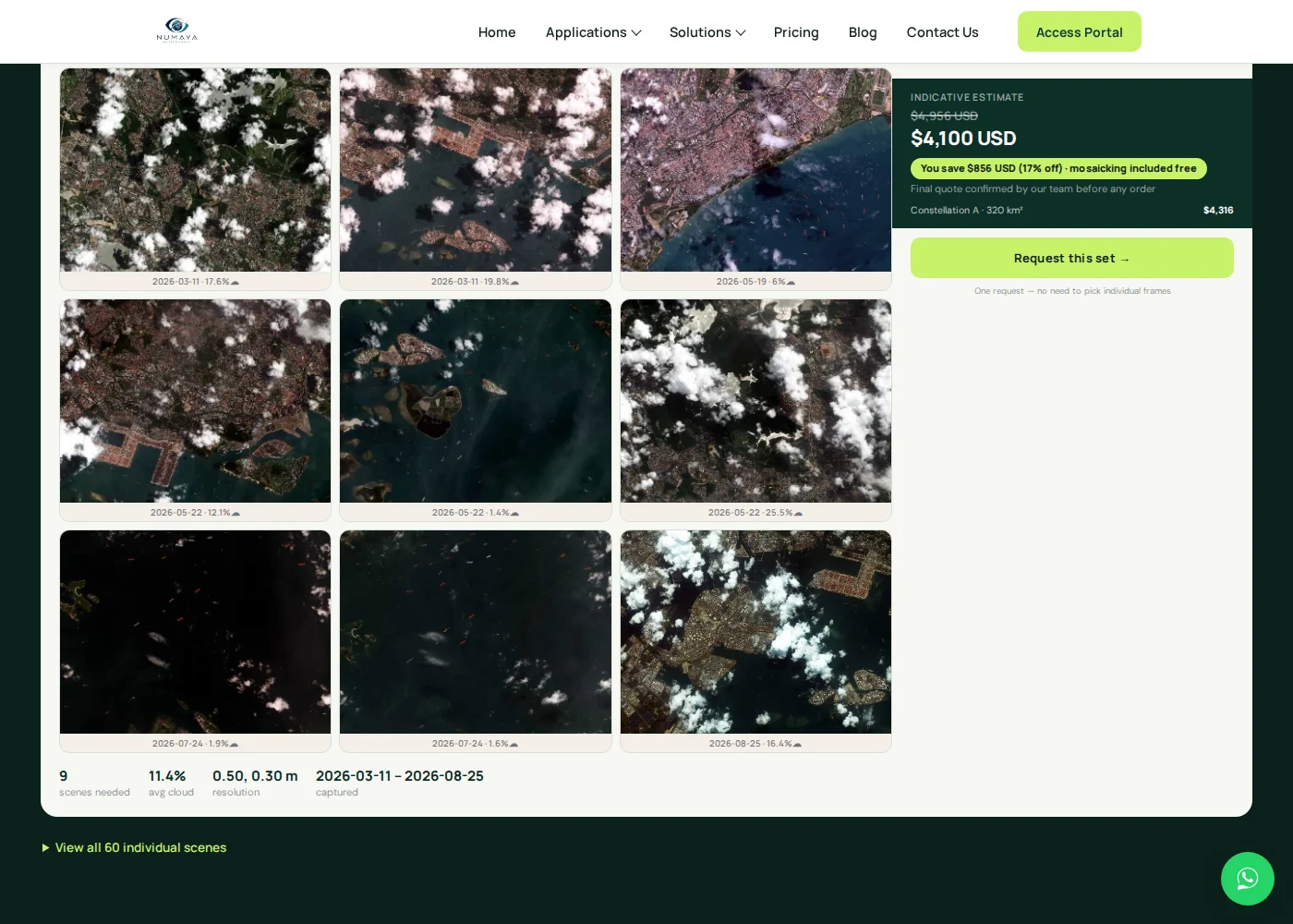
This button is what actually goes and checks the archives. Our system queries both constellation partners for your exact area and time window, then comes back within seconds with the smallest set of real scenes that covers your area of interest, each one shown as a genuine low-resolution preview thumbnail with its capture date and cloud cover percentage. Nothing here is a stock image or a mockup, every thumbnail is a real archive scene over your actual coordinates.
04. Review your price and place the order
Every result comes with a recommended scene bundle, a total area, an average cloud cover figure, and an instant price, so nothing about the cost is a surprise before you buy satellite imagery. Confirm the order and your files arrive as an analysis-ready download through a secure cloud link, or on a physical hard drive for very large area orders. On the tasking side, a typical new capture request gets an initial response within about 1.5 hours, and a fast-turnaround priority order can land in your cloud delivery link in about an hour once it's captured. Behind the scenes, that speed comes from a processing pipeline built to handle roughly 50 terabytes of new imagery a day across more than 60 petabytes of active storage, with new tasking commands normally uplinked to the satellite constellation within about 3 hours of your order.
How to choose satellite image resolution
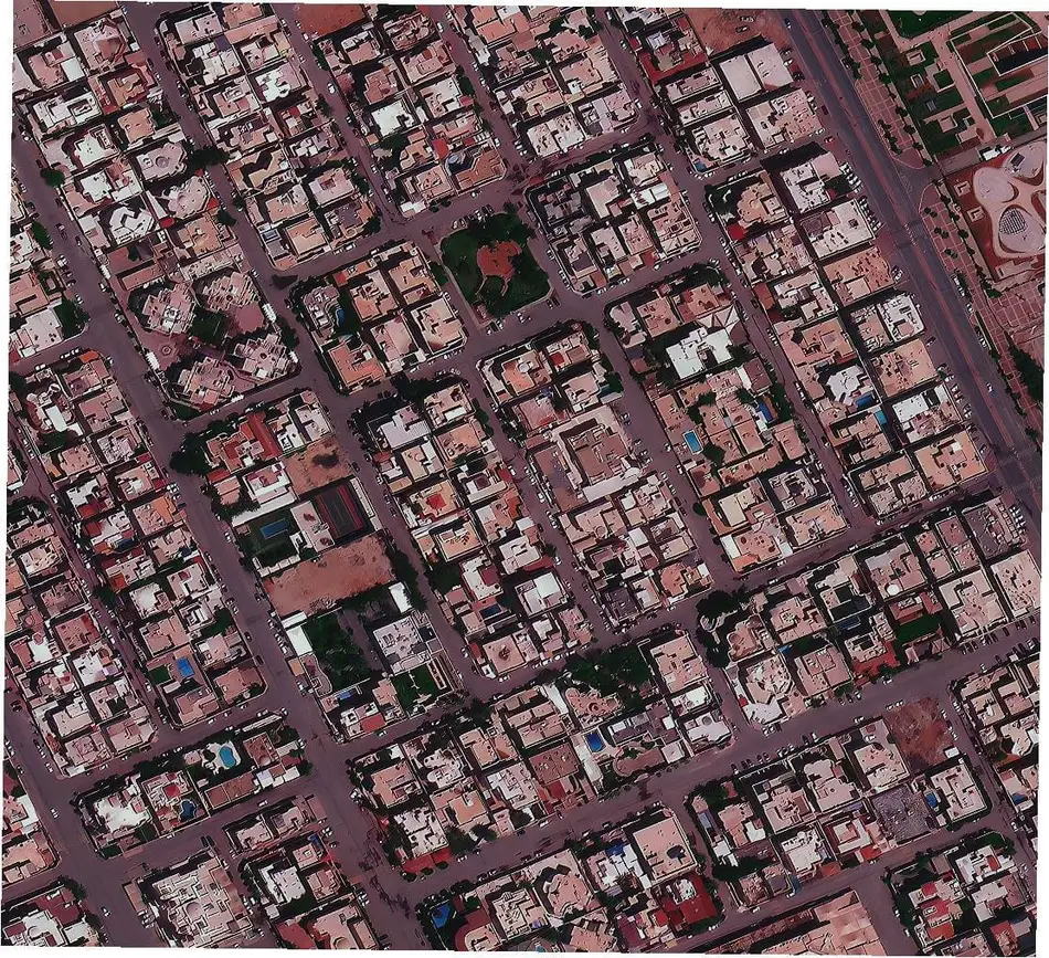
Resolution is the size of ground one pixel covers, and it is the single biggest driver of price on any order. Buy finer resolution than the job needs and you overpay for detail nobody will use, buy coarser resolution and you can't answer the question you started with. Here's what each resolution band actually shows, so you can match the number to the job instead of guessing.
- 25 to 30 cm (super high / ultra-high resolution): individual vehicles, shipping containers, aircraft, road markings, and port or airport activity. The right tier for GEOINT, security monitoring, and precise construction or infrastructure inspection.
- 31 to 50 cm (very high resolution): single buildings, rooftops, driveways, and pools. Used for property condition audits, urban planning, 3D city model input, and detailed site progress tracking.
- 51 to 80 cm (high resolution): full site layouts and building footprints, though individual vehicles start to blur. A good fit for cadastral and topographic mapping, pipeline corridors, and general infrastructure planning.
- 1 to 2 m (moderate resolution): a whole farm field, mine pit, or coastline in one frame. Buildings and vehicles are no longer visible, but field boundaries and site shapes are, well suited to single-site monitoring on a budget.
- 2 to 10 m (wide-swath / regional resolution): regional agriculture, land-cover classification, and national park or watershed monitoring across hundreds of square kilometers in one pass. Free 10 m Sentinel-2 data covers a lot of this tier at no cost.
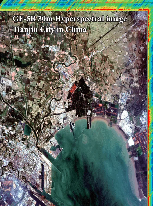
- 20 to 30 m (hyperspectral / specialist resolution): not sharper, but chemically detailed, this tier trades pixel size for hundreds of spectral bands, used for mineral, soil, and material identification rather than visual detail.
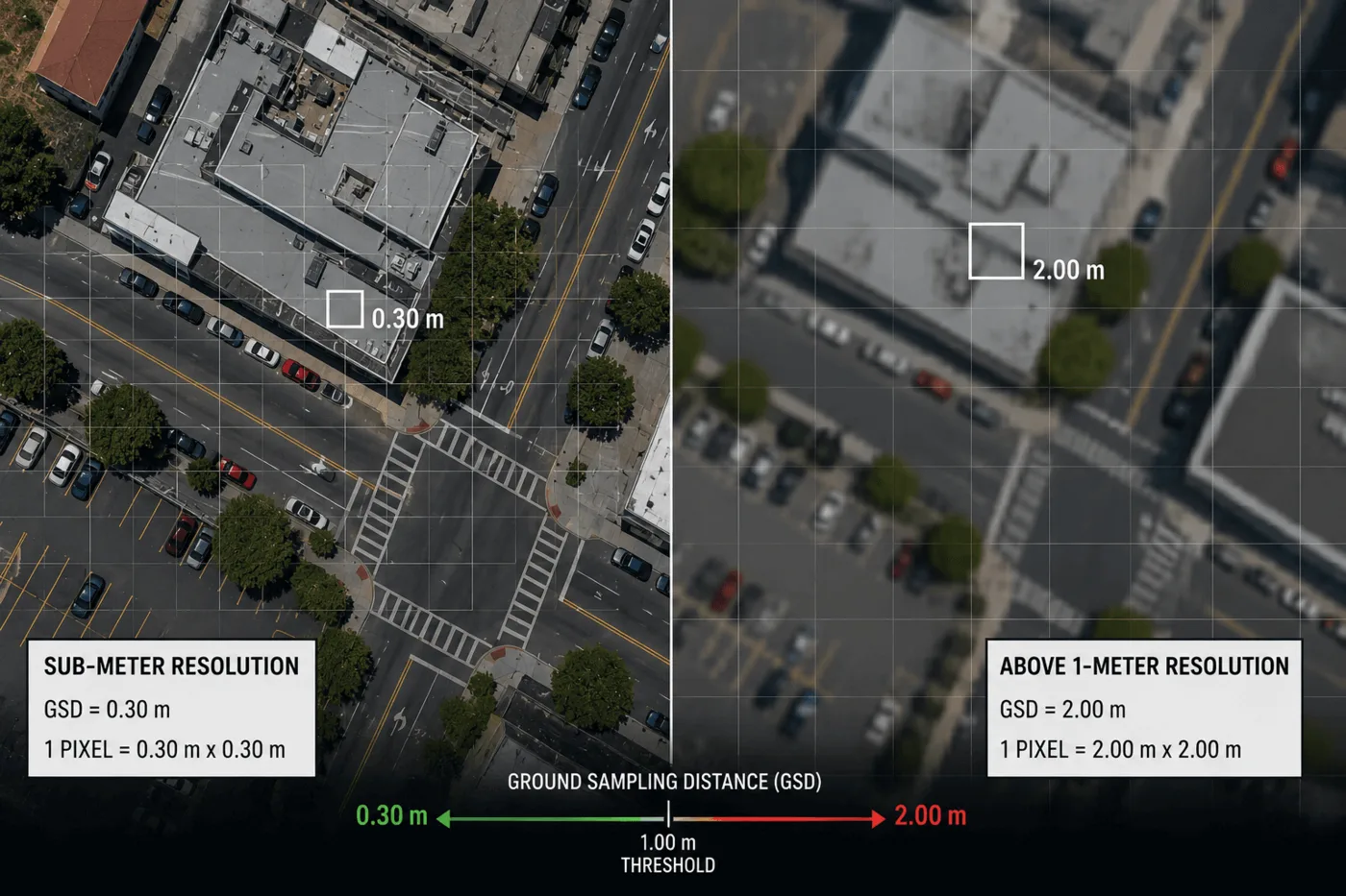
As a simple rule, match resolution to the smallest thing you need to see, not the sharpest number on the price list. For the full breakdown of every resolution tier, price, and what each pixel size actually shows, see our complete guide to choosing the right satellite image resolution.
How to choose the right sensor type and band for your order
Spatial resolution only tells you how sharp an image is. What the image can actually detect, beyond plain color, depends on the sensor type you order.
Optical panchromatic and multispectral imagery
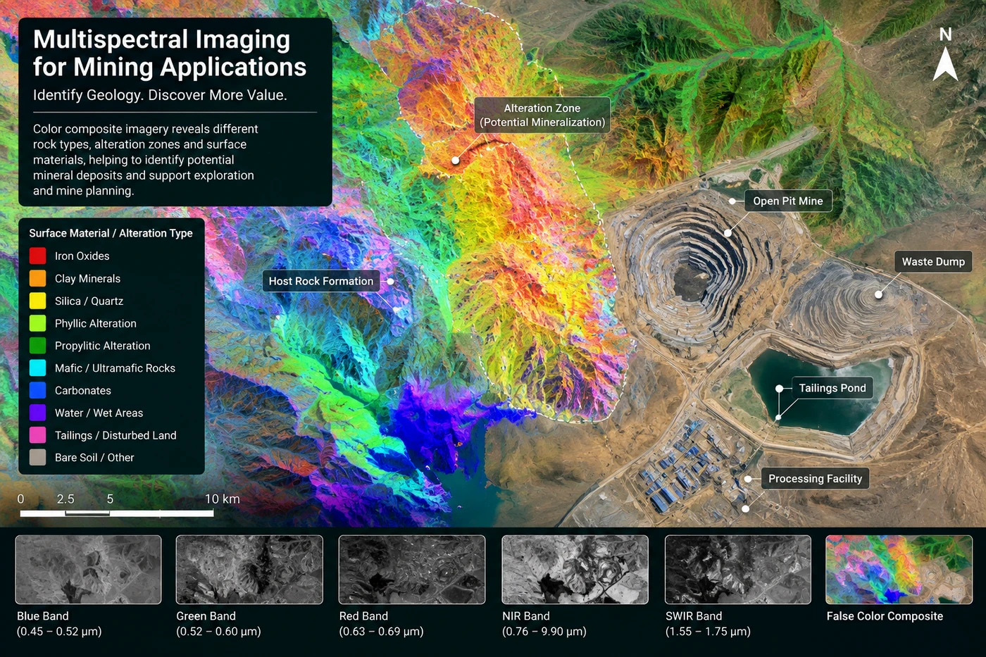
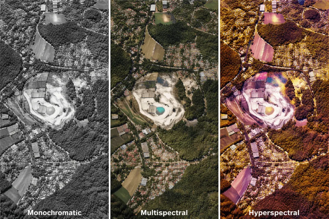
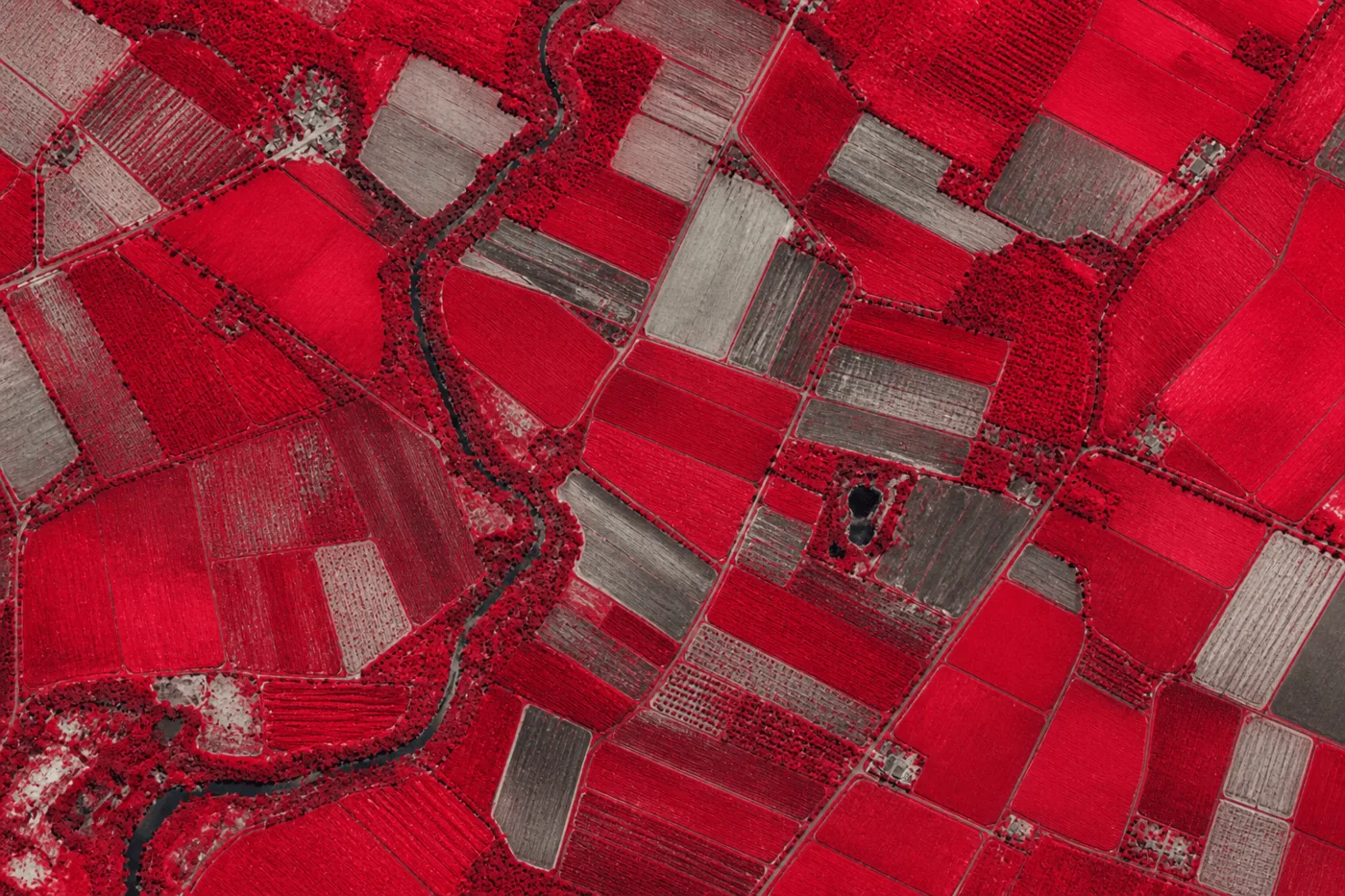
Panchromatic is a single black-and-white band, sharp but colorless, mainly used for structural detail and 3D mapping. Multispectral sensors add several separate color bands, typically red, green, blue, and near-infrared, which is what lets an image tell healthy crops from stressed ones, or water from dry ground. Order multispectral by default unless your project only needs a plain visual reference. For a full explanation of how the bands are captured and combined, read our guide to what multispectral satellite imagery is.
Hyperspectral imagery
Hyperspectral sensors split light into hundreds of narrow, continuous bands instead of a handful of broad ones, which lets them identify specific minerals, clays, and crop stress signatures rather than just general land cover types. This detail comes at a coarser pixel size, generally 20 to 30 meters, since packing in more bands trades away spatial sharpness. Order hyperspectral for mineral exploration, precision agriculture research, or environmental chemical analysis, not for a general property or infrastructure image.
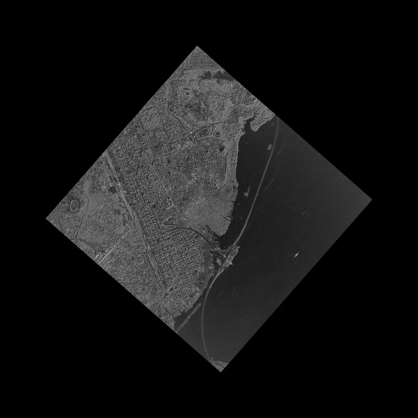
SAR, radar imagery that works through cloud
Synthetic Aperture Radar, or SAR, sends its own microwave signal down and reads the bounce back, so it works day or night and straight through cloud, smoke, and heavy rain. Order SAR when your area has persistent cloud cover, when timing matters more than color detail, or when you need to detect ground and structural movement down to a millimeter through a technique called InSAR, covered further down this page.
Spectral bands, what each one actually shows
A "band" is just one slice of light wavelength a sensor records. Ordering the right combination of bands matters as much as ordering the right resolution.
- Panchromatic (450 to 900 nm): a single grayscale band, used for sharp structural detail and stereo mapping.
- Standard multispectral bands: blue, green, red, and near-infrared, the baseline set for telling vegetation, water, and built surfaces apart.
- Extended bands (Purple, Yellow, Red Edge, NIR2): an expanded eight or nine band setup used on satellites like SuperView-2, adding Purple (400 to 450 nm), Yellow (590 to 630 nm), Red Edge (710 to 750 nm), and a second near-infrared channel (860 to 1040 nm) for deeper crop and canopy analysis.
- Red Edge (roughly 690 to 770 nm): tuned specifically to pick up a change in chlorophyll before plant stress becomes visible to the human eye.
- Thermal bands, MWIR and LWIR (3.5 to 12.5 micrometers): detect heat rather than reflected light, used to spot industrial heat anomalies, pipeline gas leaks, and warm water pollution.
Mono, stereo, and tri-stereo imagery, plus DEM, DSM, DTM, and DOM products
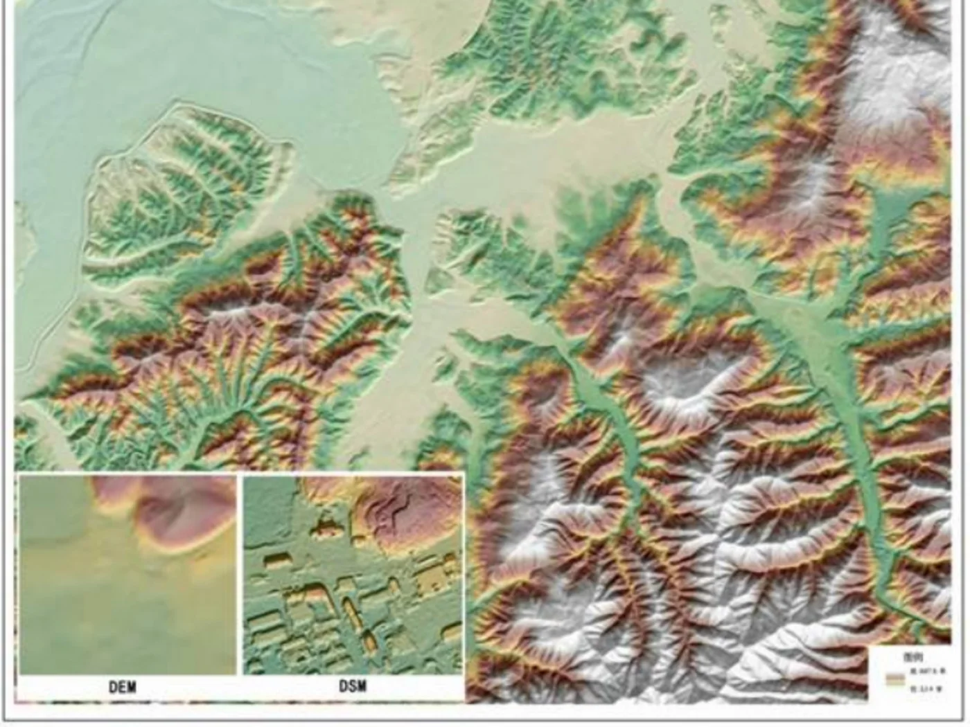
Beyond a flat picture, satellite orders can also produce a full 3D model of the ground. Which product to order depends on whether you need a picture or a measurement.
Mono imagery is a standard single-look, georeferenced orthophoto, the most common and least expensive order type. Stereo imagery is captured from two different viewing angles, forward and backward or from two orbital passes, and costs twice the mono price. Tri-stereo adds a third, nadir view for even stronger 3D accuracy, at three times the mono price. Stereo and tri-stereo eliminate terrain distortion, which is what makes an accurate elevation model possible in the first place.
| Product | What it is |
|---|---|
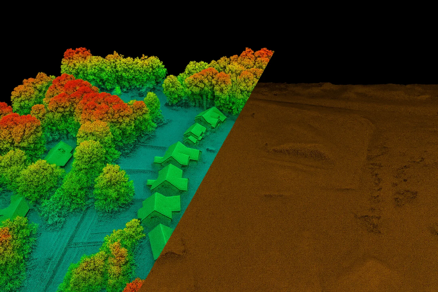
| DEM (Digital Elevation Model) | Bare-earth elevation with all vegetation and buildings removed |
| DSM (Digital Surface Model) | Top-of-surface elevation, including roofs, tree canopy, and infrastructure |
| DTM (Digital Terrain Model) | An enhanced bare-earth model with breaklines and terrain features added, built for engineering use |
| DOM (Digital Orthophoto Map) | An orthorectified image map, typically delivered at 50 cm resolution with 8 m CE90 positional accuracy |
Elevation orders are typically delivered at 2 to 10 meter grid spacing with about ±3 meters of vertical accuracy, in under 21 days. For a deeper look at how these models are built and used for planning, see our guide to building 3D models from stereo imagery, and for a flood-specific use case, see how a DEM supports flood modeling.
SAR and InSAR, ordering all-weather monitoring
Radar imagery does more than just see through cloud. Interferometric SAR, or InSAR, compares two radar passes over the same spot to measure ground and structural movement as small as 1 to 2 millimeters between visits. It's the only order type that catches slow, invisible shifts before they become visible damage.
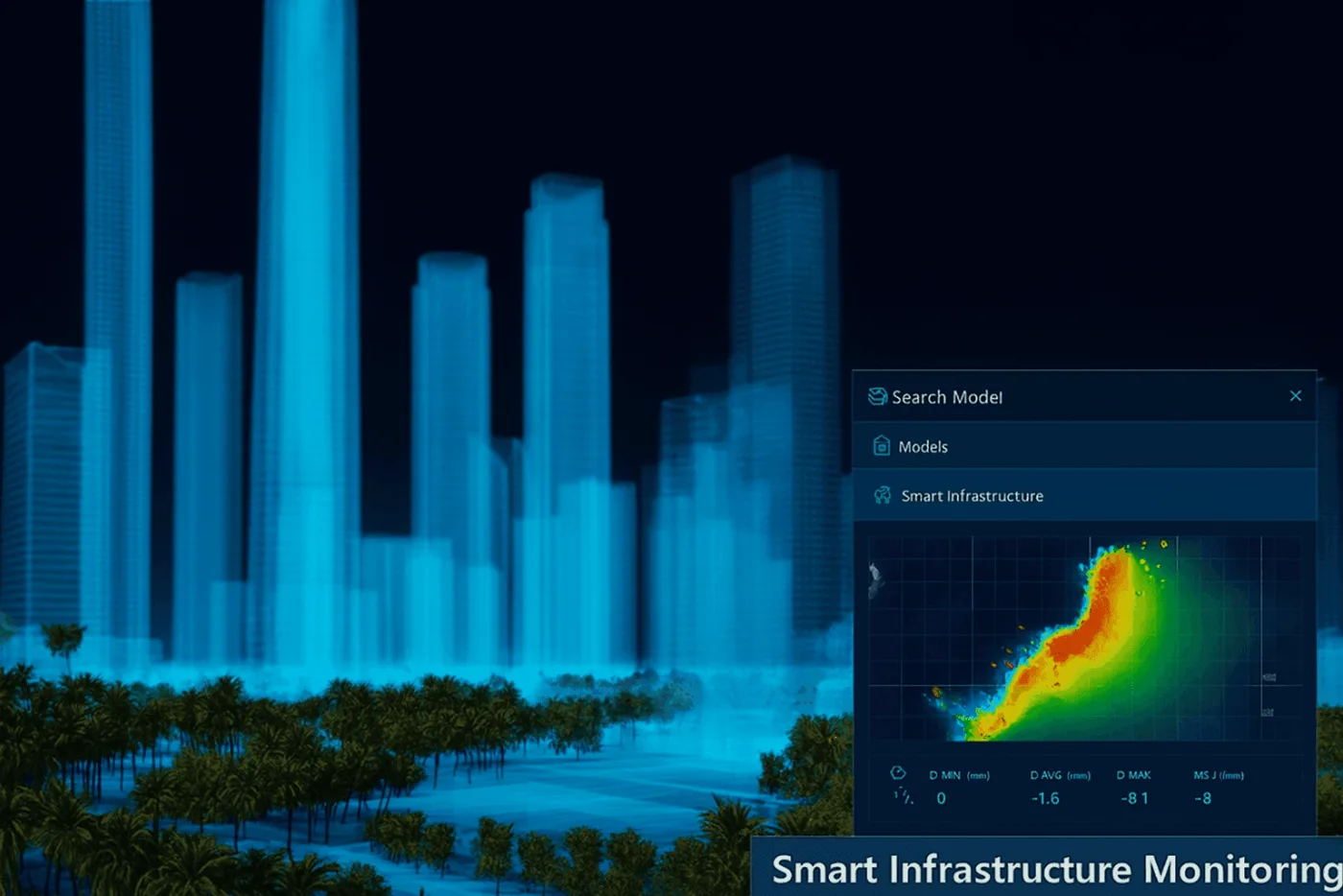
Order InSAR monitoring for tailings dams, open-pit mine slopes, bridges, pipelines, and building foundations, anywhere a slow shift needs to be caught before it turns into a failure.
Archive imagery vs new tasking, and when to order emergency capture
Every order falls into one of four timing categories, and picking the right one changes both price and how long you wait.
| Collection mode | Timing | Best for |
|---|---|---|
| Standard archive | 90 or more days old | The lowest cost option, historical baselines and comparisons |
| New collection (standard) | Scheduled tasking, standard queue | Current ground conditions where a short wait is acceptable |
| Priority collection | Faster collection window | Time-sensitive projects that can't sit in the standard queue |
| Emergency collection | Fastest possible, time-critical lead time | Active disasters and urgent situational awareness |
Archive or new tasking, which should you actually buy?
Buy archive imagery when speed and price matter most, the scene already exists, so there's no weather to wait on and nothing uncertain about what you'll receive. Buy new tasking when the project needs a specific date, current ground conditions, or coverage the archive simply doesn't have yet. As a rule, check the archive first every time, high-resolution satellites have been flying for years, and a scene from the last few weeks or months often covers the job at a fraction of the tasking price.
- Choose archive when you need a historical baseline, a fast turnaround, or the lowest possible price, and an exact capture date doesn't matter.
- Choose new tasking when you need a guaranteed, specific date, current ground conditions, or a look angle and cloud ceiling the archive can't match.
- Choose priority or emergency tasking when the standard tasking queue is too slow for the situation, an active disaster, a legal deadline, or a board deadline.

The two aren't an either-or choice on a real project. Combining archive with new tasking is common practice, pull an archive image first to confirm the resolution actually shows what you need, then order new tasking once the project is live. For the full decision framework on when each mode makes sense, see our guide to cloud cover in archive search.
Satellite image pricing, what an order actually costs
Pricing is quoted per square kilometer and set by three things, how fine the resolution is, how fast you need it, and any extra guarantees you attach to the order.
| Resolution class | Standard archive (90+ days) | New collection | Priority | Emergency | Minimum order |
|---|---|---|---|---|---|
| Super high (30 cm) | $20/km² | $30/km² | $45/km² | $80/km² | 25 km² archive / 100 km² tasking |
| Very high (50 cm) | $14/km² | $22/km² | $37/km² | $66/km² | 25 km² archive / 100 km² tasking |
| High (51 to 80 cm) | $5/km² | $10/km² | Custom quote | Custom quote | 25 km² archive / 100 km² tasking |
| Moderate / wide-swath (2 m) | $1/km² | $2/km² | Custom quote | Custom quote | Flexible |
A few add-ons change the final price per square kilometer:
- Stereo imagery costs 2 times the mono price, tri-stereo costs 3 times the mono price.
- PAN plus 8-band multispectral at 50 cm adds a 10% uplift over a standard 4-band multispectral order.
- Guaranteed cloud cover under 10% adds $8/km², under 5% adds $15/km².
- Guaranteed off-nadir angle under 15° adds $3/km², under 10° adds $9/km², a tighter angle reduces distortion on tall structures.
Orders covering a large total area, or repeat orders across multiple sites, can also qualify for a bulk or volume discount off the standard per-km² rate, worth asking about before placing a large order through our team directly.
Which satellites and sensors you can order
An order isn't tied to one satellite, the platform matches your resolution, band, and timing request to whichever satellite in the constellation can deliver it. Here is what sits behind the resolution and sensor choices above.
| Satellite | Sensor type | Resolution | Best ordered for | Revisit |
|---|---|---|---|---|
| SuperView Neo-1 | Optical VHR | 0.25 to 0.3 m PAN / 1.2 m MS | Vehicles, port detail, GEOINT | Daily |
| SuperView Neo-3 | Optical VHR | 0.5 m PAN / 2 m MS | Wide-area detail, 130 km swath | Multi-daily |
| SuperView-2 (GFDM) | Optical VHR | 0.42 m PAN / 1.68 m MS | Extended 1+8 band agriculture orders | 3 days |
| SuperView-1 | Optical VHR | 0.5 m PAN / 2 m MS | General mapping, 4-satellite tasking | Daily |
| BJ3N (Beijing-3B) | Optical VHR | 0.3 m PAN / 1.2 m MS | Rapid AI-onboard tasking | Rapid tasking |
| Beijing-3A | Optical VHR | 0.5 m PAN / 2 m MS | Mono, stereo, and tri-stereo 3D mapping | Rapid tasking |
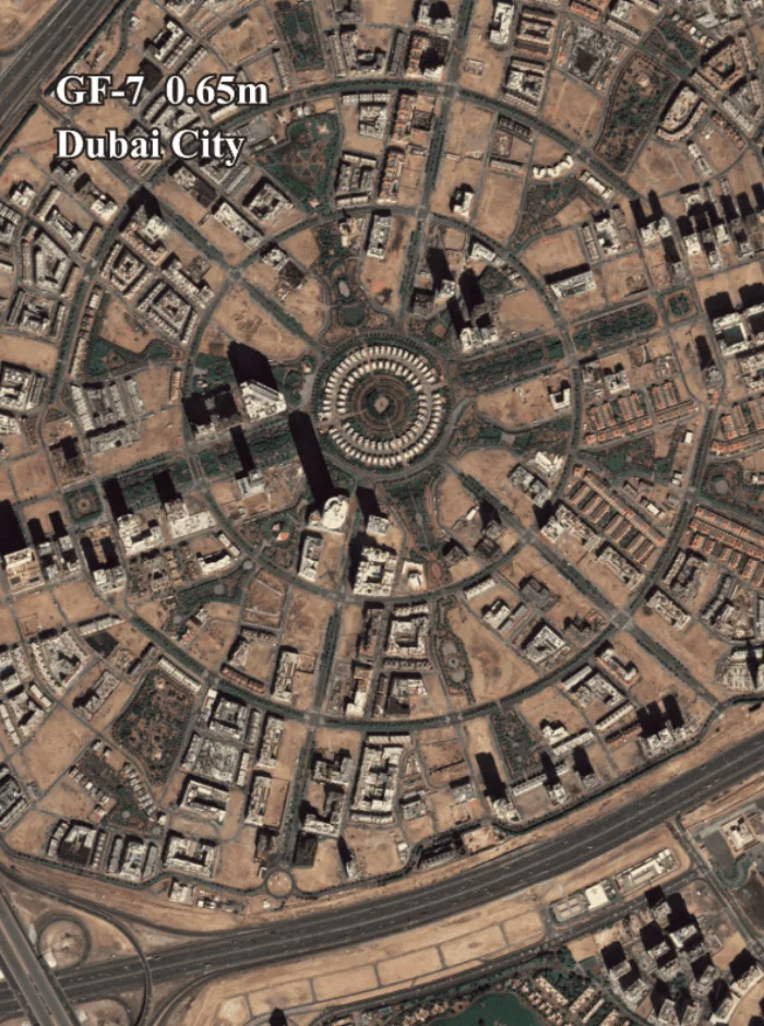
| GF-7 | Optical stereo | ≤0.65 m PAN / 2.6 m MS | Sub-meter 3D stereo mapping | 5 days |
| GF-2 | Optical HR | 0.8 m PAN / 3.24 m MS | General infrastructure, 45 km swath | 5 days |
| GF-6 | Optical specialist | 2 m PAN / 8 m MS, 16 m WFI | Regional agriculture with Red Edge band | 4 days |
| GF-4 | Geostationary optical | 50 m VNIR / 400 m MWIR | Continuous same-spot staring, wildfire | 20 seconds |
| GF-3 | C-band SAR | 1 to 500 m | All-weather, 12 imaging modes | 10 days (1 day constellation) |
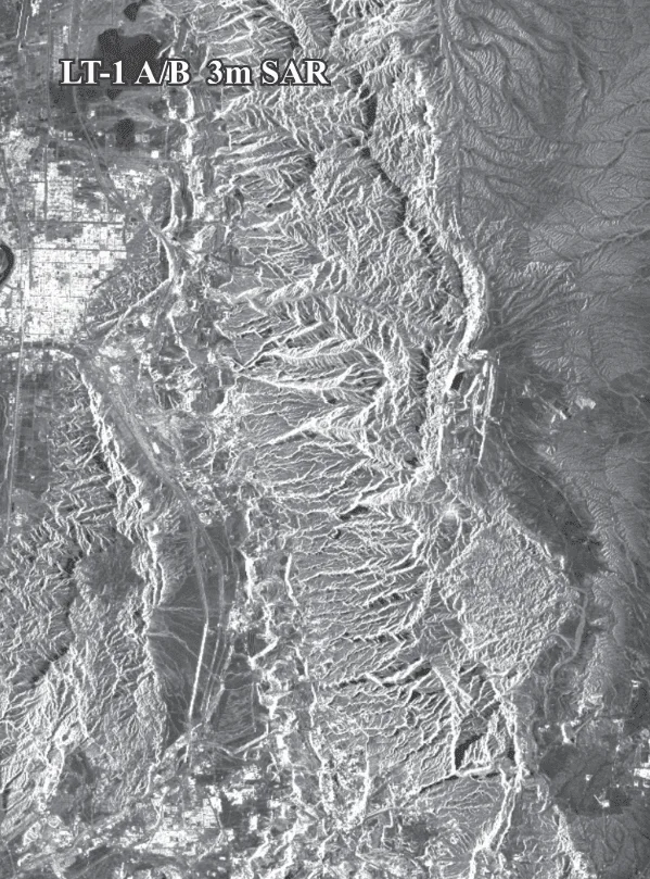
| LT-1 (A/B) | L-band SAR | 3 to 30 m | InSAR deformation, global DEMs | 4 to 8 days |
| GF-5 / GF-5B | Hyperspectral / thermal | 20 to 30 m | Mineral and material identification | 12 days |
| ZY-1 02D / 02E | Hyperspectral / optical | 30 m hyperspectral / 2.5 m PAN | 166-channel material mapping | 3 to 26 days |
Real satellite imagery samples from 30 cm to 2 m resolution
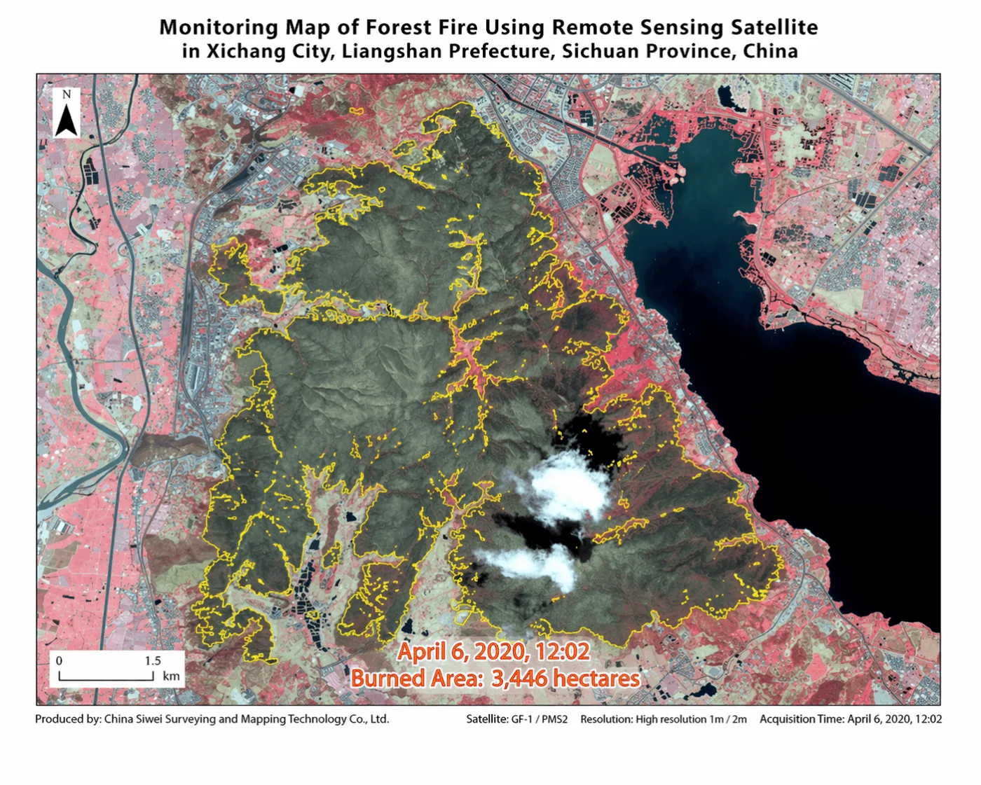
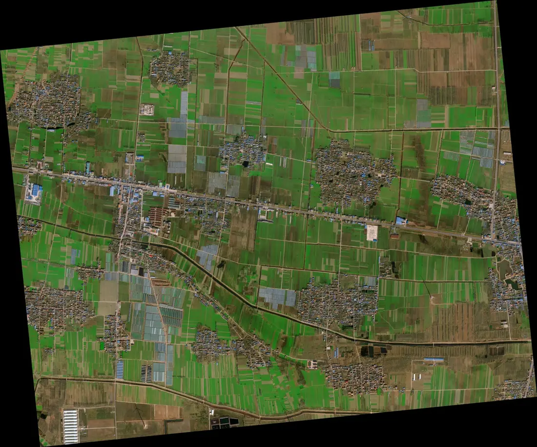
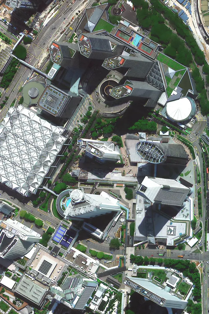
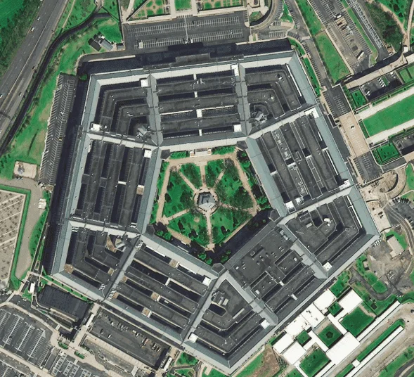
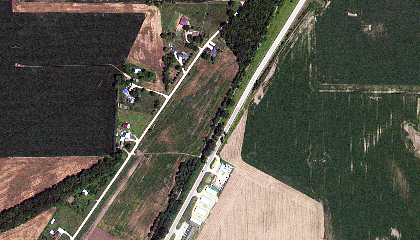
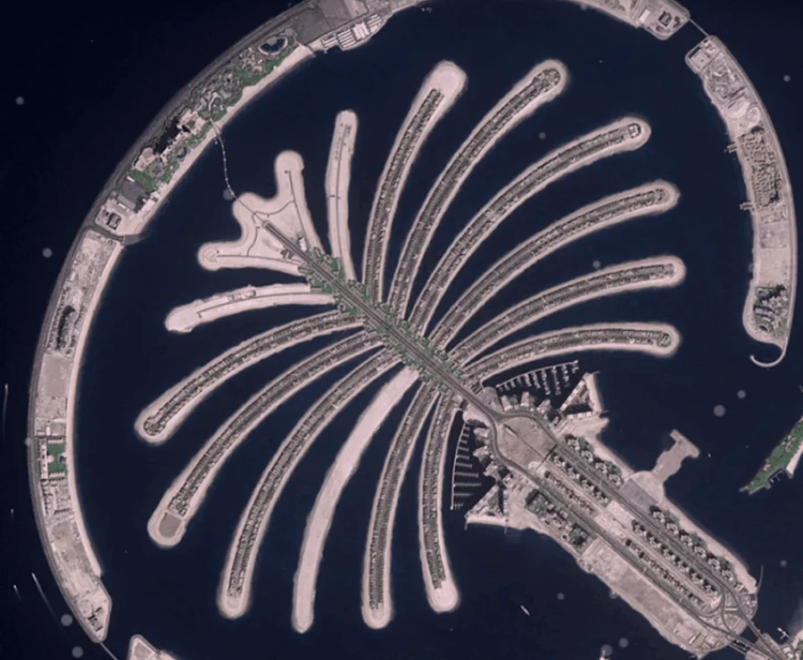
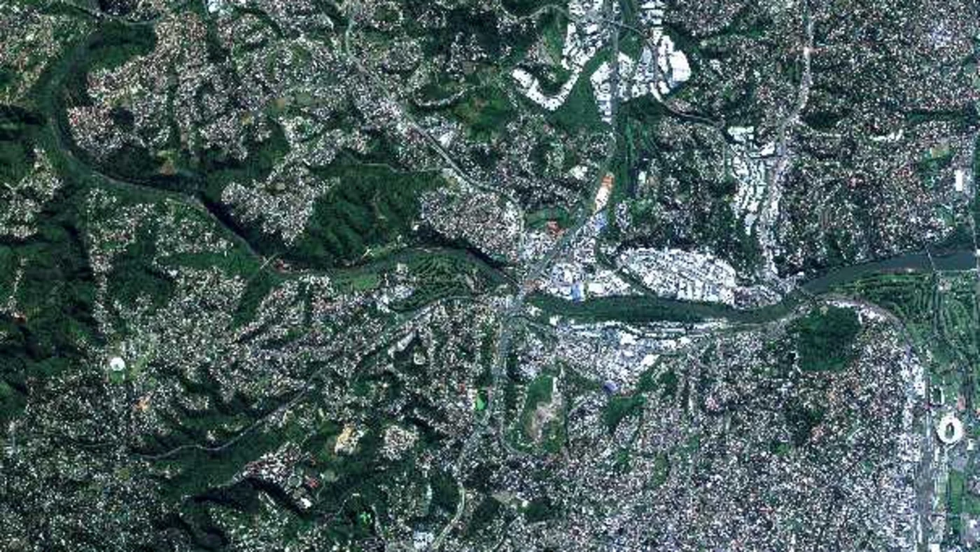
Numbers on a pricing table are abstract until you see what each resolution actually resolves. The four optical samples below are real ordered captures at four different resolutions over four different places, arranged from the sharpest to the widest, so you can see exactly what gets sharper, and what disappears, as the pixel size grows from 30 cm to just over 2 m. Two more samples after them show the same idea for SAR and multispectral orders.
What processing and AI analytics come with your order
A satellite order is rarely just a raw picture. Standard processing runs orthorectification, block adjustment, pan-sharpening, spectral fusion, color balancing, and mosaicking before you receive a file, and several AI-driven analytics can be added on top.
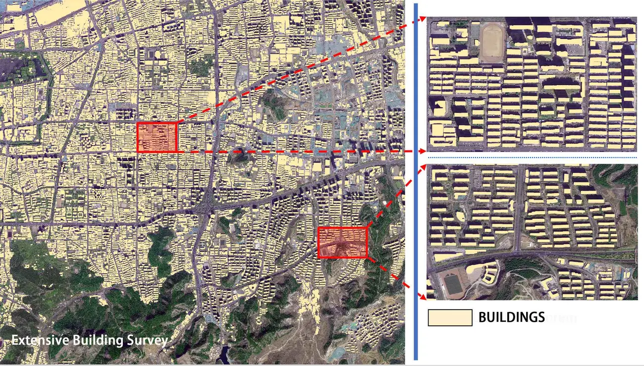
01. Building footprint and 3D model extraction
Automated detection pulls building footprints and full 3D massing straight out of stereo imagery, without a manual digitizing pass.
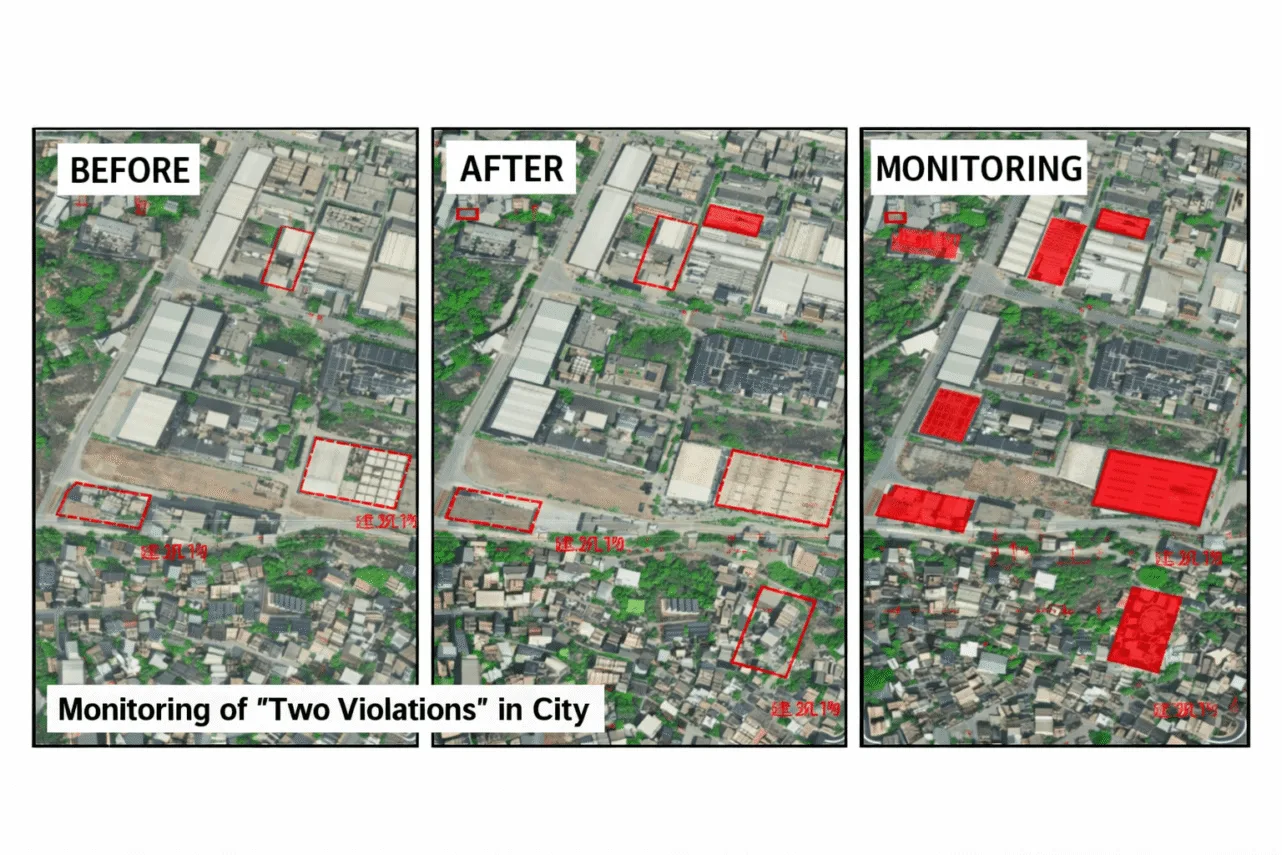
02. Semantic segmentation and change detection
Before-and-after processing flags urban expansion, unauthorized construction, and deforestation automatically, instead of a person comparing two images by eye.
03. Agriculture Watch crop classification
Automated classification separates crop types and flags non-grain land conversion at over 90% accuracy, with yield estimation reaching up to 85% accuracy against ground truth.

Ordering mineral exploration and prospectivity data
Mineral exploration orders go a step past a standard image. AI prospectivity mapping fuses hyperspectral data, shortwave-infrared alteration layers, and structural fault lines, then calibrates the result against real ground-truth mineral samples using principal component analysis.

The output is a color-coded probability map for gold, copper, or another target mineral, with prioritized GPS coordinates and a confidence layer, so a drilling program can be planned around ranked targets instead of blind exploration. For how the underlying satellite data detects mineral signatures in the first place, see our guide to how satellites detect minerals. Mineral prospectivity orders also qualify for bulk pricing on large or multi-site exploration areas.
Licensing, what you can actually do with imagery you order
Satellite imagery is licensed, not sold outright. By default, an order covers internal business, analysis, and reporting use, so you and your team can measure, map, and build reports from it without restriction. Sharing the files with a contractor, consultant, or project partner working on the same job is normally fine.
What isn't covered by a standard order is reselling the raw imagery, redistributing it as a standalone data product, or publishing it outside your own reporting, that needs written consent confirmed at order time. Ownership of the imagery itself stays with the imagery provider, you're licensing the right to use it for your project, not buying the underlying data. If a public report, a court filing, or a client deliverable needs specific publication rights, say so when you order rather than assuming a standard license covers it, since exact usage terms are confirmed per order. Full terms are on our terms of use page.
One practical limit sits alongside licensing rather than inside it, orders can't be placed for an area of interest that overlaps a small number of countries under sanctions or export restrictions, even a small overlap at the edge of a polygon. Outside those restricted territories, tasking can reach almost anywhere on Earth.
Who orders satellite images and why
Satellite imagery buyers range from a single engineer checking one site to a national government tracking an entire coastline. Matching your persona below to the sections above narrows down what to actually order.
Businesses
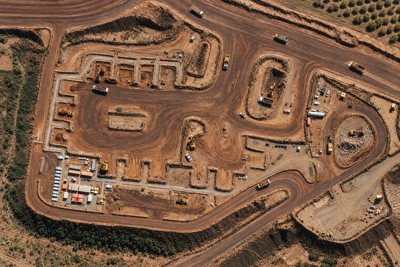
Mining, construction, oil and gas, and agriculture companies are the most frequent commercial buyers. Most purchase satellite imagery on a recurring schedule, ordering high resolution satellite imagery for site progress and haul roads, SAR for all-weather asset checks, and hyperspectral for exploration. See our dedicated pages for mining, agriculture, and oil and gas satellite imagery for industry-specific detail.
Government and public agencies
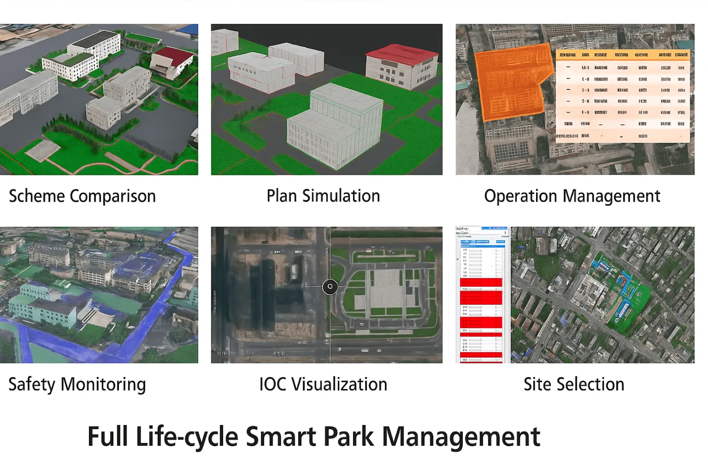
City and regional governments order moderate-resolution imagery on a recurring schedule to track zoning, land use, and infrastructure growth across an entire municipality rather than one site. See our guide to tracking urban growth with change detection for how this order type is used over time.
NGOs and research organizations
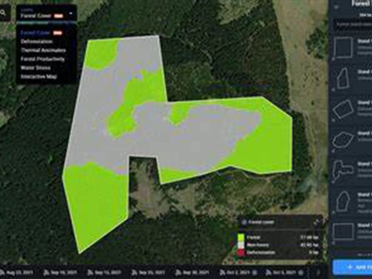
Conservation groups and researchers order wide-swath and archive imagery to track deforestation, water stress, and habitat change over years, usually working with a tighter budget than a commercial buyer. See our guide to forestry canopy monitoring for a full breakdown of this order type.
First responders and disaster response teams
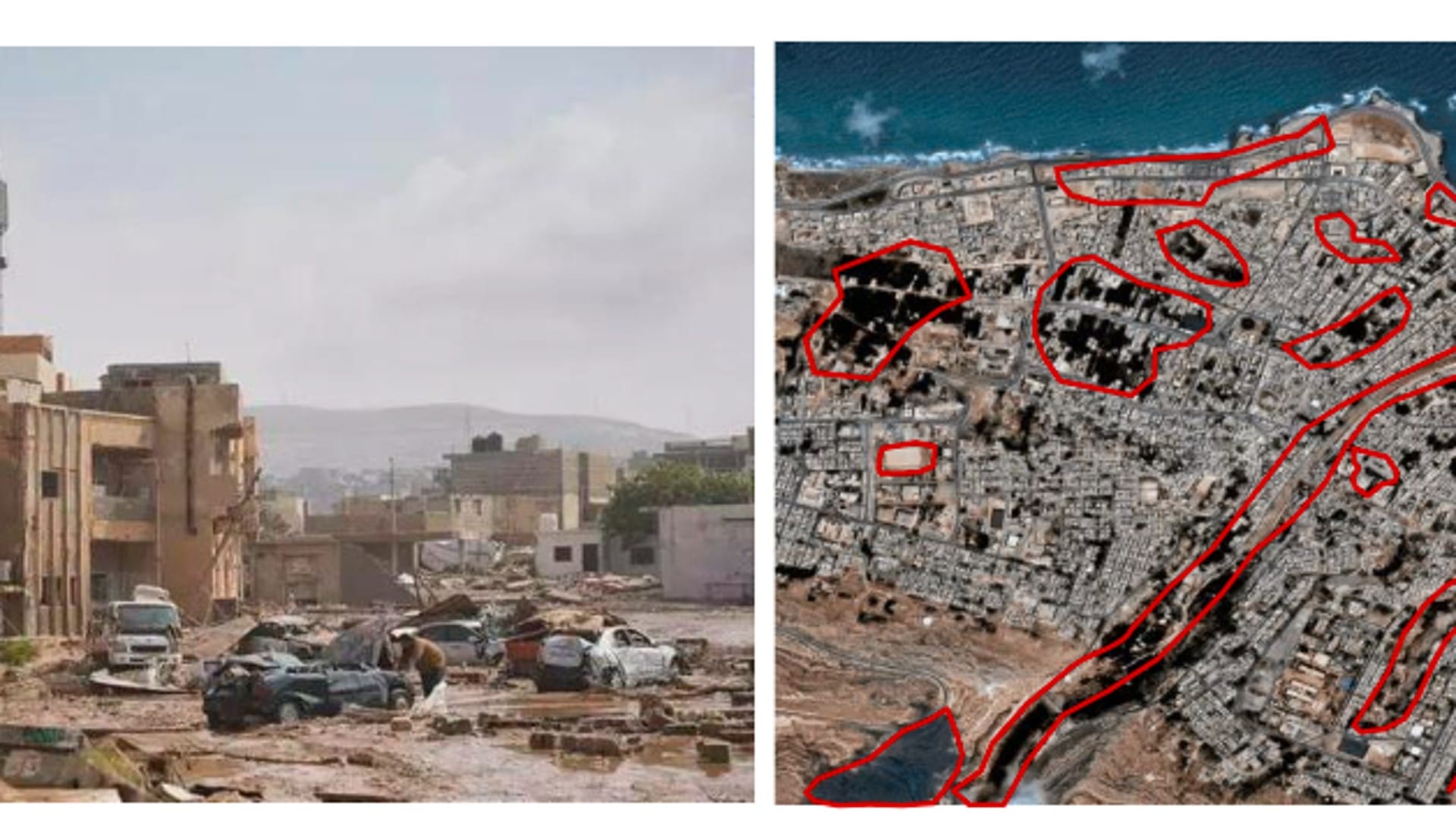
Emergency management teams order SAR and rapid optical tasking within hours of a flood, earthquake, or storm, since speed matters more than pixel size in the first hours after a disaster. See our guide to mapping disaster response with radar for how emergency tasking is used on the ground.
Insurance carriers and individuals
Insurers order pre- and post-event imagery to verify storm and flood damage claims building by building, and individuals order a one-time image for a single property, land parcel, or personal project. See our guide to using satellite imagery as insurance evidence for how a claims order is put together. Anyone who only needs a free, lower-resolution reference image rather than a paid order can also check our roundup of free satellite imagery sources first.

Mistakes to avoid when ordering satellite images for the first time
Most buyers trying to buy satellite imagery for the first time run into the same handful of avoidable mistakes.
- Ordering the finest resolution by default. The sharpest tier is also the most expensive, and it's wasted money on a project that only needs regional coverage.
- Trusting the scene-level cloud cover number alone. A scene reported at 10% cloud cover can still sit exactly under the one cloud covering your specific site, always check the preview over your own area, not just the overall percentage.
- Ordering mono imagery when the real need is elevation data. A flat orthophoto can't produce a DEM or DSM, that requires a stereo or tri-stereo order from the start.
- Missing the minimum order size. Sub-meter tasking orders typically require at least 100 km², a smaller area gets bumped up or rejected at checkout.
- Assuming new tasking guarantees an exact date. Weather and orbital pass timing can shift a capture window by a few days, priority or emergency collection narrows that window but rarely removes it entirely.
- Not asking about bulk pricing. Large-area orders and repeat orders across multiple sites often qualify for a lower per-square-kilometer rate than the standard published price.
- Assuming the quoted price already includes processing. Some providers bill orthorectification, pansharpening, and color balancing as separate add-ons after the fact, always confirm whether a per-km² quote is the finished, analysis-ready price or a raw-file starting point.
- Using a free map screenshot for a job that needs a verified record. An insurance claim, a legal filing, or a government report needs an image with a confirmed capture date and proper orthorectification, a basemap screenshot has neither and won't hold up under scrutiny.
Key takeaways
- Ordering satellite images comes down to three steps, mark your area of interest, choose resolution and sensor type, then pick archive or new tasking.
- Pricing runs from about $1/km² for 2 m wide-swath archive imagery up to $80/km² for 30 cm emergency tasking, with stereo, cloud, and angle guarantees adding to the base price.
- Optical resolution and sensor type answer "how sharp," while mono, stereo, tri-stereo, and SAR/InSAR answer "flat picture or 3D and movement data."
- Archive imagery (90+ days old) is the cheapest starting point, new tasking, priority, and emergency collection each trade a higher price for a faster turnaround.
- Buyer type shapes the order just as much as the project does, businesses, governments, NGOs, first responders, and individuals typically land on very different resolution and timing choices.
Frequently asked questions
How do I order satellite images?
To order satellite images or purchase satellite imagery online, mark your area of interest by drawing it on a map or uploading a KML, KMZ, or shapefile boundary, choose a resolution and sensor type such as optical, multispectral, or SAR, pick archive imagery or new tasking, then search and check out. Most platforms show a live price per square kilometer before you pay, and files are delivered through a secure cloud link or on a physical drive for very large areas.
How much does it cost to order satellite imagery?
Pricing runs from about $1 per square kilometer for 2 meter wide-swath archive imagery up to around $80 per square kilometer for 30 cm super high resolution emergency tasking. Stereo imagery costs 2 times the mono price, tri-stereo costs 3 times, and guaranteed cloud cover or off-nadir angle limits add a small per-square-kilometer surcharge.
What resolution should I order for my project?
Match resolution to the smallest feature you need to see. Order 25 to 50 cm for vehicles, buildings, and infrastructure detail. Order 2 to 10 meters for farm fields, forest blocks, and land-use boundaries. Order 20 to 30 meter hyperspectral data for mineral or material identification. Buying finer resolution than the project needs only adds cost.
What is the difference between archive and new tasking imagery?
Archive imagery is previously captured data, cheapest once it is 90 or more days old, and is the fastest, most affordable option for historical comparisons. New tasking schedules a fresh satellite pass over your exact area and date range, needed when current ground conditions or a specific capture window matter, and it costs more than archive imagery.
How long does it take to receive satellite images after ordering?
An archive order can be delivered almost immediately since the imagery already exists. A standard new tasking order typically takes a few days depending on the next available satellite pass, priority collection shortens that window, and emergency collection is prioritized above the standard queue for active, time-critical situations.
What file formats do satellite images come in?
Standard delivery formats are GeoTIFF, SHP, DWG, or UTM, chosen for direct compatibility with GIS software such as ArcGIS and QGIS with no conversion step needed. Larger orders can also be delivered as Cloud-Optimized GeoTIFF (COG) or GeoPackage. Elevation orders such as DEM, DSM, or DTM data are delivered as gridded terrain files at the same 2 to 10 meter spacing. Files arrive through a secure cloud download link, or on a physical hard drive for very large area orders.
Can I order SAR or hyperspectral imagery?
Yes. SAR (radar) imagery is available from 1 to 500 meters and works through cloud, smoke, and darkness, useful for all-weather monitoring and millimeter-level deformation detection. Hyperspectral imagery, generally 20 to 30 meters resolution with hundreds of spectral bands, is available for mineral exploration and material identification. Both can be selected as a capture mode when placing an order.
Is there a minimum area I have to order?
Sub-meter resolution orders (super high, very high, and high resolution tiers) generally require a minimum of 25 square kilometers for archive imagery and 100 square kilometers for new tasking. Moderate and wide-swath resolution orders have a flexible, much lower minimum.
Do you offer discounts for large or bulk satellite imagery orders?
Yes. Orders covering a large total area, or repeat orders across multiple sites, can qualify for a discounted rate off the standard per-square-kilometer price. Contact our team directly with your area and timeline to get a bulk pricing quote.
Does anyone need special approval to order satellite imagery?
No special accreditation is needed to order commercial satellite imagery, it's sold to businesses, government agencies, NGOs, and individuals alike. A standard order is licensed for your internal business, analysis, and reporting use, and specific usage terms, such as publication or client-deliverable rights, are confirmed at order time if your project needs them.
Can I order satellite imagery of any location?
Nearly anywhere. New tasking can reach almost any point on Earth, and archive coverage is deepest over populated and frequently monitored regions. The one exception is a small number of countries under sanctions or export restrictions, orders cannot be placed for an area of interest that overlaps those territories, even partially.
Sources and further reading
- China Siwei and 21AT: SuperView Neo, SuperView-1/2, Beijing-3, and GF series satellite specifications
- CNSA and CRESDA: GF-5/5B, GF-6, GF-4, GF-3, and ZY-1 mission specifications
- ESA Copernicus: Sentinel-1 and Sentinel-2 mission specifications
- NASA/USGS: Landsat mission history and archive access
- XRTech Group: satellite imagery ordering, pricing, and collection speed data, 2026
Ready to place your order?
Draw your area on our portal and see live pricing across every resolution and sensor type in seconds, no remote sensing background needed.
Still not sure which resolution, band, or capture mode fits your project? Our team reviews first-time orders for free and points you to the right specification before you pay for anything.
Not sure what to order yet?
Tell us your area, industry, and timeline, and we'll recommend the exact resolution, sensor, and collection mode before you commit to a price.