

Digital Elevation Models (DEM) for Flood Risk Modeling
On this page
- What a DEM actually is, and why "bare-earth" matters
- Core hydrological functions DEM data powers
- From elevation to inundation: how DEMs simulate flood risk
- 01. Floodplain delineation
- 02. Digital basin and smart flood prevention
- 03. Urban flood simulation and joint dispatching
- 04. Volume and retention calculations
- DEM data during an active flood: emergency response
- DEM technical specifications for flood modeling
- Choosing the right DEM resolution and accuracy
- DEM vs. DSM vs. DTM at a glance
- Frequently asked questions
- Sources and further reading
A flat map cannot tell you which street floods first. A Digital Elevation Model can, because it adds the one variable a satellite photo leaves out: height. DEM data is what turns a 2D image into a 3D surface that water actually flows across, and it's the foundation underneath every flood model, watershed study, and emergency response map built today.
Quick answer
A Digital Elevation Model (DEM) is a 3D representation of ground elevation, built from satellite stereo imagery or radar, that hydrologists use to simulate how water moves across terrain. DEM images convert a flat map into a surface with slope, aspect, and drainage direction, letting flood models calculate where water will pool, how fast it will move, and which buildings and roads sit in its path. For flood modeling specifically, the DEM needs to be bare-earth (buildings and trees removed), with 2 to 10 meter grid spacing and vertical accuracy around ±3 m RMSE.
What a DEM actually is, and why "bare-earth" matters
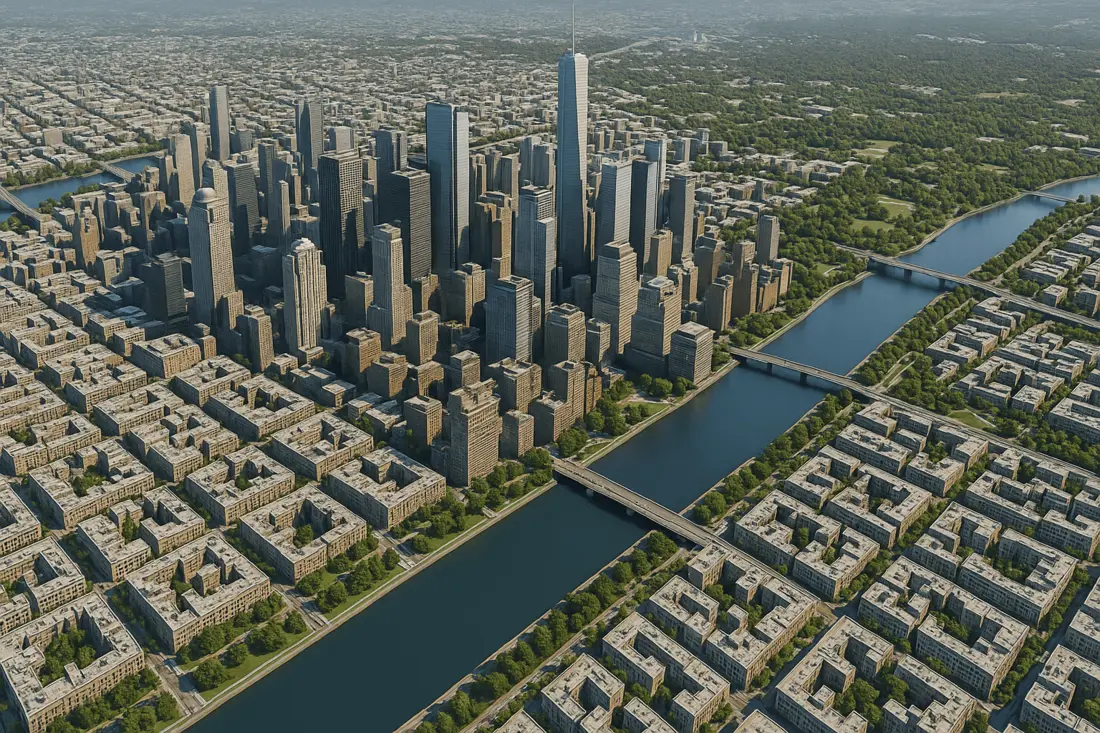
Elevation data comes in three related but distinct products, and mixing them up is the most common mistake in flood modeling:
- DEM / DTM (bare-earth): strips out trees, vegetation, and buildings to model the true ground surface, river bed slopes, and natural channel hydraulics. This is the version flood models actually need.
- DSM (Digital Surface Model): keeps every building and treetop in place. Comparing a DSM against a DEM of the same area reveals physical flow barriers, urban drainage bottlenecks, and the overland runoff channels that form around buildings.
- DTM refinements: a more detailed bare-earth model that also captures breaklines, ridges, and channel edges, used for the most demanding engineering and cartographic work.
Core hydrological functions DEM data powers
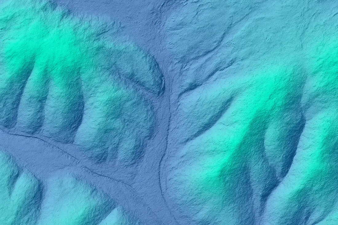
Flood risk modeling starts by converting a flat geographic map into a 3D topographical surface that software can run water across.
- Terrain parameter extraction: DEMs derive slope, aspect (the direction a face points), and surface roughness, the values that determine water velocity and overland runoff behavior during heavy rainfall.
- Watershed and catchment delineation: analyzing elevation gradients across a grid delineates watershed boundaries, identifies drainage basins, and maps river network pathways automatically.
From elevation to inundation: how DEMs simulate flood risk
01. Floodplain delineation
DEM elevation values feed directly into hydraulic flow models to map prospective inundation zones and calculate flood water depth across surrounding low-lying terrain.
02. Digital basin and smart flood prevention
Treating a watershed as one integrated spatio-temporal unit, multi-dimensional terrain data combines with hydrological physics models to run real-time flood progression simulations across an entire river basin, not just a single site.
03. Urban flood simulation and joint dispatching
In built-up areas, high-resolution DEMs combine with ground IoT sensors and 3D city models so municipal agencies can simulate stormwater accumulation, model flash flooding, and coordinate drainage and reservoir dispatching before, during, and after a storm.
04. Volume and retention calculations
DEMs let engineers calculate the cut-and-fill or volumetric capacity of retention basins, reservoirs, and dams, confirming whether they can hold up against an extreme storm surge before one arrives.
DEM data during an active flood: emergency response
Pre-event DEM baselines combined with live satellite imagery are what turn a flood map from a forecast into real-time situational awareness.
- AI waterline and extent extraction: AI algorithms process real-time SAR or optical satellite imagery and overlay the water-covered area onto a pre-existing DEM, producing precise flood boundary and water-depth estimates even through ongoing rain or cloud cover.
- Evacuation zone and hazard mapping: elevation-derived inundation maps help authorities plan safe evacuation routes, identify isolated ground, and allocate emergency supplies during a live disaster.
- Inundation impact assessment: overlaying elevation data onto cadastral or 3D city layers calculates affected building counts, flags threatened roads, and estimates infrastructure damage.
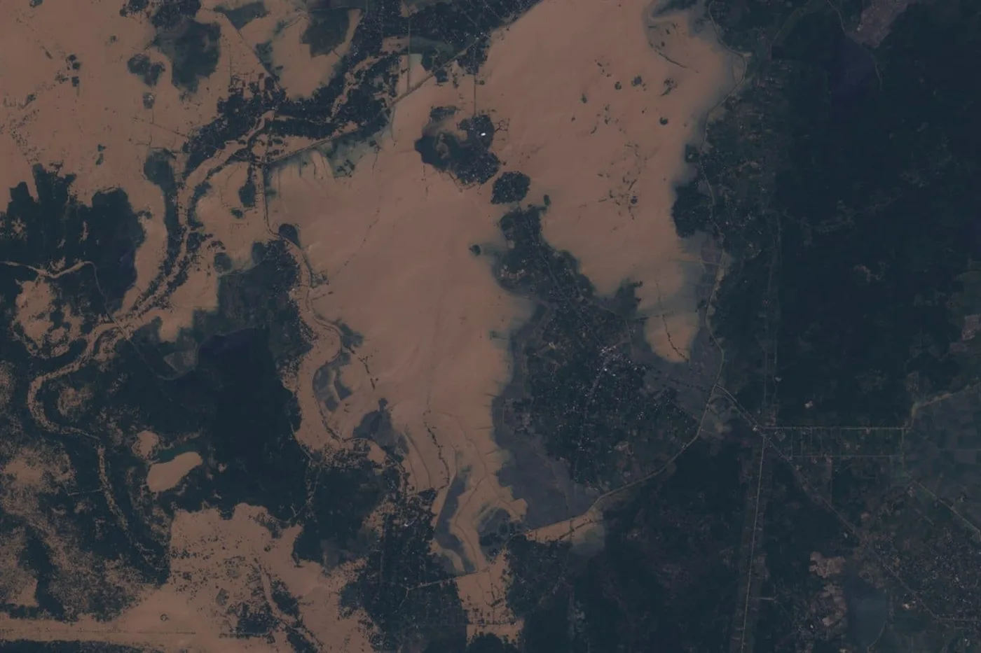
That combination played out directly during Cyclone Ditwah: satellite imagery of the flooding was delivered in 3 days, fast enough to inform evacuation and relief decisions while the water was still rising rather than after it receded.
DEM technical specifications for flood modeling
A flood model is only as good as the elevation data underneath it. These are the specs that actually move the needle.
| Parameter | Recommended specification | Impact on flood modeling |
|---|---|---|
| Vertical accuracy (RMSE) | ±3 m RMSE, or sub-meter laser altimetry | Critical: a small elevation error can miscalculate flood extent by hundreds of meters on flat terrain |
| Grid spacing (resolution) | 2 to 10 meter | Finer grid spacing captures narrow drainage ditches, dikes, and embankments that coarser grids miss entirely |
| Acquisition technology | Stereo optical (GF-7) or InSAR (LT-1 SAR) | GF-7's dual-linear stereo camera and laser altimeter, or LT-1's L-band InSAR, keep terrain modeling accurate even over cloudy or mountainous ground |
| File delivery formats | GeoTIFF, SHP, DWG | Direct compatibility with standard GIS, CAD, and hydrological modeling software, no conversion step needed |
| Delivery time | Under 21 days | Keeps a flood modeling project on schedule instead of waiting months for an aerial survey |
Choosing the right DEM resolution and accuracy
- Flat, low-lying terrain: prioritize vertical accuracy over grid spacing. A half-meter elevation error on a floodplain with almost no slope can shift the modeled water line by hundreds of meters.
- Urban or engineered terrain: use fine grid spacing (2 to 5 m) to resolve dikes, levees, and drainage channels, and pull a DSM alongside the DEM to capture building-level flow barriers.
- Cloud-prone or mountainous regions: favor InSAR-derived elevation data (such as LT-1) over stereo optical, since radar acquisition isn't blocked by persistent cloud cover the way stereo photography is.
- Regional or river-basin scale: 10 m grid spacing is usually sufficient and keeps processing time and file size manageable across a large watershed.
DEM vs. DSM vs. DTM at a glance
| Model | What it represents | Best for |
|---|---|---|
| DEM | Bare-earth ground surface, structures and vegetation removed | Flood modeling, hydrology, general terrain analysis |
| DSM | Every surface feature, including rooftops and tree canopy | Urban drainage bottlenecks, line-of-sight, canopy studies |
| DTM | Bare-earth with added breaklines and terrain features | Engineering-grade design, precise cartographic mapping |
Key takeaways
- Flood models need a bare-earth DEM, not a DSM, since buildings and vegetation would otherwise distort how the model thinks water flows.
- Vertical accuracy matters more than grid spacing on flat terrain: a small elevation error can shift a modeled flood line by hundreds of meters.
- Combining a pre-event DEM with real-time SAR or optical imagery is what lets responders extract waterline extent and depth during an active flood, even through rain or cloud cover.
- Satellite-derived DEM data is typically delivered at 2 to 10 m grid spacing, ±3 m vertical RMSE, in GeoTIFF, SHP, or DWG formats compatible with standard GIS and hydrological software.
- InSAR-based elevation data (like LT-1) keeps working in cloudy or mountainous regions where stereo optical DEM generation struggles.
Frequently asked questions
What is a Digital Elevation Model (DEM)?
A Digital Elevation Model is a 3D representation of ground elevation, usually derived from satellite stereo imagery or radar, where every pixel stores a height value instead of a color. It gives hydrologists and planners the terrain surface needed to simulate how water flows, pools, and drains across a landscape.
What is the difference between DEM, DSM, and DTM?
A DEM is a bare-earth model with buildings and vegetation removed, showing only the ground surface. A DSM keeps every surface feature, including rooftops and tree canopy. A DTM is a more refined bare-earth model that also captures breaklines and terrain features, used for precise engineering and cartographic work.
What resolution DEM do I need for flood modeling?
Most flood modeling projects use 2 to 10 meter grid spacing. Finer spacing, closer to 2 meters, is needed to capture narrow drainage ditches, dikes, and levees, while 10 meter spacing is usually sufficient for regional or river-basin scale modeling.
How accurate does elevation data need to be for flood mapping?
Vertical accuracy of around ±3 meters RMSE is the standard baseline, though sub-meter laser altimetry improves results further. Accuracy matters most on flat, low-lying terrain, where even a small elevation error can shift the modeled flood extent by hundreds of meters.
Can satellite DEMs be generated in cloudy or mountainous regions?
Yes. While stereo optical satellites like GF-7 need relatively clear skies to generate elevation data, InSAR-based radar satellites such as LT-1 use L-band synthetic aperture radar to derive terrain elevation regardless of cloud cover, making them the more reliable choice for persistently cloudy or mountainous areas.
How is DEM data used during an active flood emergency?
Responders overlay real-time SAR or optical satellite imagery of the flood onto a pre-existing DEM baseline. AI algorithms extract the waterline automatically, producing flood extent and water-depth estimates that guide evacuation routes, hazard mapping, and emergency supply allocation, even while rain or cloud cover would block a standard optical image.
What file formats do satellite DEM images come in?
Standard delivery formats are GeoTIFF, SHP, and DWG, chosen specifically for direct compatibility with GIS, CAD, and hydrological modeling software without requiring a separate conversion step.
How long does it take to get a custom satellite DEM?
Custom Digital Elevation Models derived from a satellite constellation are typically delivered in under 21 days, even for large or remote areas, compared to the months a traditional aerial survey can take.
Sources and further reading
- China Siwei and CNSA: GF-7 stereo mapping and laser altimetry specifications
- China Siwei: LT-1 A/B L-band InSAR mission specifications
- XRTech Group: Digital Elevation Model technical specifications and delivery pipeline, 2026
- XRTech Group: satellite imagery delivery during the Sri Lanka Cyclone Ditwah flood response, 2026
Need elevation data for a flood model?
Request a custom DEM for your area of interest, bare-earth or full surface, delivered in under 21 days with a free sample tile.


