

Cloud Cover in Satellite Imagery Archive Search
On this page
- What is cloud cover in satellite imagery?
- How common is cloud cover in satellite imagery, really?
- What does 0%, 10%, 20%, or 30% cloud cover actually mean?
- Does 10% cloud cover mean 10% of my site is cloudy?
- Do you always need 0% cloud cover?
- Cloud cover is not the only problem, what about haze and cloud shadow?
- How to search an archive for low cloud cover satellite imagery
- 01. Define your area of interest
- 02. Choose a realistic date range
- 03. Set a maximum cloud cover threshold
- 04. Select the resolution you need
- 05. Compare scene previews over your AOI
- 06. Check AOI coverage, not just scene footprint
- 07. Check the off-nadir angle
- 08. Compare price and order
- How much cloud cover is acceptable for your project?
- What to do when there is no suitable cloud-free image in the archive
- Archive imagery vs new satellite tasking
- Does cloud cover matter for SAR satellite imagery?
- Cloud cover is only one archive search filter
- A practical example, finding a low cloud image of a mining site
- Frequently asked questions
- Sources and further reading
Cloud cover is the single filter that decides whether an archive search turns up a usable satellite image or a wasted afternoon. Most archive tools let you cap the maximum cloud cover on a scene, but that percentage describes the whole image footprint, not necessarily the small patch of ground you actually care about. A scene reported at 10% cloud cover can leave your site perfectly clear, or it can sit exactly under the one cloud that scene has. This guide walks through what cloud cover percentages actually mean, why scene-level cloud cover and cloud cover over your area of interest are two different numbers, and how to combine cloud limits with date range, resolution, and preview inspection to pull a genuinely usable image out of an archive.
Quick answer
Cloud cover in satellite imagery is the share of a scene's total footprint hidden by clouds, usually reported as a percentage in the image metadata. A lower maximum cloud cover filter returns fewer archive results but a higher chance the scene is clear; a higher limit returns more options but requires checking the preview to confirm your specific area of interest is not the part that is covered. For most high-resolution optical projects, a working range is 10% to 20% cloud cover combined with a preview check, rather than insisting on 0%, which can rule out an otherwise perfect archive image.
What is cloud cover in satellite imagery?
Cloud cover is the percentage of a satellite scene's footprint that is obscured by clouds at the moment the sensor captured it. Every optical satellite image comes with this figure in its metadata alongside acquisition date, resolution, and sensor, and it is one of the first filters shown in almost any archive search interface. A scene with 2% cloud cover is nearly clear across its entire footprint; a scene at 80% is mostly unusable for visual analysis.
The number is calculated automatically from the scene itself, using onboard or ground-processing algorithms that classify each pixel as cloud, clear ground, or, on some platforms, cloud shadow. Optical and multispectral sensors both rely on visible and near-infrared light reflecting off the ground, so clouds sitting between the sensor and the surface simply block that signal the same way they would block a photograph taken from an airplane.
How common is cloud cover in satellite imagery, really?
Cloud cover is not a rare inconvenience, it is the default condition most optical satellites work around on every pass. NASA's long-run MODIS satellite data puts average global cloud coverage at around 67%, and even over open ocean, less than 10% of the sky is completely cloud-free at any given moment. That is exactly why archive search, rather than a single fixed capture, exists in the first place, an archive gives you dozens or hundreds of past passes to choose from instead of one shot at the weather.
How much of the archive is actually usable
The scale of the problem shifts a lot by geography, which is exactly why an archive with a long history and a wide sensor mix matters more in some regions than others.
Average share of Earth's surface covered by cloud at any given moment, based on nearly 13 years of NASA MODIS satellite observations.
Average share of land surface that is completely cloud-free at any one time, well below the ocean average.
Sentinel-2 scenes that came back fully cloud-free in a lowland tropical forest study in Brazil, out of 72 scenes captured over the same period.
Land-cover classification accuracy achieved by combining SAR and optical imagery over a cloud-heavy tropical site, versus 89.53% using optical alone.
None of this means an archive search is hopeless in cloudy regions. It means the search itself, stacking date range, cloud threshold, and sensor choice together, does more of the work than any single filter can on its own.
What does 0%, 10%, 20%, or 30% cloud cover actually mean?
Cloud cover percentages map roughly to how usable a scene will be, though the right number always depends on where the clouds happen to sit relative to your project.
| Cloud cover | What it generally means | Typical use |
|---|---|---|
| 0-5% | Virtually clear across the whole scene | Detailed mapping and visual interpretation |
| 5-10% | Low, scattered cloud | Most high-resolution visual projects |
| 10-20% | Some cloud present | Often usable once the AOI is confirmed clear |
| 20-30% | Moderate cloud coverage | Usable if the clouds sit outside your AOI |
| 30-50% | Heavy cloud coverage | Limited to partial or lower-priority analysis |
| 50%+ | Extensive cloud coverage | Usually unsuitable for optical analysis |
Treat this table as a starting range, not a fixed rule. A 20% cloudy scene can be perfectly usable when the clouds sit in a corner of the footprint far from your site, and a nominally clear 5% scene can be useless if that 5% happens to sit directly over the building or field you are studying, which is exactly the distinction the next section covers.
Set your own cloud threshold and see results instantly
Search our live archive with a maximum cloud cover filter, resolution down to 30 cm, and date-range control, then inspect the scene preview before you commit to an order.
Does 10% cloud cover mean 10% of my site is cloudy?
No, and this is the single most important thing to understand before filtering an archive by cloud cover. The percentage in a scene's metadata describes cloud coverage across the entire satellite footprint, which is often hundreds or thousands of square kilometers. Your actual area of interest, a mine, a single field, a construction site, might be a tiny fraction of that footprint, and the clouds could easily be concentrated somewhere else entirely, or sitting exactly on top of it.
This is why archive platforms that let you draw an area of interest and then inspect the scene preview, rather than trusting the scene-wide percentage alone, give a much more reliable answer. When a footprint is large relative to your AOI, always look at the actual preview over your polygon before ordering, not just the headline cloud figure.
Do you always need 0% cloud cover?
No. For most projects, chasing a perfectly clear 0% scene costs more than it is worth. Every archive search filter trades off against the others, and cloud cover is no exception, a lower maximum cloud threshold shrinks the pool of usable scenes and can push out the date range you actually needed, while a slightly higher threshold, paired with a preview check over your AOI, often turns up a perfectly usable image days or weeks closer to the date you actually wanted.
A practical rule most experienced buyers use is to start the search around a 10% to 20% maximum, inspect the previews of the top few results, and only tighten the filter further if none of them are actually clear over the AOI. That keeps the widest possible pool of dates and resolutions in play without wasting time on scenes that were never going to work.
Cloud cover is not the only problem, what about haze and cloud shadow?
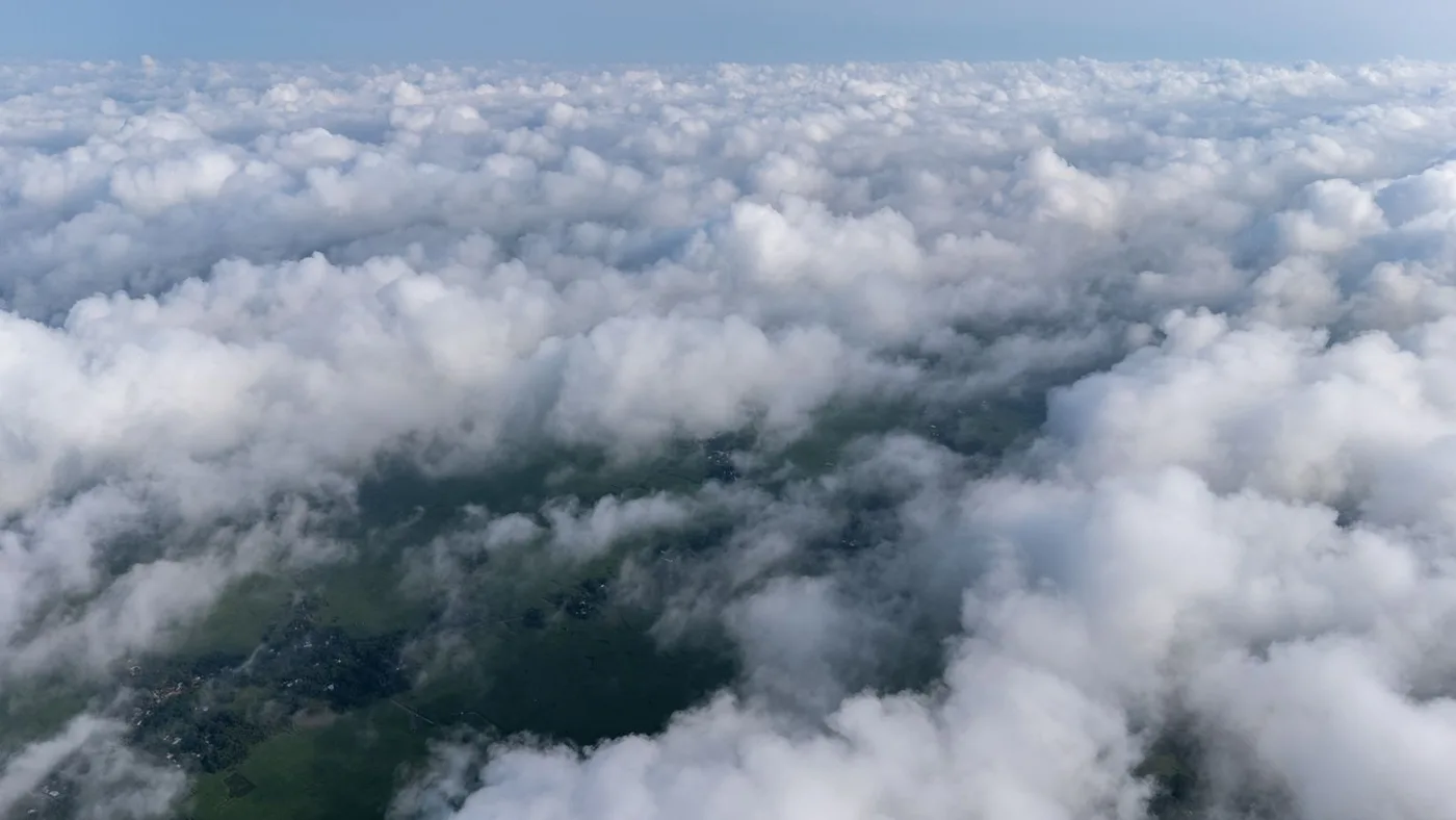
A scene reporting 0% cloud cover is not automatically a perfect image. Cloud cover algorithms flag dense, opaque cloud, but they do not always catch every source of atmospheric interference that can still degrade a scene:
- Haze. A thin, hazy atmosphere softens contrast and muddies color without registering as cloud in the metadata.
- Thin cirrus. High, wispy cirrus cloud can be nearly transparent to the eye in a preview thumbnail while still degrading fine detail.
- Smoke and dust. Wildfire smoke or a dust storm can obscure a scene the same way cloud does, but from a completely different cause.
- Cloud shadow. Even where the cloud itself sits outside your AOI, the shadow it casts can fall across your site and darken it in the same pass.
None of this shows up reliably in a single cloud cover number, which is exactly why the scene preview matters as much as the filter itself. A quick visual check over your AOI catches haze, shadow, and thin cirrus that the metadata alone would never flag.
How to search an archive for low cloud cover satellite imagery
A reliable archive search stacks several filters together rather than relying on cloud cover alone. This is the order that consistently turns up the most usable results.
01. Define your area of interest
Draw or upload the exact polygon you need imagery for, rather than searching a whole city or region. A tighter AOI makes every downstream filter, including cloud cover, far more meaningful, since the platform can check cloud coverage against your actual footprint instead of the full scene.
02. Choose a realistic date range
A narrow, single-week window can rule out an otherwise perfect scene just because the satellite passed on the wrong day. Widening the window, from a two-week search to a two-month one, dramatically increases the odds of finding a low cloud pass without changing anything else about your requirements.
03. Set a maximum cloud cover threshold
Start around 10% to 20% rather than 0%, unless the project genuinely cannot tolerate any cloud at all. This keeps the results list wide enough to compare, instead of filtering out scenes that would have worked fine after a preview check.
04. Select the resolution you need
Cloud cover and resolution interact with satellite revisit frequency together, a sensor with a tighter resolution requirement may pass less often, narrowing your effective choice of low cloud dates. Set resolution based on what the analysis genuinely requires, not the highest number available.
05. Compare scene previews over your AOI
This is the step that actually confirms usability. Zoom the preview thumbnail to your polygon specifically, not just the full scene, and check for haze, thin cirrus, and cloud shadow as well as obvious cloud.
06. Check AOI coverage, not just scene footprint
Confirm the scene actually covers your full area of interest edge to edge. A scene can be well within your cloud threshold and still clip a corner of your site if the footprint does not fully overlap it.
07. Check the off-nadir angle
A steep off-nadir angle changes viewing geometry and can introduce building lean or terrain distortion, which matters for measurement-heavy applications even when the scene is perfectly clear of cloud.
08. Compare price and order
Once you have a shortlist of clear, correctly dated, correctly resolved scenes, price is usually the final filter. Archive imagery is typically the cheaper and faster route compared with commissioning a new capture, which is covered in more detail below.
How much cloud cover is acceptable for your project?
Cloud tolerance is not one-size-fits-all, it depends heavily on how the imagery will be used and how large the AOI is relative to typical scene footprints.
| Application | Typical acceptable cloud cover | Why |
|---|---|---|
| Mapping and surveying | 0-10% | Needs consistently sharp detail across the entire mapped footprint |
| Agriculture monitoring | 10-20% | Usable once the specific field is confirmed clear in the preview |
| Mining and exploration | 10-20% | A lease boundary is often small enough to stay clear even in a cloudier scene |
| Construction monitoring | 0-15% | Repeated monitoring benefits from consistently low cloud across the same footprint each pass |
| Oil and gas infrastructure | 10-20% | Specific tanks or pipeline segments need visibility, not the entire scene |
| Urban planning | 0-15% | Rooftops and infrastructure need to be resolvable across a large footprint |
| Disaster response | Whatever is available | Speed matters more than a clean threshold, and SAR often fills the gap where optical cannot |
What to do when there is no suitable cloud-free image in the archive
Sometimes every scene in the archive over your date range and AOI comes back too cloudy to use. A few adjustments, in order, usually solve this before a new capture is needed:
- Relax the cloud threshold. Move from 5% to 10%, then to 20%, and re-check the previews at each step rather than assuming a higher number is automatically unusable.
- Expand the date range. A two-week window that returns nothing can turn into several usable options once stretched to two or three months, especially outside a region's rainy season.
- Adjust resolution or off-nadir tolerance. If the analysis allows it, accepting a slightly wider off-nadir angle or a different sensor can unlock a pass that would otherwise be excluded.
- Consider a different sensor type. Switching part of the analysis to SAR, covered below, sidesteps the cloud problem entirely for the pass in question.
- Order new satellite tasking. When the archive genuinely has nothing suitable, tasking a new capture lets you specify an acceptable cloud cover threshold in advance rather than accepting whatever the archive happened to record. See our full archive versus tasking guide for how to decide between the two.
Archive imagery vs new satellite tasking
| Factor | Archive imagery | New tasking |
|---|---|---|
| Availability | Already captured, ready to review immediately | Requires a future collection window |
| Speed | Usually faster, no waiting for a satellite pass | Slower, dependent on orbit and weather at capture time |
| Cost | Usually lower | Usually higher |
| Cloud conditions | Fixed at whatever was captured historically | A cloud cover threshold can be requested in advance |
| Date | Fixed to a past acquisition | Flexible within the requested collection window |
Archive search should almost always be the first move, since it is faster and cheaper whenever a clear enough scene already exists. New tasking becomes the right call once relaxing the cloud threshold, widening the date range, and adjusting resolution have all been tried and the archive still has nothing that meets the project's real requirements.
Does cloud cover matter for SAR satellite imagery?

Optical and multispectral sensors both depend on reflected visible or near-infrared light, so clouds block them directly. Synthetic aperture radar, or SAR, works differently, it sends its own microwave signal down and measures what bounces back, and that signal passes through cloud largely unaffected. That makes SAR a genuinely useful fallback for cloud-persistent regions and time-critical monitoring, including maritime and disaster response applications where radar's day-night, all-weather advantage matters most.
SAR is not a universal replacement for optical imagery, it measures surface texture and moisture rather than true color, and interpreting it takes different expertise. For a project already struggling to find a clear optical scene in the archive, adding a SAR option is often the fastest way to get usable data on the date that actually matters, rather than waiting out the weather.
Cloud-limited optical archive? Compare SAR options too
Search archive optical, multispectral, and SAR imagery side by side, or task a new capture with your own cloud cover threshold, all from the same portal.
Cloud cover is only one archive search filter
Cloud cover gets the most attention because it is the filter most likely to rule a scene out entirely, but a genuinely usable archive image depends on several factors working together.
| Factor | Why it matters |
|---|---|
| Haze and cloud shadow | Can degrade a scene even when the reported cloud percentage is low |
| Acquisition date | Determines how current the image is relative to your project timeline |
| Resolution (GSD) | Sets the level of detail visible, from broad area context to individual features |
| Off-nadir angle | Affects viewing geometry, building lean, and measurement accuracy |
| AOI coverage | Confirms the scene footprint actually overlaps your full area of interest |
| Sensor type | Optical, multispectral, and SAR each suit different conditions and analysis goals |
| Sun angle | Affects shadow length and illumination, especially at high latitudes |
| Price | Archive scenes vary in cost by sensor, resolution, and exclusivity |
A practical example, finding a low cloud image of a mining site
Consider a 20 km² mining operation that needs a satellite image captured between January and March, at 50 cm resolution or better, with the site itself confirmed clear of cloud. Rather than searching broadly, the workflow narrows fast, upload the exact lease boundary as the AOI, set the date range to the full January to March window rather than a single month, set resolution to 50 cm or finer, and set an initial maximum cloud cover around 20% rather than 0%. That search typically returns several candidate scenes. From there, open the preview on each one zoomed to the lease boundary specifically, discard any where cloud or shadow actually falls on the site regardless of the scene-wide percentage, check that the remaining candidates fully cover the boundary edge to edge, and compare price across whatever is left. In most cloud-affected regions, this produces at least one usable scene without ever needing to task a new capture.
Key takeaways
- Cloud cover is the percentage of a satellite scene's entire footprint hidden by cloud, not necessarily the percentage covering your specific area of interest.
- Average global cloud cover sits around 67%, which is exactly why searching an archive of past passes works better than relying on a single capture.
- A working default is a 10% to 20% maximum cloud cover filter combined with a preview check over your AOI, rather than insisting on a 0% scene.
- Haze, thin cirrus, and cloud shadow can degrade a scene even when the reported cloud percentage is low, which is why the preview matters as much as the filter.
- When the archive has nothing suitable, relaxing the cloud threshold, widening the date range, or switching to SAR usually solves it before a new tasking order is needed.
Frequently asked questions
What is cloud cover in satellite imagery?
Cloud cover in satellite imagery is the percentage of a scene's total footprint obscured by cloud at the moment it was captured. It is calculated automatically and included in the scene's metadata alongside acquisition date, resolution, and sensor, and it is one of the primary filters used when searching an imagery archive.
What percentage of cloud cover is acceptable for satellite imagery?
A working range for most high-resolution optical projects is 10% to 20% maximum cloud cover, combined with a preview check over the specific area of interest. Mapping and construction monitoring often need closer to 0-10%, while agriculture, mining, and oil and gas projects can often work with 10-20% since the site itself may stay clear even in a cloudier scene.
Is 10% cloud cover good for satellite imagery?
Yes, in most cases. A scene at 10% cloud cover is generally usable, especially once the preview confirms the cloud is not sitting over your specific area of interest. The scene-wide percentage alone does not guarantee your exact site is clear, so checking the preview remains an important step even at this level.
Does cloud cover percentage apply to my whole area of interest?
No. Cloud cover percentage describes the entire satellite scene footprint, which is often far larger than a specific area of interest. A scene reported at 8% cloud cover could leave your site completely clear, or the cloud could sit directly over it, since the metadata figure does not distinguish between the two outcomes.
How do I find cloud-free satellite imagery in an archive?
Define a precise area of interest, widen the date range rather than searching a single narrow window, set a maximum cloud cover filter around 10-20% rather than 0%, and inspect the scene preview zoomed to your AOI before ordering. If nothing suitable turns up, relax the cloud threshold further or expand the date range before considering new satellite tasking.
Can I buy satellite imagery with 0% cloud cover?
Yes, fully cloud-free scenes exist in most archives, though they are less common in persistently cloudy regions such as tropical lowlands, where studies have found only a small fraction of scenes come back completely clear. Widening the date range significantly improves the odds of finding a genuinely 0% cloud cover scene.
Does SAR satellite imagery work through cloud cover?
Yes. Synthetic aperture radar sends its own microwave signal and measures the return, rather than relying on reflected sunlight, so cloud cover largely does not block it. This makes SAR a useful option for persistently cloudy regions or time-critical monitoring where an optical archive search cannot find a clear scene.
What should I do if there is no cloud-free imagery in the archive?
First relax the maximum cloud cover threshold and re-check previews, then widen the date range, then consider a different resolution or off-nadir tolerance, and consider SAR imagery as an alternative sensor type. If none of those produce a usable scene, new satellite tasking lets you specify an acceptable cloud cover threshold for a future capture.
Can I filter satellite imagery by cloud cover percentage?
Yes, a maximum cloud cover filter is a standard search option in most satellite imagery archive tools, alongside date range, resolution, and area of interest. Setting this filter narrows results to scenes at or below the chosen cloud cover percentage across the scene's footprint.
Sources and further reading
- NASA Earth Observatory, MODIS-based global cloud cover analysis, 2002-2015
- NASA ISCCP (International Satellite Cloud Climatology Project), cloud classification methodology
- Peer-reviewed Sentinel-2 cloud cover study, lowland tropical forest region, Brazil
- Peer-reviewed study on combined Sentinel-1 SAR and Sentinel-2 optical land-cover classification accuracy
- ESA Copernicus, Sentinel-1 SAR and Sentinel-2 multispectral mission specifications
Stop guessing whether a scene is actually clear
Draw your AOI, set your cloud cover, date, and resolution filters, and preview every candidate scene before you buy, archive imagery or new tasking, optical or SAR, all from one search.

