The Real Benefits and Trade-Offs of Remote Sensing Today
On this page
- Key advantages of remote sensing
- 01. Unmatched speed, scale, and efficiency
- 02. Lower cost and higher ROI than field-first exploration
- 03. All-weather, day-and-night coverage with radar
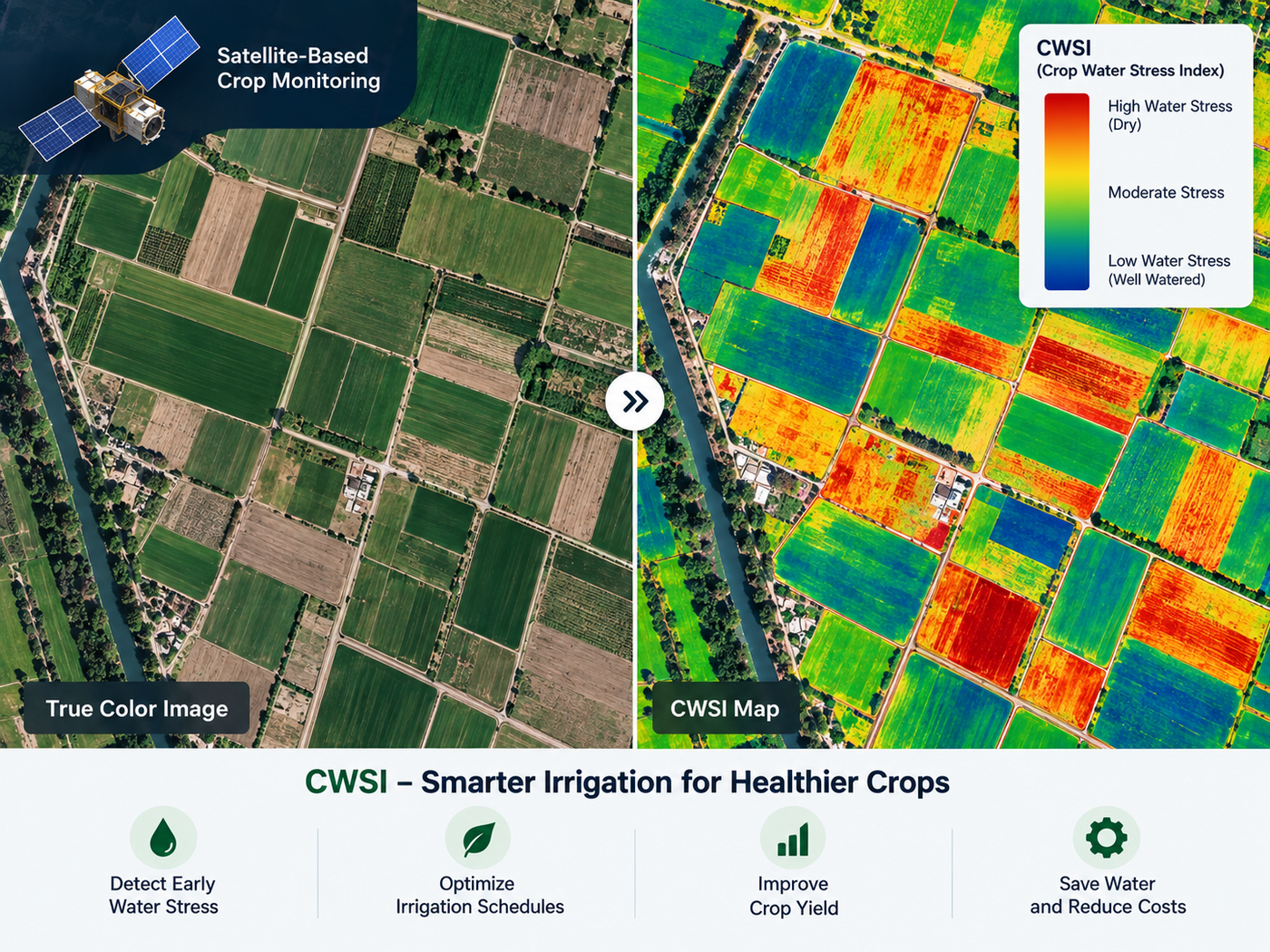
- 04. Chemical and material fingerprinting with hyperspectral sensors
- 05. Safer operations and millimeter-level risk detection
- 06. AI-powered predictive accuracy
- What AI now makes possible in remote sensing
- Where these advantages show up across industries
- Disadvantages of remote sensing and how they're overcome
- Key takeaways
- Frequently asked questions
- Sources and further reading
A practical guide to the advantages and disadvantages of remote sensing, how satellite and radar sensors cut cost and turnaround time against field surveys, why an optical sensor's biggest weakness gets solved by all-weather radar, what AI now does with the resulting data, and where the real trade-offs still sit.
Quick answer
Remote sensing's core advantages are speed, cost, and reach. A single high-resolution satellite can add well over a million square kilometers of new coverage a day, radar sensors keep working through cloud, fog, and total darkness, hyperspectral sensors reveal chemical and material differences invisible to the eye, and AI now turns raw imagery into classification, yield, and risk outputs at well above 90% accuracy in production workflows. The trade-offs are real but narrower than they used to be, since fine resolution and hyperspectral tasking cost more than wide-swath data and heavy cloud still blocks optical sensors specifically, but pairing radar with optical, tiered pricing, and AI-automated processing closes most of that gap, which is why the benefits outweigh the drawbacks for the large majority of monitoring use cases.
Key advantages of remote sensing
Satellite remote sensing replaces slow, expensive, one-site-at-a-time field surveys with repeatable, wide-area data collection, and each advantage below compounds with the others rather than standing alone.
01. Unmatched speed, scale, and efficiency
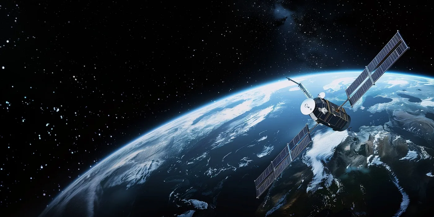
A single SuperView Neo-class satellite adds roughly 1.5 million km² of new collection capacity a day, more ground than a field survey crew could realistically walk in a season, and the busiest constellations revisit the same area daily. Cloud delivery pipelines built to process around 50 TB of imagery a day turn a tasked capture into an analysis-ready file in about 1 to 1.5 hours, with command uploads reaching a satellite within roughly 3 hours globally, fast enough to inform a same-day decision instead of waiting on a scheduled site visit.
02. Lower cost and higher ROI than field-first exploration
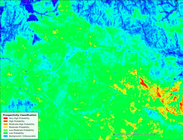
Screening a target area from orbit before sending anyone to the ground cuts the number of site visits down to the ones actually worth making. AI-vetted mineral exploration through a platform like Khaza'in runs $12 to $20 per km² depending on area size, a fraction of blind greenfield drilling costs, and the same logic drives variable-rate seeding in agriculture and pre-flagged inspection routes in infrastructure monitoring, spending field time only where the data already points to a real find.
03. All-weather, day-and-night coverage with radar
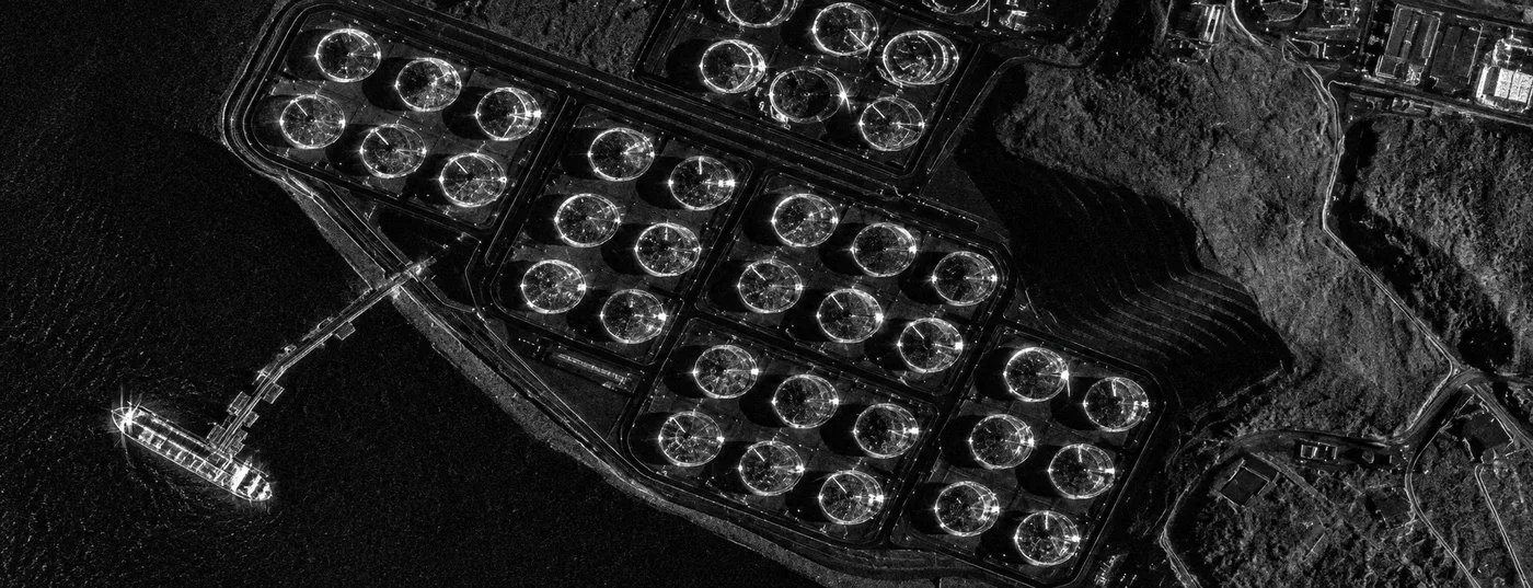
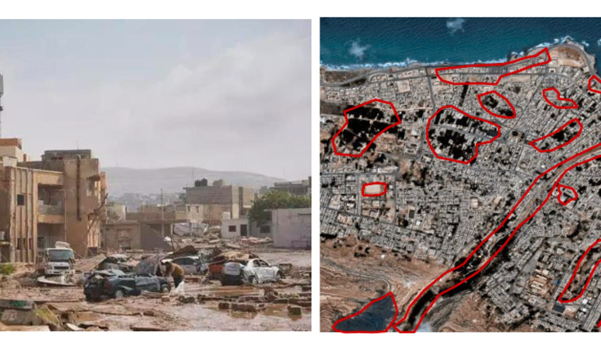
Active Synthetic Aperture Radar (SAR) sensors like GF-3 and the L-band LT-1 constellation generate their own signal instead of relying on reflected sunlight, so they penetrate heavy cloud cover, fog, smoke, and complete darkness. That keeps monitoring running 24/7 through a monsoon season, a wildfire's smoke plume, or a disaster response that can't wait for clear skies.
04. Chemical and material fingerprinting with hyperspectral sensors
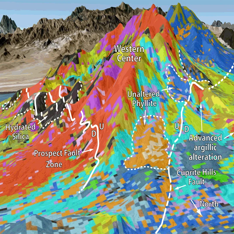
Hyperspectral sensors such as GF-5B's AHSI instrument capture 330 narrow bands across 400 to 2,500 nm, wavelengths the human eye can't see, to detect physical and chemical traits like plant chlorophyll stress, soil moisture, mineral alteration halos, and gas leaks. That is the same "surface chemistry" read that a mineral exploration platform turns into a ranked drill target, covered in full in our guide to how satellites detect minerals.
05. Safer operations and millimeter-level risk detection
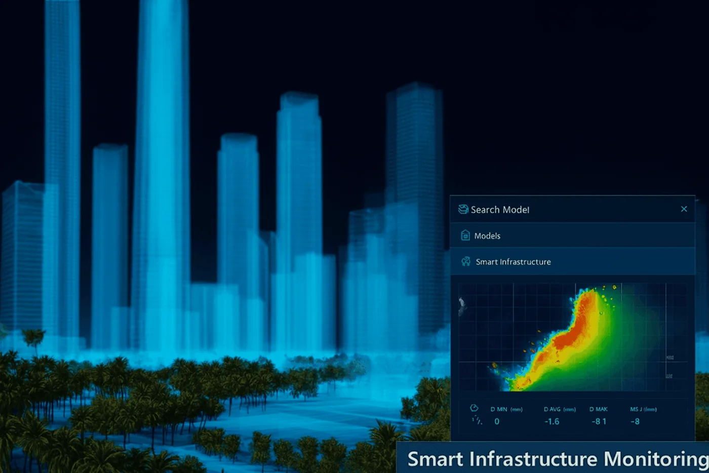
Contactless remote inspection means no one has to walk into a live blast zone, a flooded plant, or an unstable slope to get a first look. Interferometric SAR (InSAR) adds a second layer of protection by measuring ground and structural displacement down to 1 to 2 mm between passes, an early warning for tailings dams, bridges, pipelines, and urban foundations well before movement becomes visible on the surface.
06. AI-powered predictive accuracy
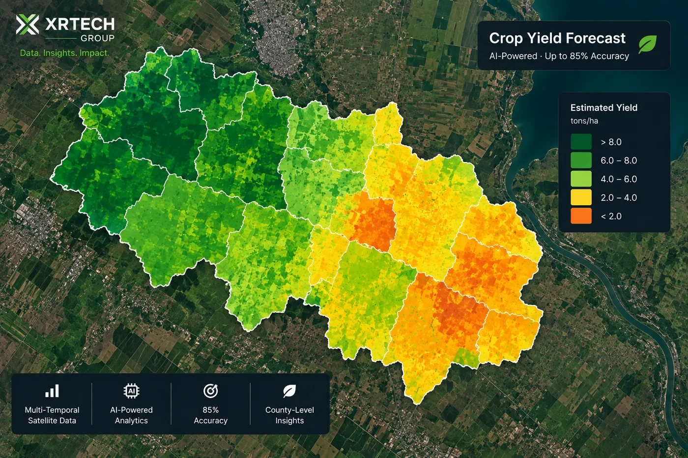
Deep learning models trained on multi-temporal imagery now classify crop type and land use at over 90% accuracy and forecast county-level crop yield at up to 85% accuracy well before harvest, numbers covered in depth in the AI section below rather than repeated here.

Want to see the turnaround for yourself?
Task new optical or SAR imagery over your area of interest and get an analysis-ready file back in as little as 1 to 1.5 hours, with a live price before you order.
What AI now makes possible in remote sensing
AI is the layer that turns a raw satellite pass into a decision instead of just a picture, and it has moved further in the past few years than most other parts of the pipeline.
- Automated feature extraction: deep learning pulls building footprints, roads, and 3D white models directly out of optical imagery, then feeds them into digital twins used for planning and traffic routing, the workflow behind our guide to tracking urban growth with satellite change detection.
- Crop and land-use classification above 90% accuracy: models trained on multi-season, multi-satellite time series now classify crop type and flag non-grain land-use change at better than 90% accuracy, detailed in our guide to how satellite imagery monitors crop growth.
- Yield forecasting around 85% accuracy at the county level: combining growth-stage tracking with ground-truth data produces regional yield estimates well before harvest, the same figure underpinning precision agriculture with satellite imagery.
- Fusion accuracy gains: combining SAR and optical imagery over a cloud-heavy tropical site reached 91.07% land-cover classification accuracy, versus 89.53% from optical data alone, proof that AI fusion adds real accuracy rather than just redundancy.
- Onboard AI cutting delivery time: BJ3N (Beijing-3B) runs detection models on the satellite itself, completing initial analytics before the image is even downlinked, part of what gets a finished map into a spray-decision window the same day.
- AI prospectivity ranking: the Khaza'in platform fuses spectral, structural, and geological layers into a single model that outputs ranked drill targets with GPS coordinates and confidence scores, verified against real deposits in West Africa, Tanzania, and Chile in our guide to hyperspectral mineral exploration.
What the numbers show
AI has moved remote sensing from raw imagery to production-grade decision data across agriculture, mining, and urban planning.
Accuracy of AI crop-type and land-use classification models trained on multi-satellite time series.
County-level crop yield forecasting accuracy from models combining growth tracking with ground-truth data.
Land-cover classification accuracy from AI fusion of SAR and optical imagery over a cloud-heavy site, versus 89.53% for optical alone.
Tasking-to-delivery time for a finished map when onboard AI processing runs before downlink.
Where these advantages show up across industries
The same underlying sensors and AI models serve very different jobs once they hit a specific industry.
| Industry | Advantage put to work | Typical application |
|---|---|---|
| Agriculture and forestry | Multispectral vegetation indices, AI yield models | Precision farming, crop health monitoring, deforestation alerts, see forestry canopy monitoring |
| Mining and energy | Hyperspectral fingerprinting, AI prospectivity ranking | Early-stage mineral discovery, tailings dam safety, pipeline leak checks, see how satellite imagery prevents mining accidents |
| Urban planning and construction | 3D elevation modeling, InSAR deformation monitoring | Construction progress tracking, smart-city digital twins, infrastructure health checks |
| Disaster management and defense | All-weather SAR, rapid tasking and delivery | Flood extent mapping, vessel monitoring, border surveillance, see mapping disaster response with radar |
Disadvantages of remote sensing and how they're overcome
None of the advantages above erase the real constraints of working from orbit instead of on the ground. What has changed is that most of these constraints now have a working fix, which is why they read as trade-offs to plan around rather than reasons to skip remote sensing altogether.
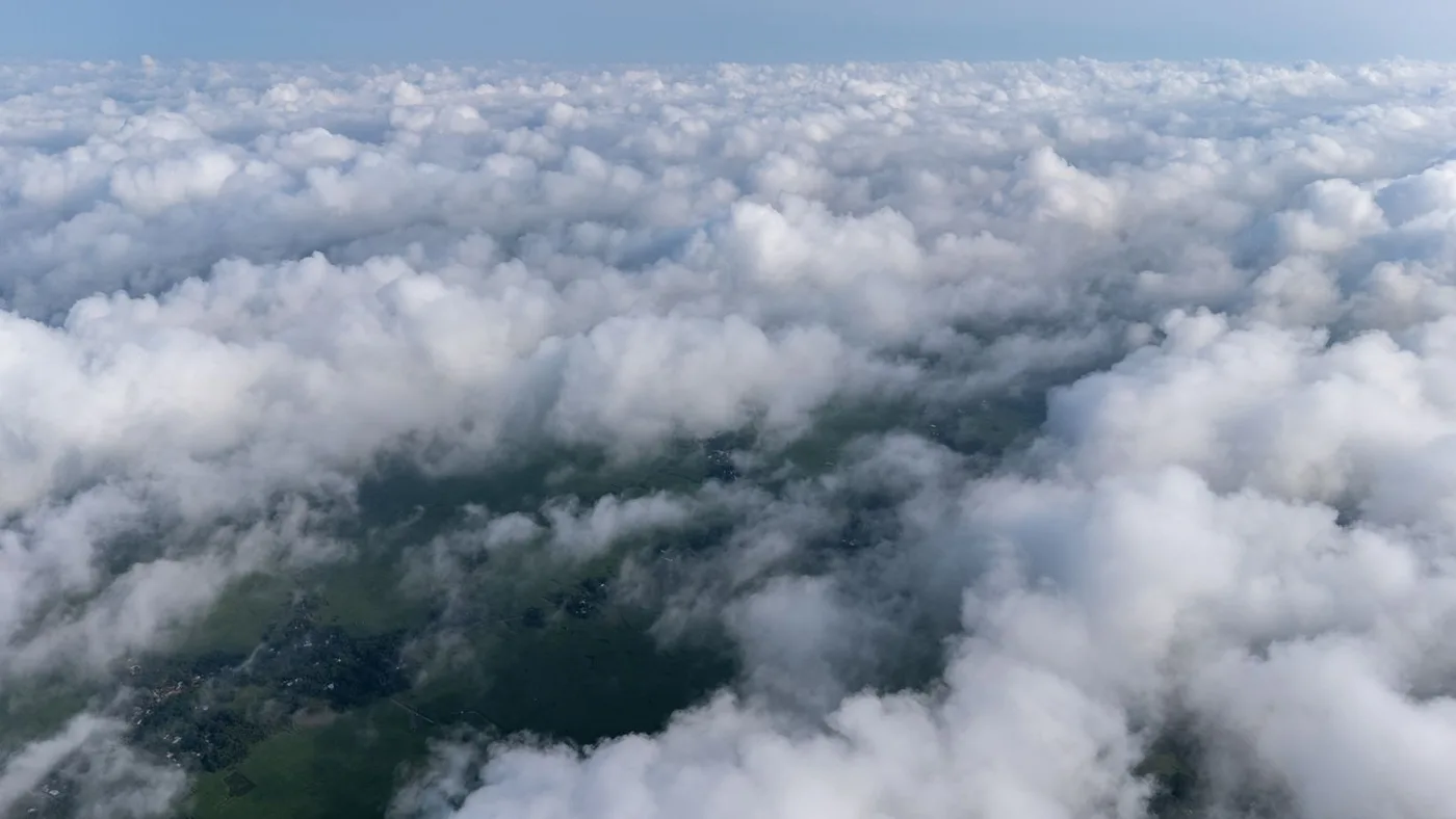
An optical satellite is a camera, and a camera needs light and a clear line of sight. Persistent cloud cover over a region can delay a usable optical capture by days or weeks during exactly the season, like monsoon flooding, that a monitoring program needs it most.
Sub-meter optical tasking and hyperspectral capture carry a real premium over wide-swath multispectral imagery, and a project that defaults to the highest resolution everywhere pays for detail it doesn't actually need for most of the area.
No single satellite maximizes resolution, swath width, and revisit cadence at once, a sensor built for 25 cm detail necessarily images a narrower strip less often than a wide-field sensor built for regional coverage.
A single tasking order can return gigabytes of raw sensor data that isn't directly usable, someone still has to orthorectify, calibrate, and classify it before it answers a real question.
A spectral signature or an AI classification is a strong probability, not a certainty, drilling a target or approving an insurance claim on imagery alone still carries real risk without some field confirmation.
Key takeaways
Key takeaways
- Remote sensing's biggest advantages are speed and cost, covering millions of square kilometers a day and screening a site before committing to an expensive field visit.
- All-weather SAR and InSAR solve what optical sensors alone can't, imaging through cloud, fog, and darkness while also measuring millimeter-scale ground and structural movement.
- AI has pushed classification accuracy above 90% and county-level yield forecasting to around 85%, turning raw imagery into a decision instead of just a picture.
- The main disadvantages, weather-dependent optical sensors, higher cost for fine resolution and hyperspectral data, the resolution-versus-coverage trade-off, heavy data volumes, and the need for ground-truth validation, all have a working fix in practice.
- Pairing sensor types, tiered pricing, and AI-automated processing is what makes the advantages outweigh the drawbacks for the large majority of monitoring use cases today.
Frequently asked questions
What are the main advantages of remote sensing?
Remote sensing covers vast areas quickly at a lower cost than field surveys, works through cloud, fog, and darkness using radar, detects chemical and material signatures invisible to the eye using hyperspectral sensors, and increasingly relies on AI to classify land use and forecast yield at well above 90% accuracy in many workflows.
What are the disadvantages of remote sensing?
The main drawbacks are that optical sensors can't see through cloud cover or darkness, fine resolution and hyperspectral tasking cost more than wide-swath data, a satellite can't maximize resolution, coverage, and revisit frequency all at once, large data volumes need real processing capacity, and some decisions still need ground-truth validation. Pairing radar with optical sensors, tiered pricing, multi-satellite constellations, and AI-automated processing addresses most of these in practice.
Can remote sensing work through clouds, fog, or at night?
Optical sensors can't, since they depend on reflected sunlight the same way a camera does. Synthetic Aperture Radar (SAR) generates its own signal and images through cloud, fog, smoke, and complete darkness, which is why most monitoring programs pair an optical tasking order with a SAR fallback.
How accurate is AI-based remote sensing today?
AI crop-type and land-use classification models trained on multi-satellite time series now exceed 90% accuracy in commercial deployments, county-level yield forecasts reach roughly 85% accuracy well before harvest, and fusing SAR with optical imagery has lifted land-cover classification accuracy as high as 91.07% on cloud-heavy test sites.
Is remote sensing cheaper than field surveys?
Yes, for most monitoring at scale. Screening an area from orbit before sending a team to the ground, at rates like $12 to $20 per km² for AI-vetted mineral exploration, cuts the number of site visits down to the ones a data layer already flagged as worth making, which is almost always cheaper than a blind field survey covering the same ground.
Which industries benefit most from remote sensing?
Agriculture and forestry use it for crop health and deforestation monitoring, mining and energy use it for mineral discovery and tailings dam safety, urban planning and construction use it for 3D modeling and structural deformation monitoring, and disaster management and defense use it for flood mapping, vessel monitoring, and border surveillance.
Sources and further reading
- eoPortal and SpaceNews: SuperView Neo-1 collection capacity and resolution specifications
- China Siwei and CNSA/CRESDA: GF-3, LT-1, and GF-5B AHSI sensor specifications
- USGS: Cuprite, Nevada hyperspectral alteration mapping
- Peer-reviewed study on combined SAR and optical land-cover classification accuracy
- XRTech Group: Khaza'in AI prospectivity platform methodology and case studies
Ready to put remote sensing to work?
Search live satellite and SAR imagery over your area of interest, compare resolution and price, and order archive or new tasking directly, no account needed for a first estimate.