UK SATELLITE IMAGES | SATELLITE MAP OF ENGLAND & GREAT BRITAIN
UK Satellite Images: Satellite View of England, Scotland, Wales & Northern Ireland
Coordinates: 54.7024°N, 3.2766°W
Explore satellite images of the United Kingdom and search a live satellite map of England, Scotland, Wales, and Northern Ireland through the interactive imagery portal below. View free public imagery for a broad, whole-country look, or search commercial archive and new-tasking imagery down to 25cm resolution from providers like SuperView Neo and 21AT for detail on a specific building, site, or stretch of coastline. Availability and acquisition dates depend on the satellite, the location, and cloud cover.
Yes. The UK is fully covered by both free and commercial satellite imagery, viewable directly through the interactive satellite map and search portal on this page. Free public archives such as Sentinel-2, Landsat, and NASA/NOAA's MODIS and VIIRS instruments suit a broad, whole-country view, while commercial providers like 21AT and SuperView Neo resolve down to 25cm, sharp enough to identify individual buildings and sites anywhere in England, Scotland, Wales, or Northern Ireland. Satellite imagery isn't a live video feed; each image represents a specific pass over Great Britain, not continuous footage, and the UK's frequent cloud cover means a genuinely clear, whole-country picture is less common than in drier climates.
Satellite View of the UK
Explore the satellite view of the UK using the interactive satellite imagery portal below. The portal lets you pan and zoom across England, Scotland, Wales, and Northern Ireland, and investigate locations including London, Manchester, Birmingham, Edinburgh, Cardiff, Belfast, and the wider British countryside and coastline. Use the map to explore an area, then check what archive and new-tasking imagery is available for it, with an instant price estimate before you commit to anything.
Opening imagery workspace…
Satellite Map of the UK: How to Use This Tool
The map above is a working satellite map of the UK, not just a viewer: you can search any location, check what imagery dates are available, and request archive or newly tasked imagery for it, all in the same workspace. Use it to view and analyze the latest and historical satellite images of the UK in a few steps:
Search or pan to your exact area within the UK using the map's location search bar, from central London to the Scottish coastline.
Draw a rectangle or polygon over your area of interest, or upload a boundary file (KML, KMZ, or zipped Shapefile).
Choose your capture mode, archive imagery for an instant search of existing captures, or new tasking for a fresh satellite pass, and set your preferred resolution, date range, and maximum cloud cover.
Review the available scenes for your area, along with an instant, transparent price estimate, so you know your high-resolution satellite image cost before you commit.
Submit your request to download archive imagery or order new tasking. Our team confirms details, sends you a price quote, and delivers your imagery.
Commercial Satellite Image Samples From England and Wales
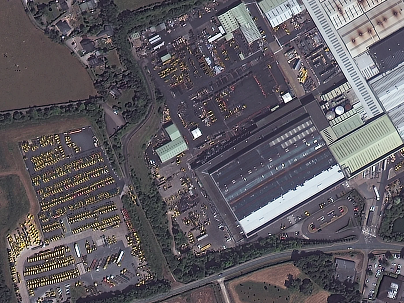
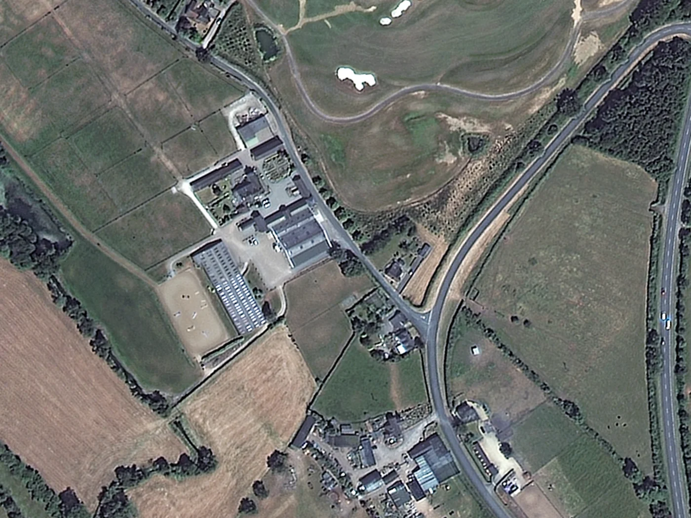
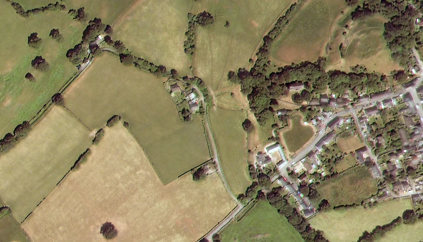
The three images below are real 50cm commercial satellite images, not free public data, captured by SuperView-1, part of the same commercial satellite family as SuperView Neo, one of the providers available to search and task through the portal above. This is the actual building- and vehicle-scale detail a paid archive search or new tasking order delivers anywhere in Britain, a useful comparison against the free public-archive samples further down this page.
A SuperView-1 satellite image at 50cm natural-color resolution over the JCB heavy-machinery plant in Rocester, Staffordshire, England, individual buildings, yards, and parked equipment clearly resolved.
Satellite: SuperView-1 · Resolution: 50cm
A 50cm SuperView-1 satellite image of farmland and a golf course on the outskirts of Rocester, England, showing field boundaries, buildings, and course features at commercial resolution.
Satellite: SuperView-1 · Resolution: 50cm
A 50cm SuperView-1 satellite image of the village of New Radnor in Powys, Wales, close to the England border, individual houses, gardens, and field patterns distinguishable at this resolution.
Satellite: SuperView-1 · Resolution: 50cm
Free Sample Satellite Images of the UK
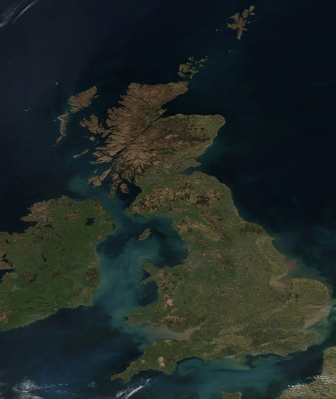
The four images below are free, publicly available samples from NASA and NOAA, shown here at 250m to 375m resolution, a useful contrast with the real 50cm commercial SuperView-1 samples above. They are not what you get from a paid order: commercial imagery from 21AT and SuperView Neo, searchable and purchasable through the portal above, resolves down to 25cm, sharp enough to make out individual buildings and vehicles rather than just coastline and cloud.
A rare cloud-free satellite image of Great Britain, Northern Ireland, and Ireland, captured by the VIIRS instrument on the Suomi NPP satellite, April 2, 2025. Imagery courtesy of NASA Worldview (NASA/NOAA).
Captured: April 2, 2025 · Satellite: Suomi NPP (VIIRS) · Resolution: 375m
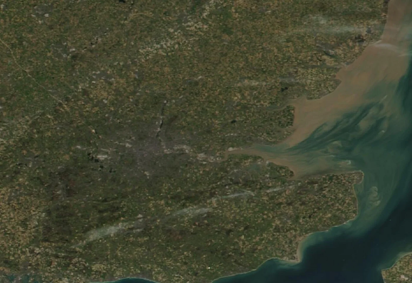
A closer VIIRS crop over London and the Thames Estuary, showing the capital's grey urban footprint and sediment carried out into the North Sea, April 2, 2025. Imagery courtesy of NASA Worldview (NASA/NOAA).
Captured: April 2, 2025 · Satellite: Suomi NPP (VIIRS) · Resolution: 375m
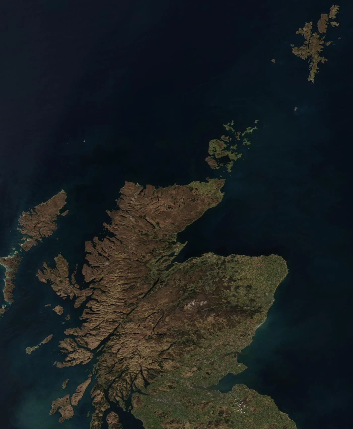
A VIIRS crop over the Scottish Highlands and the Northern Isles, showing the mountainous west coast, Orkney, and Shetland, April 2, 2025. Imagery courtesy of NASA Worldview (NASA/NOAA).
Captured: April 2, 2025 · Satellite: Suomi NPP (VIIRS) · Resolution: 375m
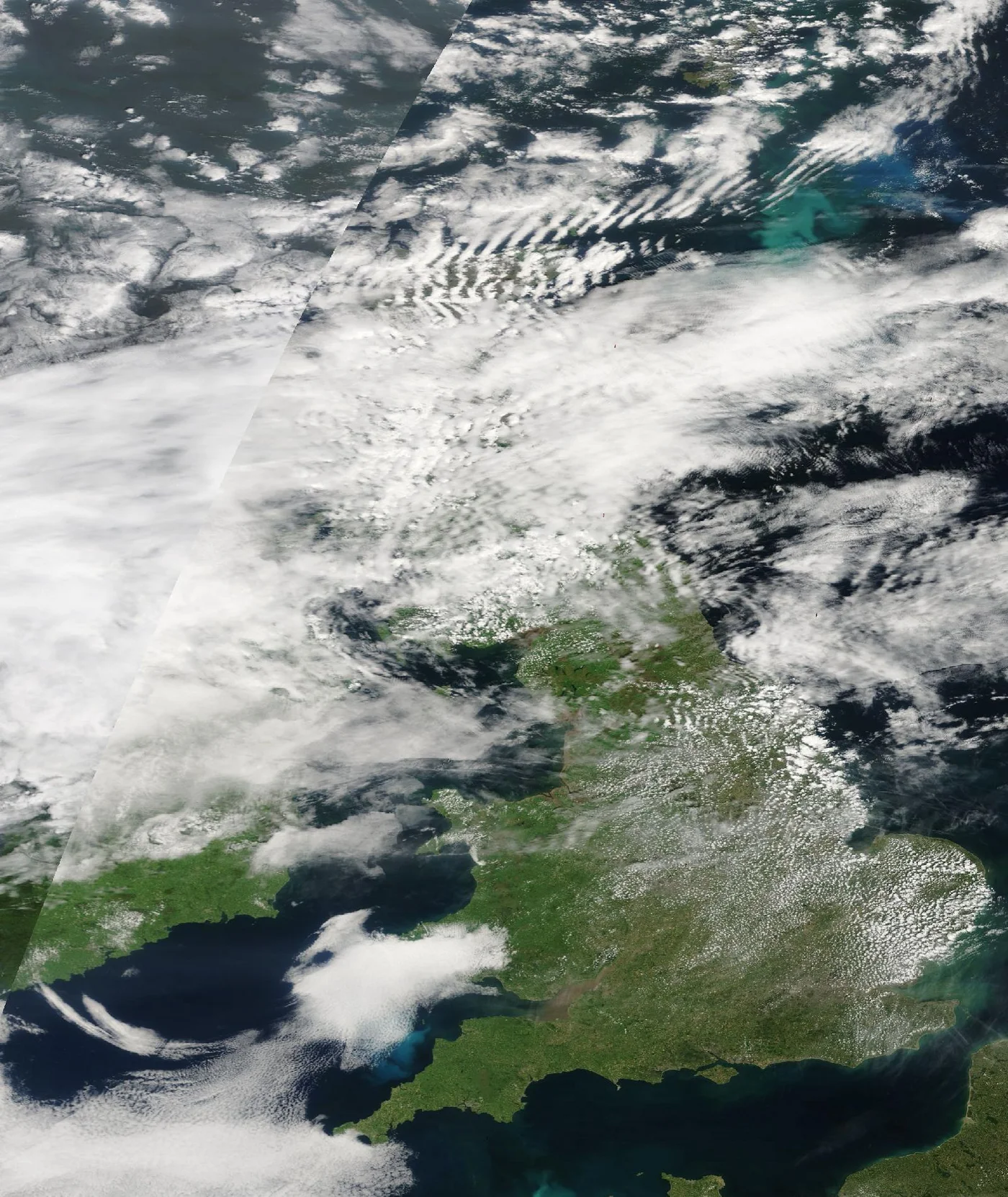
A MODIS Terra true-color image from June 18, 2025, showing the more typical view: England and Wales partly hidden under cloud, a good illustration of why radar imagery matters for the UK. Imagery courtesy of NASA Worldview (NASA).
Captured: June 18, 2025 · Satellite: Terra (MODIS) · Resolution: 250m
Satellite Images of England
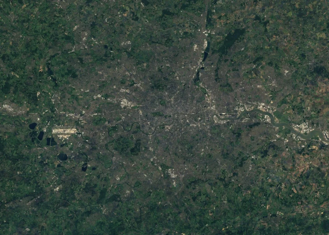
England spans from the dense streets of Greater London to the industrial Midlands, the arable belt of East Anglia, and a long southern coastline. Commercial imagery resolves individual streets and buildings across London, Manchester, Birmingham, Liverpool, and Bristol, while free archive data is enough to track farmland, woodland, and coastal change across the wider English countryside. The Sentinel-2 image below shows Greater London and the River Thames winding through the capital.
A Sentinel-2 satellite image of Greater London, England, showing the River Thames winding through the capital out toward the M25 orbital motorway. Cloud-free composite built from ESA Copernicus Sentinel-2 data via the EOX s2cloudless global mosaic.
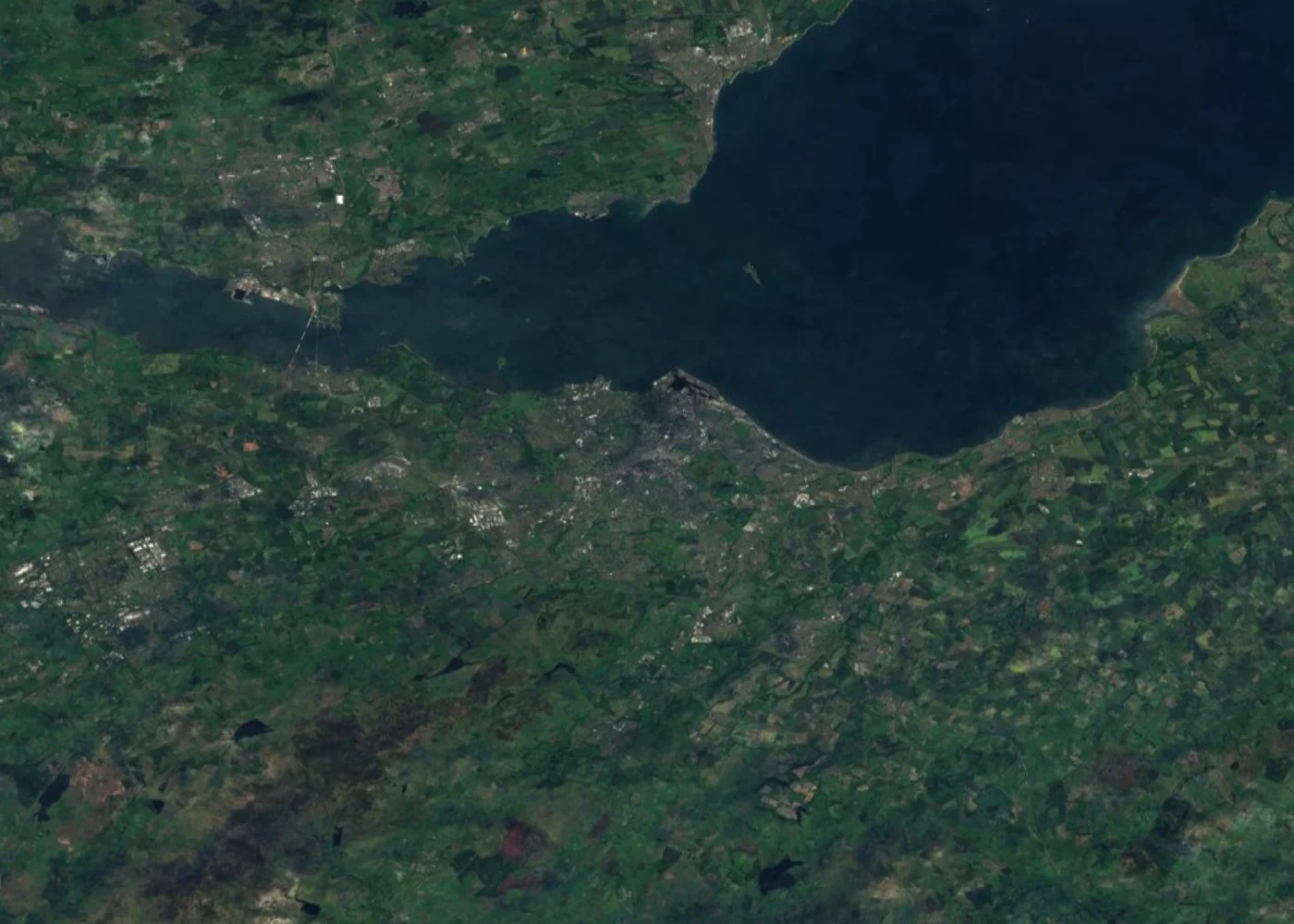
Scotland's satellite coverage runs from Edinburgh and Glasgow's Central Belt to the Scottish Highlands, Loch Ness, and the remote island groups of Orkney and Shetland. The contrast between Scotland's dense central cities and its sparsely populated north shows up clearly even in free-resolution imagery, and commercial imagery adds building-level detail for Scottish infrastructure and land projects. The Sentinel-2 image below shows Edinburgh on the south shore of the Firth of Forth.
A Sentinel-2 satellite image of Edinburgh, Scotland, on the south shore of the Firth of Forth. Cloud-free composite built from ESA Copernicus Sentinel-2 data via the EOX s2cloudless global mosaic.
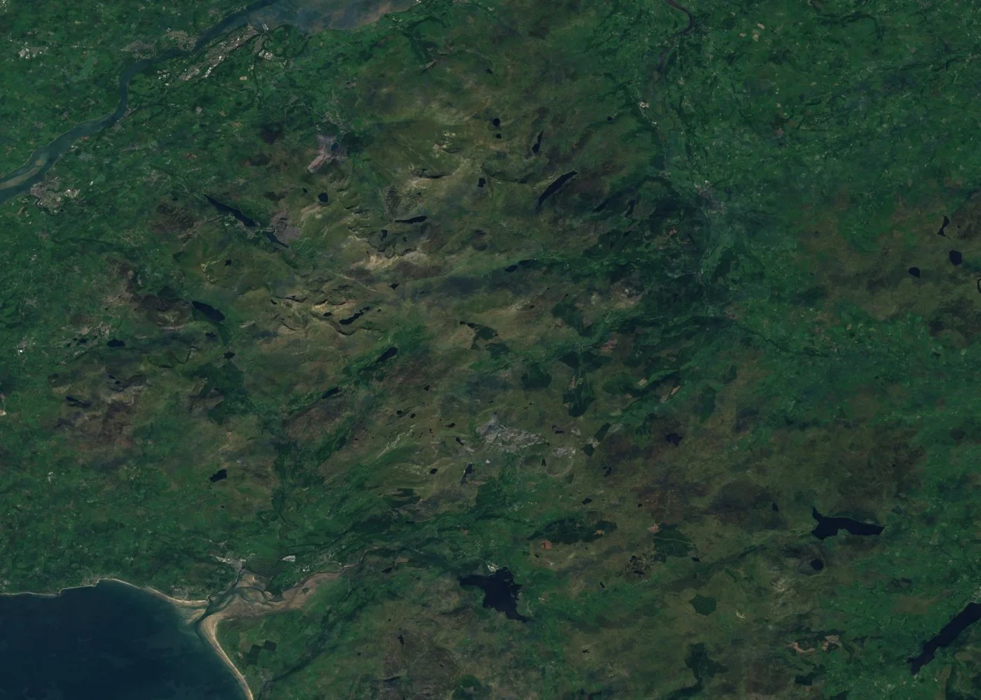
Wales's satellite coverage runs from Cardiff and Swansea on the south coast, up through the Brecon Beacons, and into the mountains and lakes of Snowdonia (Eryri) National Park in the north. Commercial imagery, including the New Radnor sample shown further up this page, resolves individual houses and field boundaries in Welsh towns and villages, while free archive imagery works well for tracking upland land cover and the length of the Welsh coastline. The Sentinel-2 image below shows the Snowdonia (Eryri) mountains and lakes.
A Sentinel-2 satellite image of the Snowdonia (Eryri) mountains and lakes in North Wales. Cloud-free composite built from ESA Copernicus Sentinel-2 data via the EOX s2cloudless global mosaic.
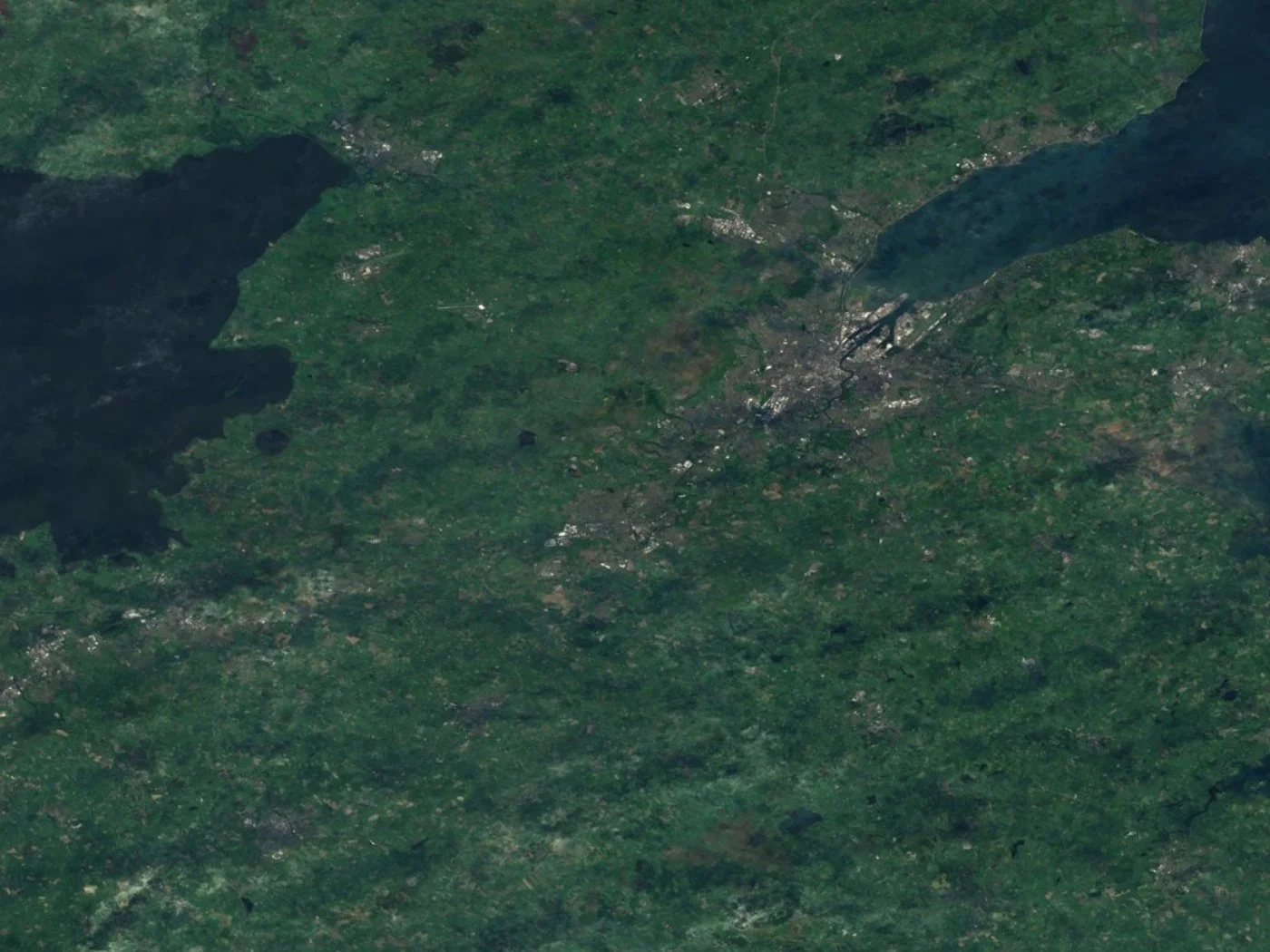
Northern Ireland's satellite imagery covers Belfast and Belfast Lough, the Causeway Coast, and a rural landscape of small fields and drumlin hills around Lough Neagh, the largest lake in the UK. Commercial imagery resolves Belfast's docks, shipyards, and street grid in building-level detail, while free imagery works well for tracking land-cover change across Northern Ireland's farmland and coastline. The Sentinel-2 image below shows Belfast on Belfast Lough, with Lough Neagh visible to the west.
A Sentinel-2 satellite image of Belfast, Northern Ireland, on Belfast Lough, with Lough Neagh visible to the west. Cloud-free composite built from ESA Copernicus Sentinel-2 data via the EOX s2cloudless global mosaic.
Free UK Satellite Imagery and Mapping Data From Government Sources
Alongside the international free archives already covered on this page, Sentinel-2, Landsat, and NASA/NOAA's MODIS and VIIRS instruments, the United Kingdom also runs its own national platforms for free geospatial and aerial mapping data. These British government sources won't replace a genuine high-resolution satellite image of the UK, but they're a useful complement for anyone who also needs authoritative basemap, elevation, or environmental data layered underneath the imagery.
Ordnance Survey (OS) Open Data
Ordnance Survey is Great Britain's national mapping agency, and its OS Open Data programme is the best-known free source of British map data, though it's worth knowing upfront that OS's sharpest aerial photography, the 25cm OS MasterMap Imagery Layer, is a separate licensed product rather than part of the free tier. What OS Open Data does provide at no cost is authoritative vector and terrain data covering all of England, Scotland, and Wales, the kind of basemap layer that pairs naturally underneath the satellite imagery on this page.
Free topographic and street-level vector mapping across the whole of Great Britain, from OS OpenMap Local down to small-scale overview maps
OS Terrain 50 and OS Terrain 5 digital elevation models, useful for terrain and viewshed analysis alongside a satellite image of the UK
Boundary-Line administrative, postcode, and constituency boundary data, handy for clipping a British area of interest to an exact council or region
Released under the Open Government Licence and downloadable directly from the OS Data Hub, with no registration barrier
A strong basemap companion to the commercial and free satellite imagery searchable through the portal above, rather than a substitute for it
DEFRA Data Services Platform
The Department for Environment, Food & Rural Affairs (DEFRA) operates a Data Services Platform that hosts England's national LIDAR archive alongside a wide range of environmental and agricultural datasets, some of them cross-referenced against Copernicus Sentinel data. It's one of the most useful free sources for anyone working on English flood risk, land use, or agricultural land, going a step further than raw satellite imagery alone.
National LIDAR elevation data covering roughly 70% of England, most of it at 1m resolution with select floodplain, coastal, and urban blocks surveyed as fine as 25cm
Flood risk and floodplain mapping built from that same LIDAR-derived terrain data, refreshed on a rolling quarterly survey cycle
Land use, soil, and agricultural statistics that complement Sentinel-2-based crop and land-cover monitoring across English farmland
Water quality and river catchment monitoring data covering England's waterways and coastline
Free government data published under an open licence, with no account needed to browse or download
Scotland's Spatial Data
Scotland's Spatial Data is the Scottish Government's own geospatial portal, and it fills a gap the England-focused sources above leave open, dedicated aerial photography and mapping data for Scotland specifically, rather than Great Britain as a whole.
Continuous 25cm aerial photography covering the whole of Scotland, based on a survey programme running since 2008
Sharper 12.5cm aerial imagery over Scotland's cities and other densely populated areas
Land cover and habitat mapping supporting environmental monitoring across the Scottish Highlands, islands, and Lowlands
Built to sit alongside Ordnance Survey's Great Britain-wide datasets rather than duplicate them, filling in Scotland-specific detail
Free to access through the Scottish Government's own spatial data portal, spatialdata.gov.scot
Satellite Map Coverage Across the UK
High-resolution satellite images and maps of the UK are available from multiple commercial constellations and free public archives, so coverage isn't limited to a single sensor or a single date. Our satellite imagery coverage extends across every nation and region of the UK, from Greater London, the South East, and the South West of England, through the Midlands and the North of England, up into Scotland's Central Belt and Highlands, across Wales and Northern Ireland, and out to island groups such as the Isle of Wight, the Hebrides, Orkney, and Shetland. Whether your area of interest is a single building in central London, a farm in East Anglia, or the full coastline of Great Britain, the same search and tasking tools on this page work anywhere in the UK.
What You Can See in Satellite Pictures of the UK
A satellite image of Great Britain captures a landscape that shifts from dense capital-city streets to open farmland, mountains, and a heavily indented coastline within a few hundred miles. A few places that show up distinctly in high-resolution satellite images of England, Scotland, Wales, and Northern Ireland:
The Houses of Parliament, Big Ben, and the Thames, running through central London alongside the London Eye and Tower Bridge
Buckingham Palace and the Royal Parks, their formal layout and green space distinct against the surrounding city
The Tower of London and Tower Bridge, on the north bank of the Thames near the historic docklands
Edinburgh Castle and the Old Town, perched on volcanic rock above Scotland's capital
The White Cliffs of Dover, the chalk coastline facing France across the English Channel
Stonehenge, the prehistoric stone circle on the Wiltshire plain, distinctive even at moderate resolution
Cardiff Bay, the redeveloped waterfront at the heart of the Welsh capital
Belfast and the Northern Ireland coastline, including the docks where the Titanic was built
Applications of Satellite Imagery in the UK
Satellite imagery of the UK supports work across a country that mixes dense cities, a long, flood-prone coastline, and one of the world's largest offshore wind sectors:
Agriculture and crop monitoring, tracking crop health and yield across England's arable belt, Scotland's farmland, and Welsh and Northern Irish pasture
Urban planning and development tracking, monitoring construction and regeneration across London, Manchester, Birmingham, and other major cities
Coastal erosion and flood monitoring, tracking shoreline change and river floodplain risk, a recurring concern across low-lying parts of England and Wales
Offshore wind farm planning and monitoring, supporting one of the largest offshore wind sectors in the world across the North Sea and Irish Sea
Onshore renewable and solar site planning, assessing land suitable for wind and solar development across the UK
Rail and transport network mapping, supporting planning around rail corridors, road networks, and major infrastructure projects
Heritage and historic site monitoring, tracking condition and encroachment at listed buildings, castles, and World Heritage sites
Insurance and disaster response, giving insurers and responders fast situational awareness after flooding or storm damage
Water resource and reservoir monitoring, tracking reservoir levels and catchment condition across the country
Forestry and land-cover change tracking, monitoring woodland cover and land-use change across rural Britain
Why Choose Us for Satellite Imagery of the UK
Buying satellite images of the UK from us means fast, accurate answers backed by a provider that treats every order as its own project:
Access to multiple providers in one search, comparing commercial high-resolution imagery and free archive data from several constellations instead of contacting providers one by one
Lower cost than a physical survey, replacing repeat site visits or aerial charters with a single image or an ongoing monitoring plan
Fast turnaround, with archive imagery delivered instantly and new tasking available within days
Resolution to match the job, from 25cm and 30cm high-resolution commercial imagery down to free 10m and 30m archive data, so you pay for the detail you actually need
Radar options for the UK's cloud cover, with Sentinel-1 SAR data available for the days optical satellites simply can't get a clear shot
Accuracy for large-scale projects, with sub-meter imagery precise enough for measurement and mapping across multi-site agricultural or infrastructure projects
AI-ready data, with imagery structured for change detection and automated monitoring, not just a picture to look at once
Historical comparison, using archive imagery to show how a site or coastline has changed over months or years
Personalized service, with direct answers from our team rather than an automated ordering queue
Satellite Providers Covering the UK
You get access to purchase high-resolution satellite images of the UK from multiple commercial providers in a single search, alongside the free public archives shown in the sample gallery above:
21AT (Beijing-3 and TripleSat), optical imagery down to 30cm panchromatic and 1.2m multispectral, with the TripleSat Constellation's three satellites offering frequent revisits over the UK
SuperView Neo, a commercial constellation delivering 25cm to 50cm resolution optical imagery, sharp enough to resolve individual buildings, vehicles, and infrastructure across Britain
Gaofen satellites, part of China's high-resolution civilian Earth observation program, contributing sub-meter to multi-meter resolution archive coverage over the UK
Sentinel-1 and Sentinel-2 (Copernicus), ESA's free Copernicus programme, pairing Sentinel-2's 10m optical archive with Sentinel-1's cloud-piercing radar, which matters more here than almost anywhere given how often the UK sits under cloud
Landsat, a free, continuous 30m resolution multispectral archive going back decades, useful for tracking land-cover and coastline change across the UK over time
NOAA and NASA (Suomi NPP VIIRS and Terra/Aqua MODIS), free daily wide-area imagery at 250m to 375m resolution, the source behind the sample satellite images of Great Britain shown further up this page
How Satellite Imagery Resolution and Cost Work for the UK
Not every project needs the same level of detail, and UK imagery is priced according to the resolution, area, and tasking mode you choose. Commercial imagery from constellations like 21AT and SuperView Neo is where most business use cases start, sub-meter detail, 25cm to 50cm, sharp enough to identify individual structures, vehicles, and construction equipment, priced per square kilometer and available as an archive search or a new tasking order. Free archive imagery from Sentinel-2 (10m), Landsat (30m), and NASA/NOAA's MODIS and VIIRS instruments (250m to 375m) costs nothing and covers broad land-cover monitoring, regional change detection, and whole-country snapshots like the samples above, though individual buildings and vehicles won't be distinguishable at these coarser resolutions. One factor matters more for the UK than for most countries covered on this site, cloud cover. Optical satellites, commercial and free alike, need a clear sky to get a usable image, and Britain's weather does not always cooperate, which is why Sentinel-1's radar, unaffected by cloud, is worth knowing about for any UK order with a tight deadline. Every search on this page returns an instant, transparent price estimate before you commit, so there are no surprises on cost.
Satellite Image Resolutions Available for the UK
Resolution
Source
Best For
25cm–50cm panchromatic
21AT / SuperView Neo (commercial)
Individual buildings, vehicles, and infrastructure
Whole-country daily true-color snapshots, as shown above
Vector & terrain data (25cm aerial imagery licensed separately)
Ordnance Survey Open Data (free)
Authoritative Great Britain basemap, boundaries, and elevation
1m LIDAR, 25cm in select floodplain/urban blocks
DEFRA Data Services Platform (free)
English flood risk mapping and land-use data
12.5cm–25cm aerial photography
Scotland's Spatial Data (free)
Scotland-specific aerial imagery and land cover mapping
Latest and Historical Satellite Images of the UK
There is no single satellite image of the UK that updates continuously. Different satellites capture different areas on different schedules, and cloud cover can prevent a usable optical capture on any given pass, so the most recent available image for a specific location depends on the satellite, sensor, acquisition date, and cloud conditions at the time. Archive search on the portal above shows the actual capture dates available for your exact area of interest, and new tasking can request a fresh pass within days.
Source
Typical Resolution
Update Frequency
Sentinel-2 (Copernicus)
10m optical
Every 5 days
Sentinel-1 (Copernicus)
5–20m radar
Every 6 days, unaffected by cloud
Landsat 8 & 9
30m multispectral
Every 8 days combined
NOAA/NASA MODIS & VIIRS
250m–375m
Daily
Commercial optical (21AT, SuperView Neo)
25cm–1.2m
New tasking within days, location dependent
Free vs High-Resolution Commercial Satellite Imagery of the UK
Free Public Imagery
Commercial Imagery
Example
Sentinel-2, Landsat, NOAA/NASA VIIRS
SuperView Neo, 21AT
Resolution
10m to 375m
25cm to 1.2m
Cost
Free
Paid, priced by area and resolution
Best for
Regional and whole-country monitoring
Site-level detail and mapping
Buildings
Not distinguishable at 10m or coarser
Clearly resolved
Vehicles
Not distinguishable
Distinguishable at sub-meter resolution
New tasking
Not available
Available, new capture within days
Frequently Asked Questions
What is a satellite image of the UK?
A satellite image of the UK is an overhead image of England, Scotland, Wales, and Northern Ireland captured by an Earth-observation satellite. Depending on the sensor, it can show the UK's cities, coastline, farmland, and infrastructure at resolutions ranging from 375m whole-country snapshots down to 25cm sub-meter detail.
What is the difference between the UK, Great Britain, and England in satellite imagery?
These terms describe different areas, and satellite coverage follows the same boundaries. The UK (United Kingdom) covers England, Scotland, Wales, and Northern Ireland. Great Britain covers only England, Scotland, and Wales, the main island, excluding Northern Ireland. England is one nation within both. A satellite image of Great Britain will not show Belfast or the rest of Northern Ireland, while a satellite image of the UK will.
Can I get a live satellite view of the UK?
Satellite imagery isn't updated in true real-time the way a live traffic camera is, but the UK is imaged frequently by multiple satellite constellations, so recent, near-current imagery is available for most areas. A genuinely cloud-free image of the whole country, like the sample gallery on this page, is uncommon given the UK's weather.
Where can I get high-resolution satellite images of the UK?
You can search and buy satellite images of the UK directly on this page. Draw your area of interest anywhere in England, Scotland, Wales, or Northern Ireland, choose archive or new tasking, and get an instant price before you order.
Can satellite imagery see through UK cloud cover?
Optical satellites cannot see through cloud, and the UK's weather means a clear shot isn't guaranteed on any given day. Sentinel-1's radar (SAR) is the exception, imaging the ground regardless of cloud cover, rain, or darkness, which is why it's worth considering for any UK order on a tight deadline.
How much do high-resolution satellite images of the UK cost?
Cost depends on the resolution, area size, and whether you choose archive imagery or new tasking. Commercial sub-meter imagery from 21AT and SuperView Neo is priced by area and resolution and can be ordered directly through this page; free archive options like Sentinel-2 and Landsat cost nothing but max out at 10m to 30m resolution. Every search on this page returns an instant, transparent price estimate before you order.
Can I see London or Buckingham Palace from satellite imagery?
Yes. High-resolution commercial satellite imagery resolves central London, including Buckingham Palace, the Houses of Parliament, and Tower Bridge, clearly enough to distinguish individual buildings, roads, and open spaces.
Can I see Scotland, Wales, or Northern Ireland from satellite imagery?
Yes. Coverage extends across every nation of the UK, not just England, including Edinburgh and the Scottish Highlands, Cardiff and Snowdonia in Wales, and Belfast and the Northern Ireland coastline, as shown in the sample Scotland image in the gallery on this page.
Is historical satellite imagery of the UK available?
Yes. Archive imagery covering the UK extends back several years across multiple sensors, useful for comparing coastal change, urban growth, or construction progress at a site over time.
What is the difference between free and commercial satellite imagery of the UK?
Commercial imagery from constellations like 21AT and SuperView Neo offers 25cm to 1.2m resolution, suited to identifying individual buildings, vehicles, and infrastructure detail, priced by area and resolution, and can be searched or tasked directly on this page. Free imagery from Sentinel-1/2, Landsat, and NASA/NOAA's MODIS and VIIRS offers 250m to 30m resolution at no cost, suited to broad land-cover, weather, and whole-country monitoring rather than site-level detail.
Can satellite imagery track flooding or coastal erosion in the UK?
Yes. Comparing satellite imagery captured at different dates over the same stretch of coastline or floodplain is a common way to track erosion and flood extent remotely, and Sentinel-1 radar is especially useful here since flood events are often accompanied by heavy cloud cover.
Do you provide satellite pictures of the UK for commercial use?
Yes. Archive and newly tasked satellite imagery of the UK can be licensed for commercial use, including construction monitoring, insurance verification, agricultural analysis, and infrastructure planning, with pricing shown instantly for each search.
What are the best free satellite images of the UK?
Sentinel-2 is the best starting point for free UK imagery, at 10m resolution and refreshed roughly every five days. Landsat adds a much longer historical archive at 30m resolution, and Sentinel-1 provides cloud-piercing radar imagery for days when the UK's weather rules out a clear optical shot. NASA and NOAA's MODIS and VIIRS instruments update daily but only at 250m to 375m resolution, best suited to whole-country weather and cloud-cover snapshots like the samples on this page. None of these free sources resolve individual buildings or vehicles; commercial imagery is the option once a project needs that level of detail.