Coordinates: 20.5937°N, 78.9629°E
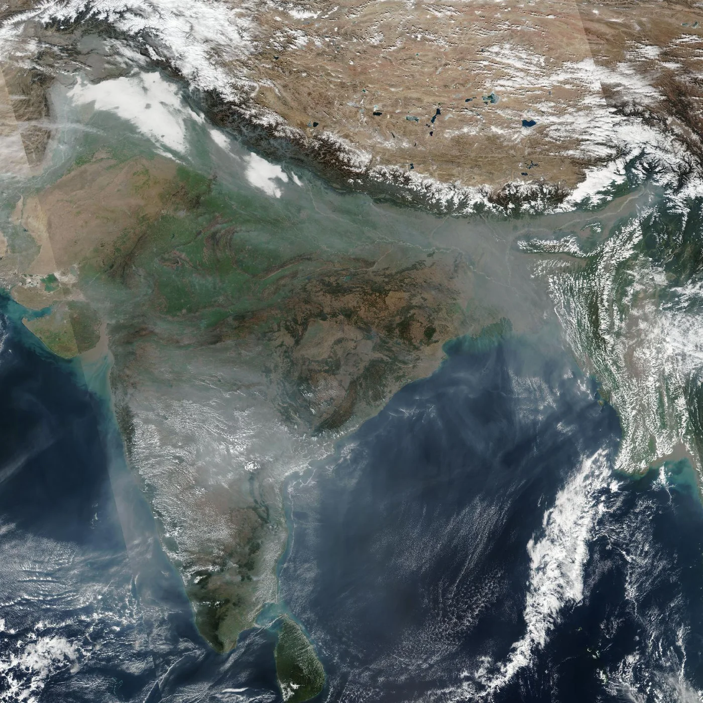
Get a satellite view of India from 25cm resolution, ready to search below, sharp enough to resolve individual buildings, vehicles, and city blocks anywhere in the country. Commercial archive and new-tasking imagery from providers like SuperView Neo and Beijing-3 (21AT) covers the full country, from Delhi and Mumbai to the Himalayas, the Ganges plain, and the Kerala coast; availability and acquisition dates depend on the satellite, the location, and cloud cover.
Yes. A satellite view of India, including Delhi, Mumbai, the Himalayas, and the Kerala coast, is searchable on this page. Commercial satellites resolve the country down to 25cm, sharp enough to identify individual buildings and vehicles, with a fresh capture available within days through new tasking.
The map below is a working satellite view of India, not a static picture, covering Delhi, Mumbai, Bengaluru, Chennai, Kolkata, the full sweep of the Himalayas, the Ganges and Indus river plains, the Thar Desert, and both the Arabian Sea and Bay of Bengal coastlines. It is the same overhead view most people mean by a "satellite photo of India," a "satellite picture of India," or an "aerial view of India," captured from orbit rather than from an aircraft. Pan to an area, then check what archive and new-tasking imagery exists for it, with an instant price estimate before you commit to anything. Satellite imagery is not a live video feed: each scene is a record of one specific pass, so the dates available for your area are what the portal shows.
The map above is a working satellite tool for India, not just a viewer: search any location, check available imagery dates, and request archive or newly tasked imagery for it, all in the same workspace. Use it in a few steps:
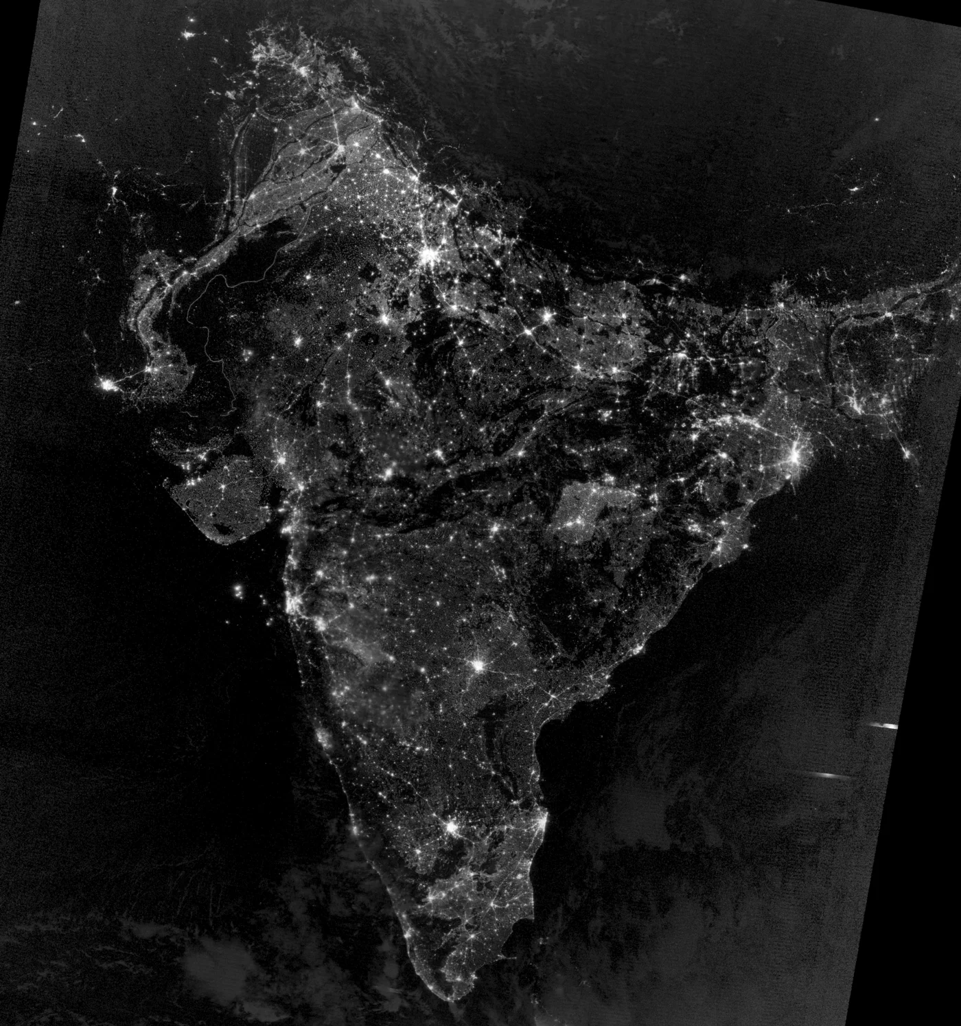
This is what India looks like from orbit after dark: a dense net of city lights tracing the Indo-Gangetic plain from Delhi to Kolkata, with Mumbai, Bengaluru, Hyderabad, and Chennai standing out as bright clusters further south. It is a useful contrast to the daytime detail a commercial order delivers: this night view shows the scale and density of human settlement across the country, not individual buildings or streets.
Archive imagery is fast and cheap. New tasking gets you a fresh capture of your exact site.
Satellite imagery of India is priced per square kilometre by resolution and capture mode. Archive scenes already exist and are the cheapest, fastest option. New tasking books a satellite to fly your area and costs more. Every search on this page returns an instant estimate before you order.
| Resolution Tier | Revisit | Archive Price | New Tasking Price | Priority | Emergency | Stereo | Tri-Stereo |
|---|---|---|---|---|---|---|---|
| 25-30cm — Super High Resolution | Daily | $19/km² (min. 15-25km²) | $25/km² (min. 50-100km²) | $40/km² | $70/km² | $50/km² | $75/km² |
| 31-50cm — Very High Resolution | 1-3 days | $13/km² | $19/km² | $32/km² | $51/km² | $40/km² | $60/km² |
| 51-80cm — High Resolution | 3-5 days | $6/km² | $10/km² | $15/km² | $25/km² | Not available | Not available |
| 81cm-1m — Standard Resolution | 4-5 days | $4/km² | $8/km² | $13/km² | $20/km² | Not available | Not available |
| 2m and Specialized Data (SAR, Hyperspectral, Multispectral) | Varies | Custom pricing | Custom pricing | Custom pricing | Custom pricing | Not available | Not available |
Delivery formats are GeoTIFF, SHP, DWG, or UTM. Upload your own area of interest as KML, KMZ, or zipped Shapefile. Archive imagery is typically ready in minutes to 48 hours; new tasking typically delivers within 7 days, weather permitting, with priority and emergency slots faster. Imagery is licensed, not sold, for your internal business, analysis, and reporting use; resale or redistribution needs written consent.
Prices are shown in US dollars. Indian customers are invoiced in USD unless another currency is agreed when the order is confirmed.
Both are used across India, but a satellite does not need overflight clearance near international borders, defence installations, or other restricted and security-sensitive areas the way an aircraft charter does.
| Satellite Imagery | Aerial Photography | |
|---|---|---|
| Coverage | Anywhere in India, including Himalayan border regions and offshore sites, with no flight clearance needed | Flown per project, constrained by airspace restrictions, aircraft range, and airstrip access |
| Revisit speed | Archive available instantly; new tasking typically within 7 days | Scheduled per survey, dependent on aircraft, crew, and permit availability |
| Cost | Priced per km², scaling well across large farms, infrastructure corridors, or nationwide portfolios | Mobilisation cost per sortie, often higher for remote mountain or island sites |
| Best use | Large or sensitive sites, nationwide monitoring, and repeat change detection | Maximum detail on a single, accessible site with no overflight restriction |
Search any Indian site on the map above for an instant archive price, or send us the area and we will come back with confirmed coverage and pricing, usually within one business day.
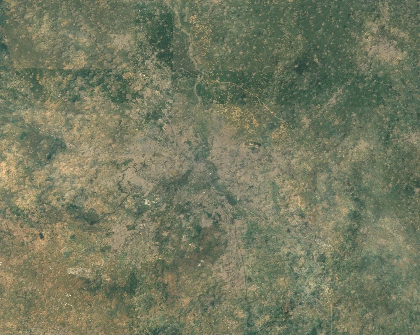
Delhi, India's capital, sits on the Yamuna River at the heart of the National Capital Region, a built-up area that now runs continuously into the satellite cities of Gurugram, Noida, Faridabad, and Ghaziabad. The image below shows that density from orbit: a grey urban core threaded by the Yamuna, ring roads, and the Delhi Metro corridor, with cropland and smaller towns spreading out toward the surrounding plain. Commercial imagery resolves individual buildings, construction sites, and vehicles anywhere across the region.
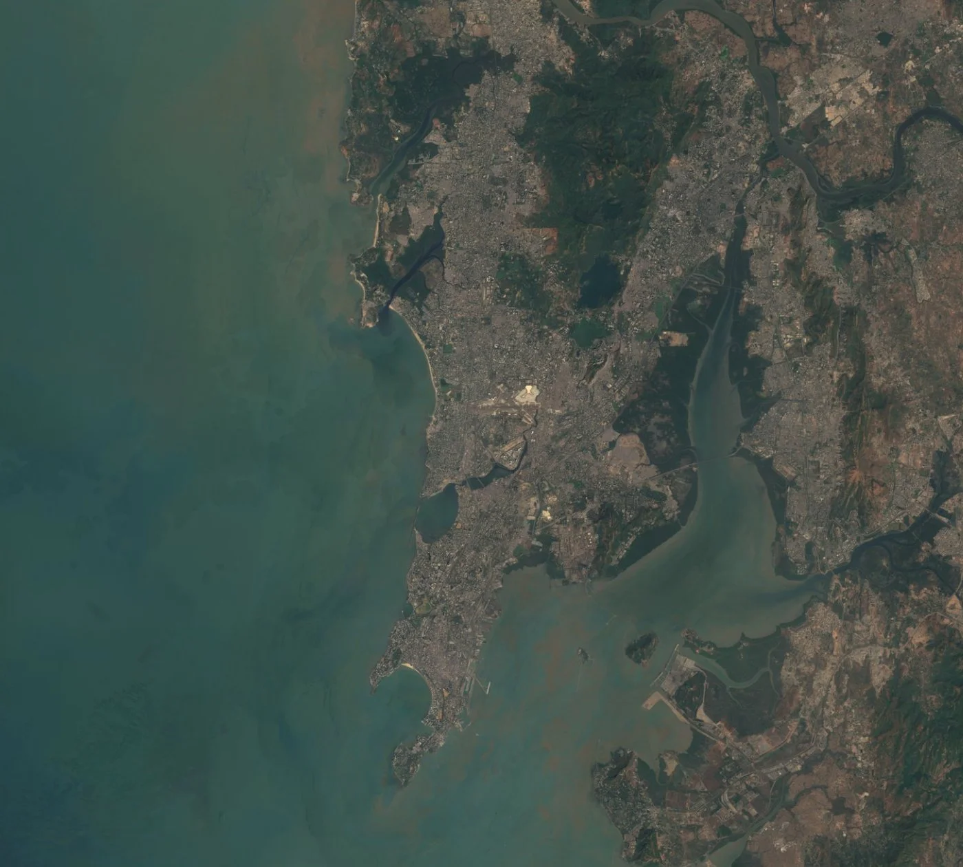
Mumbai, India's financial capital, occupies a narrow peninsula on the Arabian Sea, hemmed in by Thane Creek to the east and the sea on three other sides, a shape clearly traced from orbit in the image below alongside the city's port, airport, and the Bandra-Worli Sea Link. The western coast beyond Mumbai, from Gujarat's industrial ports down to Goa, carries much of India's maritime trade. Commercial imagery supports port, real-estate, and coastal infrastructure monitoring down to individual buildings and vessels.
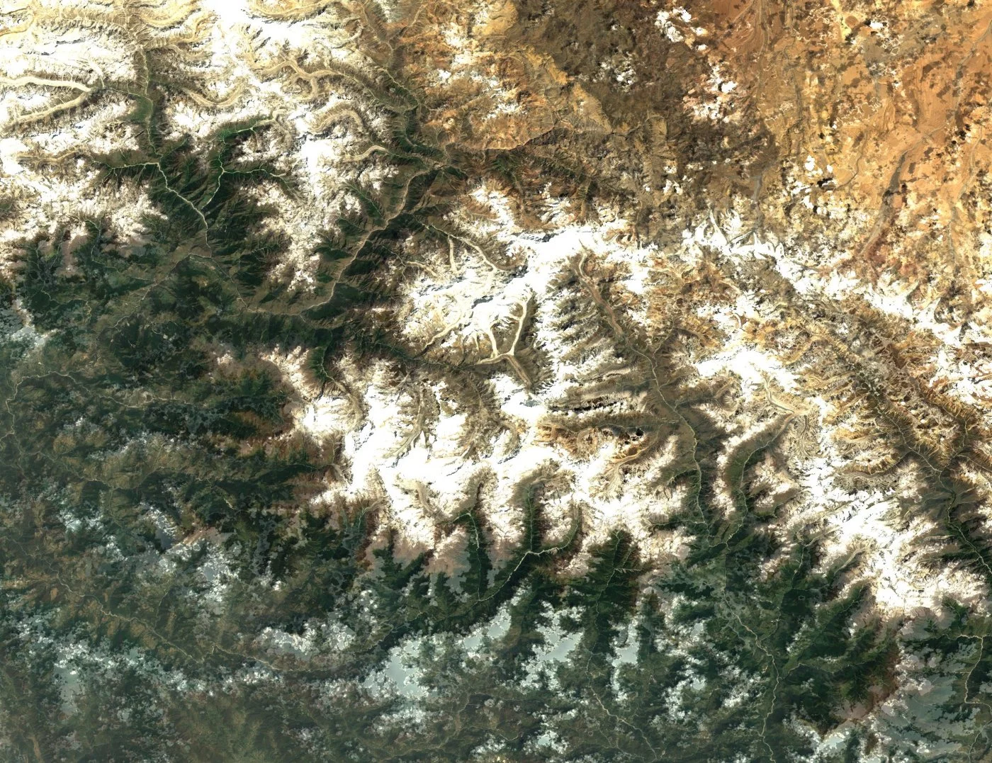
North of the Gangetic plain, the Himalayas rise through Uttarakhand, Himachal Pradesh, and the northern border states, carrying some of the world's highest peaks and largest glacier systems outside the poles. The image below shows the Nanda Devi massif in Uttarakhand, ridgelines, glacier tongues, and snowlines resolved in sharp detail. Commercial and free satellite imagery both support glacier retreat monitoring, hydropower and road-infrastructure planning, and disaster response across this difficult-to-access mountain terrain.
Along India's southwestern coast, Kerala's backwaters, a network of lagoons, canals, and lakes running parallel to the Arabian Sea, are clearly visible from orbit as the dark linear water body shown in the image below, fed by rivers draining the Western Ghats. Vembanad Lake, the largest of these backwaters, supports dense coconut cultivation, fishing, and aquaculture along its banks. Commercial and free satellite imagery both support coastal erosion, aquaculture, and agricultural monitoring across this densely farmed, water-rich region.
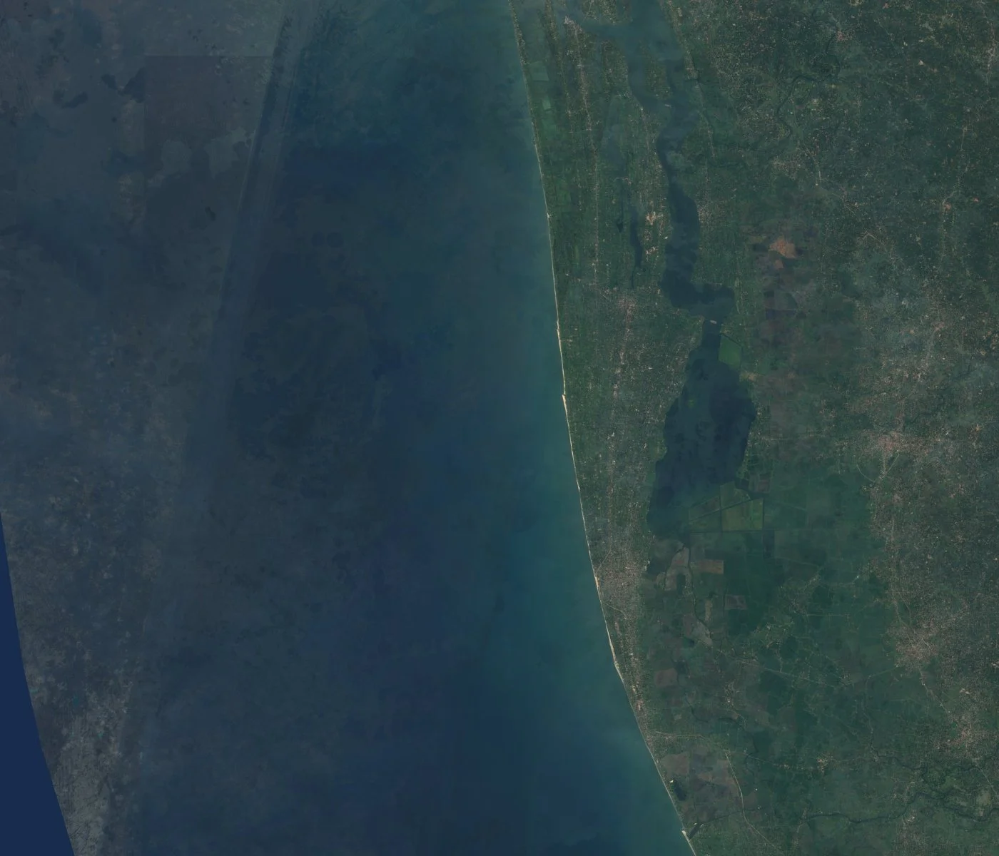
A satellite view of India moves from Himalayan glaciers to tropical backwaters within a single country. These places are all distinguishable in high-resolution satellite images of India.
The Taj Mahal's white marble mausoleum, flanking minarets, and formal charbagh garden and reflecting pool sit on a bend of the Yamuna River, their symmetrical layout unmistakable from orbit. At sub-meter commercial resolution, the monument, its gardens, and the surrounding Agra Fort complex are all individually resolved.
India's capital and its satellite cities form one of the largest continuous built-up areas in the country, threaded by the Yamuna River and the Delhi Metro network, shown in the Delhi NCR image earlier on this page.
India's financial capital occupies a narrow peninsula on the Arabian Sea, its dense urban footprint, port, and the Bandra-Worli Sea Link clearly distinguishable at commercial resolution, shown in the Mumbai and Western Coast image earlier on this page.
The world's highest mountain range runs along India's northern border, its glaciers, ridgelines, and snowlines resolvable in sharp detail, shown in the Himalayas image earlier on this page.
India's most sacred river winds through the densely farmed Indo-Gangetic plain, its crescent bend at Varanasi, one of the world's oldest continuously inhabited cities, a recognizable landmark from orbit even at moderate resolution.
India's great desert spans western Rajasthan and into Gujarat and Pakistan, its sand dune fields and sparse vegetation forming a sharp, pale contrast with the irrigated farmland along its margins, visible from orbit as a distinct texture change.
Where the Ganges and Brahmaputra rivers meet the Bay of Bengal, the Sundarbans form the world's largest mangrove forest, its branching tidal channels and dense green canopy, shared between India and Bangladesh, a distinctive pattern from orbit useful for tracking mangrove loss and shoreline change.
One of the largest salt marshes on Earth, the Rann of Kutch turns into a vast white expanse during the dry season, its flat, reflective surface and seasonal flooding pattern one of the most visually distinctive landscapes in any satellite image of India.
A network of lagoons and canals running parallel to India's southwestern coast, fed by rivers draining the Western Ghats, shown in the Kerala Backwaters image earlier on this page.
India's technology hub sits on the Deccan Plateau in southern Karnataka, its rapid outward urban growth and numerous artificial lakes (locally called tanks) clearly trackable in satellite imagery over successive years.
Satellite imagery of India supports work across a country defined by intensive agriculture, rapid urbanisation, extreme terrain, and a monsoon climate:
One search on this page covers multiple commercial constellations together. Which one you want comes down to how much detail the job needs, and how much of the country you need to cover.
These are the paid constellations you can search and task directly through the portal above, and the only ones that resolve individual buildings, vehicles, and structures like the Taj Mahal at near-building detail.
Imagery is priced per square kilometre by the resolution and capture mode you pick, so the practical question is how much detail the job actually needs. Sub-meter detail is where most infrastructure, agriculture, and site-level work starts.
Optical satellites need a clear sky, and India's southwest monsoon, roughly June through September, brings heavy cloud cover across most of the country, with the northeast monsoon adding cloud to the southeastern coast into December.
| Resolution | Source | Best For |
|---|---|---|
| 25cm-50cm panchromatic | Beijing-3 (21AT) / SuperView Neo (commercial) | Individual buildings, vehicles, and sites like the Taj Mahal |
| 1.2m multispectral | Beijing-3 (21AT) constellation (commercial) | Detailed site analysis with color/spectral data |
| Sub-meter to multi-meter | Gaofen satellites (archive) | Regional and nationwide mapping across India |