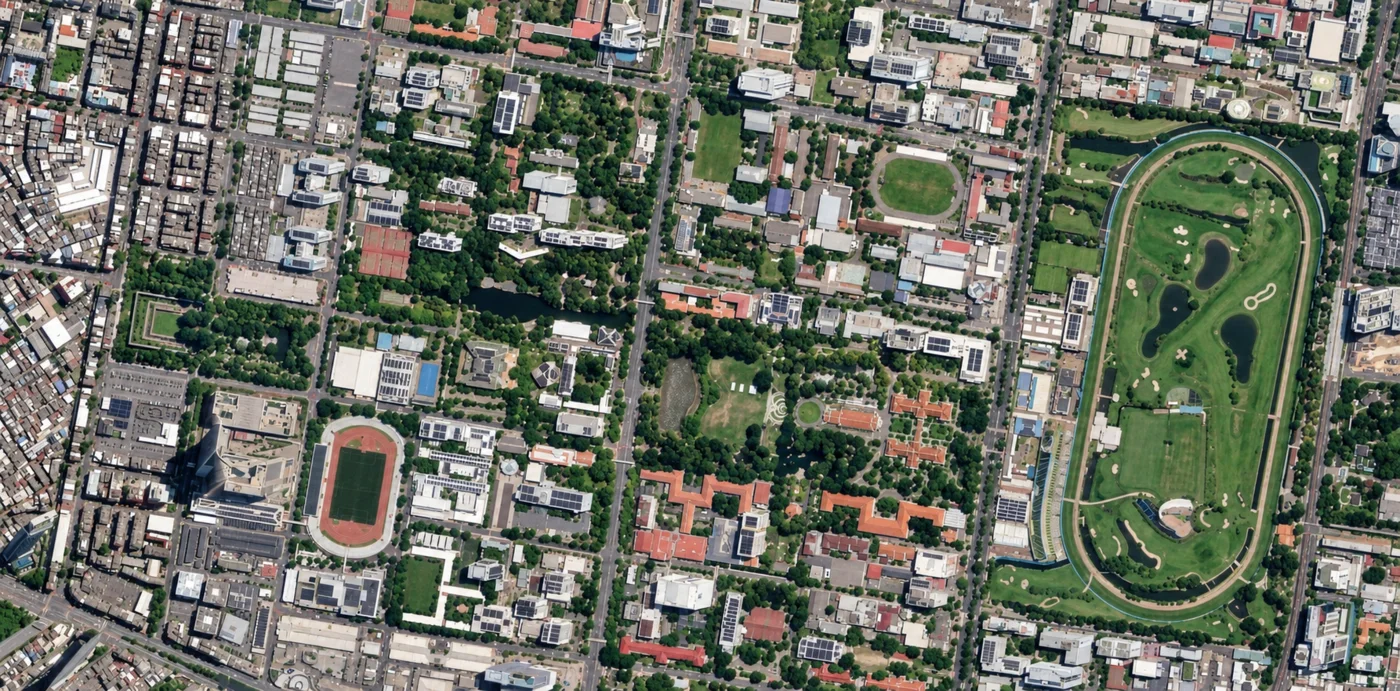
SINGAPORE SATELLITE IMAGERY | SATELLITE VIEW OF SINGAPORE
Singapore Satellite Imagery: Buy High-Resolution Satellite Images of Singapore
Coordinates: 1.3521°N, 103.8198°E
Get a satellite view of Singapore from 25cm resolution, ready to search below, sharp enough to resolve individual buildings, vehicles, and shipping containers anywhere on the island. Commercial archive and new-tasking imagery from SuperView Neo and Beijing-3 (21AT) covers all of Singapore, from the Raffles City and Marina Bay skyline to the Port of Singapore, Changi Airport, Jurong Island, and the HDB heartland towns; availability and acquisition dates depend on the satellite, the location, and cloud cover.
Yes. A satellite view of Singapore, including Raffles City, Marina Bay, the Port of Singapore, and Changi Airport, is searchable on this page. Commercial satellites resolve the island down to 25cm, sharp enough to identify individual buildings, vehicles, and shipping containers, with a fresh capture available within days through new tasking, cloud cover permitting.
25-30cmSharpest commercial resolution available
~735 km²Full island covered, reclaimed land included
DailyRevisit at super high resolution
7 daysTypical new-tasking delivery
Satellite View of Singapore
The map below is a working satellite view of Singapore, not a static picture, covering Raffles City and the Civic District, Marina Bay and the CBD, the Port of Singapore and Tuas Mega Port, Changi Airport, Jurong Island, Sentosa, and the HDB housing towns across the island. It is the same overhead view most people mean by a "satellite photo of Singapore," a "satellite picture of Singapore," or an "aerial view of Singapore," captured from orbit rather than from an aircraft. Pan to an area, then check what archive and new-tasking imagery exists for it, with an instant price estimate before you commit to anything. Satellite imagery is not a live video feed: each scene is a record of one specific pass, so the dates available for your area are what the portal shows.
Opening imagery workspace…
Satellite Map of Singapore: How to Use This Tool
The map above is a working satellite tool for Singapore, not just a viewer: search any location, check available imagery dates, and request archive or newly tasked imagery for it, all in the same workspace. Use it in a few steps:
Search or pan to your exact area of interest anywhere in Singapore, from a Raffles City construction site to a berth at Tuas Mega Port.
Draw a rectangle or polygon over your area, or upload a boundary file (KML, KMZ, or zipped Shapefile).
Choose archive imagery for an instant search of existing captures, or new tasking for a fresh satellite pass, and set your preferred resolution, date range, and maximum cloud cover.
Review available scenes for your area alongside an instant, transparent price estimate, so you know the cost before you commit.
Submit your request to download archive imagery or order new tasking. Our team confirms coverage, sends a price quote, and delivers your imagery.
Commercial Satellite Imagery and Data Products for Singapore
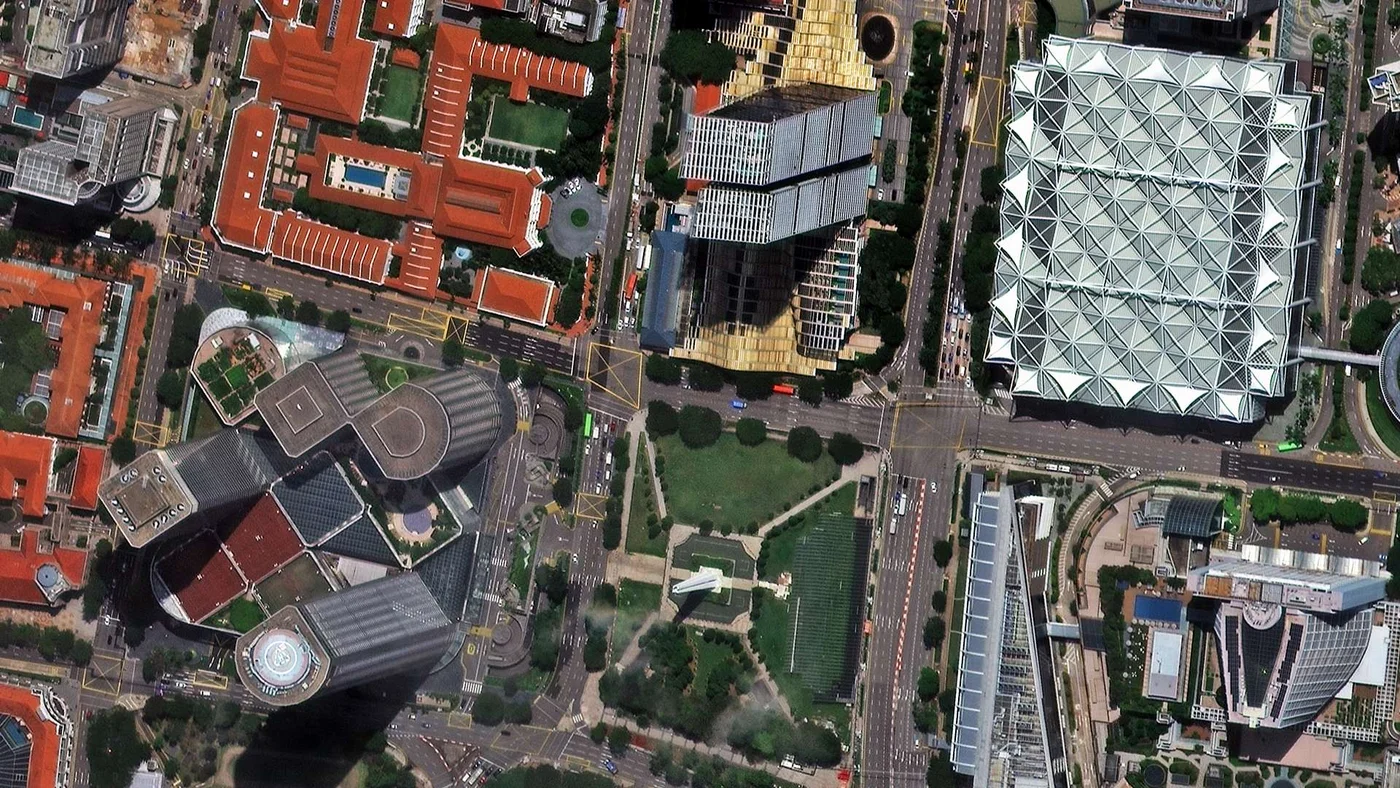
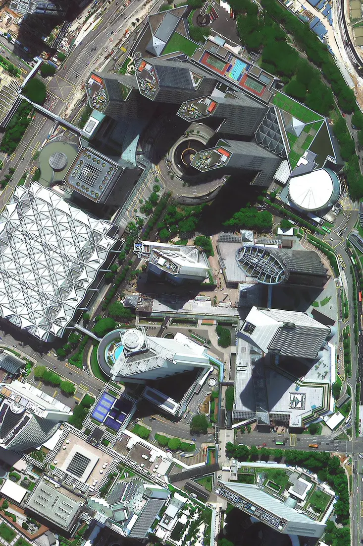
The two images below are real paid-tier samples, not free public data: 30cm SuperView Neo-1 captures showing building- and vehicle-scale detail over Raffles City and the surrounding Civic District. Imagery like this is searchable and orderable through the portal above for your own area of interest anywhere in Singapore.
A 30cm SuperView Neo-1 satellite image of Raffles City and the Civic District, downtown Singapore, showing CHIJMES’s red Gothic-revival roofline, a high-rise office tower, and a dense street intersection in sharp detail.
Satellite: SuperView Neo-1 · Resolution: 30cm
A closer 30cm SuperView Neo-1 pass over the same Raffles City precinct, showing a circular tower, connecting skybridges, and a rooftop pool deck at building-scale detail.
Singapore From Space: The Singapore Indoor Stadium and Sports Hub
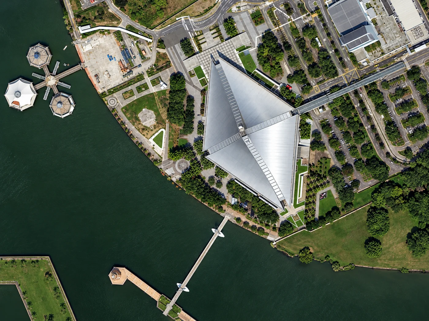
This wider SuperView Neo-1 view shows the Singapore Indoor Stadium's distinctive pyramid-shaped roof at the Singapore Sports Hub on the Kallang Basin waterfront, connected by a skybridge to the surrounding precinct, with floating platforms visible on the water. It is a useful contrast to the close-up detail of a commercial order above: this view shows how a single landmark structure relates to the waterfront and road network around it, not just its rooftop.
A SuperView Neo-1 satellite image of the Singapore Indoor Stadium’s pyramid-shaped roof at the Singapore Sports Hub, Kallang, showing the connecting skybridge, car parks, and floating platforms on the water.
Satellite: SuperView Neo-1 · Resolution: 30cm
Buy Satellite Imagery of Singapore: Prices, Formats and Delivery
Archive imagery is fast and cheap. New tasking gets you a fresh capture of your exact site.
Satellite imagery of Singapore is priced per square kilometre by resolution and capture mode. Archive scenes already exist and are the cheapest, fastest option. New tasking books a satellite to fly your area and costs more, and is weather-dependent given Singapore’s frequent cloud cover. Every search on this page returns an instant estimate before you order.
Standard Archive
Existing imagery, ready to search and download now
Super High Resolution (25-30cm)$20/km²
Very High Resolution (31-50cm)$13/km²
High Resolution (51-80cm)$5/km²
Moderate Resolution (2m)$1/km²
Minimum order area 25km² per scene. Stereo imagery is priced at $60-$90/km² (25-30cm) depending on mode.
New Satellite Tasking
Fresh capture of your exact site and date range
Super High Resolution (25-30cm)$30/km²
Very High Resolution (31-50cm)$20/km²
High Resolution (51-80cm)$8/km²
Moderate Resolution (2m)$2/km²
Minimum order area 100km² per scene. Priority tasking $37-$45/km² and emergency $66-$80/km² available on the sub-meter tiers.
Prices are shown in US dollars. Singapore customers are invoiced in USD unless another currency is agreed when the order is confirmed.
Satellite Imagery vs Aerial Photography in Singapore
Both are used across Singapore, but a satellite does not need overflight clearance near Changi Airport, Paya Lebar Air Base, Tuas Mega Port, or Jurong Island's petrochemical facilities the way an aircraft charter does.
Satellite Imagery
Aerial Photography
Coverage
Anywhere in Singapore, including port, airport, and industrial sites, with no flight clearance needed
Flown per project, constrained by Singapore’s dense, restricted airspace and limited airstrip access
Revisit speed
Archive available instantly; new tasking typically within 7 days, cloud cover permitting
Scheduled per survey, dependent on aircraft, crew, and permit availability
Cost
Priced per km², scaling well across port terminals, reclaimed land, or island-wide monitoring
Mobilisation cost per sortie, often higher for a small, densely built island
Best use
Large or sensitive sites, island-wide monitoring, and repeat change detection over months or years
Maximum detail on a single, accessible site with no overflight restriction
What You Get When You Order
Multiple providers in one search, comparing Beijing-3 (21AT), SuperView Neo, and Gaofen/SuperView-2 archive and tasking availability side by side
Transparent pricing before you commit, with an instant per-km² estimate shown in the portal, not a quote you wait days for
Clear licence terms, with imagery licensed for your internal business, analysis, and reporting use, and any wider rights agreed in writing at the time of order
GIS-ready delivery, in GeoTIFF, SHP, DWG, or UTM, ready to open in ArcGIS, QGIS, or your own environment
A human confirms every order, checking coverage and recorded cloud cover for your exact area before anything is charged
Get Your Singapore Satellite Imagery Quote
Search any Singapore site on the map above for an instant archive price, or send us the area and we will come back with confirmed coverage and pricing, usually within one business day.
A satellite view of Singapore moves from a dense, high-rise downtown to a working port, an airport, and reclaimed industrial land within a very small country. These places are all distinguishable in high-resolution satellite images of Singapore.
Raffles City and the Civic District
Downtown Singapore's historic core, where CHIJMES's red Gothic-revival roofline sits alongside modern high-rise towers in one frame, shown in the hero image and commercial gallery on this page.
Marina Bay
Singapore’s most recognizable skyline, including Marina Bay Sands’ three-tower, SkyPark-topped hotel and the Gardens by the Bay conservatories, all built largely on reclaimed land and clearly distinguishable from orbit.
Port of Singapore and Tuas Mega Port
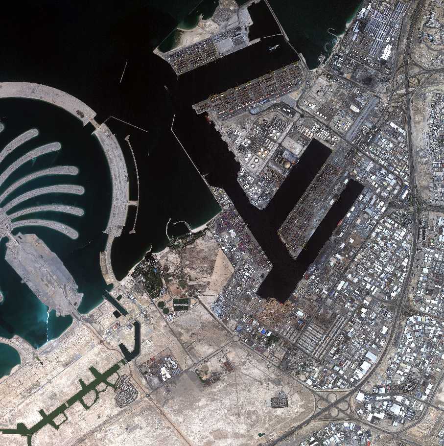
The world’s busiest transshipment hub, which handled a record 44.66 million TEUs in 2025. Its newest terminal, Tuas Mega Port, is being built in phases on reclaimed land and will eventually span roughly 1,337 hectares with 66 berths once complete in the 2040s, rows of shipping containers and berthed vessels tracked incrementally as each phase comes online.
Changi Airport
Singapore's main air hub on the eastern coast, its runways, terminals, and aircraft parked at the gates individually resolved at sub-meter commercial resolution, with ongoing expansion including Terminal 5 trackable over time.
Jurong Island
A cluster of reclaimed islands merged into one, home to Singapore’s petrochemical and energy industry, with storage tanks, refineries, and port infrastructure clearly visible from orbit.
Sentosa Island
A resort island south of the main island, connected by causeway and cable car, its beaches, theme parks, and marina all identifiable in satellite imagery alongside the container terminal it sits beside.
The Singapore Sports Hub
The National Stadium and Singapore Indoor Stadium's distinctive rooflines sit on the Kallang Basin waterfront, shown in the Singapore Indoor Stadium image above.
HDB Heartland Towns
More than 80% of Singaporeans live in public housing estates such as Punggol and Tengah, their repeating tower-block layouts and green corridors visible from orbit as the island’s dominant residential pattern.
Applications of Satellite Imagery in Singapore
Satellite imagery of Singapore supports work across a small, densely developed island with a major global port and almost no spare land:
Port and Maritime Logistics Monitoring
Tracking vessel traffic, container yard activity, and terminal construction at the Port of Singapore and the phased Tuas Mega Port build-out.
Land Reclamation and Coastline Monitoring
Singapore has grown roughly 25% larger through reclamation since 1965. Satellite imagery tracks that change site by site.
Urban Redevelopment and Megaproject Monitoring
Tracking HDB estate redevelopment, new towns like Tengah, and construction progress across reclaimed-land megaprojects islandwide.
Aviation and Airport Expansion Monitoring
Tracking apron activity, cargo infrastructure, and Terminal 5 construction progress at Changi Airport over time.
Green Canopy and Environmental Monitoring
Tracking tree canopy, park connectors, and drainage or flood risk across Singapore's low-lying, densely built island.
Satellite Providers, Resolution, and Cost for Singapore
One search on this page covers multiple commercial constellations together. Which one you want comes down to how much detail the job needs, and how much of the island you need to cover.
Commercial Providers
These are the paid constellations you can search and task directly through the portal above, and the only ones that resolve individual buildings, vehicles, and structures like shipping containers or aircraft.
Beijing-3 (21AT) / Beijing-3B (BJ3N), optical imagery down to 30cm panchromatic and 1.2m multispectral
SuperView Neo, delivering 25cm to 50cm optical imagery, the sharpest tier available on this page
SuperView-2 (GFDM), 0.42m panchromatic / 1.68m multispectral with a 9-band sensor useful for vegetation and infrastructure analysis
How Resolution Maps to Cost
Imagery is priced per square kilometre by the resolution and capture mode you pick, so the practical question is how much detail the job actually needs. Sub-meter detail is where most port, construction, and site-level work starts.
Sub-meter detail is what you need to identify structures, vehicles, and individual plots, or to measure and map a reclamation site accurately
Archive imagery already exists and is the cheapest route; new tasking books a fresh pass and costs more
Historical archive comparison shows how a reclaimed site, port terminal, or housing estate has changed over months or years, without a repeat site visit
Imagery is delivered structured for change detection and automated monitoring, not just as a one-off picture
A single image or a monitoring plan replaces repeat site visits across port and industrial areas where ground access is restricted
What Weather Does to a Singapore Order
Optical satellites need a clear sky, and Singapore sits almost on the equator, with cloud cover or rain recorded on most days year-round and frequent afternoon thunderstorms, so cloud is a real factor in planning a capture here, unlike drier desert markets.
Archive search on the portal shows the real recorded cloud cover for each available scene, so you can judge usability before ordering
New tasking over Singapore can take a few attempts to clear skies, which is why delivery windows are given as typical ranges rather than guaranteed dates
Radar (SAR) imagery is a useful fallback when persistent cloud blocks an optical capture, since it images the ground regardless of cloud, rain, or darkness
Satellite Image Resolutions Available for Singapore
Resolution
Source
Best For
25cm-30cm panchromatic
SuperView Neo / Beijing-3B (BJ3N) (commercial)
Individual buildings, vehicles, and shipping containers
0.42m-1.68m multispectral
SuperView-2 (GFDM) constellation (commercial)
Vegetation, infrastructure, and site analysis with color/spectral data
1.2m multispectral
Beijing-3 (21AT) constellation (commercial)
Detailed site analysis with color/spectral data
Frequently Asked Questions
What is a satellite view of Singapore?
A satellite view of Singapore is an overhead image of the island captured by an Earth-observation satellite rather than an aircraft. Depending on the sensor, it can show Raffles City, Marina Bay, the Port of Singapore, and Changi Airport at resolutions ranging from whole-island wide-area views down to 25cm sub-meter detail.
Is there a satellite image of Raffles City, Singapore?
Yes. Raffles City and the surrounding Civic District, including CHIJMES’s red Gothic-revival roofline, is shown in the commercial gallery on this page in 30cm SuperView Neo-1 imagery. The same resolution is searchable for any other site on the island through the portal above.
Can satellite imagery see Marina Bay Sands and Gardens by the Bay?
Yes. Marina Bay Sands’ three-tower, SkyPark-topped hotel and the Gardens by the Bay conservatories are both built on reclaimed land and are among the most recognizable features in any satellite image of Singapore, clearly identifiable even at wide-area resolution.
Is an aerial view of Singapore the same as a satellite view?
They show the same thing from a different altitude. An aerial view is captured from an aircraft, typically sharper over a small area but limited to wherever a survey has flown, and often restricted near Changi Airport, Paya Lebar Air Base, and Jurong Island’s petrochemical facilities. A satellite view of Singapore covers the whole island with no overflight clearance needed, and commercial satellite imagery now resolves individual buildings and vehicles just as clearly.
Can I get a real-time satellite view of Singapore?
No. Satellite imagery is not real time, and there is no continuous feed of Singapore from space. The island is imaged frequently by multiple constellations, so recent imagery is available for most areas, and new tasking can book a fresh pass within days, cloud cover permitting.
Where can I get high-resolution satellite images of Singapore?
You can search and buy satellite images of Singapore directly on this page. Draw your area of interest anywhere on the island, choose archive or new tasking, and get an instant price before you order.
Does cloud cover affect satellite imagery of Singapore?
Yes, more than in many other markets. Singapore sits near the equator and records cloud cover or rain on most days year-round, with frequent afternoon thunderstorms. Archive search on the portal shows the real recorded cloud cover for each scene, and radar (SAR) imagery is available as a fallback that images the ground regardless of cloud.
How much do high-resolution satellite images of Singapore cost?
Cost depends on resolution, area size, and whether you choose archive imagery or new tasking. Commercial sub-meter imagery from SuperView Neo and Beijing-3B (BJ3N) starts at $1 per km² for 2m archive imagery and runs up to $30 per km² for 25-30cm new tasking, before any priority, emergency, or stereo add-ons. Every search on this page returns an instant, transparent price estimate before you order.
Can satellite imagery track land reclamation in Singapore?
Yes. Singapore has grown its land area by roughly a quarter through reclamation since independence in 1965, from about 580 km² to around 735 km² today, and historical archive imagery is widely used to track reclamation progress at sites like Tuas Mega Port over months or years.
Can satellite imagery monitor the Port of Singapore and Tuas Mega Port?
Yes. Commercial satellite imagery is used to track vessel traffic, container yard utilisation, and construction progress at the Port of Singapore, the world's busiest transshipment hub, and at Tuas Mega Port, which is being built in phases on reclaimed land through the 2040s.
Do you provide satellite pictures of Singapore for commercial use?
Yes. Archive and newly tasked satellite imagery of Singapore can be licensed for commercial use, including port, construction, real-estate, and logistics applications, with pricing shown instantly for each search.
Is historical satellite imagery of Singapore available?
Yes. Archive imagery covering Singapore extends back several years across multiple sensors, useful for comparing land reclamation, port expansion, or urban redevelopment at a site over time.