MALAYSIA SATELLITE IMAGES | SATELLITE VIEW OF MALAYSIA
Malaysia Satellite Images: KL Towers to Borneo
Coordinates: 4.2105°N, 101.9758°E
Get a satellite view of Malaysia from 25cm resolution, sharp enough to resolve individual buildings and vehicles around the Petronas Twin Towers and Kuala Lumpur Tower. Commercial archive and new-tasking imagery from SuperView Neo and Beijing-3 (21AT) covers the whole country, from Penang and Johor to Sabah and Sarawak; availability depends on the satellite, the location, and cloud cover.
Yes. A satellite view of Malaysia, including the Petronas Twin Towers, Kuala Lumpur Tower, and sites from Penang to Borneo, is searchable on this page. Commercial satellites resolve the country down to 25cm, sharp enough to identify individual buildings and vehicles, with a fresh capture available within days through new tasking.
25-30cmSharpest resolution
~330,000 km²Country covered
DailyRevisit frequency
7 daysNew tasking delivery
Satellite View of Malaysia
The map below is a working satellite view of Malaysia, not a static picture, covering Kuala Lumpur, Penang, Johor, and both Peninsular Malaysia and Borneo's Sabah and Sarawak states. It's the same overhead view most people mean by a satellite photo of Malaysia or an aerial view of Malaysia, captured from orbit rather than from an aircraft. Pan to an area, then check what archive and new-tasking imagery exists for it, with an instant price estimate before you commit to anything. Each scene is a record of one specific pass, not a live feed, so the dates available are whatever the portal shows for your area.
Opening imagery workspace…
Satellite Map of Malaysia: How to Use This Tool
Search any location in Malaysia, check available imagery dates, and request archive or newly tasked imagery, all in the same workspace:
Search or pan to your exact area of interest anywhere in Malaysia, from the KLCC precinct to a Borneo plantation or a Johor port.
Draw a rectangle or polygon over your area, or upload a boundary file (KML, KMZ, or zipped Shapefile).
Choose archive imagery for an instant search of existing captures, or new tasking for a fresh satellite pass, and set your preferred resolution, date range, and maximum cloud cover.
Review available scenes for your area alongside an instant, transparent price estimate, so you know the cost before you commit.
Submit your request to download archive imagery or order new tasking. Our team confirms coverage, sends a price quote, and delivers your imagery.
Commercial Satellite Imagery and Data Products for Malaysia
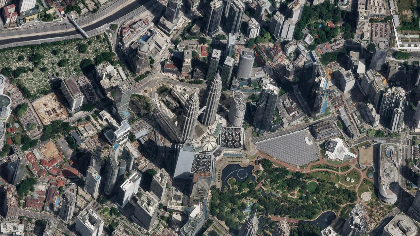
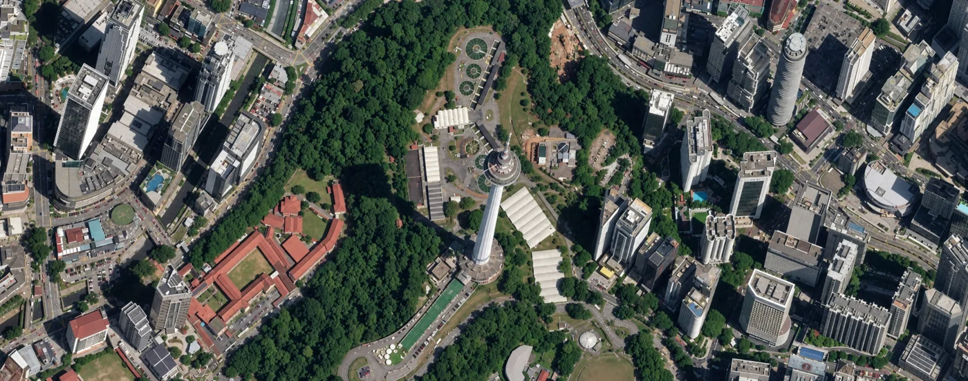
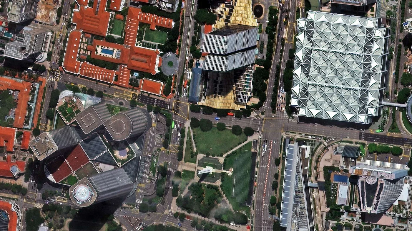
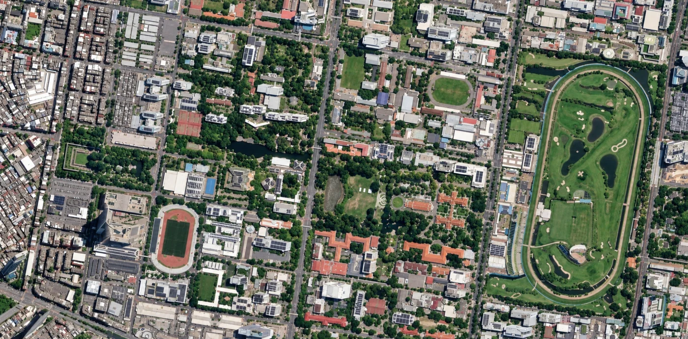
The images below are real commercial samples, not free public data: direct top-down satellite captures of the Petronas Twin Towers and Kuala Lumpur Tower, both sharp enough to resolve individual rooftops and vehicles. Imagery like this is searchable and orderable through the portal above for any site in Malaysia.
A high-resolution commercial satellite image of the Petronas Twin Towers and KLCC Park, with Suria KLCC, the Aquaria dome, and the Kuala Lumpur Convention Centre roof clearly resolved.A high-resolution commercial satellite image of Kuala Lumpur Tower on Bukit Nanas, showing the tower's long shadow, the surrounding forest reserve, and the dense city blocks around it.
Buy Satellite Imagery of Malaysia: Prices, Formats and Delivery
Archive imagery is fast and cheap. New tasking gets you a fresh capture of your exact site.
Satellite imagery of Malaysia is priced per square kilometre by resolution and capture mode. Archive scenes already exist and are the cheapest, fastest option. New tasking books a satellite to fly your area and costs more. Every search on this page returns an instant estimate before you order.
Standard Archive
Existing imagery, ready to search and download now
Super High Resolution (25-30cm)$20/km²
Very High Resolution (31-50cm)$13/km²
High Resolution (51-80cm)$5/km²
Moderate Resolution (2m)$1/km²
Minimum order area 25km² per scene. Stereo imagery is priced at $60-$90/km² (25-30cm) depending on mode.
New Satellite Tasking
Fresh capture of your exact site and date range
Super High Resolution (25-30cm)$30/km²
Very High Resolution (31-50cm)$20/km²
High Resolution (51-80cm)$8/km²
Moderate Resolution (2m)$2/km²
Minimum order area 100km² per scene. Priority tasking $37-$45/km² and emergency $66-$80/km² available on the sub-meter tiers.
Prices are shown in US dollars. Malaysian customers are invoiced in USD unless another currency is agreed when the order is confirmed.
Satellite Imagery vs Aerial Photography in Malaysia
Both are used across Malaysia, but a satellite does not need overflight clearance for Borneo's remote interior, offshore platforms, or sites that cross state and sea borders the way an aircraft charter does.
Satellite Imagery
Aerial Photography
Coverage
Anywhere in Malaysia, including remote Sabah and Sarawak interior and offshore platforms, with no flight clearance needed
Flown per project, constrained by airspace restrictions, aircraft range, and airstrip access
Revisit speed
Archive available instantly; new tasking typically within 7 days
Scheduled per survey, dependent on aircraft, crew, and permit availability
Cost
Priced per km², scaling well across large plantations, forest concessions, or nationwide portfolios
Mobilisation cost per sortie, often higher for remote Borneo or offshore sites
Best use
Large or remote sites, nationwide monitoring, and repeat change detection
Maximum detail on a single, accessible site with no overflight restriction
What You Get When You Order
Multiple providers in one search, comparing Beijing-3 (21AT), SuperView Neo, and Gaofen archive and tasking availability side by side
Transparent pricing before you commit, with an instant per-km² estimate shown in the portal, not a quote you wait days for
Clear licence terms, with imagery licensed for your internal business, analysis, and reporting use, and any wider rights agreed in writing at the time of order
GIS-ready delivery, in GeoTIFF, SHP, DWG, or UTM, ready to open in ArcGIS, QGIS, or your own environment
A human confirms every order, checking coverage and cloud cover for your exact area before anything is charged
Get Your Malaysia Satellite Imagery Quote
Search any Malaysian site on the map above for an instant archive price, or send us the area and we will come back with confirmed coverage and pricing, usually within one business day.
A satellite view of Malaysia spans a country split by the South China Sea, from Kuala Lumpur's skyline to Borneo's rainforest. These places are all distinguishable in high-resolution satellite images.
The Petronas Twin Towers
At 451.9m, the Petronas Twin Towers were the world's tallest buildings from 1998 to 2004 and remain Kuala Lumpur's most recognisable landmark, shown in the hero image on this page. Their double-pinnacle footprint and connecting skybridge are unmistakable from orbit, even before sub-meter resolution resolves the surrounding KLCC Park and Suria KLCC mall.
Kuala Lumpur Tower (Menara KL)
Standing 421m tall on Bukit Nanas, a patch of rainforest reserve inside the city, the tower and its surrounding forest canopy form a sharp, circular green landmark against dense development, shown in the gallery image above.
Merdeka 118
Completed in 2023 near the original Stadium Merdeka, Merdeka 118 reaches 678.9m, the second-tallest building in the world after the Burj Khalifa and the tallest in Southeast Asia, a sharp new silhouette in any recent Kuala Lumpur capture.
The Strait of Malacca and Port Klang
One of the world's busiest shipping lanes runs along Malaysia's west coast, carrying roughly a quarter of global seaborne trade. Port Klang, the country's busiest port, sits on its eastern shore, with container stacks and vessel traffic clearly resolved in commercial imagery.
George Town, Penang
A UNESCO World Heritage colonial core on Penang island, George Town's dense shophouse grid sits against the Strait of Malacca, distinct from the high-rise towers of nearby George Town's modern waterfront.
Forest City, Johor
A large man-made land reclamation project off Johor's coast near the Singapore border, Forest City's new geometric landmass and tower clusters are a clear example of how satellite imagery tracks coastal development over time.
Mount Kinabalu and the Borneo Rainforest
Malaysia's highest peak, at 4,095m, rises out of Sabah's dense tropical forest. Across Sabah and Sarawak, satellite imagery is widely used to track logging roads, palm oil conversion, and forest cover change that's hard to monitor any other way.
Langkawi
An archipelago of around 99 islands off Malaysia's northwest coast, Langkawi's resorts, beaches, and cable car line stand out clearly against the surrounding water in commercial imagery.
Applications of Satellite Imagery in Malaysia
Satellite imagery of Malaysia supports work across a country split between a dense Peninsular urban core and Borneo's plantations and rainforest:
Port and Maritime Traffic Monitoring
Tracking vessel traffic and container yard activity at Port Klang and along the Strait of Malacca, one of the world's busiest shipping lanes.
Palm Oil Plantation Monitoring
Tracking planted area, yield, and new clearing across Malaysia's roughly 5.7 million hectares of palm oil plantations.
Urban Development and Megaproject Monitoring
Tracking tower construction, new transit lines, and megaprojects across Kuala Lumpur and Greater KL.
Land Reclamation and Coastal Monitoring
Tracking new land and port development along the coast, including large reclamation projects like Forest City in Johor.
Rainforest and Deforestation Monitoring
Tracking logging roads, forest cover loss, and plantation conversion across Sabah and Sarawak's rainforest interior.
Satellite Providers, Resolution, and Cost for Malaysia
One search on this page covers multiple commercial constellations together. Which one you want comes down to how much detail the job needs, and how much of the country you need to cover.
Commercial Providers
These are the paid constellations you can search and task directly through the portal above, and the only ones that resolve individual buildings, vehicles, and structures like the Petronas Towers at rooftop detail.
Beijing-3 (21AT), optical imagery down to 30cm panchromatic and 1.2m multispectral
SuperView Neo, delivering 25cm to 50cm optical imagery, the sharpest tier available on this page
Gaofen, part of China's civilian Earth observation programme, adding sub-meter to multi-meter archive coverage across Malaysia
How Resolution Maps to Cost
Imagery is priced per square kilometre by the resolution and capture mode you pick, so the practical question is how much detail the job actually needs.
Sub-meter detail is what you need to identify structures, vehicles, and individual plantation blocks, or to measure and map a site accurately
Archive imagery already exists and is the cheapest route; new tasking books a fresh pass and costs more
Historical archive comparison shows how a plantation, port, or city block has changed over months or years, without a repeat site visit
Imagery is delivered structured for change detection and automated monitoring, not just as a one-off picture
A single image or a monitoring plan replaces repeat site visits across remote Borneo plantations and forest concessions where ground access is difficult
What Weather Does to a Malaysia Order
Optical satellites need a clear sky, and Malaysia's equatorial climate brings cloud cover and rain on most days year-round, with frequent afternoon thunderstorms.
Cloud cover is the main reason an optical capture can be delayed anywhere in Malaysia, including Kuala Lumpur, Penang, and Borneo
Multiple passes across different providers improve the odds of a clear capture window for your exact area
Archive search on the portal shows the real cloud conditions recorded for each available scene, so you can judge usability before ordering
Satellite Image Resolutions Available for Malaysia
Resolution
Source
Best For
25cm-50cm panchromatic
Beijing-3 (21AT) / SuperView Neo (commercial)
Individual buildings, vehicles, and landmarks like the Petronas Towers
1.2m multispectral
Beijing-3 (21AT) constellation (commercial)
Detailed site analysis with color/spectral data
Sub-meter to multi-meter
Gaofen satellites (archive)
Regional and nationwide mapping across Malaysia
Frequently Asked Questions
What is a satellite view of Malaysia?
A satellite view of Malaysia is an overhead image of the country captured by an Earth-observation satellite rather than an aircraft. Depending on the sensor, it can show Peninsular Malaysia and Borneo at resolutions ranging from whole-country wide-area views down to 25cm sub-meter detail.
Is there a satellite view of the Petronas Twin Towers?
Yes. The Petronas Twin Towers and the surrounding KLCC Park are clearly identifiable from orbit, their double-tower footprint and connecting skybridge resolved in detail by commercial sub-meter imagery, searchable on this page.
Is an aerial view of Malaysia the same as a satellite view?
They show the same thing from a different altitude. An aerial view is captured from an aircraft, typically sharper over a small area but limited to wherever a survey has flown. A satellite view of Malaysia covers the whole country, including remote Borneo interior and offshore sites, with no overflight clearance needed, and commercial imagery now resolves individual buildings and vehicles just as clearly.
Can I get a real-time satellite view of Malaysia?
No. Satellite imagery is not real time, and there is no continuous feed of Malaysia from space. The country is imaged frequently by multiple constellations, so recent imagery is available for most areas, and new tasking can book a fresh pass within days.
Where can I get high-resolution satellite images of Malaysia?
You can search and buy satellite images of Malaysia directly on this page. Draw your area of interest anywhere in the country, choose archive or new tasking, and get an instant price before you order.
Can satellite imagery see through cloud cover in Malaysia?
Cloud cover is the main challenge for optical imagery in Malaysia's equatorial climate, with frequent afternoon rain and storms year-round. Multiple satellite passes improve the odds of a clear capture, and the portal shows real recorded cloud cover for each available scene. Radar (SAR) imagery is the exception, imaging the ground regardless of cloud or darkness.
How much do high-resolution satellite images of Malaysia cost?
Cost depends on resolution, area size, and whether you choose archive imagery or new tasking. Commercial sub-meter imagery starts at $5 per km² for 51-80cm archive imagery and runs up to $30 per km² for 25-30cm new tasking, before any priority, emergency, or stereo add-ons. Every search on this page returns an instant, transparent price estimate before you order.
Can satellite imagery monitor palm oil plantations in Malaysia?
Yes. Satellite imagery is widely used to track planted area, canopy health, and new clearing across Malaysia's palm oil plantations, which cover roughly 5.7 million hectares, supporting both operational monitoring and supply chain reporting.
Can satellite imagery detect deforestation in Sabah and Sarawak?
Yes. Repeat satellite imagery is a standard tool for detecting logging roads, forest clearing, and plantation conversion across Borneo's rainforest interior, areas that are difficult and slow to monitor by ground survey alone.
Can you see the Strait of Malacca from satellite imagery?
Yes. The strait is clearly visible even at wide-area resolution, with commercial imagery resolving individual ships, convoys, and port infrastructure at Port Klang and other terminals along Malaysia's west coast.
Do you provide satellite pictures of Malaysia for commercial use?
Yes. Archive and newly tasked satellite imagery of Malaysia can be licensed for commercial use, including agriculture, infrastructure, port, and urban development applications, with pricing shown instantly for each search.
Is historical satellite imagery of Malaysia available?
Yes. Archive imagery covering Malaysia extends back several years across multiple sensors, useful for comparing Kuala Lumpur's skyline growth, plantation expansion, or coastal reclamation at a site over time.