SATELLITE IMAGERY OF JAMAICA | 25CM & 30CM SATELLITE IMAGES
Satellite Imagery of Jamaica: High-Resolution Satellite Images and Maps
Coordinates: 18.1096°N, 77.2975°W
Satellite imagery of Jamaica, searched from the archive or tasked fresh, at resolutions from 25cm to 30cm. Get a satellite view of Jamaica covering Kingston, the north coast resort towns, and the interior parishes, with an instant, transparent price on every search. Our team, based in the UAE, gives every order a direct, personalized response, not an automated queue.
How to Download Satellite Images of Jamaica Using This Map
Use this interactive satellite map of Jamaica to search the archive, order new tasking, and download satellite imagery in a few steps:
Search or pan to your exact area within Jamaica using the map's location search bar, from Kingston to any parish or coastal town.
Draw a rectangle or polygon over your area of interest, or upload a boundary file (KML, KMZ, or zipped Shapefile).
Choose archive imagery for an instant search of existing captures, or new tasking for a fresh satellite pass, and set your resolution, date range, and maximum cloud cover, including 25cm and 30cm options.
Review the available scenes for your area, along with an instant, transparent price estimate before you commit.
Submit your request to download archive imagery or order new tasking. We confirm details, send a price quote, and deliver your imagery.
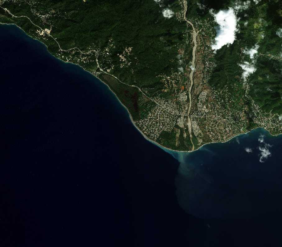
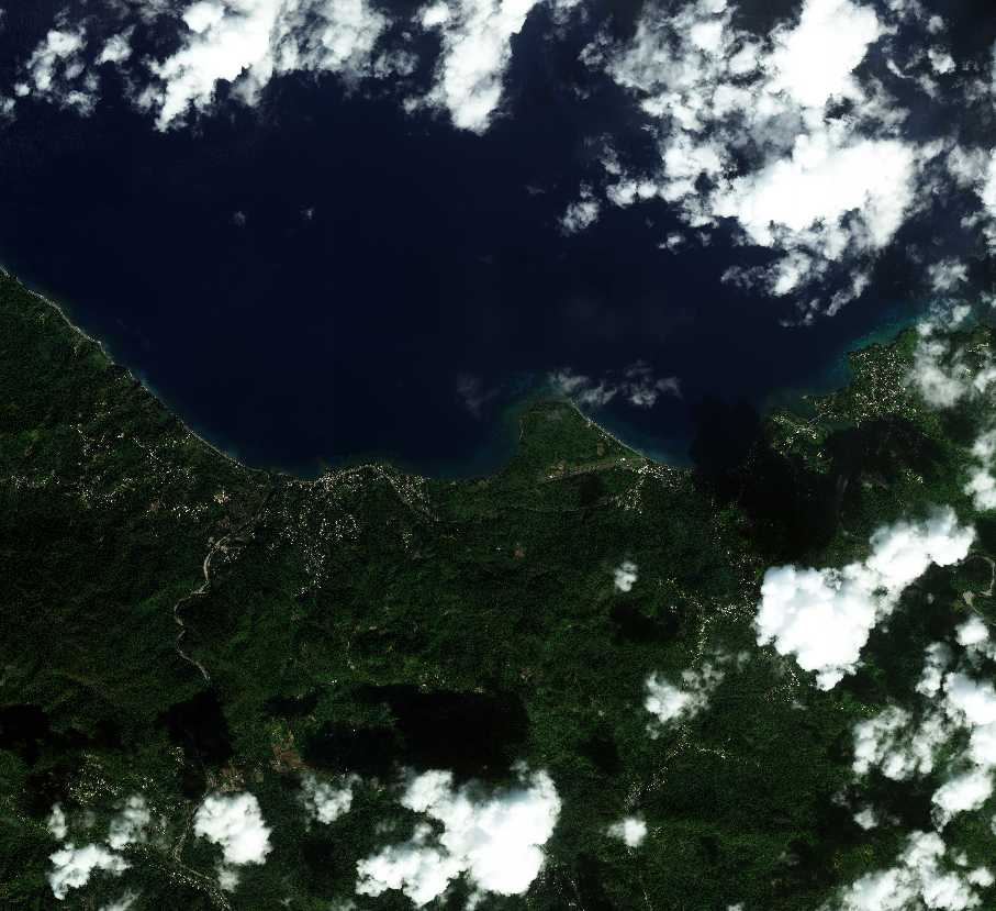
Sample Satellite Images of Jamaica: North Coast Towns and Terrain
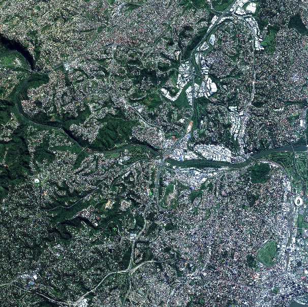
Beijing-3N satellite imagery of a coastal town on the north coast of Jamaica, showing a river mouth, road network, and coastal development at sub-meter resolutionBeijing-3N satellite imagery of Jamaica's forested north coast terrain, showing a bay, coastal settlement, and dense hillside vegetation
Satellite Map Coverage Across Jamaica
Satellite imagery of Jamaica on this page covers the whole island, not just Kingston. Coverage spans the capital and the Kingston Harbour area, the north coast resort corridor from Montego Bay to Ocho Rios and Port Antonio, the Blue Mountains, and the agricultural parishes across the interior. High resolution satellite imagery of Jamaica is available at 25cm and 30cm from commercial constellations, alongside free public archive imagery for broader monitoring. Whether your area of interest is a single property, a stretch of coastline, or an entire parish, the same search and tasking tools on this page work anywhere on the island.
What You Can See in Satellite Images of Jamaica
A satellite image of Jamaica captures a mountainous island where dense rainforest, resort development, and farmland sit close together. A few places that show up distinctly in satellite imagery of Jamaica:
Jamaica's north coast, where coastal towns, river mouths, and resort development meet the Caribbean Sea, shown in the sample gallery above
Kingston Harbour, one of the largest natural harbors in the world, with the capital city and Port of Kingston along its edge
Montego Bay, the island's main resort hub, with dense hotel and marina development along the coastline
The Blue Mountains, the forested mountain range behind Kingston, distinctive for its elevation and coffee-growing terrain
Ocho Rios, a cruise port town on the north coast with visible harbor infrastructure
Negril and the western coastline, known for its long beach and cliff-lined coast, clearly resolved in high-resolution capture
The Cockpit Country, a distinctive karst landscape of steep, closely packed hills in the island's interior
Jamaica's river valleys, visible cutting through the mountainous terrain toward the coast, as seen in the sample gallery above
Applications of Satellite Imagery in Jamaica
Satellite imagery of Jamaica supports work across an island where terrain, coastline, and weather all move fast, from tracking storm damage to planning coastal development:
Hurricane and storm damage assessment, mapping flood extent and structural damage quickly after tropical storms and hurricanes
Coastal erosion and resort development monitoring, tracking shoreline change and construction along Jamaica's resort corridor
Agriculture and land use monitoring, tracking crop health across Jamaica's coffee, sugar, and banana-growing parishes
Bauxite and mining monitoring, measuring extraction activity and site expansion at bauxite mining operations, one of Jamaica's major industries
Port and harbor monitoring, tracking vessel activity and infrastructure at Kingston Harbour and other ports without a site visit
Urban planning and development tracking, monitoring construction and infrastructure change across Kingston and Montego Bay
Forestry and deforestation monitoring, tracking forest cover change across the Blue Mountains and Cockpit Country
Insurance and disaster response, giving insurers and responders fast situational awareness after floods, landslides, or storms
Why Choose Us for Satellite Imagery of Jamaica
Buying satellite imagery of Jamaica from us means fast, accurate answers for an island where site visits can be slowed by terrain, weather, or distance:
Fast turnaround after storms, with new tasking available within days to assess damage when ground access is limited
Lower cost than a physical survey, replacing repeat site visits or aerial charters with a single image or an ongoing monitoring plan
Resolution to match the job, from 25cm and 30cm high-resolution commercial imagery down to free 10m and 30m archive data, so you pay for the detail you actually need
Accuracy for coastal and mountain terrain, with sub-meter imagery precise enough for measurement and mapping across difficult-to-access areas
AI-ready data, with imagery structured for change detection and automated monitoring, not just a picture to look at once
Historical comparison, using archive imagery to show how a coastline, mining site, or development has changed over months or years
Personalized service, with direct answers from our team rather than an automated ordering queue
Satellite Providers Covering Jamaica
Satellite imagery of Jamaica is available from a mix of high-resolution commercial constellations and free public archives, giving you a choice between 25cm-30cm detail and free, lower-resolution coverage:
21AT (Beijing-3 and TripleSat), optical imagery down to 30cm panchromatic and 1.2m multispectral, with the TripleSat Constellation's three satellites offering frequent revisits over Jamaica
SuperView Neo, a commercial constellation delivering 25cm to 50cm resolution optical imagery, sharp enough to resolve individual buildings, vessels, and vehicles
Gaofen satellites, part of China's high-resolution civilian Earth observation program, contributing sub-meter to multi-meter resolution archive coverage over Jamaica
Landsat, a free, continuous 30m resolution multispectral archive going back decades, useful for tracking coastline and land-use change across Jamaica over time
Sentinel-2, ESA's free 10m multispectral archive, well suited to storm damage assessment, agriculture, and regional monitoring across Jamaica
How Satellite Imagery Resolution and Cost Work for Jamaica
High resolution satellite imagery of Jamaica is available at 25cm and 30cm from commercial constellations, with resolution the main factor behind both clarity and cost. Free archive imagery from Sentinel-2 (10m) and Landsat (30m) costs nothing and works well for storm damage assessment, coastline change, and broad land-cover monitoring, though individual buildings, vessels, and vehicles won't be distinguishable at these resolutions. Commercial 25cm and 30cm satellite images of Jamaica, from constellations like 21AT and SuperView Neo, resolve individual structures and infrastructure, priced per square kilometer and scaling with resolution and tasking mode, archive search, new tasking, or priority and emergency turnaround after a storm. For coastal development, mining, and insurance use cases, 25cm to 30cm resolution is the practical choice, while free archive data suits broader agricultural and environmental questions across the interior. Every search on this page returns an instant, transparent price estimate before you order.
Frequently Asked Questions
Where can I get satellite imagery of Jamaica?
You can search and download satellite imagery of Jamaica directly on this page. Draw your area of interest anywhere on the island, choose archive or new tasking, and get an instant price before you order.
What resolution satellite imagery of Jamaica is available?
Resolution ranges from free 10m (Sentinel-2) and 30m (Landsat) archive imagery up to commercial 25cm and 30cm high-resolution satellite imagery from constellations like SuperView Neo and 21AT, depending on the sensor and tasking mode selected.
Can I get a live satellite view of Jamaica?
Satellite imagery isn't updated in true real-time, but Jamaica is imaged regularly by multiple constellations, and new tasking can capture a specific area within days, useful for fast turnaround after a storm.
Is historical satellite imagery of Jamaica available?
Yes. Archive imagery covering Jamaica extends back several years across multiple sensors, useful for comparing coastline change, storm damage, or development progress at a site over time.
Can satellite imagery assess hurricane damage in Jamaica?
Yes. Comparing satellite imagery captured before and after a storm is a standard way to map flood extent and structural damage across affected areas, with priority and emergency tasking available for fast turnaround.
Do you have satellite imagery of Kingston and Montego Bay?
Yes. Coverage spans the whole island, including Kingston Harbour, Montego Bay, and every other parish, not just the capital.
How much does satellite imagery of Jamaica cost?
Cost depends on resolution, area size, and whether you choose archive imagery or new tasking. Free archive options like Sentinel-2 and Landsat cost nothing; 25cm and 30cm commercial imagery is priced per square kilometer. Every search on this page returns an instant, transparent price estimate before you order.
Can satellite imagery support bauxite mining monitoring in Jamaica?
Yes. Satellite imagery is used to track extraction volumes and site expansion at bauxite mining operations, one of Jamaica's major industries, without repeated site visits.
What is the difference between free and commercial satellite imagery of Jamaica?
Free imagery from Sentinel-2 and Landsat offers 10m and 30m resolution, suited to broad land-cover and storm damage monitoring, at no cost. Commercial imagery from constellations like 21AT and SuperView Neo offers 25cm to 30cm resolution, suited to identifying individual buildings, vessels, and infrastructure detail, priced per square kilometer.