Coordinates: 26.8206°N, 30.8025°E
Get a satellite view of Egypt from 25cm resolution, ready to search below, sharp enough to resolve individual buildings, vehicles, and even the stone courses of the Great Pyramids of Giza. Commercial archive and new-tasking imagery from providers like SuperView Neo and Beijing-3 (21AT) covers the full country, from Cairo and Alexandria to the Nile Valley, the Suez Canal, and the Red Sea coast; availability and acquisition dates depend on the satellite, the location, and cloud cover.
Yes. A satellite view of Egypt, including the Great Pyramids of Giza, the Nile Valley and Delta, and the Red Sea coast, is searchable on this page. Commercial satellites resolve the country down to 25cm, sharp enough to identify individual buildings, vehicles, and the Pyramids themselves, with a fresh capture available within days through new tasking.
The map below is a working satellite view of Egypt, not a static picture, covering Cairo, Alexandria, the full length of the Nile from Aswan to the Delta, the Suez Canal, the Sinai Peninsula, and the Red Sea and Mediterranean coastlines. It is the same overhead view most people mean by a "satellite photo of Egypt," a "satellite picture of Egypt," or an "aerial view of Egypt," captured from orbit rather than from an aircraft. Pan to an area, then check what archive and new-tasking imagery exists for it, with an instant price estimate before you commit to anything. Satellite imagery is not a live video feed: each scene is a record of one specific pass, so the dates available for your area are what the portal shows.
The map above is a working satellite tool for Egypt, not just a viewer: search any location, check available imagery dates, and request archive or newly tasked imagery for it, all in the same workspace. Use it in a few steps:
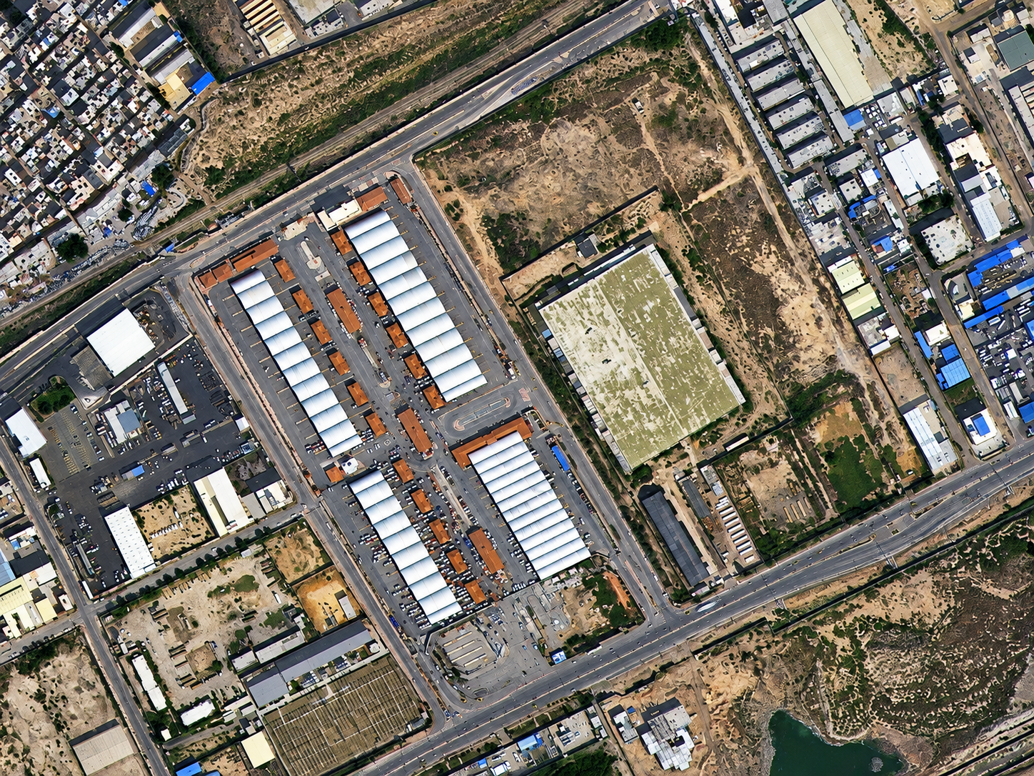
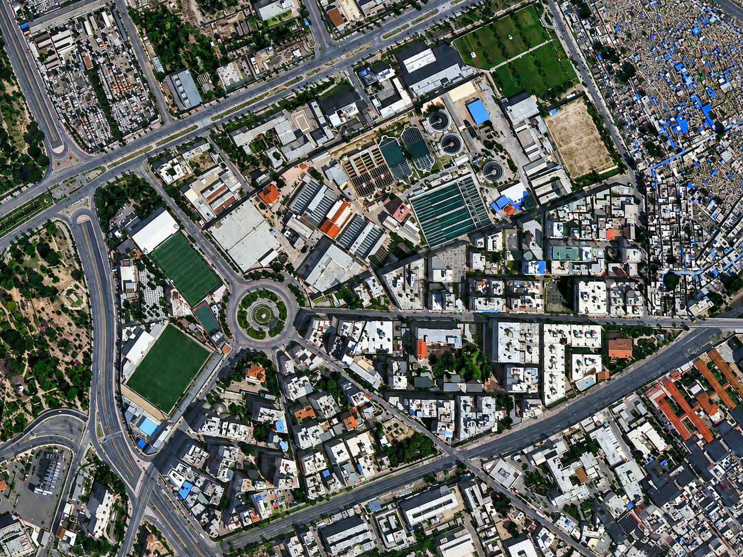
The two images below are real samples, not free public data: high-resolution optical captures over Alexandria showing building- and vehicle-scale detail. Imagery like this is searchable and orderable through the portal above for your own area of interest anywhere in Egypt.
Want this detail for your Egypt site? Search satellite imagery Egypt on the map above →
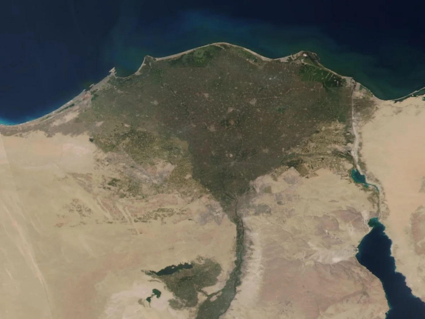
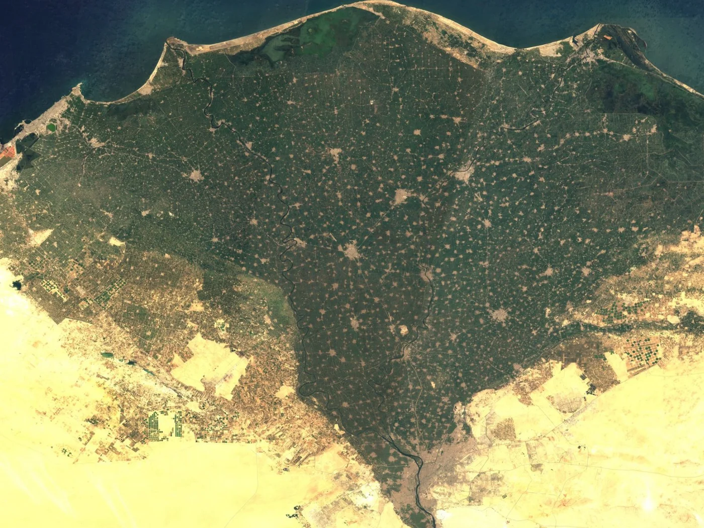
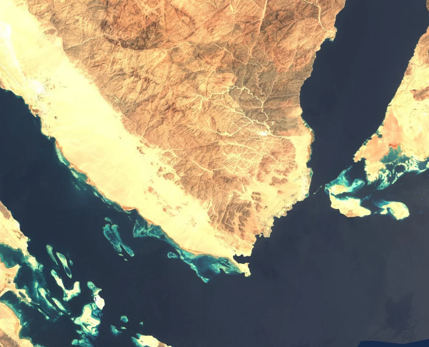
This is what northern Egypt looks like from orbit on a mostly clear day: the green fan of the Nile Delta pushing into the Mediterranean, the Nile's thread running south toward Cairo, the Sinai Peninsula, and the twin arms of the Red Sea, the Gulf of Suez and the Gulf of Aqaba, meeting at its southern tip. It is a useful contrast to the sharp, single-site detail of a commercial order above: this wide view shows regional patterns, not individual buildings.
Archive imagery is fast and cheap. New tasking gets you a fresh capture of your exact site.
Satellite imagery of Egypt is priced per square kilometre by resolution and capture mode. Archive scenes already exist and are the cheapest, fastest option. New tasking books a satellite to fly your area and costs more. Every search on this page returns an instant estimate before you order.
| Resolution Tier | Revisit | Archive Price | New Tasking Price | Priority | Emergency | Stereo | Tri-Stereo |
|---|---|---|---|---|---|---|---|
| 25-30cm — Super High Resolution | Daily | $19/km² (min. 15-25km²) | $25/km² (min. 50-100km²) | $40/km² | $70/km² | $50/km² | $75/km² |
| 31-50cm — Very High Resolution | 1-3 days | $13/km² | $19/km² | $32/km² | $51/km² | $40/km² | $60/km² |
| 51-80cm — High Resolution | 3-5 days | $6/km² | $10/km² | $15/km² | $25/km² | Not available | Not available |
| 81cm-1m — Standard Resolution | 4-5 days | $4/km² | $8/km² | $13/km² | $20/km² | Not available | Not available |
| 2m and Specialized Data (SAR, Hyperspectral, Multispectral) | Varies | Custom pricing | Custom pricing | Custom pricing | Custom pricing | Not available | Not available |
Delivery formats are GeoTIFF, SHP, DWG, or UTM. Upload your own area of interest as KML, KMZ, or zipped Shapefile. Archive imagery is typically ready in minutes to 48 hours; new tasking typically delivers within 7 days, weather permitting, with priority and emergency slots faster. Imagery is licensed, not sold, for your internal business, analysis, and reporting use; resale or redistribution needs written consent.
Prices are shown in US dollars. Egyptian customers are invoiced in USD unless another currency is agreed when the order is confirmed.
Both are used across Egypt, but a satellite does not need overflight clearance near the Suez Canal, the Sinai border zone, or other restricted and security-sensitive areas the way an aircraft charter does.
| Satellite Imagery | Aerial Photography | |
|---|---|---|
| Coverage | Anywhere in Egypt, including the Sinai, border areas, and offshore Red Sea sites, with no flight clearance needed | Flown per project, constrained by airspace restrictions, aircraft range, and airstrip access |
| Revisit speed | Archive available instantly; new tasking typically within 7 days | Scheduled per survey, dependent on aircraft, crew, and permit availability |
| Cost | Priced per km², scaling well across large archaeological sites, farms, or nationwide portfolios | Mobilisation cost per sortie, often higher for remote desert or border sites |
| Best use | Large or sensitive sites, nationwide monitoring, and repeat change detection | Maximum detail on a single, accessible site with no overflight restriction |
Search any Egyptian site on the map above for an instant archive price, or send us the area and we will come back with confirmed coverage and pricing, usually within one business day.
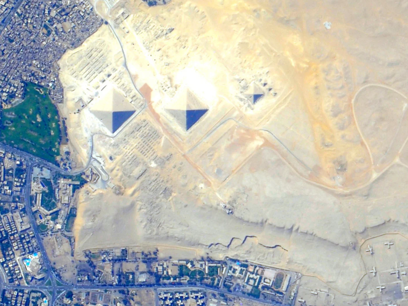
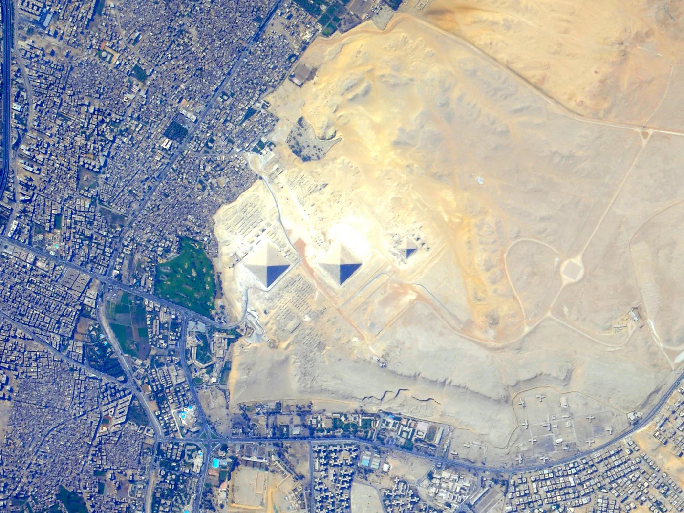
Cairo, Africa's largest city, sprawls along the Nile right up to the edge of the Giza Plateau, where the Great Pyramid, the Pyramid of Khafre, the Pyramid of Menkaure, and the Sphinx sit in plain view of the modern city, a boundary between dense urban grid and open desert clearly visible from orbit. The hero image above shows the pyramid cluster itself at close range; the image below shows the same plateau in wider context, the pyramid field, the desert escarpment, and Cairo's edge all in one frame. Commercial imagery resolves individual buildings, streets, and vehicles anywhere in the capital.
The Nile Delta is Egypt's agricultural heartland, a green fan of farmland fed by the river's branches that spreads from just north of Cairo to the Mediterranean coast, where Alexandria, Egypt's second-largest city and main port, sits at its western edge. The commercial samples above show Alexandria at building level; the image below shows the full Delta from orbit, dense green cropland set sharply against the desert on both sides, with the Nile's distributary channels and the coastal lakes clearly traced.
The Sinai Peninsula splits the Gulf of Suez from the Gulf of Aqaba, and its southern tip, around Sharm El Sheikh and Ras Mohammed National Park, is where Egypt's Red Sea diving and resort industry is concentrated. The turquoise patches visible from orbit are shallow water over coral reef and sandbank, easily distinguished from the deep blue of open sea. Commercial imagery supports resort and coastal development tracking, reef monitoring, and infrastructure planning along this entire coast, from Suez down to the Sudanese border.
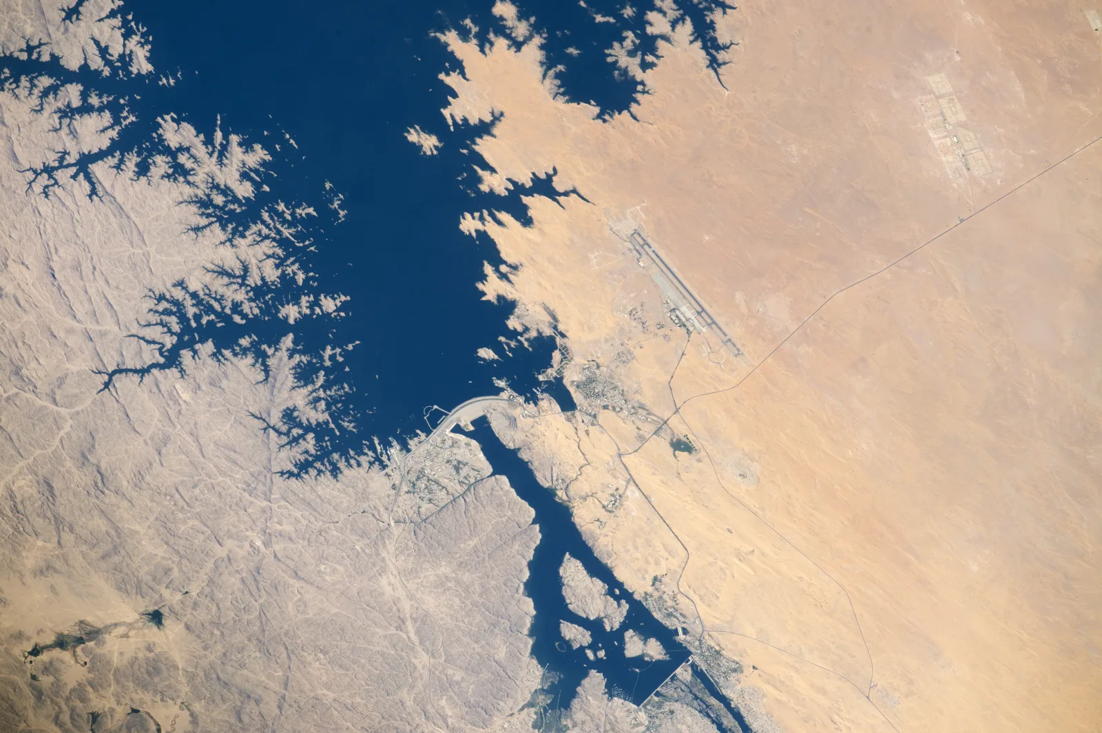
Upper Egypt, the stretch of Nile Valley south of Cairo, holds Luxor's temple complexes and the Valley of the Kings on the river's west bank, and further south, Aswan and the Aswan High Dam, which holds back Lake Nasser, one of the largest reservoirs in the world. The image below shows the dam itself, the lake's branching flooded wadis, and Aswan's airport and city, the kind of infrastructure-scale detail commercial tasking delivers for dam monitoring, archaeological site management, and reservoir-level tracking across the region.
A satellite view of Egypt moves from the Nile's narrow green ribbon through the Western Desert to the reefs of the Red Sea within a short distance. These places are all distinguishable in high-resolution satellite images of the country.
The Great Pyramid of Khufu, the Pyramid of Khafre, and the Pyramid of Menkaure sit together on the Giza Plateau, their square bases and triangular shadows unmistakable from orbit even at wide-area resolution, shown in the hero image on this page. At 25cm to 50cm, individual stone courses on the pyramid faces and the Sphinx's outline are clearly resolved.
Africa's largest metropolitan area, Cairo's dense street grid runs along both banks of the Nile and spills to the edge of the desert at Giza, with individual buildings, bridges, and the islands of Zamalek and Gezira in the river clearly distinguishable at commercial resolution.
North of Cairo, the Nile splits into its Rosetta and Damietta branches and fans out into the green triangle of the Delta, visible from orbit as a sharp boundary between dense farmland and the desert on either side, shown in the Alexandria and Nile Delta image earlier on this page.
The Suez Canal cuts a straight, unmistakable line across the Isthmus of Suez, connecting the Mediterranean to the Red Sea, with ships frequently visible as small bright marks along its length in high-resolution commercial imagery.
Luxor's Karnak and Luxor temple complexes sit on the Nile's east bank, while the Valley of the Kings' tomb entrances cut into the dry hills of the west bank, both resolvable as distinct structures in sub-meter commercial imagery.
The dam itself is a thin man-made line across the Nile south of Aswan, holding back Lake Nasser, whose flooded desert wadis branch for hundreds of kilometres toward the Sudanese border, shown in the Luxor and Aswan image earlier on this page.
Along the Sinai and mainland Red Sea coast, shallow reef and sandbank show up from orbit as pale turquoise against deep blue water, most strikingly around Sharm El Sheikh and Ras Mohammed National Park, with commercial imagery resolving individual reef structures and resort developments.
Isolated in the Western Desert near the Libyan border, Siwa's palm groves and salt lakes stand out as a small green and white patch against vast sand sea, a useful example of how satellite imagery tracks oasis agriculture and groundwater use far from the Nile.
Ramesses II's twin rock-cut temples sit beside Lake Nasser near Egypt's southern border, their carved facades and the adjacent relocation site small but identifiable targets in sub-meter commercial imagery.
Satellite imagery of Egypt supports work across a country defined by a narrow fertile river valley, rapid urban growth, and a long, strategically important coastline:
One search on this page covers multiple commercial constellations together. Which one you want comes down to how much detail the job needs, and how much of the country you need to cover.
These are the paid constellations you can search and task directly through the portal above, and the only ones that resolve individual buildings, vehicles, and structures like the Pyramids at stone-course detail.
Imagery is priced per square kilometre by the resolution and capture mode you pick, so the practical question is how much detail the job actually needs. Sub-meter detail is where most archaeological, infrastructure, and site-level work starts.
Optical satellites need a clear sky, and Egypt is one of the driest, least cloudy countries on Earth for most of the year, which makes it an easy country to capture reliably.
| Resolution | Source | Best For |
|---|---|---|
| 25cm-50cm panchromatic | Beijing-3 (21AT) / SuperView Neo (commercial) | Individual buildings, vehicles, and monuments like the Pyramids |
| 1.2m multispectral | Beijing-3 (21AT) constellation (commercial) | Detailed site analysis with color/spectral data |
| Sub-meter to multi-meter | Gaofen satellites (archive) | Regional and nationwide mapping across Egypt |