How Close Satellite Imagery Actually Gets to Real Time
On this page
- Why no satellite streams live video of one place
- The closest thing to real time, geostationary weather satellites
- Near real-time Earth observation data, free and within hours
- How fast commercial satellite tasking actually is
- Is Google Earth or Google Maps live
- The closest thing to live satellite video of Earth
- How to actually get live or near-real-time satellite imagery
- Frequently asked questions
- Sources and further reading
A practical guide to whether satellite images are real time, the difference between a real-time satellite view and current satellite imagery pulled from an archive, and where to actually find live and real-time imagery today, free or paid.
Quick answer
No, satellite images are not live video, including Google Earth and Google Maps, which show a stitched mosaic that can be months to years old. The closest thing to real-time satellite imagery comes from geostationary weather satellites like GOES-19, Himawari-9, and Meteosat-12, which refresh a full view of Earth every 10 minutes and a smaller regional sector every 1 to 5 minutes. NASA's near-real-time Earth observation data typically lands within 3 hours of capture, and a newly tasked commercial satellite image is usually delivered within 24 to 48 hours. Nothing in orbit today streams continuous live video of one specific address the way a security camera does.
Why no satellite streams live video of one place
Two orbital facts rule out a true live satellite feed of a specific address. Most imaging satellites fly low Earth orbit, 500 to 800 km up, circling the planet in about 90 minutes at roughly 7.5 km per second. That satellite only passes over your exact location once or twice a day, for a few seconds at a time, so it physically cannot hover and stream continuous footage the way a drone or security camera can.
Geostationary satellites solve the hovering problem by sitting 35,786 km above the equator, matching Earth's rotation so they stare at the same hemisphere continuously. But that altitude is the trade, a geostationary sensor resolves roughly 500 m to 2 km per pixel, enough to track a storm system or a wildfire plume, nowhere near enough to show a car, a building, or a person. You get a continuously updating view or building-level detail, never both from the same satellite. For the full mechanics of how any of these sensors turn a pass into a finished image, see our guide to how satellite images are actually taken.
The closest thing to real time, geostationary weather satellites
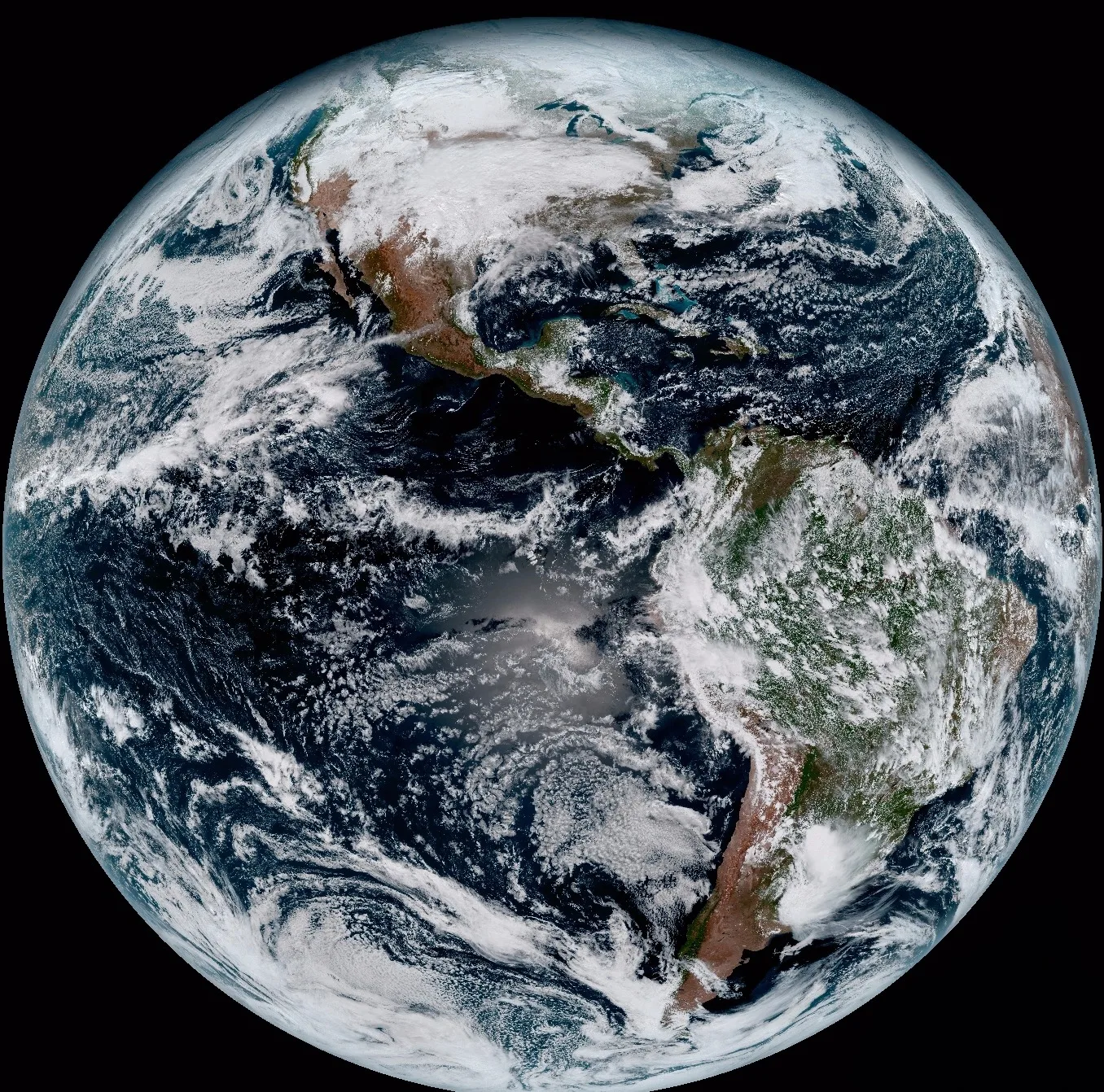
Weather agencies run a fleet of geostationary satellites specifically to get as close to continuous coverage as physics allows. Each one parks over a fixed point on the equator and re-images its hemisphere on a fixed schedule, day and night, every day of the year.
| Satellite | Coverage | Full-disk refresh | Fastest sector refresh |
|---|---|---|---|
| GOES-19 (GOES-East) | Americas and Atlantic | 10 minutes | 30–60 seconds (mesoscale) |
| Himawari-9 | Asia-Pacific | 10 minutes | 2.5 minutes (Japan sector) |
| Meteosat-12 (MTG-I1) | Europe, Africa, Atlantic | 10 minutes | Regional rapid-scan service |
All three resolve to roughly 500 m to 1 km per pixel in visible light, fine for tracking a storm, a smoke plume, or cloud cover moving across a continent, not fine enough for anything on the ground. Free, public viewers for all three are listed further down this page.
Near real-time Earth observation data, free and within hours
Between "every 10 minutes" and "days later" sits a middle tier most people never hear about. NASA's Land, Atmosphere Near real-time Capability for Earth observation (LANCE) pushes select satellite data out fast specifically for time-critical monitoring, rather than waiting for the fully validated science-grade product.
| Source | Typical latency |
|---|---|
| NASA LANCE, most products (via Worldview) | 3 to 5 hours after capture |
| NASA LANCE, AIRS atmospheric data | 75 to 140 minutes |
| NASA LANCE, AMSR2 microwave data | About 90 minutes |
| Copernicus Sentinel-1 and Sentinel-2, standard products | Hours to 1 to 2 days |
NASA Worldview is the easiest way to browse this tier yourself, a free map interface showing near-real-time imagery layered day by day, including the 10-minute geostationary loop above. It's built for exactly this use, catching a wildfire, dust storm, or flood edge within hours of the pass rather than waiting for an archived, fully processed scene.
How fast commercial satellite tasking actually is
A newly tasked commercial satellite image is not live, but it's also not the days-old archive many people picture. Total time breaks into two parts, how soon a satellite actually flies over the area, and how fast the captured scene gets processed and delivered once it does.
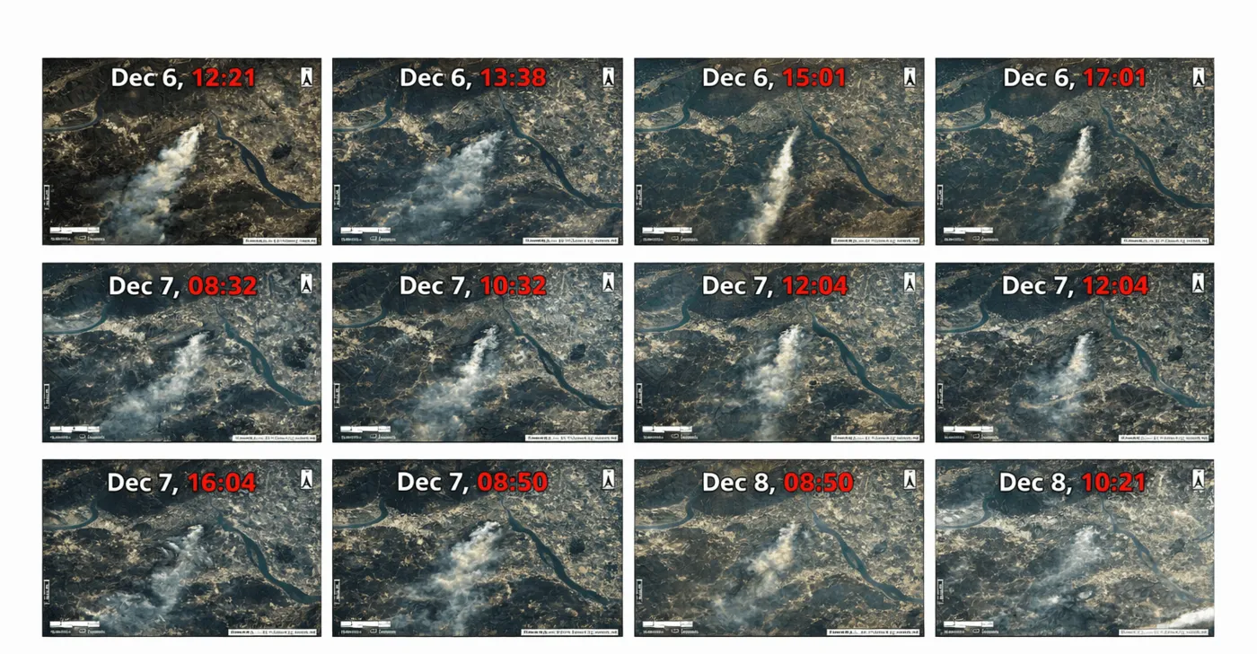
On the constellation side, the SuperView Neo fleet revisits up to 25 times a day across a combined 30 million km² of daily coverage, so a same-day capture is realistic for most areas rather than the exception. On the all-weather side, the GF-3 SAR constellation covers most regions near-daily, while the L-band LT-1 pair, flying in dual-satellite formation, revisits every 4 days with full InSAR deformation capability layered in. On the processing side, satellite command uploads reach ground stations worldwide within 3 hours of a tasking request, and the Siwei Earth Cloud platform, built to handle 50 TB of imagery a day, turns a captured scene into an analysis-ready, delivered file in about 1 hour, with a typical 1.5-hour response time from request to action. During the 2023 Derna, Libya flood response, that same pipeline delivered analysis-ready high-resolution imagery within 24 hours of the event, the proven ceiling for how fast emergency tasking gets a usable image into an analyst's hands today.
| Collection type | Timing | Best for |
|---|---|---|
| Standard archive | 90+ days old | Historical comparison, the cheapest option |
| Fresh archive or standard tasking | Next available pass, 24–48 hours | Current conditions where a short wait is fine |
| Priority tasking | Fast-tracked ahead of the standard queue | Time-sensitive projects |
| Emergency tasking | Same day, within 24 hours end-to-end | Active disasters, urgent situational awareness |
For how to actually place that order, including resolution, sensor, and pricing choices, see our guide to how to order satellite images, or choosing the right satellite resolution for matching a tier to your project.
Is Google Earth or Google Maps live
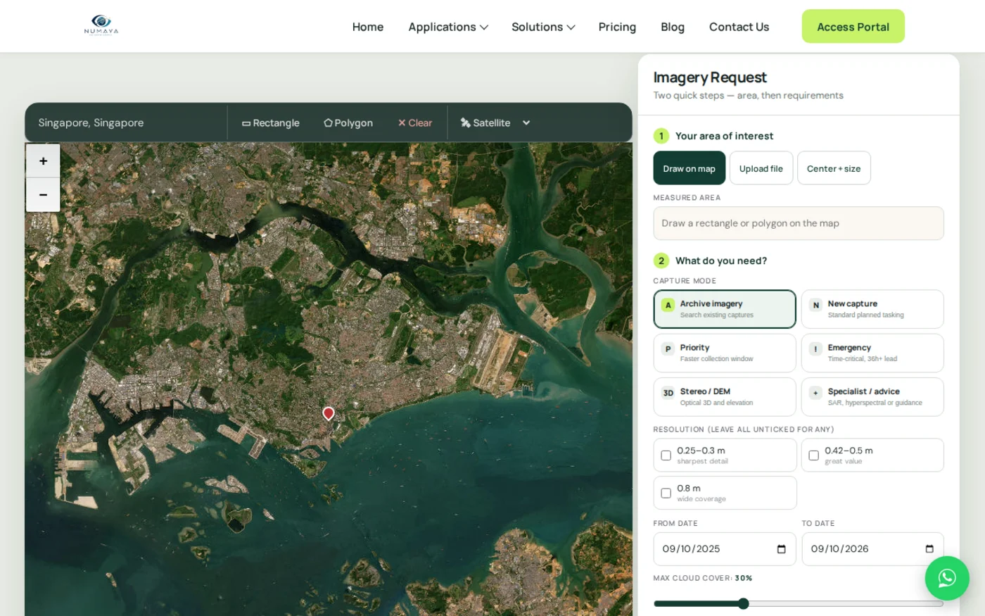
No. Google Earth and Google Maps show a stitched mosaic of satellite and aerial photos taken at different times, not a live feed, and the tiles next to each other can even be from different years. Urban areas are typically refreshed every 1 to 3 years, mid-size cities every 2 to 4 years, and rural or remote regions can go 5 to 10 years between updates. The one exception is a major disaster, Google coordinates with imagery providers to refresh affected areas within days of a wildfire, flood, or earthquake, which is also how most commercial emergency tasking works.

The closest thing to live satellite video of Earth
Two real sources get close to what people picture when they search for a live satellite view, though neither is satellite imagery in the mapping or monitoring sense. NASA's DSCOVR spacecraft sits at the L1 point, about 1.5 million km from Earth, where its EPIC camera photographs the entire sunlit face of the planet at least once every two hours, the only satellite that captures the whole globe in a single frame. The mission has run since 2015 and, as of 2026, is approaching its planned end of service.
Separately, NASA streams a continuous live HD video feed from a camera mounted on the International Space Station, genuinely live video from orbit, though it shows whatever happens to be below the station at that moment rather than a location you pick, and it cuts to a placeholder during loss of signal or orbital night. Neither one is a "satellite feed" in the remote-sensing sense covered above, they're the closest thing to literally live video from space that the public can actually watch.
Need imagery fresher than an archive?
Task a new optical, SAR, or stereo capture and get it delivered within 24 to 48 hours, or search free archive imagery first to confirm what you need.
How to actually get live or near-real-time satellite imagery
Exactly how to get a live satellite view depends on what you actually need, a continuously updating weather-scale picture or a sharp, current satellite imagery capture of one specific site.
- GOES imagery (Americas). NOAA STAR's free GOES image viewer updates every 10 minutes, with mesoscale sectors refreshing as fast as every 30 to 60 seconds.
- Himawari-9 imagery (Asia-Pacific). The JMA and CIRA real-time Himawari viewers update every 10 minutes, every 2.5 minutes over Japan.
- Meteosat imagery (Europe, Africa, Atlantic). EUMETSAT's EUMETView tool shows Meteosat-12's 10-minute full-disk loop for free.
- NASA Worldview. Browses near-real-time imagery from multiple satellites, typically 3 hours old or less, over any location on Earth.
- Zoom Earth and Windy.com. Free consumer sites that layer the geostationary feeds above into an easy, no-signup live map, popular for storm tracking.
- New commercial tasking. For sub-meter detail of a specific site rather than a weather-scale view, task a fresh optical, SAR, or stereo capture through a provider's portal, typically delivered in 24 to 48 hours.
Key takeaways
- Satellite images are not live video. No satellite streams continuous footage of one specific address the way a security camera does.
- Geostationary weather satellites like GOES-19, Himawari-9, and Meteosat-12 get closest to real time, refreshing a full hemisphere every 10 minutes at roughly 500 m to 1 km resolution.
- NASA's near-real-time LANCE data and Worldview viewer deliver select imagery within 3 to 5 hours of capture, free, for any location.
- A newly tasked commercial satellite image, sub-meter and site-specific, typically arrives within 24 to 48 hours, far fresher than the 90-day-old archive tier but not instant.
- Google Earth and Google Maps are not live. Imagery is typically 1 to 3 years old in cities and 5 to 10 years old in rural areas, refreshed quickly only after a major disaster.
Frequently asked questions
Are satellite images real time?
No. The closest satellites get is geostationary weather satellites refreshing a full view of Earth every 10 minutes, NASA near-real-time data delivered within 3 to 5 hours, and commercial tasking delivered within 24 to 48 hours. No satellite streams continuous live video of one specific location.
Can I see real time satellite images of my house?
No. No public or commercial satellite provides live video of a specific address. The closest options are a freshly tasked commercial satellite image, typically delivered within 24 to 48 hours, or Google Earth and Google Maps, which show a mosaic that is usually 1 to 3 years old in cities and older in rural areas.
How do I get a live satellite view?
For a weather-scale live view, free tools like NOAA's GOES viewer, the Himawari-9 real-time viewer, EUMETSAT's EUMETView, Zoom Earth, or Windy.com update every 10 minutes or faster. For a specific site at sub-meter detail, task a new commercial satellite capture, typically delivered within 24 to 48 hours.
How to get live images from the satellite?
Use a free geostationary weather satellite viewer such as NOAA's GOES viewer, JMA's Himawari-9 viewer, or EUMETSAT's EUMETView for imagery refreshed every 10 minutes, NASA Worldview for near-real-time imagery within 3 to 5 hours, or a commercial tasking portal for a fresh, sub-meter image of a specific site within 24 to 48 hours.
Is Google Earth satellite imagery live?
No. Google Earth and Google Maps display a stitched mosaic of satellite and aerial images captured at different times, not a live feed. Urban areas update roughly every 1 to 3 years, and rural areas can go 5 to 10 years between updates, except after a major disaster, when affected areas are often refreshed within days.
What is live satellite imagery of Earth?
The closest things to it are geostationary weather satellites, which re-image the same hemisphere every 10 minutes, NASA's DSCOVR spacecraft, which photographs the entire sunlit side of Earth from 1.5 million km away roughly every two hours, and a continuous live HD video feed NASA streams from a camera on the International Space Station.
What are satellite feeds?
In Earth observation, a satellite feed usually refers to the continuously updating imagery stream from a geostationary weather satellite, refreshed every 10 minutes and viewable for free through tools like NOAA's GOES viewer or Zoom Earth, rather than a single static captured image.
How often do weather satellites update their images?
Current geostationary weather satellites like GOES-19, Himawari-9, and Meteosat-12 capture a full-disk image of their hemisphere every 10 minutes. Smaller regional sectors update faster, as often as every 30 to 60 seconds for GOES mesoscale sectors and every 2.5 minutes for Himawari's Japan sector.
Sources and further reading
- NOAA / NESDIS: GOES-19 full-disk and mesoscale imagery refresh schedules
- Japan Meteorological Agency: Himawari-9 full-disk and Japan-sector refresh rates
- EUMETSAT: Meteosat-12 (MTG-I1) operational status and full-disk imagery, 2025–2026
- NASA Earthdata: LANCE and Worldview near-real-time data latency documentation
- NASA: DSCOVR EPIC full-Earth imaging frequency and 2026 mission status
- Industry sources: Google Earth and Google Maps imagery refresh cycles by region
- XRTech Group: commercial satellite tasking and collection speed tiers, 2026
- China Siwei: Earth Cloud processing platform capacity, global command uplink timing, and the 2023 Derna, Libya flood response turnaround
For what satellite imagery actually is and how a scene gets captured in the first place, see our guide to what satellite imagery is and how it works.
Need the freshest imagery of a specific site?
Skip the weather-satellite view and task a sub-meter optical or radar capture, delivered within 24 to 48 hours.