How Much Area a Satellite Can Image in a Day
On this page
- Why Daily Capacity Numbers Depend on What You're Counting
- How Many Scenes an Agile Satellite Can Capture in a Day
- Daily Area Coverage, One Satellite Versus a Full Constellation
- SuperView Neo and China Siwei's Expanding Constellation
- How the Largest Commercial Fleets Compare
- Frequently asked questions
- Sources and further reading
A practical guide to how many pictures satellites take per day, covering why the answer depends on counting individual target scenes versus total square kilometers covered, how a single high-resolution satellite's daily output compares to its full constellation, how modern agile pointing multiplies that number over older fixed-track designs, and how the largest commercial fleets in orbit today stack up against each other.
Quick answer
There's no single number because it depends on what's being counted and at what scale. By area, one SuperView-1 satellite can image up to 700,000 km² in a day, but the full four-satellite SuperView-1 constellation acquires more than 2 million km² daily, and China Siwei's SuperView Neo system, nine satellites in orbit as of 2026, already covers about 5.8 million km² a day with revisit up to 25 times daily over the same target zone. By scene count rather than area, agile satellites like Airbus's Pleiades capture more than 500 images a day per satellite, around 1,300 a day across its two-satellite system. At the top end, Vantor's six-satellite WorldView Legion constellation (the fleet formerly flown under the Maxar Intelligence name) collects more than 6 million km² of 30 cm-class imagery daily, and Planet Labs' roughly 200-satellite SuperDove fleet images essentially all of Earth's 149 million km² of land surface, every single day.
Why Daily Capacity Numbers Depend on What You're Counting
Ask "how many pictures does a satellite take per day" and get wildly different answers, and almost always it's because the question was answered against a different scope than it was asked. Three separate things get lumped under "daily capacity," and mixing them up is the single biggest source of numbers that look contradictory at first glance. Scene count measures distinct target images, a specific port, a specific farm, a specific city block, each counted once regardless of its size. Area covered measures total square kilometers swept, which rewards wide swaths and long strips even if most of that ground is empty ocean or desert nobody tasked. And scope itself varies by source, a spec sheet quoting "one satellite" versus "the full constellation" versus "the fully built-out future constellation" can differ by a factor of ten or more for the exact same satellite program.
A fourth factor compounds the first three, operational reality versus theoretical maximum. A manufacturer's daily acquisition capacity figure describes what the sensor and downlink can physically support running flat out, not what gets captured on an average Tuesday when demand, cloud cover, and ground-station passes all fall short of ideal. Treat every number below as a stated maximum capacity unless noted otherwise, the same caveat worth applying to any satellite spec sheet.
How Many Scenes an Agile Satellite Can Capture in a Day
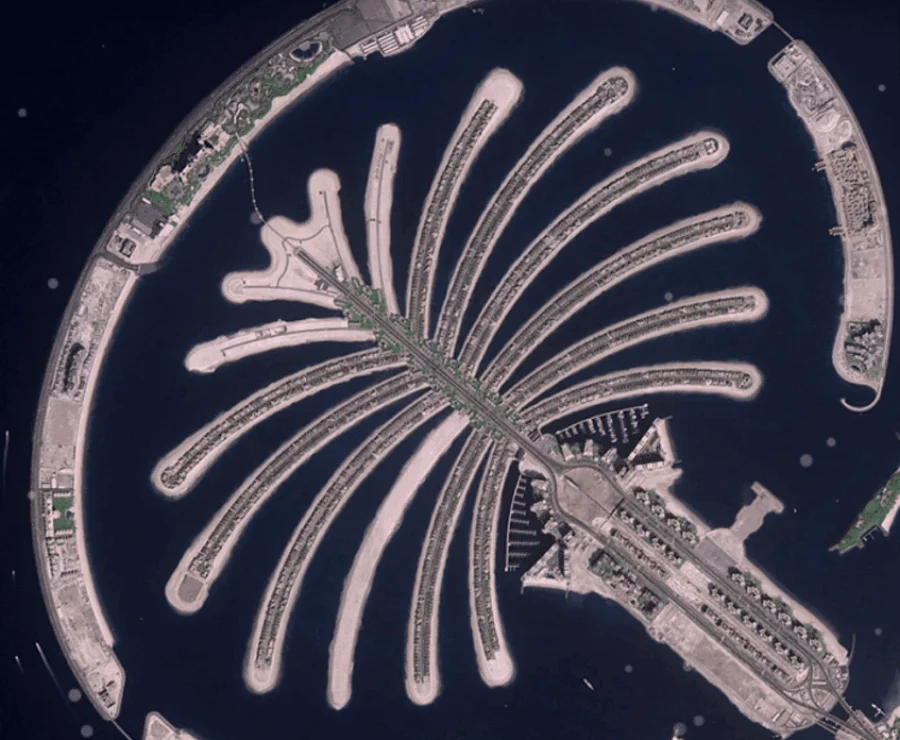
A satellite without three-axis agility can only record what passes directly beneath its fixed orbital track, one continuous strip per pass, so a given target either falls under that track that day or it waits for the next revisit, with no way to re-point mid-orbit for a handful of extra scattered scenes elsewhere. Three-axis agile satellites, which can roll, pitch, and yaw to redirect the sensor within a single pass, broke that constraint, and the scene counts published for them show how much it changed daily throughput.
Airbus's two-satellite Pléiades constellation is one of the better-documented examples. According to its eoPortal mission profile, each satellite is specified to deliver more than 500 images per day on its own, and the pair together routinely acquire roughly 1,300 separate images daily, while also covering up to 1 million km² of total area in that same day when strip and mosaic modes are counted in. Planet's SkySat constellation, built for fast point-and-shoot tasking rather than long strips, is rated for an agility of about 2.3 separate targets per minute during an active imaging window, letting it hop between closely spaced targets, say several sites across one metro area, within a single overhead pass rather than needing a separate orbit for each one.
Need a specific scene, not a whole swath?
Task an agile point target across XRTech's SuperView, Beijing-3, and GF-series fleet, or search existing archive first. No account needed for a first estimate.
Daily Area Coverage, One Satellite Versus a Full Constellation
SuperView-1, part of the China Siwei fleet XRTech's own portal searches and tasks directly, is a clean illustration of the single-satellite-versus-constellation gap. A single SuperView-1 spacecraft, flying at 0.5 m panchromatic resolution with a 12 km swath, is rated to image up to 700,000 km² in a day on its own. SuperView-1 flies as a four-satellite constellation rather than a lone spacecraft, though, and with all four working concurrently, published China Siwei specifications put combined daily capacity at more than 2 million km² and revisit at under 1 day over any point on Earth. That same spec sheet also lists a broader 1 to 3 day range for typical, lighter-tasking scenarios where not all four satellites are pointed at the same target, so a quoted "SuperView-1 revisit rate" can mean either number depending on how many of the four are actually in play for a given request.
SuperView-2, the fleet's other optical workhorse at 0.42 m panchromatic resolution with 8 multispectral bands, adds up to 200,000 km² a day of its own collection capacity. XRTech's own published fleet specs list SuperView-2's revisit at about 1.5 days when viewing at a 30° off-nadir angle, while other third-party spec sheets cite a broader 1 to 3 day practical range for the same satellite, a gap that mostly comes down to how wide an off-nadir viewing angle each source allows before it stops counting a pass as a usable revisit. It's the smaller of the two area-coverage figures here, but it's also the sharper of the two multispectral sensors, the resolution-versus-coverage tradeoff that shows up across almost every satellite comparison on this topic.
One SuperView-1 satellite's rated daily acquisition capacity, 0.5 m panchromatic resolution.
The full four-satellite SuperView-1 constellation's combined daily capacity, revisit under 1 day.
SuperView-2's daily collection capacity at 0.42 m panchromatic resolution, 8 multispectral bands.
SuperView Neo and China Siwei's Expanding Constellation
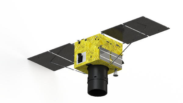
SuperView Neo is where China Siwei's daily capacity is growing fastest. SuperView Neo-1, the ultra-high-resolution 0.3 m panchromatic tier, now flies four satellites in orbit as of 2026 (the first pair launched April 2022, a second pair followed in February 2025), and SpaceNews reported that this Neo-1 group adds roughly 1.5 million km² a day to China Siwei's total collection capacity on its own and lifts revisit to about 2 times a day over a given target, notably higher agility than the original SuperView-1 generation. Folded into the broader Neo system alongside four Neo-2 SAR satellites and one Neo-3 ultra-wide-swath optical satellite, nine satellites are in orbit today, and that combined fleet already covers about 5.8 million km² a day, with revisit over the same target zone reaching up to 25 times per day according to XRTech's own current published fleet specifications, a higher figure than the 2-times-a-day cited for Neo-1 alone because it reflects the full nine-satellite fleet plus agility gains since Neo-1's 2022 debut, and the fastest optical revisit rate in the company's resold catalog short of the geostationary GF-4.
That nine-satellite fleet is still a fraction of where SuperView Neo is headed. China Siwei's full build-out plan calls for 28 satellites total, 16 high-resolution optical satellites at 0.2 to 0.3 m resolution, 4 wide-swath optical satellites at 0.7 m resolution with a 100 km swath, and 8 SAR satellites at 0.5 m resolution, which will push daily area coverage well past today's 5.8 million km² once the remaining satellites reach orbit. No authoritative source has published a specific projected figure for the completed 28-satellite system yet, so that number is left out here rather than estimated.
SuperView Neo's 25x daily revisit, searchable now
Pull 30 cm SuperView Neo-1 archive or task a fresh capture over your site, alongside SuperView-1, SuperView-2, and the rest of XRTech's optical and SAR fleet.
How the Largest Commercial Fleets Compare
Zoom out past any single operator and the spread between fleets gets even wider, because fleet size, satellite generation, and resolution tier all move independently of each other. Vantor, the Earth-imaging business that operated under the Maxar Intelligence name until its October 2025 corporate rebrand, is the clearest before-and-after case. Its legacy fleet, WorldView-1, WorldView-2, WorldView-3, and GeoEye-1, collected a combined more than 3 million km² a day of high-resolution imagery before the newer satellites below came online. WorldView Legion, the six-satellite constellation that finished launching in February 2025 and has been fully operational since, adds enough capacity that the combined fleet now collects more than 6 million km² a day of 30 cm-class imagery specifically, with Legion's dual mid-inclination and Sun-synchronous orbit design enabling up to 15 revisits a day over any single location above a 15° sun angle, among the fastest optical revisit rates of any commercial constellation in service.
Planet Labs sits in a different category altogether. Its roughly 200-satellite SuperDove fleet trades resolution, 3 to 4 m rather than sub-meter, for sheer breadth, imaging essentially the entire 149 million km² of Earth's land surface every single day, a figure no sub-meter constellation can match simply because no sub-meter sensor can afford the swath width needed to cover that much ground daily. More on how Planet's satellite count and others stack up industry-wide is covered in our guide to how many satellites are in space.
| Satellite or fleet | Satellites | Daily capacity | Metric |
|---|---|---|---|
| SuperView-1 (single satellite) | 1 of 4 | 700,000 km² | Area |
| SuperView-1 (full constellation) | 4 | 2,000,000+ km² | Area |
| SuperView-2 | 2 | 200,000 km² | Area |
| SuperView Neo system (current) | 9 | 5,800,000 km² | Area |
| Pléiades | 2 | ~1,300 images | Scenes |
| Vantor legacy fleet (ex-Maxar) | 4 | 3,000,000+ km² | Area |
| Vantor WorldView Legion | 6 | 6,000,000+ km² | Area, 30 cm-class |
| Planet Labs SuperDove | ~200 | 149,000,000 km² | Area, entire landmass |

Key takeaways
- There's no single "how many pictures per day" figure, because sources measure scene count or area covered, for one satellite or a whole constellation, at theoretical maximum rather than typical daily output.
- One SuperView-1 satellite images up to 700,000 km² a day; the full four-satellite constellation combines for more than 2 million km² daily with sub-1-day revisit.
- China Siwei's SuperView Neo system, nine satellites in orbit as of 2026, covers about 5.8 million km² a day with revisit up to 25 times daily over the same zone, and is still growing toward a planned 28 satellites.
- By scene count rather than area, Airbus's two-satellite Pléiades constellation captures more than 500 images a day per satellite, around 1,300 a day combined.
- Vantor's six-satellite WorldView Legion constellation, operating under the name Maxar Intelligence used until October 2025, collects more than 6 million km² a day of 30 cm-class imagery, with up to 15 revisits a day per location.
- Planet Labs' roughly 200-satellite SuperDove fleet images essentially all 149 million km² of Earth's land surface daily at 3 to 4 m resolution, the broadest daily coverage of any commercial fleet, at the cost of resolution.
Frequently asked questions
How many pictures does a satellite take per day?
It depends on the satellite and whether you're counting individual scenes or total area. A single agile satellite like Pléiades captures more than 500 images a day, while a constellation of several satellites together can collect anywhere from a few hundred thousand to several million square kilometers of imagery daily.
How much area can a satellite image in a day?
For a single high-resolution satellite, typically 200,000 to 700,000 km² a day. A full multi-satellite constellation scales that up substantially, SuperView-1's four satellites combine for more than 2 million km² a day, and Vantor's six-satellite WorldView Legion constellation collects more than 6 million km² a day of 30 cm-class imagery.
How many square kilometers does SuperView-1 cover per day?
A single SuperView-1 satellite is rated for up to 700,000 km² a day. With all four satellites in the constellation working together, combined daily capacity exceeds 2 million km², and any point on Earth gets revisited in under a day.
How much area does the SuperView Neo constellation image per day?
China Siwei's SuperView Neo system, with nine satellites in orbit as of 2026 (four Neo-1 optical, four Neo-2 SAR, and one Neo-3 wide-swath), covers about 5.8 million km² a day, with revisit reaching up to 25 times daily over the same target zone. The system is planned to grow to 28 satellites total.
How many images per day can an agile satellite like Pléiades capture?
Each Pléiades satellite is rated for more than 500 images a day on its own, and the two-satellite constellation together captures roughly 1,300 images daily while covering up to 1 million km² of total area.
How does Vantor's WorldView Legion compare to the older Maxar satellites?
Vantor, which operated under the Maxar Intelligence name until an October 2025 rebrand, flew a legacy fleet (WorldView-1, WorldView-2, WorldView-3, and GeoEye-1) that collected more than 3 million km² a day combined. WorldView Legion, a newer six-satellite constellation fully operational since February 2025, adds enough capacity to push the combined fleet past 6 million km² a day of 30 cm-class imagery specifically, with up to 15 revisits a day per location.
Does Planet Labs really image the whole planet every day?
Planet's roughly 200-satellite SuperDove fleet images essentially all of Earth's land surface, about 149 million km², every day at 3 to 4 m resolution. That's far coarser than sub-meter satellites like SuperView or WorldView Legion, but no sub-meter sensor has the swath width to cover that much ground daily.
Why do different sources give different numbers for satellite daily capacity?
Mostly because they're measuring different things, scene count versus area covered, one satellite versus a full constellation, or theoretical maximum acquisition capacity versus typical day-to-day output limited by cloud cover, tasking demand, and ground-station passes. A number quoted without specifying which of these it refers to is easy to misread as contradicting a different, equally correct number.
For how that captured data actually gets from sensor to finished image, see our guide to how satellite images are taken. For the broader picture of how many satellites are up there at all, most of them not built for imaging, see how many satellites are in space.
Sources and further reading
- eoPortal, Pléiades High-Resolution Optical Imaging Constellation mission profile, daily image acquisition and area coverage specifications
- eoPortal, WorldView Legion and SkySat Constellation mission profiles, daily capacity, orbit design, and agile pointing rate
- SpaceNews, "China Siwei releases 30 cm imagery from SuperView Neo," constellation size and daily capacity figures, 2026
- SpaceNews, "Maxar retires its name, rebrands as Vantor and Lanteris," October 2025
- Satellite Imaging Corporation, SuperView Neo satellite constellation specifications
- XRTech Group, SuperView-1, SuperView-2, and SuperView Neo product and revisit-rate specifications
- Apollo Mapping and Geopera, SuperView-1 and SuperView-2 satellite imagery specification pages
- Via Satellite and Maxar/Vantor press materials, WorldView Legion fifth and sixth satellite launch coverage, February 2025
From a single scene to millions of square kilometers
Search live archive imagery or task a fresh capture across XRTech's full optical, multispectral, and SAR fleet, whatever scale your project actually needs.